

Delaware River between Sparrowbush, New York, and Matamoras, Pennsylvania
Length: 2.3 miles
Water Level at Time of Trip: 2.9 to 3.9 feet
Average moving speed: 3.5 MPH with two paddlers
Time: 45 minutes
The southern terminus of the Upper Delaware Scenic and Recreational River is at the Sparrowbush Boat Ramp, but of course the Delaware River continues on. There is a gap of approximately 8.5 miles between the Sparrowbush ramp and Delaware Water Gap National Recreation Area. Though not part of any National Park, I continued down the river and have included reviews of the 8.5-mile gap. This review covers the 2.3 miles of the river from the Sparrowbush Boat Romp to the Matamoras Boat Ramp in Matamoras, Pennsylvania. The rest of the gap is covered in National Park Planner’s review of Delaware Water Gap National Recreation Area.
Before starting a trip on the Upper Delaware Scenic and Recreational River, it is a good idea to check the water levels so that you have an idea of the river conditions. Levels of 2.5 to 4 feet are average and provide plenty of water for a trip down the river with conditions suitable for paddlers of all skill levels. The water level gauges relevant to the Sparrowbush–Matamoras section of the river are at Barryville, New York, and Port Jarvis, New York. On the day of my trip in late October, the Barryville gauge was at 3.85 feet and the Port Jarvis gauge at 2.9 feet, and for the most part, there was plenty of water for an enjoyable trip. The observations made in this report are based on these water levels, so adjust your expectations according to the conditions on the day you do the trip. The lower the water, the more often you will hit rocks on the bottom of the riverbed and get stuck. The higher the water, the more paddling skills you need.
The water is calm at the Sparrowbush Boat Ramp, but about a quarter mile downriver are some nice rapids, perhaps Class II. The water level was high enough that I didn’t have to dodge any rocks and was able to just plow through the waves. Expect to take on a little water in your boat, so make sure the drain plugs are open (if your boat has them). The rapids come at the start of a slight bend in the river to the east. This area is easy to spot due to the large rock cliffs on the Pennsylvania (right) side of the river. The closer to the cliffs, the bigger the rapids, so that’s where you want to be for the action.
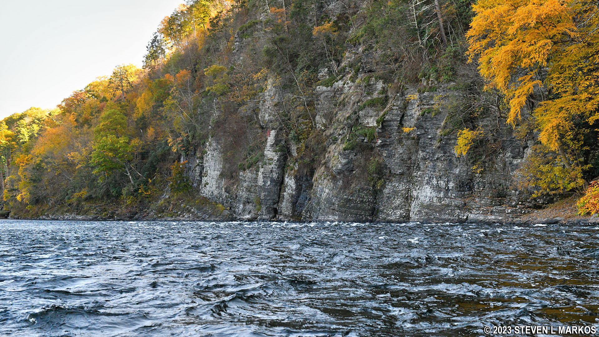
Rapids and cliffs on the Delaware River just downstream from the Sparrowbush Boat Ramp
There is a small waterfall at the tail end of the rapids where the Delaware River makes a final curve to the south, about .75 mile before the Matamoras Boat Ramp. There are two small creeks that empty into the Delaware River in this area, and I suspect one of them is the source of the waterfall.

Waterfall on the shore of the Delaware River just south of Sparrow Bush, New York
Other than some riffles just before the Matamoras Boat Ramp, the current is pretty slow once you get past the cliff-side rapids. You won’t get far without constant paddling.

Delaware River right before the boat ramp at Matamoras, Pennsylvania
The Matamoras Boat Ramp is owned by the Pennsylvania Fish and Boat Commission (PFBC). Keep in mind all that types of non-motorized watercraft including canoes, kayaks, stand-up paddleboards, rowboats, rafts, and sailboats without a motor need a launch permit to use PFBC ramps. If you don’t have a permit or need to exit in New York due to having a warrant for your arrest in Pennsylvania, there is another boat ramp at West End Park just .75 mile farther down on the opposite side of the river. You can’t miss either of these boat ramps.

Boat ramp on the Delaware River at Matamoras, Pennsylvania
Previous River Section | River by Section Home Page
With a few exceptions, use of any photograph on the National Park Planner website requires a paid Royalty Free Editorial Use License or Commercial Use License. See the Photo Usage page for details.
Last updated on August 20, 2023


