

Path to the South Fork Dam’s north abutment overlook and spillway, Johnstown Flood National Memorial
Johnstown Flood National Memorial Self-Guided Tour Main Page
SELF-GUIDED TOUR STOP 1
The first stop on a self-guided tour of Johnstown Flood National Memorial is the north abutment of the former South Fork Dam. From the park’s Visitor Center and Museum, exit the parking lot and turn left on Lake Drive. After going around a curve you will come to the parking area for the north abutment. A long, paved path that runs slightly uphill leads past the original dam spillway and to an overlook of the gap in the dam that was created by the flood waters. The round trip is about a quarter mile, but if you are unable to walk the distance, you can get a similar view from the south side abutment overlook (Tour Stop 3), which is much closer to the parking lot. You will, however, miss viewing the spillway site here on the north side.
A bridge spans the spillway of the former Lake Conemaugh. The National Park Service built this bridge, but from the time when the South Fork Dam began operation in the early 1850s until its demise in 1889, a bridge of some sort spanned the spillway. Excess water flowed over the spillway and around the dam, rejoining the Little Conemaugh River on the other side. However, it was not deep and wide enough to handle the excessive water flow caused by the rain storms on May 29th, 30th, and 31st, 1889. On top of that, a screen had been hung from the bottom of the bridge to prevent fish from escaping. This ultimately impeded the water flow even further. Eventually the water went over the top of the earthen South Fork Dam, and once water tops an earthen dam, collapse is inevitable as the water flows down the backside, carrying with it the dirt and other materials used in its construction.
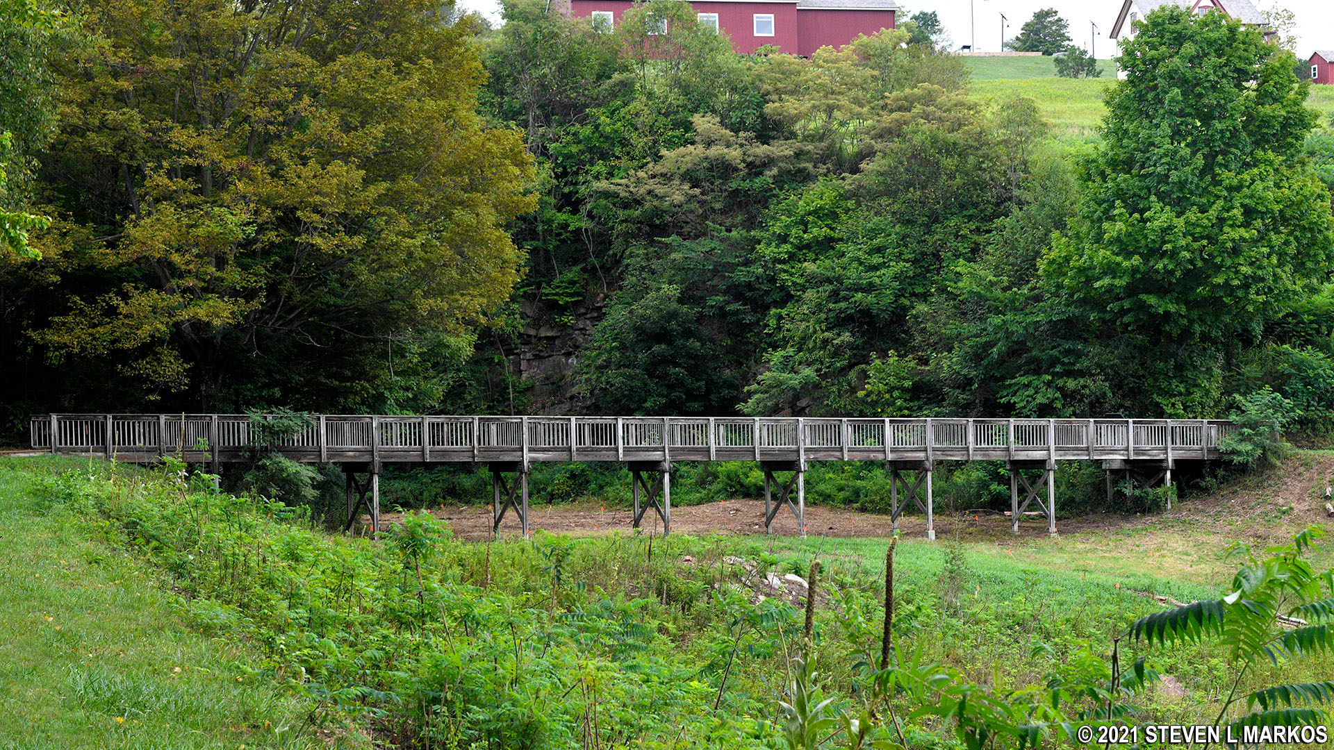
Bridge over the South Fork Dam’s spillway, Johnstown Flood National Memorial
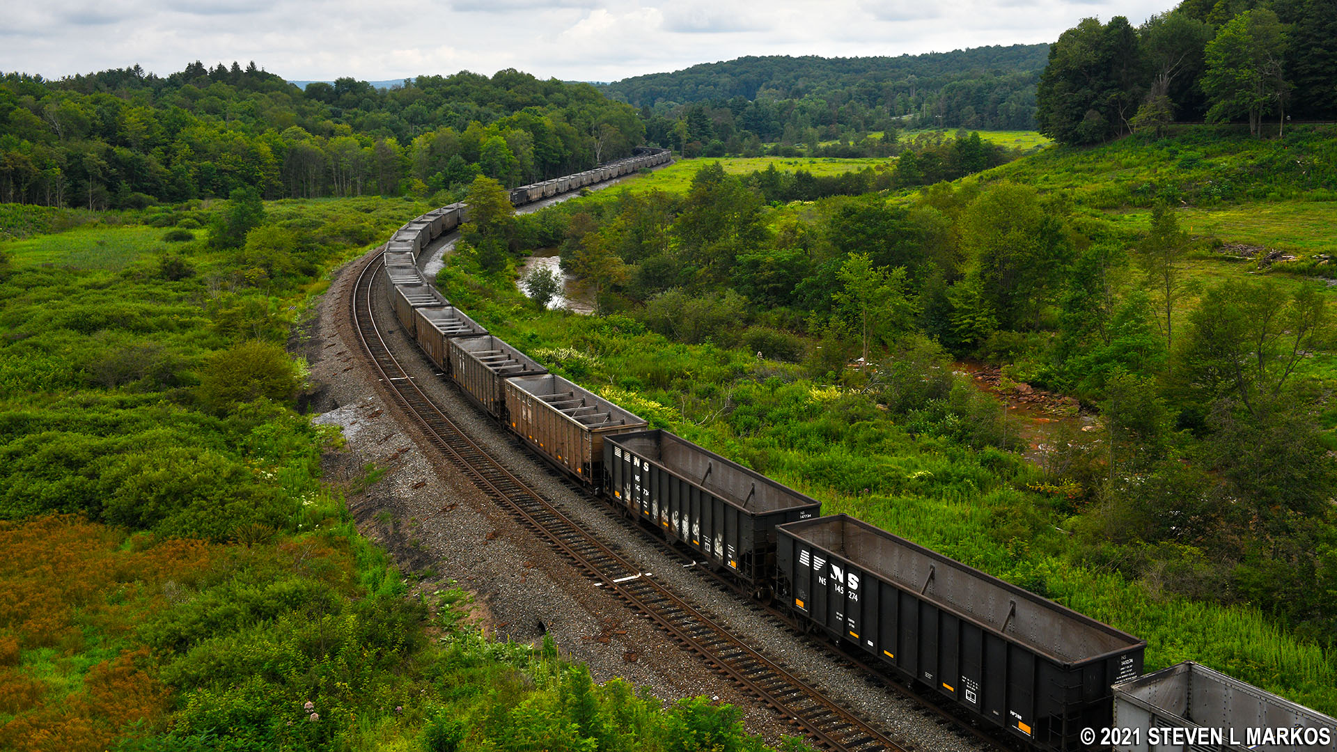
From the north abutment overlook you can see the south abutment overlook 931 feet away, the length of the former South Fork Dam. Below, the Little Conemaugh River once again follows its original path as it flows through the 300-foot wide gap in the dam caused by the flood waters of 1889. The railroad tracks were laid in 1891, a little over a year after the disaster. They are still in use today.

View from the north abutment towards the south abutment of the South Fork Dam, Johnstown Flood National Memorial
The view to your left was once covered with water. You can still see the high banks on either side of the valley, banks that once defined the shores of Lake Conemaugh. From where you are standing at the north abutment, the water was typically only 12 feet below you. Technically, it would never rise higher because excess water would flow out of the spillway, but we all know how that turned out.
View of the former Lake Conemaugh at Johnstown Flood National Memorial
When done at the north abutment, continue on your self-guided tour of Johnstown Flood National Memorial by making a trip to Stop 2, the St. Michael Historic District. Here you will find the original South Fork Fishing and Hunting Club’s clubhouse along with some of the summer homes once owned by club members.
With a few exceptions, use of any photograph on the National Park Planner website requires a paid Royalty Free Editorial Use License or Commercial Use License. See the Photo Usage page for details.
Last updated on April 8, 2025


