

Union artillery on Cemetery Ridge, Gettysburg National Military Park
Length: 2.25 miles, round trip
Time: 1.5 hours round trip with time to explore Cemetery Ridge
Difficulty: Easy with some mild hills
Cemetery Ridge is one of the most visited places at Gettysburg National Military Park. At the High Water Mark stop on the Gettysburg Battlefield Tour (Stop 15) there are more memorials, monuments, and artillery exhibits than anywhere else on the battlefield. Cemetery Ridge is perfectly accessible by vehicle, but for those who would like a little exercise, it is possible to walk to the ridge from the Gettysburg National Military Park Visitor Center. The route is .75 mile, but by the time you walk around the area and return to the Visitor Center you will have walked a little over two miles. The hike is easy, and there are a few points of interest along the way that you can’t see from a vehicle. The only thing to be concerned about is that the hike is often out in the open, so wear a hat and apply sunscreen if avoiding the sun is important to you.
To get the most out of the walk, purchase the Cemetery Ridge Trail Walking Tour booklet at the Visitor Center gift shop ($5 at the time of this writing). The book includes information about ten points of interest along the route. It’s a great way to put a personality to some of the monuments at Gettysburg National Military Park.
The Cemetery Ridge Trail begins on the left side of the Visitor Center building. Take the paved path and follow the signs to Soldiers’ National Cemetery (aka Gettysburg National Cemetery) and Meade’s Headquarters. If you are parked at Parking Lot 3, there is a connector path at the back of the parking lot that is a lot closer to the trail than starting from the Visitor Center (though if you buy the booklet, that’s probably where you’ll start).

Start of the Cemetery Ridge Trail at the Gettysburg National Military Park Visitor Center
The first part of the Cemetery Ridge Trail is paved and proceeds through a wooded area for a half mile before coming out at Taneytown Road. This area is a little hilly, for you are essentially on the backside of Cemetery Ridge and must walk up to the crest.

Wooded area of the Cemetery Ridge Trail at Gettysburg National Military Park

Intersection of the Cemetery Ridge Trail and Taneytown Road in Gettysburg
Once at Taneytown Road, you will be at the first point of interest, the Lydia Leister Farm. The Leisters left Gettysburg on the evening of July 1, 1893, the day the fighting began. Union General George Meade, who was made commander of the Army of the Potomac just three days before the Battle of Gettysburg, used the house as his headquarters starting on July 2nd. The farmhouse and barn were repaired after the battle and still stand today.

Leister Farmhouse on Taneytown Road in Gettysburg

Leister Barn on Taneytown Road in Gettysburg

Monument marking the location of Union General George Meade’s headquarters during the Battle of Gettysburg
The house was not open when I visited (I’m not sure if it is ever open), but I was able to access the back porch and look through the windows. The rooms are furnished with reproductions of the furniture that was in the house during the battle. Some of the original furniture is now on display at the Gettysburg Museum in the Visitor Center. There is an audio program that you can listen to when standing on the porch. Push a button to begin the program.

Interior of the Leister Farmhouse at Gettysburg National Military Park

Interior of the Leister Farmhouse at Gettysburg National Military Park
To remain on the Cemetery Ridge Trail, stay straight on the paved path that runs past the Leister Farm. There are a few monuments opposite the farm buildings.

Cemetery Ridge Trail near the Leister Farmhouse at Gettysburg National Military Park

93rd New York Infantry Monument (1890), Gettysburg National Military Park

6th Pennsylvania Cavalry Monument (1891), Gettysburg National Military Park
The trail continues uphill, though you can see the crest from here. Hancock Avenue and the Cemetery Ridge monuments are another .2 mile ahead.

Cemetery Ridge Trail at Gettysburg National Military Park
The next point of interest are two cannon that mark the July 3rd position of Lieutenant John Turnbull’s Battery F and K, part of the 3rd U. S. Artillery.

Cannon mark the July 3, 1863, position of Lieutenant John Turnbull’s Battery F and K, part of the 3rd U. S. Artillery, Gettysburg National Military Park
In the field just beyond the Turnbull cannons is the equestrian statue of General George Meade. It was dedicated in 1895.

Major General George Meade Memorial (1895), Gettysburg National Military Park
When you reach Hancock Avenue, you are at the crest of Cemetery Ridge. If you visited the Gettysburg Cyclorama, this is the vantage point depicted in the painting. There are dozens of monuments in the area, but the tour booklet route leads to specific ones. Follow the guide to see monuments that most people do not get close to because seeing them requires more effort than simply getting out of a vehicle and walking along the road.
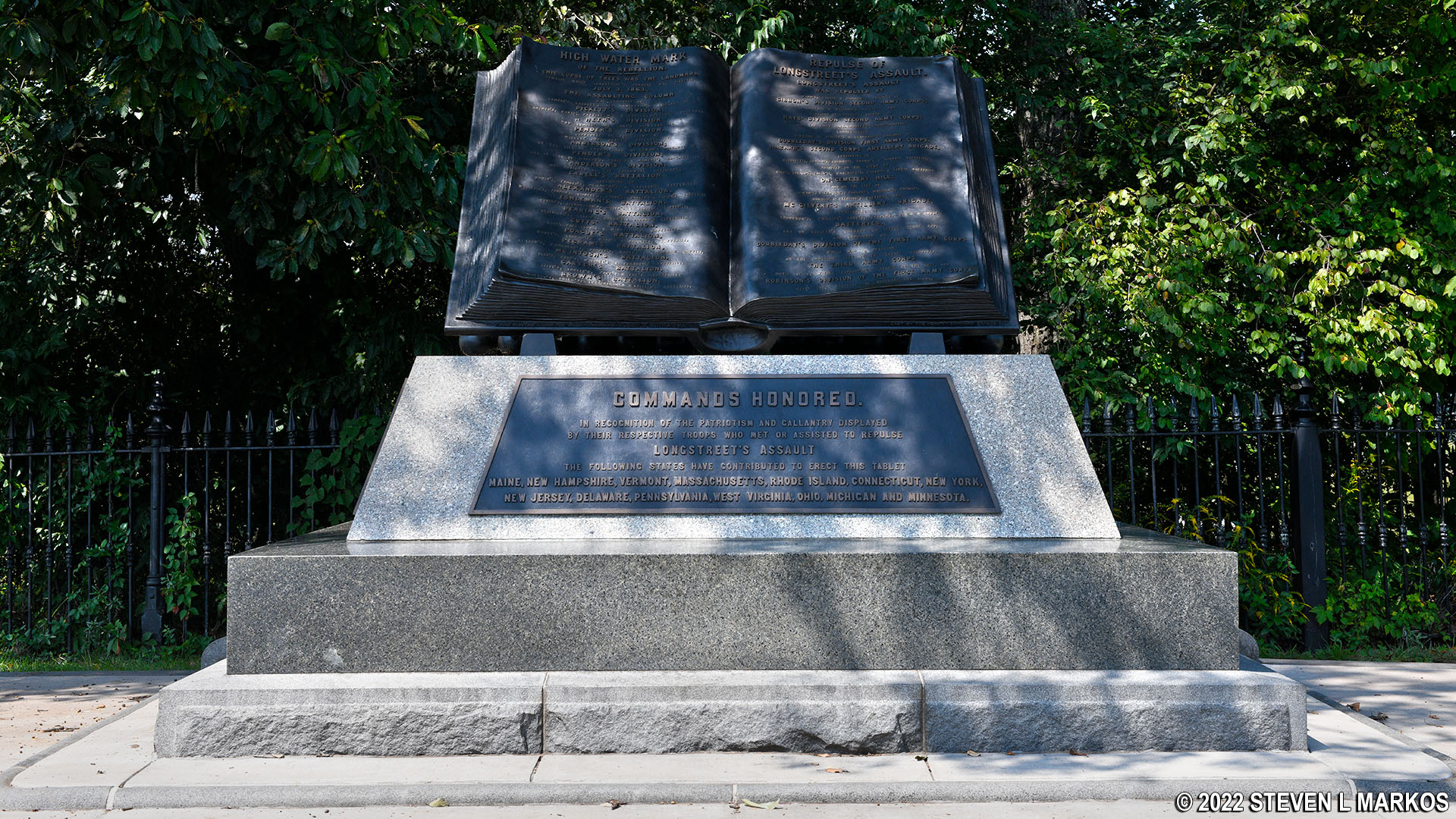
Follow Hancock Avenue south to the first monument featured on Cemetery Ridge, the High Water Mark of the Rebellion Memorial dedicated in 1892. This monument marks the forward-most progress of the Confederates during Pickett’s Charge on the afternoon of July 3, 1863. It is surrounded by what is known as the Copse of Trees. The trees were the point of reference used by the Confederates to mark their targeted assault location. Most of the trees that made up the Copse of Trees were cut down by souvenir hunters and the man who owned the property, but two of them are supposedly original.

High Water Mark of the Rebellion Memorial (1892) at Gettysburg National Military Park
High Water Mark of the Rebellion Memorial (1892) at Gettysburg National Military Park
Continue south on the paved path to the next stop on the Cemetery Ridge Trail, the 20th Massachusetts Infantry Monument (dedicated in 1886). This is one of the truly unique monuments at Gettysburg National Military Park. It consists of a 30-ton pebbled conglomerate rock from Massachusetts. The regiment’s commander was Paul Revere’s grandson, Colonel Paul Joseph Revere. He was killed during the fighting on July 2nd.

20th Massachusetts Infantry Monument (1886), Gettysburg National Military Park
At this point the trail leaves the paved path and heads north through the field, following a line of monuments that mark the positions of the Union infantry. Stop when you arrive at the 69th Pennsylvania Infantry Monument, which was dedicated in 1887.

Line of monuments mark the positions of the Union infantry at Cemetery Ridge, Gettysburg National Military Park
There were ten companies in the 69th Pennsylvania regiment, and stone markers connected together by a chain mark the position of all ten. This gives you an idea of how much territory a regiment typically covered during the Battle of Gettysburg. This is the only regimental monument in the park with such a feature. At this point in the war, most regiments had been whittled down from 1,000 men to around 300.

69th Pennsylvania Infantry Monument (1887), Gettysburg National Military Park

Company markers for the 69th Pennsylvania Infantry Monument at Gettysburg National Military Park

Company marker for the 69th Pennsylvania Infantry Monument at Gettysburg National Military Park
Just north of the 69th Pennsylvania Infantry Monument is the 72nd Pennsylvania Infantry Monument, dedicated in 1891. The story behind this monument is that this is not where the 72nd was originally positioned on July 3rd, and battlefield regulations concerning monument placement state that regimental monuments had to be placed where the regiment stood at the start of the battle. The 72nd was originally positioned in reserve behind Cemetery Ridge. When the Confederates temporarily overran Union troops in this area now marked by these monuments, the 72nd moved forward to help in a counterattack and remained in this area for the duration of Pickett’s Charge. Men of the 72nd took their case to the Pennsylvania Supreme Court, which ruled in their favor despite the battlefield rules.

72nd Pennsylvania Infantry Monument (1891), Gettysburg National Military Park

72nd Pennsylvania Infantry Monument (1891), Gettysburg National Military Park
Continue north to the last monument before coming to a stone wall that makes a 90-degree right-hand turn, a location now known as The Angle (the wall was 2-3 feet high in 1863). During Pickett’s Charge, this position was manned by the 71st Pennsylvania Volunteer Infantry. It was at The Angle that Confederate soldiers under the command of Brigadier General Lewis Armistead, part of Pickett’s division, were able to breach the stone wall and reach Cemetery Ridge. However, Union reinforcements soon arrived and drove them back. Armistead and many of his men were killed during the fighting. Other than this one bright moment, the Confederate charge was an utter failure.
Notice that the last monument before the wall reads “California Regiment.” This regiment was put together by Californians living in New York and Philadelphia and began as the 1st California Infantry. After its commander and organizer Senator Edward Baker was killed earlier in the war, the regiment was absorbed into the 71st Pennsylvania Infantry.

71st Pennsylvania Volunteer Infantry Monument (1887), Gettysburg National Military Park
The last stop on the Cemetery Ridge Trail is the Bryan Farmhouse and barn. To get there, follow the stone fence back to Hancock Avenue and turn north (left). Walk down the road for about .2 mile. The Bryan House is on one side of the road and the barn is on the other. The farm was owned by Abraham Bryan, a free black man. When he got news that the Confederates were on their way to Gettysburg, he and other free black property owners left town. If they were captured by the Confederates, they risked being brought back south and forced into slavery, or perhaps even being shot on the spot. During the Battle of Gettysburg, the house, barn, and stone fences of the farm were used as cover by both Union and Confederate soldiers. While most of his farm was destroyed, Bryan returned to Gettysburg, rebuilt, and lived out his life here, dying in 1879.

Bryan House on Cemetery Ridge at Gettysburg National Military Park

Bryan Barn on Cemetery Ridge at Gettysburg National Military Park
At this point, the tour of Cemetery Ridge ends. To return to the Visitor Center, walk back south along Hancock Avenue and take the paved path at the Meade statue. Round trip to and from the Visitor Center is just a little over two miles. The hike took me 1.5 hours to complete, which is exactly how much time the trail booklet suggests to allow for the walk.
If you haven’t yet visited the Soldiers’ National Cemetery, now is a good time to do so. When you get back to Taneytown Road, the cemetery entrance is just a quarter mile up the road. Walking saves you the hassle of trying to park, and if you are this close, you might as well walk.

Walking path along Taneytown Road to Soldiers’ National Cemetery
In truth, the walk along the Cemetery Ridge Trail doesn’t accomplish much other than burning calories. The information in the booklet is interesting, and it does enhance a visit to Cemetery Ridge. However, if you don’t want to walk from the Visitor Center, buy the booklet and just drive to Cemetery Ridge. From there you can visit all points described in the booklet at roughly half the distance of the walk from the Visitor Center. There is also a parking lot at the Leister House, which is another good place to start the walk.
With a few exceptions, use of any photograph on the National Park Planner website requires a paid Royalty Free Editorial Use License or Commercial Use License. See the Photo Usage page for details.
Last updated on January 18, 2025


