

Delaware River near Milford Beach in Delaware Water Gap National Recreation Area
PORT JERVIS TO MILFORD BEACH RIVER TRIP
Length: 9 miles
Water Level at Time of Trip: 3.25 feet to 6.15 feet
Average moving speed: 4.4 MPH with two paddlers
Top Speed: 5.7 MPH
Time: 2.25 hours
This river review covers the Delaware River from the West End Beach boat ramp in Port Jervis, New York, to the Milford Beach Boat Ramp in Delaware Water Gap National Recreation Area on the Pennsylvania side of the river.
Those who want to paddle the entire Delaware River within Delaware Water Gap National Recreation Area must start their trip outside of the park because the northernmost boat ramp within the park, the Milford Beach Boat Ramp, is 4.5 miles south of the northern park boundary. The closest public boat launches to the north are the Westfall Boat Ramp in Matamoras, Pennsylvania, and at West End Beach in Port Jarvis, New York, both roughly nine river miles from Milford Beach. I launched from West End Beach. From what I read, there is an entrance fee during the summer, but I did the trip on October 8th. My vehicle was still there when I picked it up later, and there were no parking tickets on the front window.
(NOTE: Three-quarter mile upriver from Milford Beach is the Caddoo Access Canoe Launch. This is a decent launch point for canoes and kayaks, but it is impossible to spot from the river unless you know what to look for and is therefore not a good take-out point. Despite scouring the riverbank and having it plotted on my GPS unit, I never saw anything. I had to drive to it later to find out what I missed.)

Boat ramp on the Delaware River at West End Beach in Port Jervis, New York
Before starting a river trip through Delaware Water Gap National Recreation Area, it is a good idea to check the water levels so you have an idea of the river conditions. At the north end of the park, the USGS water level gauge at Montague (which is right at Milford Beach) is the gauge used by the National Park Service to assess conditions. Levels between five and seven feet are typical and provide plenty of water for a trip down the river with conditions suitable for anyone with basic paddling skills. If the Montague gauge reads less than four feet, there may be spots on the river with very little water. Levels over seven feet require more paddling experience, and the river is closed due to extreme danger when water levels at Montague reach fifteen feet.
It had been raining heavily for a few days prior to my trip, so there was plenty of water. The gauge at Montague reported 6.15 feet. Keep in mind that the observations in my report are based on this water level. If you do the trip when the levels are lower, you may be dragging your boat to deeper water in some places and probably won’t experience the same degree of rapids as I report (historically, water levels at Montague rarely dip below five feet). If the water levels are significantly higher, you may experience more intense rapids, and more of them. Also be aware that regardless of water levels, extreme winds can cause turbulent conditions that require advanced skills on water otherwise suited for all paddlers.
A half mile from West End Beach is the US 209 bridge, and just past it is a small rapid of no real consequence other than it breaks up the monotony of the calm water up to that point. There is also a turbulent area about .4 mile past the bridge that may be caused by the remnants of some sort of manmade structure under the water—perhaps a former dam—because there appeared to be a 6-inch drop over a ledge that stretched halfway across the river on the Pennsylvania side. Beyond that, the water for the rest of the journey to Milford Beach was either calm or slightly choppy as seen in the second photo below.

The US 209 bridge spans the Delaware River between Matamoras, Pennsylvania, and Port Jervis, New York

Choppy water on the Delaware River near Port Jervis, New York
A little more than a mile past the first bridge is the much larger I-84 bridge. Total distance from West End Beach to the bridge is 1.75 mile.

I-84 Bridge spans the Delaware River between Matamoras, Pennsylvania, and Port Jervis, New York
You’ll know you are about to enter Delaware Water Gap National Recreation Area when you see what appears to be the first public access to the river. However, this is the privately owned Kittatinny Canoes River Beach Campground (5.3 miles from the start). This is where I was camping, so my assistant and I got out to get some items from our campsite. If you need a break, I doubt anyone is going to run you off if you pull up on shore, but you can’t launch or take out here unless you are a customer. The park border is just downriver from the campground. Of course you would need a map to know this because there is no WELCOME TO THE PARK sign on the riverbank.

Kittatinny Canoe’s River Beach Campground on the Delaware River near Milford, Pennsylvania
It is approximately four miles from the River Beach Campground to Milford Beach on relatively calm water. In fact, at six-foot water levels, there is nothing on this 9-mile stretch of river that would rule out taking a toddler (who can swim and has on a life jacket) with you in your boat. It is an easy paddle that is suitable for all skill levels.

Delaware River near Milford, Pennsylvania, in Delaware Water Gap National Recreation Area
Milford Beach is right before the third bridge you will come to, this one being the US 206 bridge. Don’t quote me on it, but I believe the tower on the Pennsylvania side of the river (where Milford Beach is located) is the Montague water gauge.
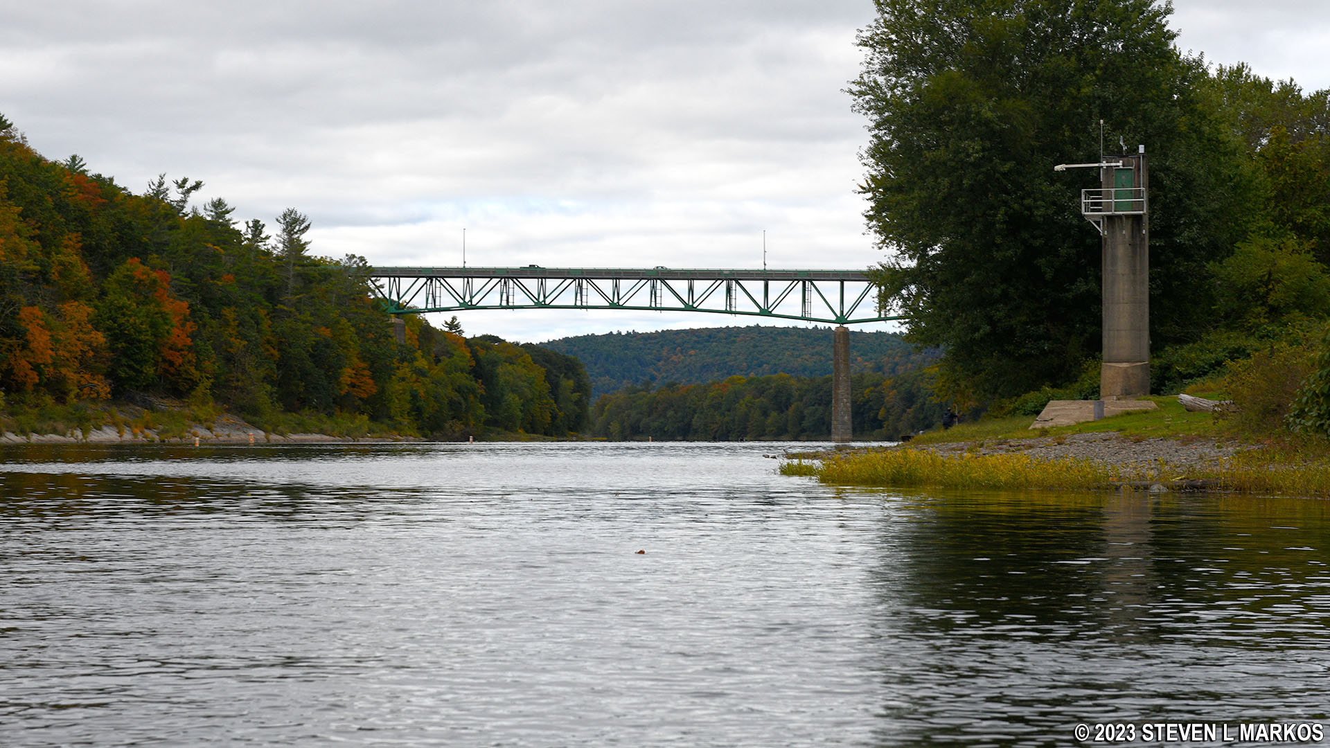
US 206 bridge and Montague water gauge at Milford Beach in Delaware Water Gap National Recreation Area
While there is an actual concrete boat ramp at Milford Beach, if you are in a canoe or kayak and are just stopping to take a break, you can pull up on the shore. The facility has restrooms and a picnic area.

Shore of Milford Beach at Delaware Water Gap National Recreation Area
Next River Section | Paddling Home Page
With a few exceptions, use of any photograph on the National Park Planner website requires a paid Royalty Free Editorial Use License or Commercial Use License. See the Photo Usage page for details.
Last updated on January 29, 2024


