
Nature Trail at Sagamore Hill National Historic Site
Length: 1-mile loop, including side trip to the beach
Time: 30 minutes
Difficulty: Moderate
There is only one trail at Sagamore Hill National Historic Site, a short loop trail that leads out to Cold Spring Harbor, part of Oyster Bay. Called the Nature Trail, it begins on the right side of the Visitor Center, which is housed in the Old Orchard Mansion.

Start of the Nature Trail at Sagamore Hill National Historic Site

Nature Trail Map (click to enlarge)
From the Visitor Center, it is roughly 400 feet to where the loop portion of the trail begins. A sign at the intersection recommends going to the right (counterclockwise) to avoid hiking up the steepest hill. As the name implies, Roosevelt’s Sagamore Hill is at the top of a hill, and it is about 100 feet higher up than Cold Spring Harbor. I went to the right as suggested, and this report is written from that perspective.

Start of the loop portion of the Nature Trail at Sagamore Hill National Historic Site
At the far end of the loop is a side trail to the bay, and from the start until the side trail, the Nature Trail heads steeply downhill. However, it is a wide path, and other than a few roots sticking out of the ground here and there, the surface is smooth and easy to walk on. (The photo below is looking back up the hill.)

Steep hill on the south side of the Nature Trail at Sagamore Hill National Historic Site
The steepest part of the hill lasts for .2 mile. It does taper off near the bottom, and at that point you can see the bay through the trees (at least in the winter).

Nature Trail approaches the intersection with a side trail to Cold Spring Harbor, Sagamore Hill National Historic Site
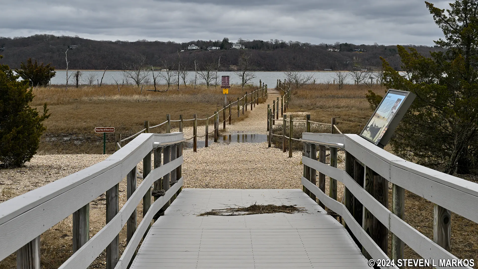
The intersection with the trail to Cold Spring Harbor comes .3 mile from the Visitor Center. A boardwalk carries hikers over Eel Creek to the beach. Eel Creek is a tidal salt marsh, so at high tide the area will be underwater, and at low tide, which is when I arrived, the water level will be low and there will be a lot of muddy areas. This is the best time to come for birdwatching because the birds can walk around in the mud and snag sea creatures and other bits of food. Herons and King Fishers are a common sight, though there wasn’t much action when I did the hike during the first week of April.

Nature Trail Boardwalk to Cold Spring Harbor, Sagamore Hill National Historic Site

Eel Creek and saltwater marsh along the Nature Trail’s boardwalk to Cold Spring Harbor, Sagamore Hill National Historic Site
The walk to the Roosevelt Family beach is a little over a tenth of a mile, and of course you must walk back the same way. As did the National Park Service, Theodore Roosevelt built a boardwalk to access it. He also built a bathhouse for changing clothes and a dock. Today this area is part of the Oyster Bay National Wildlife Refuge. There is no swimming or wading allowed from the park property, though nothing prevents visitors from bringing a chair and sunbathing along the shore.

View north of Cold Spring Harbor from the beach at Sagamore Hill National Historic Site

View south of Cold Spring Harbor from the beach at Sagamore Hill National Historic Site
Once back at the loop, take a left to continue the hike on the Nature Trail. The journey back is just the opposite of the hike down—uphill all the way. If this is a smaller hill than the one I came down, it’s not smaller by much. In hindsight, I doubt it makes much difference which way you travel around the loop.

Hilly terrain on the north side of the Nature Trail loop at Sagamore Hill National Historic Site
Including the trip to the beach, the hike took me 30 minutes, though I didn’t stay any longer at the beach than the time required to take a few photos. It is a nice hike if you don’t mind hills.
With a few exceptions, use of any photograph on the National Park Planner website requires a paid Royalty Free Editorial Use License or Commercial Use License. See the Photo Usage page for details.
Last updated on December 16, 2024


