

Riverwalk Ramble and Heritage Hike map (click to enlarge)
Download the Canalway Walk Brochure
Length: 4.6 miles round trip
Time: 3 hours round trip
The Riverwalk Ramble is one of four urban trails at Lowell National Historical Park. This enjoyable walk along the Merrimack River runs from the Boott Cotton Mills to the Guard Locks and Francis Gate on the Pawtucket Canal. The National Park Service’s Lowell Waterways brochure claims the trail is 1.6 miles, but I measured it to be 2.3 miles on two different occasions. Furthermore, there is no way to make a loop out of it, so you must walk back to the starting point, doubling the distance. There were plans to continue the trail from the Guard Locks back to the Visitor Center, but this has not materialized.
If the Visitor Center is where you want to end up instead of Boott Cotton Mills, on the way back you can take the Heritage Hike. The intersection of the two trails is at the bridge on Pawtucket Street that crosses over the Northern Canal. The Heritage Hike ends near the Swamp Locks and Gatehouse—the middle of three locks on the Pawtucket Canal—which is just down the road from the Visitor Center. Round trip is about 5 miles, a little longer than walking back to the mills the same way you came, but at least you get to see new territory.
As mentioned, the Riverwalk Ramble starts at Boott Cotton Mills. There is a trolley that runs between the Visitor Center and the mills during the summer (Wednesdays through Sundays), or you can walk between the two locations in ten minutes. Once at Boott Cotton Mills, enter the complex and just keep walking straight ahead to a passageway through one of the mill buildings that allows access to the river, then take a left at the concrete walkway to begin the hike. Signs along the walkway refer to this section as the Merrimack Riverwalk.

Entrance to Boott Cotton Mills, Lowell National Historical Park

Walkway along the Merrimack River behind the Boott Cotton Mills, Lowell National Historical Park
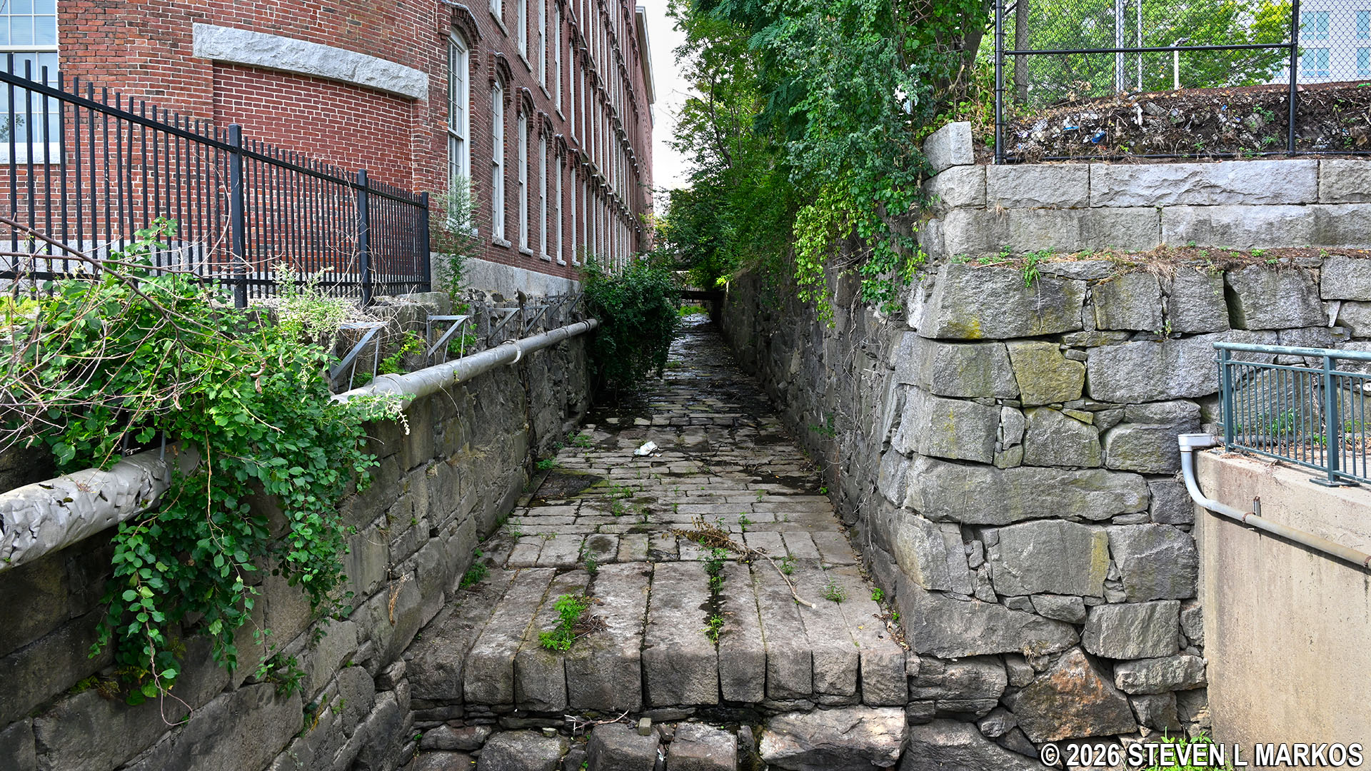
While the walkway runs right along the river for .6 miles, trees and brush block the view at least half the time.

View of the Merrimack River from the Merrimack Riverwalk in Lowell, Massachusetts

Section of the Merrimack Riverwalk in Lowell, Massachusetts, without a view of the Merrimack River
While walking along the river you will pass two wasteways, the first being the Merrimack Wasteway and second the Lawrence Wasteway. A wasteway is an exit that allows excess water to flow out of the canal and back into the Merrimack River. It was also an integral part of draining the canals every Saturday (when the mills were closed) so that repairs could be made and silt and garbage could be removed. Private citizens would also comb the dry canals for anything salvageable that had been dumped or lost in the canals during the week, then sell what they found to junk men.
Merrimack Canal wasteway at the northern end of the canal, Lowell National Historical Park

Lawrence Wasteway empties into the Merrimack River in Lowell, Massachusetts
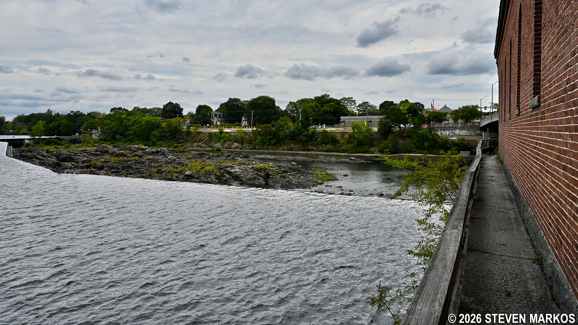
A large bend in the river comes just after passing under the 1883 Aiken Street Bridge (aka Ouellette Bridge). The Riverwalk Ramble shifts inland a little, curves around the back of the Lelacheur Park baseball field and some apartments, and eventually comes to the Eldred L. Field Hydroelectric Plant that is operated by Boott Hydropower (part of Enel Green Power North America). This is where you will first see the rocks and rapids at the lower end of Pawtucket Falls.
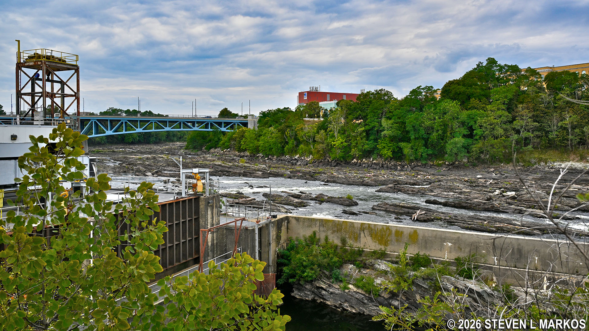
Lower end of Pawtucket Falls near the Eldred L. Field Hydroelectric Plant in Lowell, Massachusetts
The Pawtucket Canal was originally built to circumnavigate the Pawtucket Falls. The Merrimack River, which begins in the lake region of New Hampshire, was used to transport lumber from the area to the shipyards of Newburyport, Massachusetts, where the river meets the Atlantic Ocean. Lumber could also be shipped down the coast to Boston, a journey of roughly 60 miles. The only problem was that boats could not get past the one-mile stretch of falls, rocks, and rapids that dropped 32 feet. Goods had to be unloaded just before the falls, carted a mile downriver, and then reloaded onto another boat, an obvious waste of time and money.
In 1792, a group of wealthy Boston merchants formed the Proprietors of Locks and Canals to build a canal around Pawtucket Falls. Completed in 1796, the result was a two-mile long Pawtucket Canal that ran from just south of the falls to the east side of what was then the farming village of East Chelmsford (Lowell wasn’t incorporated as a town until 1826, and as a city until 1836).

Pawtucket Canal (click to enlarge)
The Merrimack Riverwalk section of the Riverwalk Ramble ends at Pawtucket Street where you will find yourself at a red brick crosswalk. Continue across the street and take a right towards the bridge over the Northern Canal. Just before the bridge are some steps on your left that lead down to the canal; take the steps. At this point you will have walked 1.1 miles.
Intersection of the Merrimack Riverwalk and Pawtucket Street in Lowell, Massachusetts

Steps from Pawtucket Street down to the Northern Canal in Lowell, Massachusetts
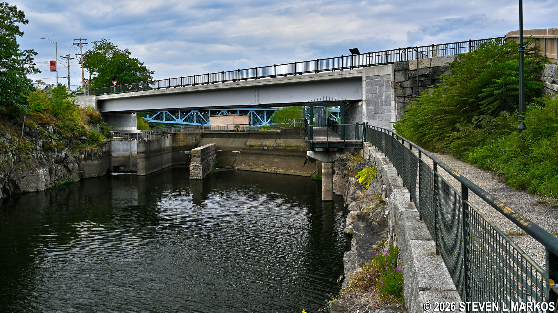
When you get to the canal, take a right and head under the Pawtucket Street bridge until you come to the gated pedestrian bridge that spans the Northern Canal and marks the start of the Northern Canal Walkway. From here you can walk all the way to the Pawtucket Dam along the wall that separates the canal from the Merrimack River. The start of the Heritage Hike is also at the bottom of the steps—turn left instead of right. If you plan to take this route back to the Visitor Center, when you get to the end of the Riverwalk Ramble at the Francis Gate and Guard Locks, you will retrace your steps back to this point.
Continuation of the Riverwalk Ramble at the mouth of the Northern Canal in Lowell, Massachusetts
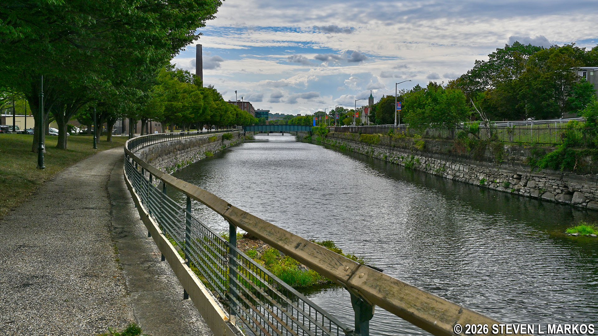
Start of the Heritage Hike at the mouth of the Northern Canal in Lowell, Massachusetts

Pedestrian bridge over the Northern Canal as seen from the vehicle bridge on Pawtucket Street in Lowell, Massachusetts
The Northern Canal Walkway is the highlight of the Riverwalk Ramble. Keep in mind that it is only open from May 15th to October 15th between the hours of 9 AM and 5 PM, and even then it can be closed if the water is too high. When closed, you must walk along Pawtucket Street until reaching School Street / Mammoth Road .4 miles ahead. That’s just a walk through a city, and there is nothing interesting about it.
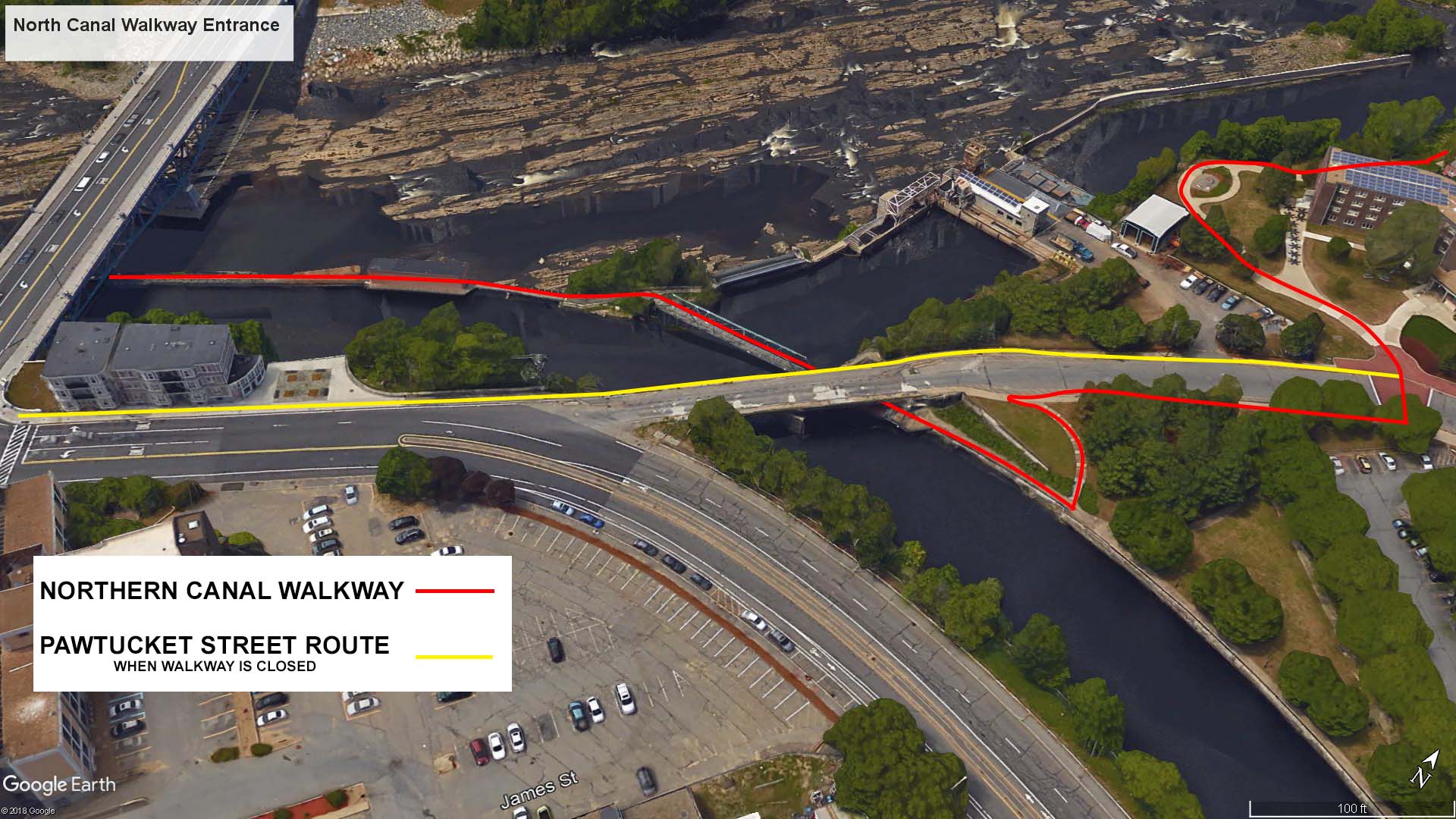
Northern Canal Walkway route of the Riverwalk Ramble (click to enlarge)

Northern Canal Walkway in Lowell, Massachusetts
The surface of the Northern Canal Walkway is a combination of the original stones slabs used to build it in 1847-48 and a modern concrete path. When walking on an original section, the stones are a little uneven, so watch your step.
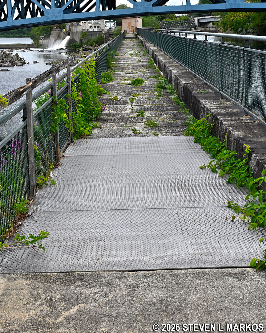
Cement path and original stones slabs make up the surface of the Northern Canal Walkway in Lowell, Massachusetts
There is a nice view of the hydroelectric plant a short ways down the walkway. To illustrate how much technology has advanced since the Industrial Revolution, this one modern hydroelectric plant that opened in 1985 could have powered every mill in Lowell.

Eldred L. Field Hydroelectric Plant in Lowell, Massachusetts
The Northern Canal was the last canal built in Lowell (opened in 1848). The Walkway was planned from the start as a way to merge industry with nature. In fact, the upper portion near the dam is actually on an island, and back in the 1800s this served as a park for the people of Lowell. Today it is overgrown and covered with trees.
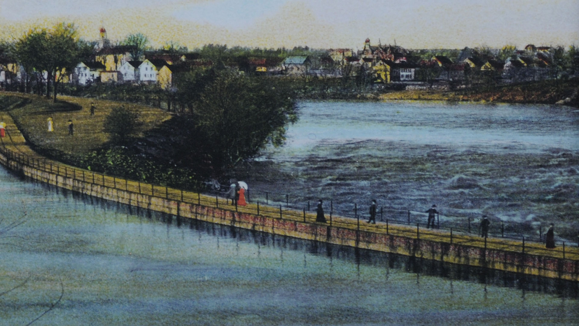
Northern Canal Walkway painting

Island portion of the Northern Canal Walkway today, Lowell, Massachusetts
The Northern Canal Walkway eventually ends at the Mammoth Road Bridge (aka O’Donnell Memorial Bridge) and the Pawtucket Dam. Stairs lead up to the road, but the gate at the top is usually locked. If so, just take the handicap access ramp that begins under the stairs. At this point you will have walked 1.75 miles.

End of the Northern Canal Walkway at Pawtucket Dam in Lowell, Massachusetts
When you get to Mammoth Road, you will see a long, brick building—the Pawtucket Gatehouse. Built between 1846 and 1848, the gatehouse controlled the flow of water into the Northern Canal. It was also used as an experimental station by engineers James Francis and Uriah Boyden to test their hydraulic turbine designs. Francis would go on to perfect a turbine that revolutionized the mills at Lowell by replacing the inefficient waterwheels with what is now called a Francis Turbine: a mixed-flow turbine that, while since modified, is still being used today in many hydroelectric power plants. The first Francis Turbine used in Lowell was installed in Boott Cotton Mills in 1849.
To continue the Riverwalk Ramble and to get the best view of the Pawtucket Dam—which you cannot see at this point—walk directly across the street and pass through a picket fence gate to the left of the gatehouse. You can then walk down the steps and along a walkway that runs the length of the gatehouse for an up-close look at the dam.
Pawtucket Gatehouse at the Pawtucket Dam in Lowell, Massachusetts
Stairs at the side of the Pawtucket Gatehouse lead down to a pool of water created by the Pawtucket Dam in Lowell, Massachusetts
Walkway along the upriver side of the Pawtucket Gatehouse in Lowell, Massachusetts
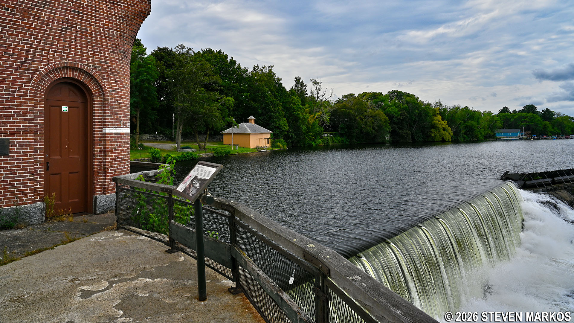
View from the west side of the Pawtucket Gatehouse of the waterfall created by the Pawtucket Dam in Lowell, Massachusetts
The Pawtucket Dam was originally built between 1826 and 1833 to form a pool that could be used to keep the Pawtucket Canal filled with water year-round. The dam was renovated between 1847 and 1875, and this is largely the dam that still stands today.
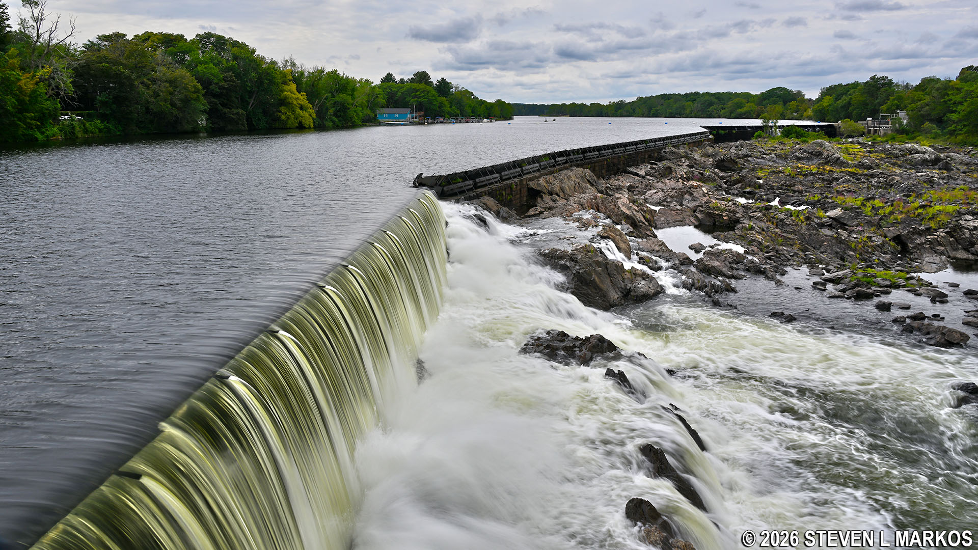
View of the Pawtucket Dam in Lowell, Massachusetts
The Pawtucket Dam was built as a 15-foot tall granite wall, and by 1840 it had a wooden flashboard system installed on top that extended its height by two feet. Over the years this increased to five feet. The flashboards were replaced in 2018—a controversial decision—by a pneumatic crest gate system comprised of steel plates and inflatable bladders. This new system is discussed later in this article, but for the sake of posterity, let’s examine the historical flashboard system, which is shown in the photo below.

Flashboard system installed on the Pawtucket Dam in Lowell, Massachusetts, up until 2016
A flashboard system is comprised of iron rods that are inserted into the top of the granite wall and wooden panels that are placed on the upriver side so that the force of the water holds them in place. The idea of the system is to create a wall that will collapse if the water gets too high. If the entire height of the dam was granite, in heavy rain the water would rise to the point that it would flood the area upriver of the dam. With the flashboard system, the iron rods bend when the weight of the water exceeds what they are designed to withstand, leading to the eventual collapse of the flashboards so that the water can flow down the river as normal. Workers would then have to replace the rods and boards after the high water receded. This was a dangerous job that was originally done by immigrants desperate for work.

Flashboard system on the Pawtucket Dam in Lowell, Massachusetts
In 2016, the replacing of the flashboard system began under protest of preservationists, the local community, and the National Park Service. Though primitive, the flashboards not only worked, there were so many gaps in the boards that the illusion of a waterfall was created, which everyone loved. The new system used steel plates and inflatable bladders, and very little water escapes between the panels. When air is pumped into the bladders, the wall stays up; let air out and the wall lowers. In a rare instance of a government agency suing another, the U. S. Department of Interior took the Federal Energy Regulatory Commission to court and lost, and then lost again in a subsequent appeal. The project was completed in 2018.
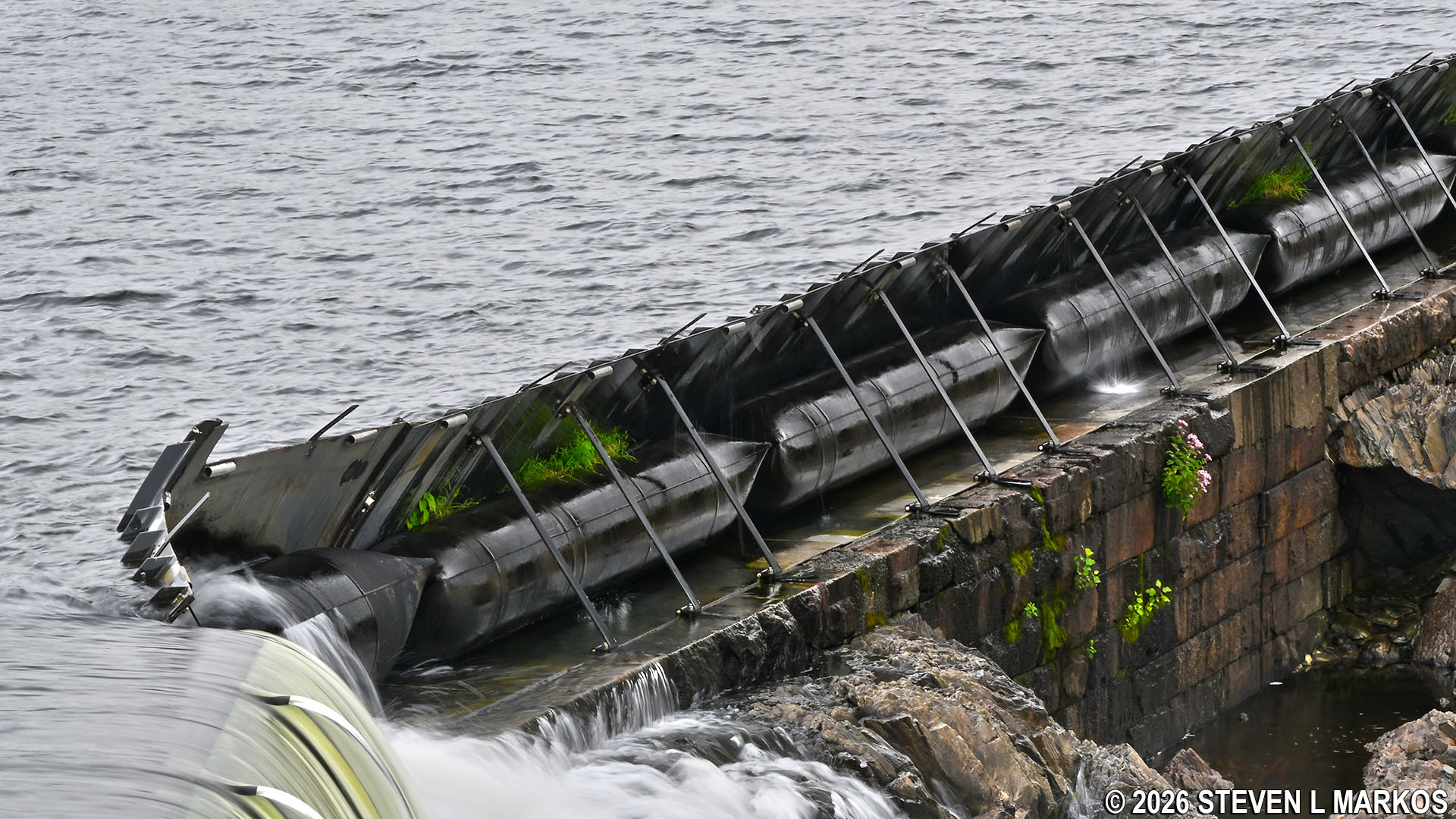
Pneumatic crest gate system installed in 2018 on the Pawtucket Dam in Lowell, Massachusetts
There are two ways to continue the Riverwalk Ramble from the Pawtucket Gatehouse. One is to go back to Mammoth Road and continue east (away from the gatehouse) to Pawtucket Street, then take a right (note that Mammoth changes names to School Street once over the bridge). However, the official route is to go back to the stairs and take them down to a field along the shore of the Merrimack River. There is a wayside exhibit and an old building, which is the historical blacksmith shop for the dam. Once on the field, you will see another staircase, and this leads up to Pawtucket Street, not far from the corner of School and Pawtucket. The benefits of this route are the blacksmith shop, which is closed, and the wayside exhibit about what it took to maintain the dam.
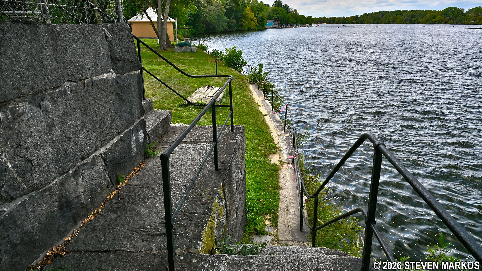
Stairs from the Pawtucket Gatehouse to the field along the Merrimack River in Lowell, Massachusetts
Stairs near the Pawtucket Gatehouse that lead to Pawtucket Street in Lowell, Massachusetts
Once on Pawtucket Street, take a right. In .2 miles you will cross over the Pawtucket Canal (it looks just like a river). On the other side of the street is the entrance to Francis Gate Park / Lowell Heritage State Park. Follow the walkway for a quarter mile to reach the Guard Locks and Francis Gate, which mark the end of the Riverwalk Ramble.

Francis Gate Park / Lowell Heritage State Park entrance, Lowell, Massachusetts
On your own, all you can do is walk around the outside of the three buildings at the lock, but if you take the Pawtucket Canal Boat Tour offered by the National Park Service, you can get inside the Francis Gate building. You can also visit Francis Gate Park by vehicle.

3-D satellite view of the Guard Locks and Francis Gate
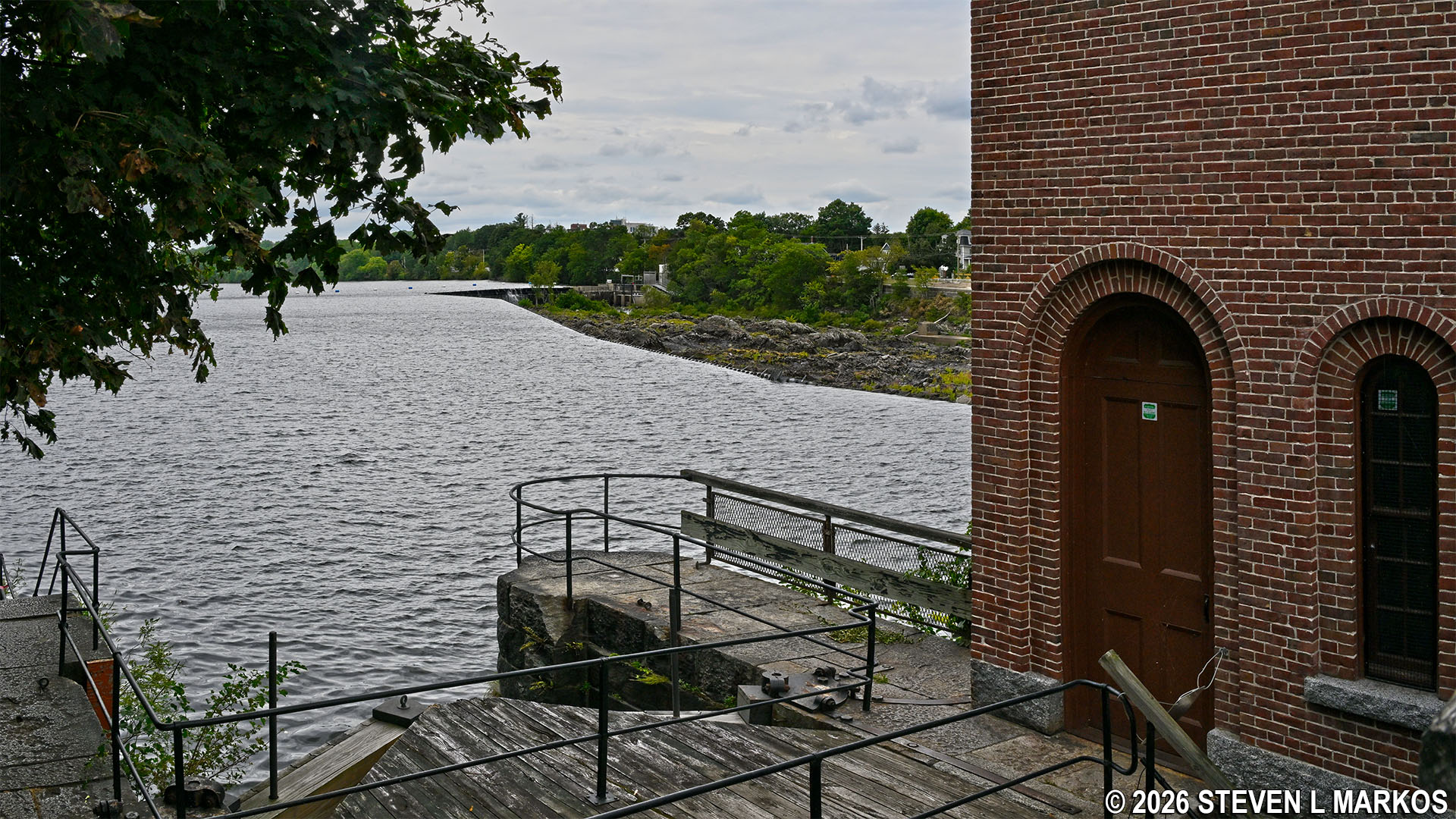
A guard lock on a canal connects it to its source of water—in this case the Merrimack River just a third of a mile upstream—and controls the flow of water into the canal. On many canals, this is also where boats enter and exit. Here at the Pawtucket Canal guard locks, the building with the red lumber levers sticking out of it, the Lockhouse, controls the lift lock that boats pass through, and the brick building to the side, the Gatehouse, controls the flow of water. A third building, a wooden structure known as the Francis Gate, is a flood gate, which is not always present at a guard lock (more on it later).

Lockhouse at the Guard Locks on the Pawtucket Canal in Lowell, Massachusetts

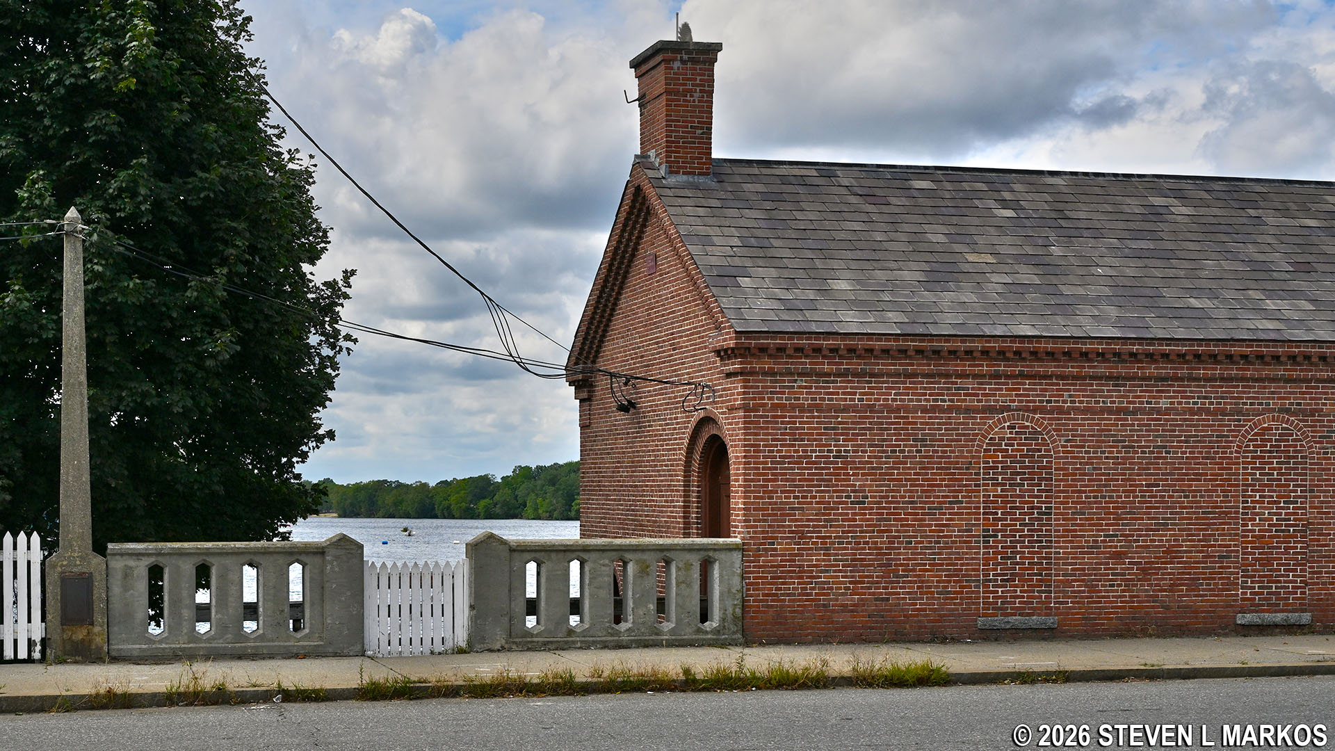
Gatehouse at the Guard Locks on the Pawtucket Canal in Lowell, Massachusetts
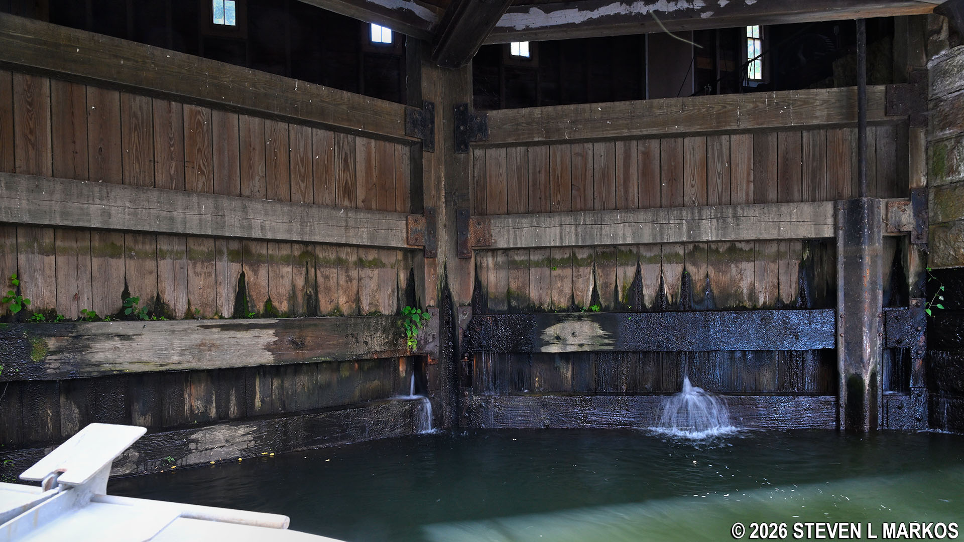
The Gatehouse now standing was built in 1870 to replace an older, wooden building. It is the fourth gatehouse, with the very first having been built in 1822. The Gatehouse controls the flow of water by opening and closing five sluice gates located at the lower level of the building. The sluices are not visible in the photo above, which is the downstream side of the building. Unless water levels are very low, you wouldn’t see them from the upstream side either because they are usually below water (photo below). The gates themselves are too large and heavy for a human to raise without help, so inside the building are turbines and other equipment to do the job. A worker simply threw a lever on a machine to open or close a gate.
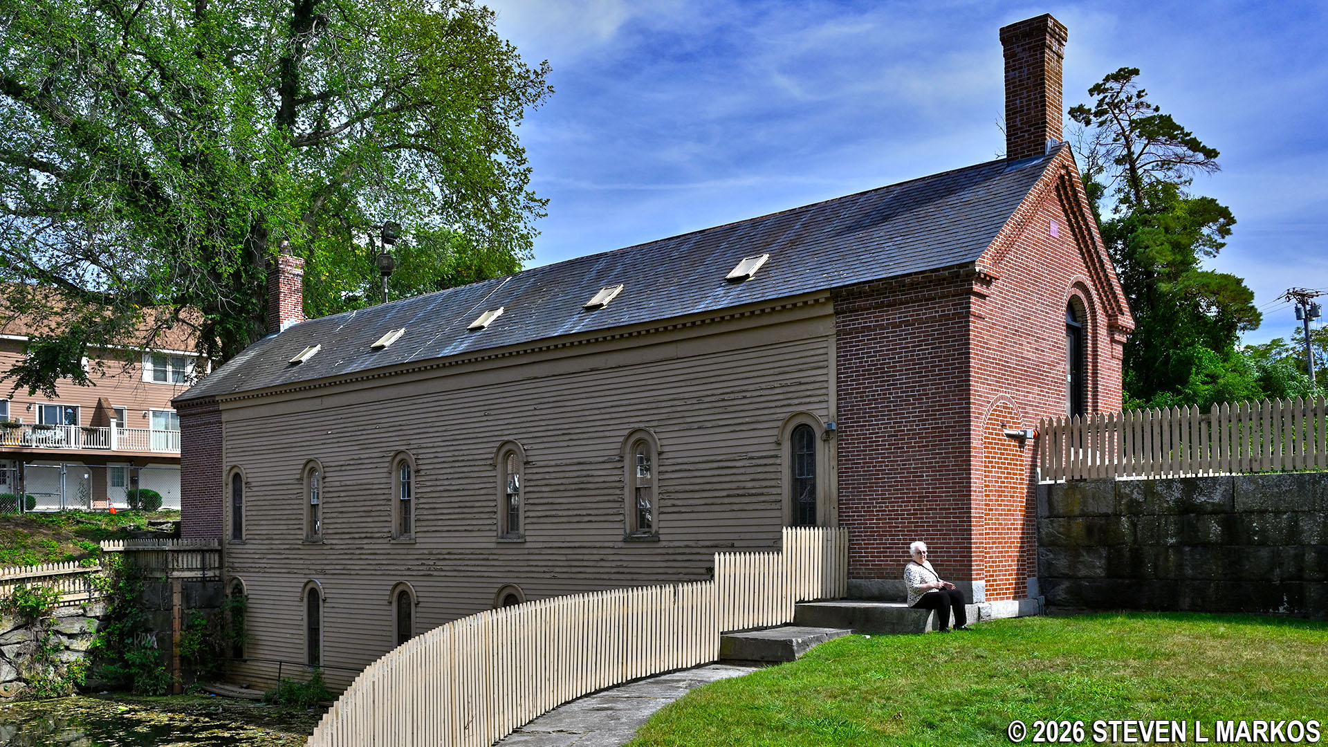
Upstream side of the Gatehouse at the Guard Locks on the Pawtucket Canal in Lowell, Massachusetts
The Lockhouse now standing was built around 1881 to replace an older structure from 1857. It sits atop the upstream gate of a two-gate lift lock, the other being 70 feet or so downstream.
Upstream lock gates underneath the Lockhouse at the Guard Locks on the Pawtucket Canal in Lowell, Massachusetts
Lift locks allow boats to be raised and lowered to different levels of the canal similar to the way a toy boat in a bathtub can be raised or lowered by controlling the water level in the tub. Two gates are essential for the system to work, and one always has to be closed to keep massive amounts of water from rushing downstream. Watch the following video to learn exactly how lift locks work.
With a transportation canal, a lockhouse is where the lockkeeper—the man who operated the lock—and his family lived. When a canal boat arrived, he and members of his family used the wooden levers (painted red here at the Guard Locks) to open and close the gates. Once the Pawtucket Canal was converted to support water power for the mills in the early 1820s, the lockhouse was used to store chains and windlass equipment needed to assist in opening the massive lock gates.
As noted, there is a third building at the Guard Locks on the Pawtucket Canal. This is known as the Francis Gate, a flood gate built around 1850 by engineer James Francis (same guy responsible for the Francis Turbine). Allowing enormous amounts of water of flow down the canal during heavy rain or spring snowmelt could flood the city and damage the mills. While the lock gates can stop the water when closed, at only 2 tons each there was doubt that they could hold back serious flood water. To protect against a failure, Francis came up with the idea of building a massive stop gate: a 20-ton wooden wall made of white pine that was seated in grooves cut into the granite walls on either side of the lock. The wooden wall was held up by a thick iron shackle, and when flood waters required that it be put in place, the shackle was cut, dropping the gate like a guillotine (it took 40 oxen to hoist it back up). It was used just two years after its construction with great success and again in 1936. In both cases, the standard lock gates broke.

Upstream side of the Francis Gate on the Pawtucket Canal in Lowell, Massachusetts

Downstream side of the Francis Gate on the Pawtucket Canal in Lowell, Massachusetts
Notice that there is an extra set of grooves cut into the granite. These were included so that more wooden beams could be dropped if needed. In 2006, flooding hit the area, and the city wanted to use the gate. However, it was ruled that the wood was too old and possibly rotten, so instead, iron beams were dropped into the second set of grooves to hold back the water. This was done by crane, and it took fourteen hours to get them in place. The beams are still piled off to the side just in case they are needed again.

Grooves in the Francis Gate where the wooden wall or beams would slide down to block flood waters, Lowell, Massachusetts
When done exploring the lock, it is time to walk back to either Boott Cotton Mills or the Visitor Center, and there are a few options. One is to walk all the way back to the mills the same way that you just came. The second is to take the Heritage Hike back to the Visitor Center. It is not any shorter—certainly not if you really want to get to Boott Cotton Mills—but at least you don’t have to see the same things twice for part of the way.
However, the quickest way back to the Visitor Center is simply to take city streets from the Guard Locks. The road and bridge that you can see from the lock is Broadway Street, and if you take it east (left), you will come out at the Visitor Center parking lot, just .8 miles away. Francis Gate Park is fenced in, so you must climb over the fence to get to the street. The best place to do this is behind the Gatehouse, for on the other side of the fence is a public street. If you hop the fence closest to the Francis Gate, you will end up in somebody’s backyard.
With a few exceptions, use of any photograph on the National Park Planner website requires a paid Royalty Free Editorial Use License or Commercial Use License. See the Photo Usage page for details.
Last updated on March 29, 2026


