

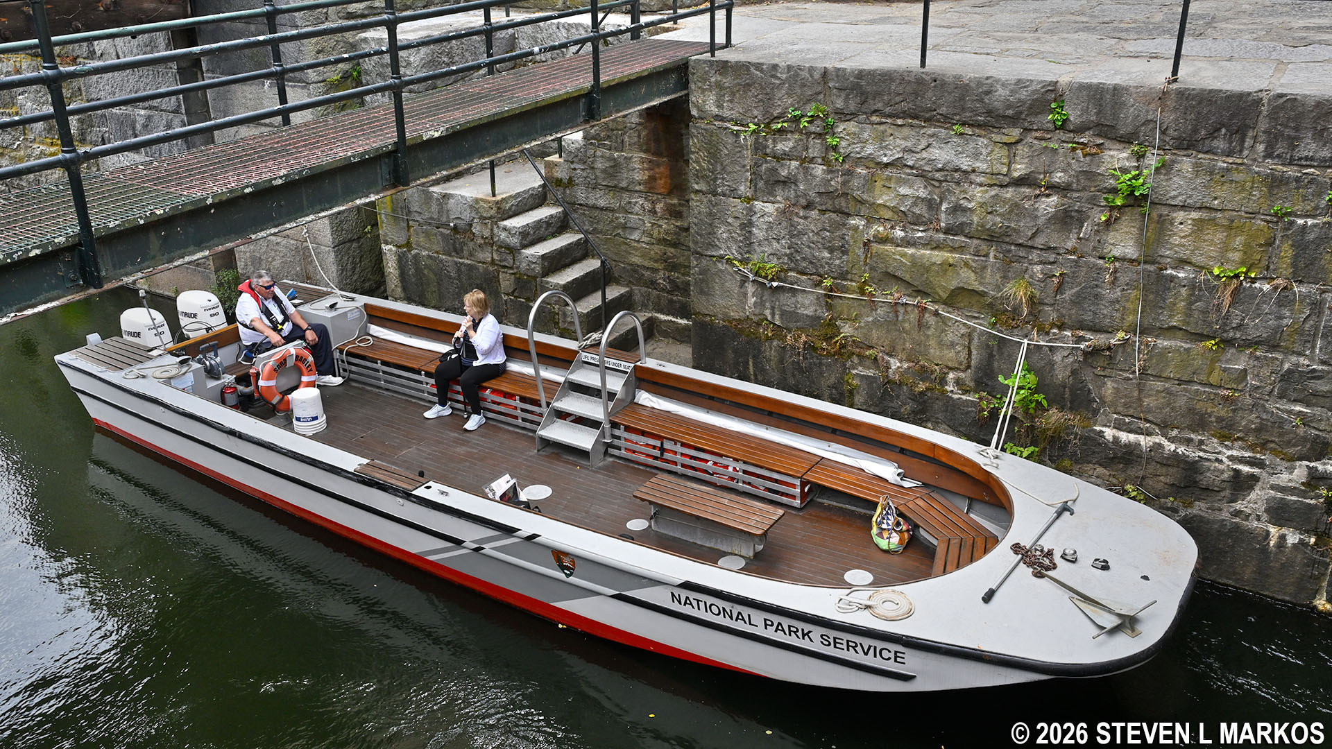
Visitors to Lowell National Historical Park enjoy a boat ride on the Pawtucket Canal
GENERAL INFORMATION
The 1.5-hour Pawtucket Canal Boat Tour provides a rare opportunity for visitors to Lowell National Historical Park to travel down one of the city’s canals, which for many people will be the highlight of their visit. The tour schedule varies each season, but they generally start around Memorial Day and continue through Columbus Day. For the current schedule, visit the National Park Service’s Guided Tours web page.
Fee-based tickets are required for the tour. These can be purchased at the Visitor Center on the day of your visit, or you can make a reservation in advance online at Recreation.gov. Each tour is limited to 18 people. I took my tour on a Monday in mid-August and had no problem getting a ticket at the Visitor Center, but there were seventeen passengers on the boat, not far from being full. If you know for sure when you plan to visit, be safe and make a reservation. You can get the current ticket prices on the National Park Service’s official Fees and Passes web page for the park.
The canal tours are conducted in a modern motorboat. There is no top on the boat, and the tour remains in the open the entire time. If avoiding the sun is important to you, be sure to wear a hat and apply sunscreen. Furthermore, the boats are not wheelchair accessible, but disabled visitors who can make it down three steps with assistance are welcome to attend. Collapsible wheelchairs can be stored on the boat.
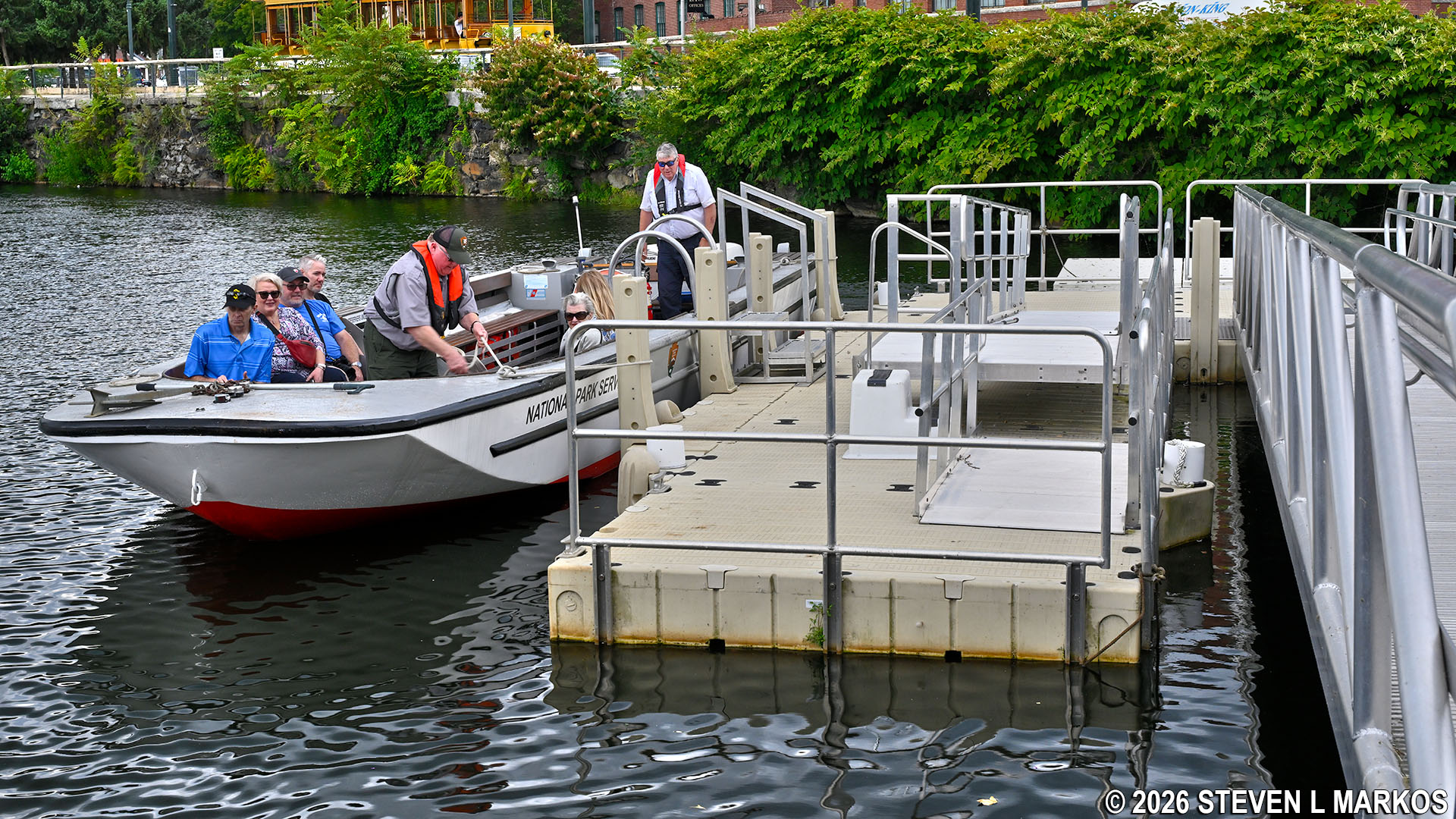
Participants on the Pawtucket Canal Boat Tour board the boat at the dock near the Swamp Locks, Lowell National Historical Park
TOUR DETAILS
The Pawtucket Canal Boat Tour begins at the Visitor Center, and from there participants take the Lowell trolley bus down the street to the Swamp Locks where the boat awaits. If the trolley is not operating, participants must walk to the dock (.2 miles).
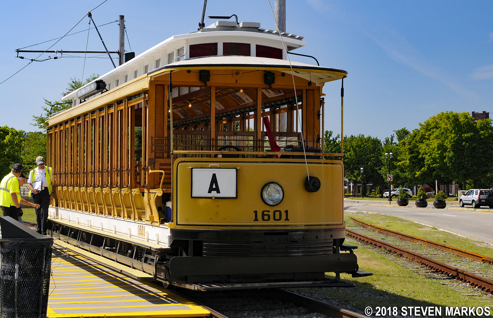
Lowell trolley, Lowell National Historical Park
Before beginning the tour, the Ranger gives a brief history overview of the canal.
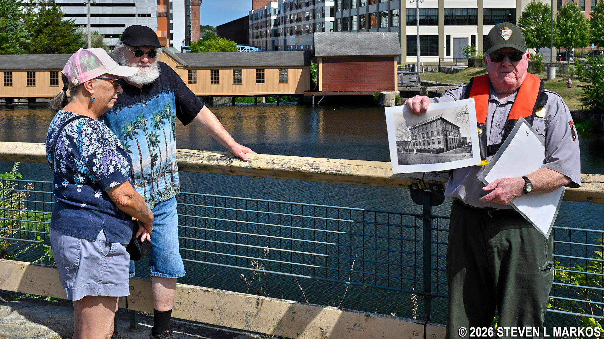
Ranger gives a talk on the history of the Pawtucket Canal near the Swamp Locks Dam Gatehouse, Lowell National Historical Park
The tour proceeds upstream on the Pawtucket Canal to the Guard Locks and Francis Gate, the first of the three locks on the canal (Swamp Locks is the middle lock). The Pawtucket Canal was originally built to circumnavigate the Merrimack River’s Pawtucket Falls located on the northwest side of Lowell. The river, which begins in the lake region of New Hampshire, was used to transport lumber from the area to the shipyards of Newburyport, Massachusetts, where the river meets the Atlantic Ocean. Lumber could also be shipped down the coast to Boston, a journey of roughly 60 miles. The only problem was that boats could not get past the one-mile stretch of falls, rocks, and rapids that dropped 32 feet. Goods had to be unloaded just before the falls, carted a mile downriver, and then reloaded onto another boat, an obvious waste of time and money.

View of the Pawtucket Falls section of the Merrimack River in Lowell, Massachusetts
In 1792, a group of wealthy Boston merchants formed the Proprietors of Locks and Canals to build a canal around Pawtucket Falls. Completed in 1796, the result was a two-mile long canal that ran from just south of the falls to the east side of what was then the farming village of East Chelmsford (Lowell wasn’t incorporated as a town until 1826, and as a city until 1836).

Pawtucket Canal (click to enlarge)
In 1804, the Middlesex Canal opened, and it connected the Merrimack River directly to Boston (it started just a mile downriver from the Pawtucket Canal). This cut the distance of transporting goods to Boston in half, plus cargo could travel on the calm and controlled waters of a canal instead of on the open sea from Newburyport. Furthermore, while lumber was still needed for the shipbuilding industry in Newburyport during the first decade of the 1800s, in 1811 a fire destroyed the city, and the War of 1812 put a damper on trade, and thus the market for new merchant ships. As a result of these two factors, the Pawtucket Canal’s usefulness dwindled, and by 1820 it saw very little boat traffic.
When the war ended in 1815, wealthy mill owner Francis Cabot Lowell began looking for a place to build more mills. Realizing the potential of the little-used Pawtucket Canal as a source of water power, Lowell and fellow investors decided to focus their attention on developing East Chelmsford into an industrial center. The idea was to dig power canals—canals built for water power, not transportation—that branched off of the Pawtucket Canal and used the Pawtucket Canal to keep them filled. Massive textile mills could then be built right along the edges. When canal-side real estate ran out, simply dig a new canal and put up more mills. By the mid-1800s there were approximately ten major mill companies and dozens of smaller ones operating in Lowell.
Francis Cabot Lowell died suddenly in 1817 from pneumonia and never saw the results of his ideas—or the city named for him—but his Boston Manufacturing Company continued on with the Lowell project. The first power canal built was the Merrimack Canal in 1823, and more canals were built in the following years. The Hamilton Canal opened in 1825, and within ten years the Lowell, Western, Lawrence, and Eastern canals were in operation. The Northern Canal, the last one built in Lowell, opened in 1848. This canal connected directly to the Merrimack River at Pawtucket Falls and was 100 feet wide, so it not only provided power for the mills situated along its edge, it provided 50 percent more water for the entire canal system. In all, there are approximately 5.5 miles of canals in Lowell.
To provide the necessary water on a reliable basis, two other construction projects were undertaken. First off, the original Pawtucket Canal needed to be widened and deepened, for while it was perfect for canal boats, more water was required to power the mills. A typical transportation canal of the time was around 50 to 80 feet wide and only 3-4 feet deep. The Pawtucket Canal was enlarged to at least 75 feet wide and 12 feet deep. This expansion ran from the Merrimack River to the Swamp Locks. All of this, as well as the original work on the canal, was done by hand, and mainly by Irish immigrants.
The second project was to create holding ponds where multiple canals came together, such as at the Swamp Locks where the Merrimack Canal (and later the Hamilton and Western canals) branched off of the Pawtucket Canal, and at the Lower Locks where the Pawtucket and Eastern canals diverged. This was accomplished by building the Swamp Locks Dam and the Lower Locks Dam, and then constructing gatehouses over the top of them to control the flow of water.
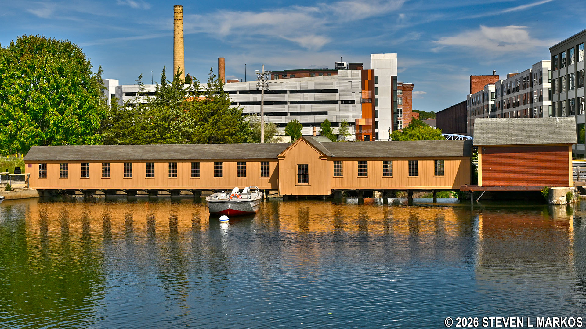
Upstream side of the Swamp Locks Dam Gatehouse on the Pawtucket Canal in Lowell, Massachusetts
If you look underneath either of the Swamp Locks Dam Gatehouse or the Lower Locks Dam Gatehouse, you will see many sluice gates. If all are open, most of the water continues down the Pawtucket Canal. If they are all closed, the water is diverted into the side canals. The entire canal system was still owned by the Proprietors of Locks and Canals, but instead of charging canal boats a toll, the company now operated as a water company. Mill owners paid for the amount of water they used, and the gatehouses allowed for the release of just the right amount of water at any given time.
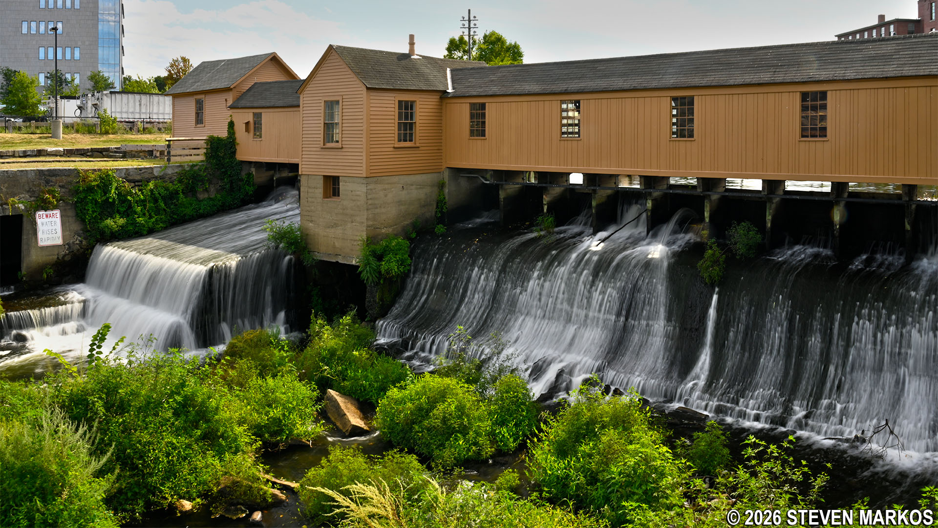
Sluice gates of the Swamp Locks Dam Gatehouse on the Pawtucket Canal in Lowell, Massachusetts
Once reaching the Guard Locks and Francis Gate, tour participants can exit the boat for a Ranger-guided tour of the site, which includes going inside the Francis Gate building. You can visit the lock on your own by either driving to Francis Gate Park or hiking the urban Riverwalk Ramble trail, but you cannot get inside the building unless you are on a tour.
Pawtucket Canal Tour boat approaches the Francis Gate (left) and Gatehouse (right) in Lowell, Massachusetts

3-D satellite view of the Guard Locks and Francis Gate
Those who cannot get up the steps from the boat to the buildings are welcome to wait onboard with the captain.
Participant on the Pawtucket Canal Boat Tour waits onboard the boat during a tour of the Francis Gate and Guard Locks in Lowell, Massachusetts
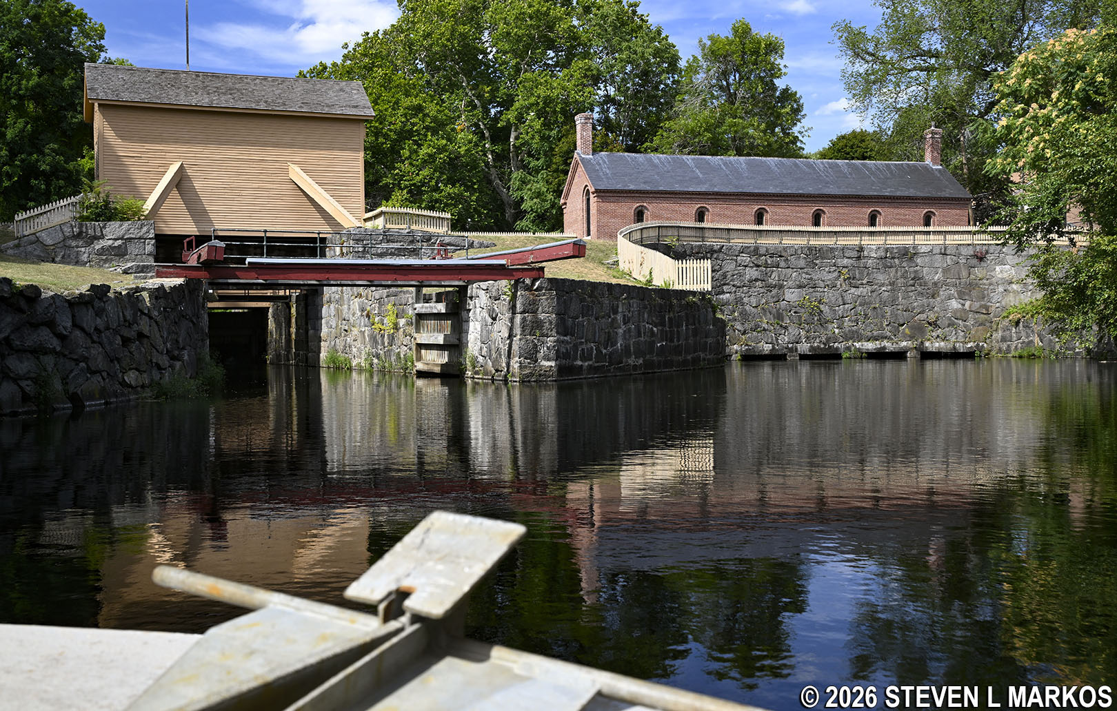
A guard lock on a canal connects it to its source of water—in this case the Merrimack River just a third of a mile upstream—and controls the flow of water into the canal. On many canals, this is also where boats enter and exit. Here at the Pawtucket Canal guard locks, the building with the red lumber levers sticking out of it, the Lockhouse, controls the lift lock that boats pass through, and the brick building to the side, the Gatehouse, controls the flow of water. A third building, a wooden structure known as the Francis Gate, is a flood gate, which is not always present at a guard lock (more on it later).
Lockhouse at the Guard Locks on the Pawtucket Canal in Lowell, Massachusetts

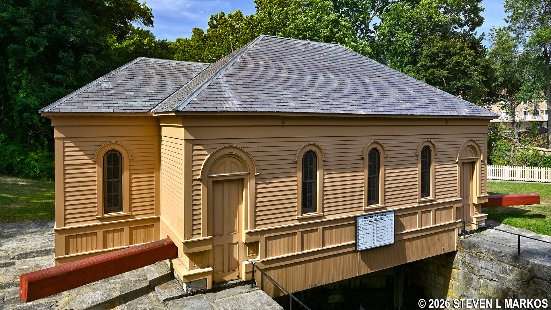
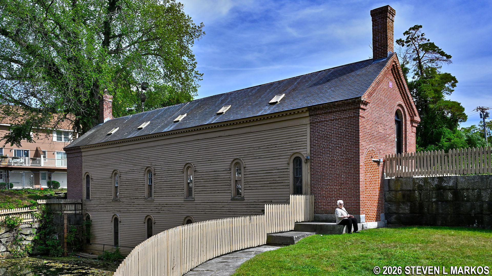
Gatehouse at the Guard Locks on the Pawtucket Canal in Lowell, Massachusetts
The Gatehouse now standing was built in 1870 to replace an older, wooden building. It is the fourth gatehouse, with the very first having been built in 1822. The Gatehouse controls the flow of water by opening and closing five sluice gates. The sluices are not visible in the photo above, which is the downstream side of the building. Unless water levels are very low, you wouldn’t see them from the upstream side either because they are on the lower level of the building and actually below water (photo below). To better picture the sluice gate system, just refer to the photo earlier in this article that showed the sluice gates on the Swamp Locks Dam Gatehouse. The gates themselves are too large and heavy for a human to raise without help, so inside the building are turbines and other equipment to do the job. A worker simply threw a lever on a machine to open or close a gate.
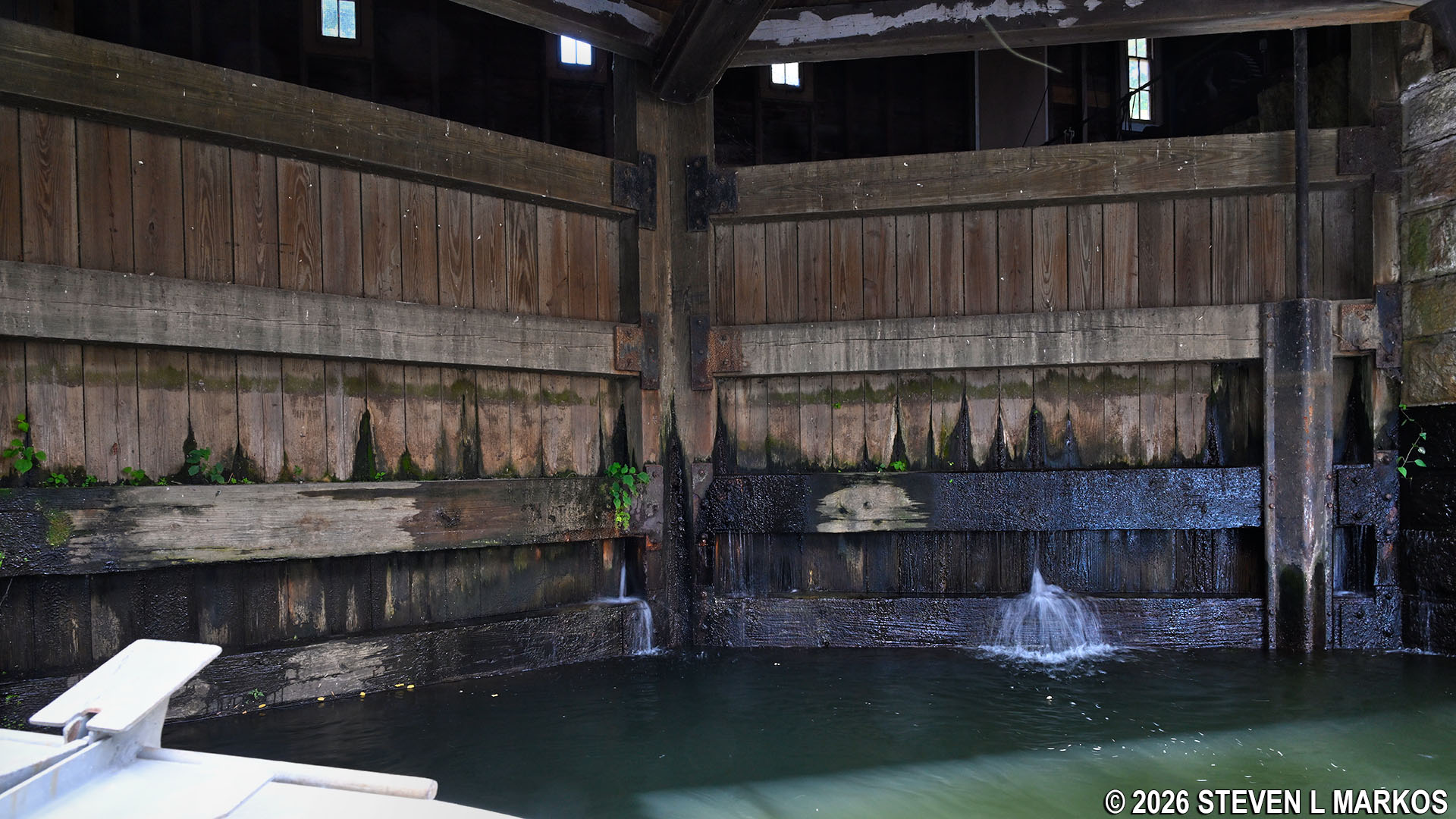
Upstream side of the Gatehouse at the Guard Locks on the Pawtucket Canal in Lowell, Massachusetts
The Lockhouse now standing was built around 1881 to replace an older structure from 1857. It sits atop the upstream gate of a two-gate lift lock, the other being 70 feet or so downstream. When you enter the lock in the tour boat, you pass the downstream gate before coming to the closed upper gate below the building.
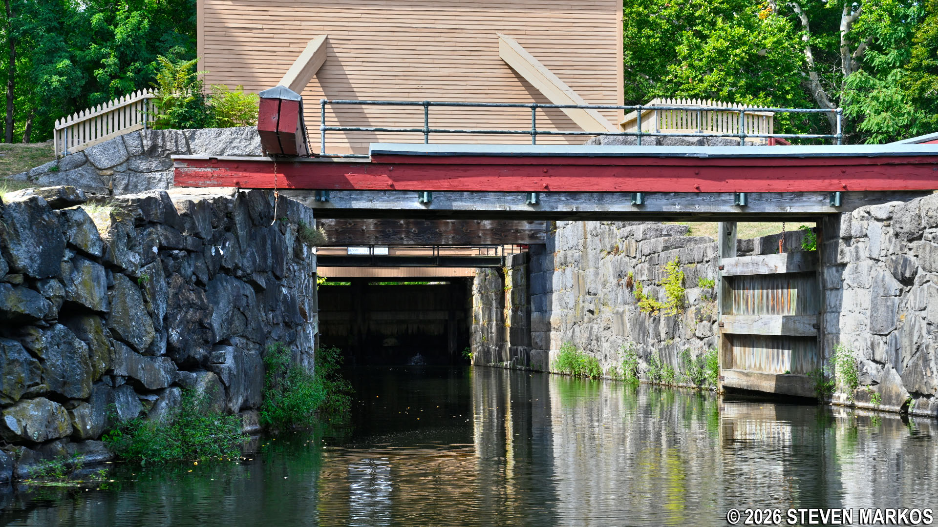
Tour boat enters the lift lock at the Guard Locks on the Pawtucket Canal in Lowell, Massachusetts
Upstream gates of the Guard Locks lift lock on the Pawtucket Canal in Lowell, Massachusetts
Lift locks allow boats to be raised and lowered to different levels of the canal similar to the way a toy boat in a bathtub can be raised or lowered by controlling the water level in the tub. Two gates are essential for the system to work, and one always has to be closed to keep massive amounts of water from rushing downstream. Watch the following video to learn exactly how lift locks work.
With a transportation canal, a lockhouse is where the lockkeeper—the man who operated the lock—and his family lived. When a canal boat arrived, he and members of his family used the wooden levers (painted red here at the Guard Locks) to open and close the gates. Once the Pawtucket Canal was converted to support water power for the mills in the early 1820s, the lockhouse was used to store chains and windlass equipment needed to assist in opening the massive lock gates.
As noted, there is a third building at the Guard Locks on the Pawtucket Canal. This is known as the Francis Gate, a flood gate built around 1850 by engineer James Francis. Allowing enormous amounts of water of flow down the canal during heavy rain or spring snowmelt could flood the city and damage the mills. While the lock gates can stop the water when closed, at only 2 tons each there was doubt that they could hold back serious flood water. To protect against a failure, Francis came up with the idea of building a massive stop gate: a 20-ton wooden wall made of white pine that was seated in grooves cut into the granite walls on either side of the lock. The wooden wall was held up by a thick iron shackle, and when flood waters required that it be put in place, the shackle was cut, dropping the gate like a guillotine (it took 40 oxen to hoist it back up). It was used just two years after its construction with great success and again in 1936. In both cases, the standard lock gates broke.

Upstream side of the Francis Gate on the Pawtucket Canal in Lowell, Massachusetts
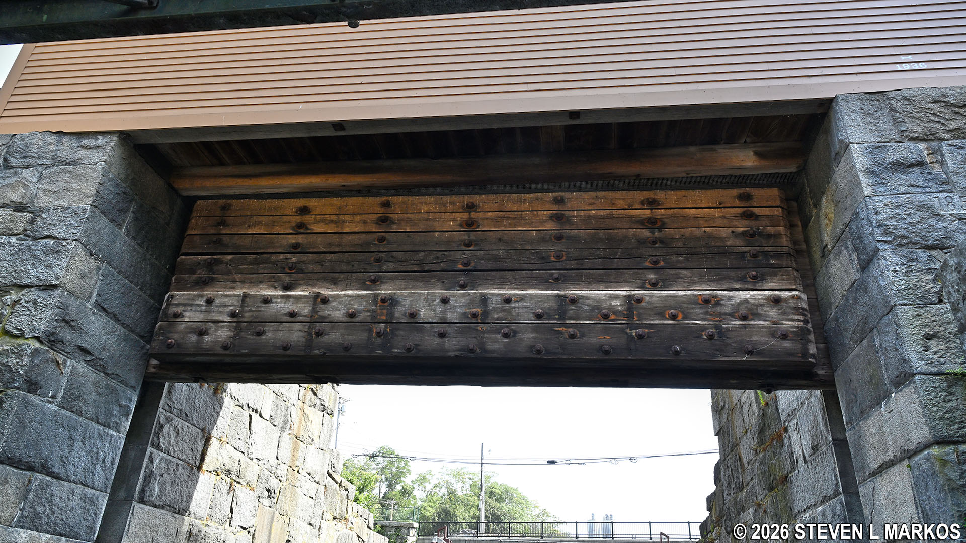
Wooden flood gate of the Francis Gate in Lowell, Massachusetts
Notice that there is an extra set of grooves cut into the granite walls of the lock. These were included so that more wooden beams could be dropped if needed. In 2006, flooding hit the area, and the city wanted to use the wooden gate. However, it was ruled that the wood was too old and possibly rotten, so instead, iron beams were dropped into the second set of grooves to hold back the water. This was done by crane, and it took fourteen hours to get them in place. The beams are still piled off to the side just in case they are needed again.

Grooves in the Francis Gate where the wooden wall or beams would slide down to block flood waters, Lowell, Massachusetts
After departing the Guard Locks, the Pawtucket Canal Boat Tour returns back down the canal to the starting point at the Swamp Locks. Total time of the tour is roughly an hour and a half.
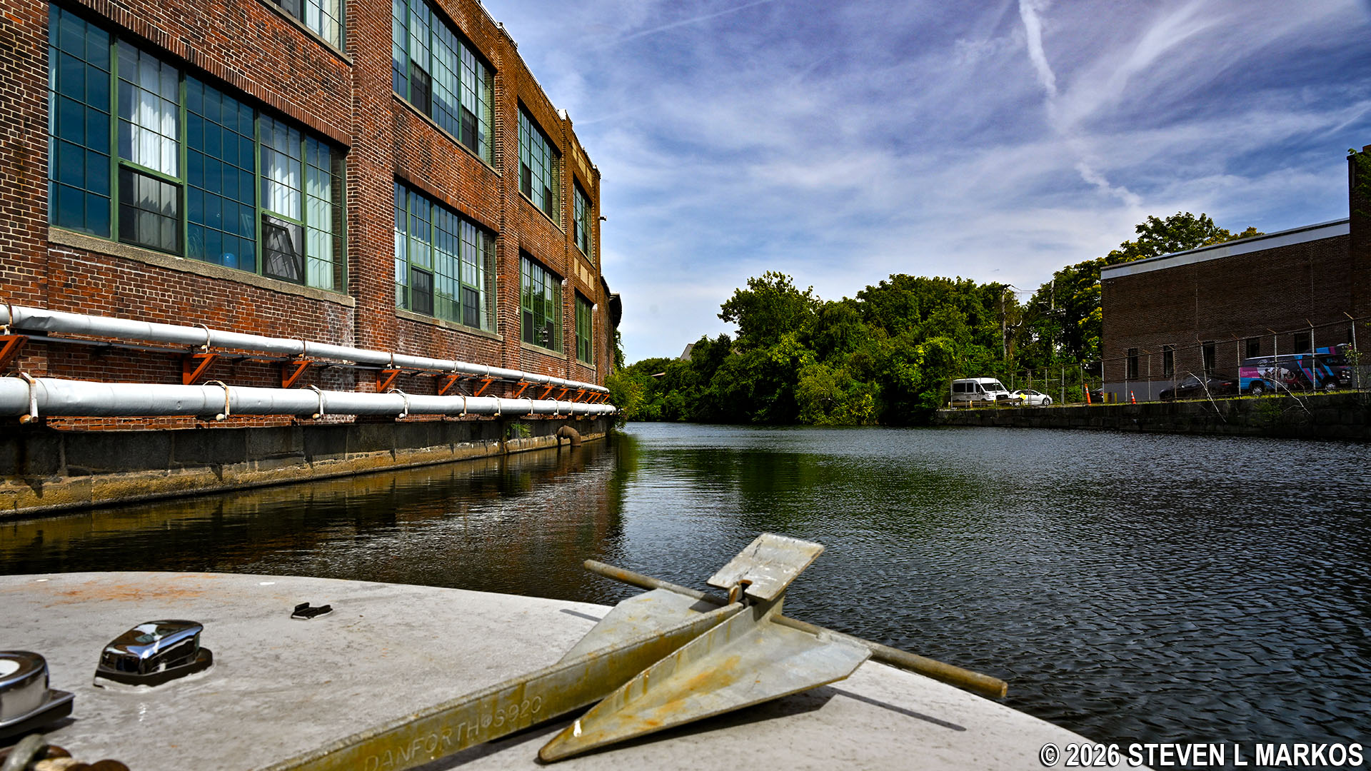
Pawtucket Canal Boat Tour returns downstream to the starting point at the Swamp Locks, Lowell National Historical Park
With a few exceptions, use of any photograph on the National Park Planner website requires a paid Royalty Free Editorial Use License or Commercial Use License. See the Photo Usage page for details.
Last updated on March 29, 2026


