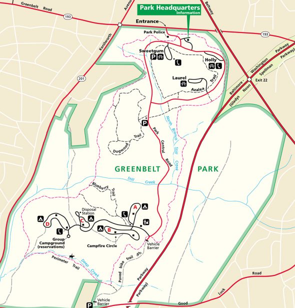
There are four hiking trails within Greenbelt Park. The longest, the Perimeter Trail, circles the entire park and can be accessed from the D Loop of the campground or from any of the picnic areas. Unless you are camping, the recommended access point is the Sweetgum Picnic Area. Access to the Blueberry Trail is from the campground Ranger Station. The Dogwood Trail has its own parking lot along the main park road. The Azalea Trail can be reached from any of the picnic areas.
If you are hiking the Perimeter Trail, which is already 5.3 miles long, and want to hike all other trails at the same time, this can be done. The Blueberry and Dogwood Trails intersect with the Perimeter Trail, and it’s easy enough to take a short detour to one of the picnic areas to get to the Azalea Trail. Total distance when hiking all four trails is about 9 miles.
Tick warnings are posted frequently throughout the park, and while I never encountered any during three separate visits, apparently they are a major problem. I suggest wearing long pants when hiking, and stay on the earthen paths and away from as much vegetation as possible. Mosquitoes are also prevalent in the summer, so the application of tick and mosquito repellent is not a bad idea.
With a few exceptions, use of any photograph on the National Park Planner website requires a paid Royalty Free Editorial Use License or Commercial Use License. See the Photo Usage page for details.
Last updated on April 15, 2020


