

Saint Croix Island in the Saint Croix River
Saint Croix Island is .6 mile from the mainland section of Saint Croix Island International Historic Site. The National Park Service highly discourages traveling out to and landing on the island for preservation reasons, but legally cannot stop anyone from going. Because of this, no tours are given, so you must have your own motorboat, canoe, or kayak, which eliminates most tourists. No permit is required, but the National Park Service does request that you stop at the Visitor Center and let a Ranger know of your plans.
As for how many people actually visit the island each year, this is unknown because anyone with a boat can stop at the island, not just people who depart from the mainland section of park. Saint Croix Island is located in the United States, so visiting it from Maine does not require crossing over into Canada. Anyone who visits the island from the Canadian mainland, on the other hand, is technically in the United States illegally. The U. S. Border Patrol does monitor the area, and if they suspect that anyone has landed on the island from Canada, agents will travel out to investigate.
For those who insist on motorboating or paddling to the island, or who just want to boat on the Saint Croix River for other purposes, there is a boat ramp at Saint Croix Island International Historic Site. In order to drive down the ramp to the water, you must have a 4-wheel drive vehicle. If you do not have one, there is a public boat ramp located three miles south on Highway 1 at Robbinston that is accessible by any vehicle. Canoeists and kayakers without a 4-wheel drive are welcome to carry their gear from the parking lot, a .1-mile walk.
If paddling, Saint Croix Island is upriver from the mainland park, so it is recommended to launch anywhere from a few hours after low tide up until high tide in order to paddle with the current. Of course you’ll have to wait until after high tide for the water to start flowing in the other direction. Tides range up to 24 feet, so currents in the Saint Croix River can be very strong. See the How Tides Affect Your Paddling article here on National Park Planner if you are not familiar with paddling on tidal rivers.
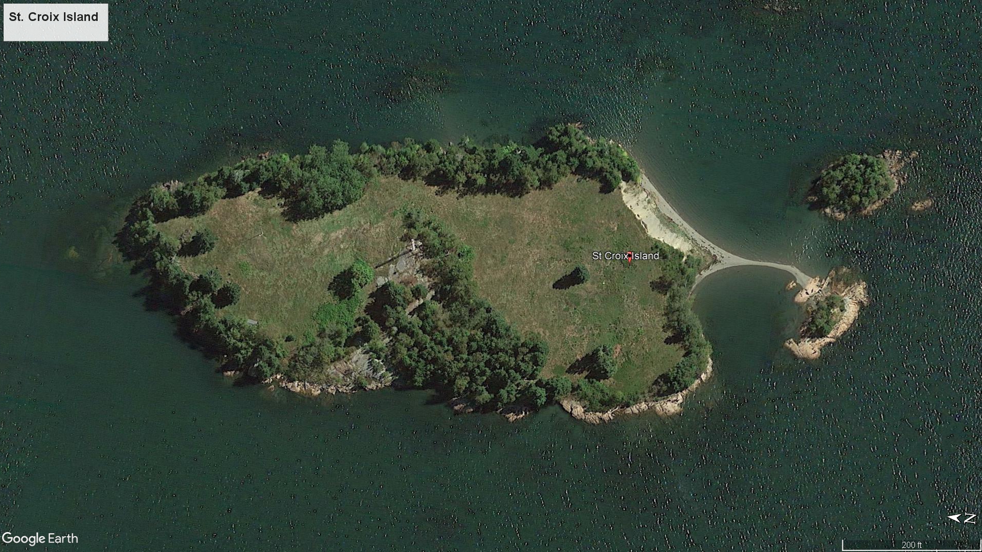
Motorboaters must be careful at low tide because there is a shallow, hard-to-see ledge around parts of the island that extends far into the river. A Ranger told me that many boats have been damaged or wrecked on this ledge.
The island itself is only .15 mile long and .1 mile wide (6.5 acres), and other than a couple of wayside exhibits, an old boathouse, and a tool shed, there is nothing on it. There used to be a lighthouse, but in 1976 a group of Canadian kids stopped by and ended up starting a fire that destroyed it (the boathouse was part of the lighthouse complex).
Saint Croix Island
With a few exceptions, use of any photograph on the National Park Planner website requires a paid Royalty Free Editorial Use License or Commercial Use License. See the Photo Usage page for details.
Last updated on November 22, 2025


