WALKING TOUR STOPS 5 and 6
Ridge 1 South and Ridge 1 Southwest
Stop 5 on the walking tour of the Poverty Point National Monument archaeological site is at the south end of Ridge 1 and offers the first glimpse of the ridge system built by the Indians of Poverty Point. A series of six ridges were laid out in a semicircular pattern. To picture this, just imagine a semicircular theater with six rows of seats divided into sections by four isles, only the distance from the first front-row seat on the left to the first front-row seat on the right is nearly .4 mile. That’s a damn big theater. If all the ridges were laid out end to end, they would stretch for six miles. And just as there would be a stage area in front of the seats, the area in front of the ridges forms a 43-acre open plaza that was possibly used for community events, ceremonies, commerce, and games.
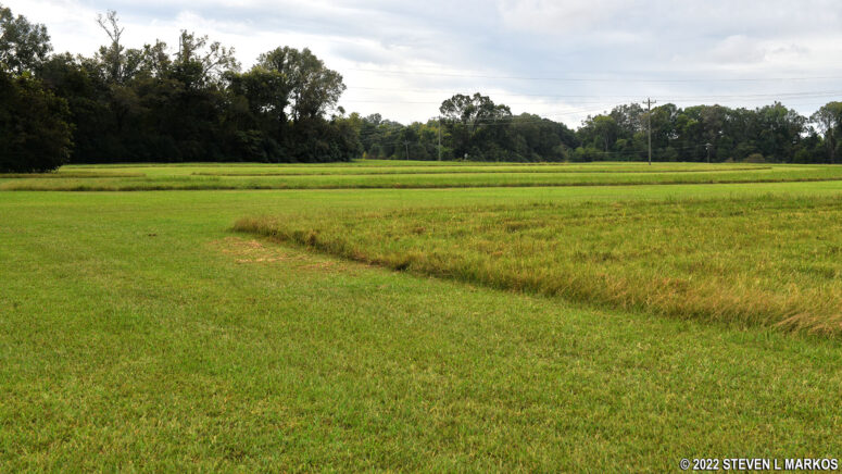
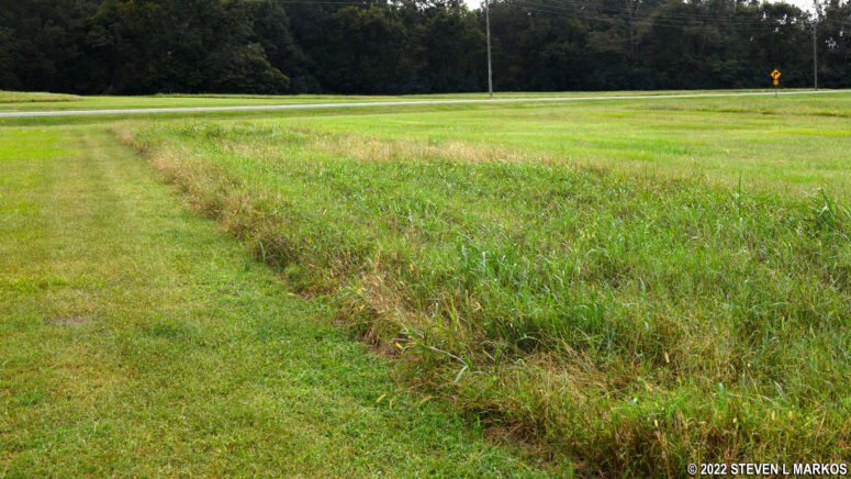
The ridges themselves range from 1 to 6 feet in height and are roughly 50 feet wide with 90 feet of open space between them. However, due to erosion and subsequent human settlement, most of the ridges are so worn down that they aren’t even noticeable unless pointed out, particularly in the open fields on the south end of the park. They are a little more distinguishable in the forested sections of Poverty Point, for the trees helped stem erosion and modern settlers never farmed these areas. Furthermore, some of the ridges on the south end of the semicircle are very narrow (see the photo at the top of this page) while others are the advertised 50-feet wide (see photo below).
Due to the abundance of household artifacts and earth ovens found on the ridges, archaeologists believe the Indians built houses on them, possibly making Poverty Point an early Indian city. The 50-foot wide platforms were more than wide enough to hold a decent sized structure—my townhome could fit on one—and if the houses were built 50 feet apart, over 600 could fit on the ridges.
Stop 5 is at the southernmost point of the innermost ridge, which is called Ridge 1. To make the ridges more distinct for visitors to Poverty Point National Monument, the grass is allowed to grow taller on them, whereas it is cut short between the ridges. For the record, I stepped onto the grass and felt no noticeable step up, rise, or anything else resembling a former ridge, so my guess is that if the grass was mowed, there wouldn’t be a thing underneath.
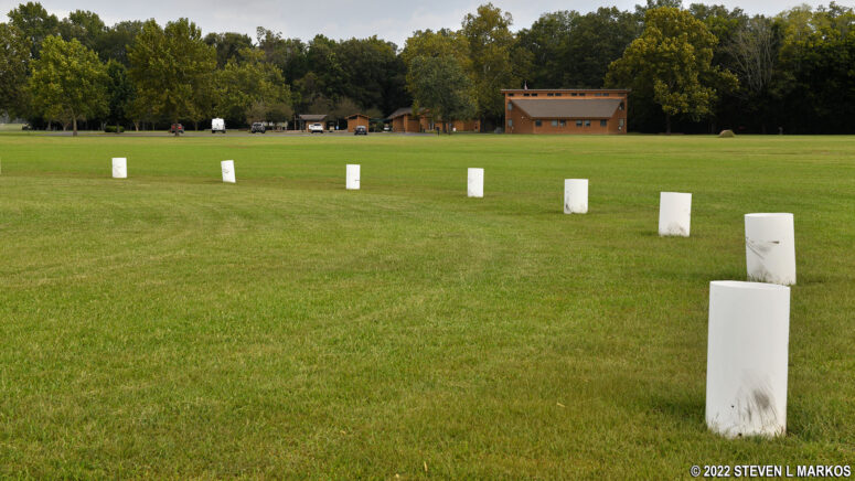
On the Plaza are white PVC posts arranged in a circle. These mark the locations of post holes dug by the Indians. The posts were as wide as 2.1 feet in diameter and were sunk as deep as 9 feet into the ground. To this day, archaeologists do not know what they were used for. The holes were discovered when the ground was being mapped with a magnetic gradiometer. No rotted wood was found in the holes, thus the wooden posts were removed when no longer needed.
Numerous circles and arches of post holes were found in the Plaza area. However, these did not exist all at the same time. Radiocarbon dating shows that the holes were dug between 1630 BC and 1100 BC. Posts were removed and new holes were dug over the years to form new configurations. The PVC pipes seen today mark just a small sample of the post holes.
Stop 6, which is just another point on Ridge 1, is on the other side of Highway 577 from Stop 5. The road, which was built long before anyone recognized that the ridges existed, cuts through all six ridges, forming a man-made isle between them (the road cuts through the ridges on the north end as well, forming a second man-made isle). It wasn’t until 1953 when archaeologist James Ford studied an aerial photograph of the area that the ridges were first recognized.
Stop 7: Survey Monument | Stops 3-4: Mound D | Walking Tour Main Page
With a few exceptions, use of any photograph on the National Park Planner website requires a paid Royalty Free Editorial Use License or Commercial Use License. See the Photo Usage page for details.
Last updated on November 8, 2022


