

Visitor Center – Pigeon Hill Loop Hike map (click to enlarge)
Length: 5.4 mile loop
Time: 4 hours, including rests and seeing the exhibits
Difficulty: Moderate to Strenuous
The loop trail from the Kennesaw Mountain National Battlefield Visitor Center to Pigeon Hill takes you to all the Civil War points of interest in the Kennesaw Mountain area of the park. The hike starts off on the West Trail and leads up Kennesaw Mountain. The trailhead is at the top of the hill behind the Visitor Center. There are official names for all of the trail segments, but since the trail system is one big loop, most people know the trails by which side of the loop they are on. Thus, the name West was given to the trails on the west side of the loop (not very imaginative, but it serves its purpose).
The hike up the mountain is a 1 mile, strenuous climb that should take you 45 minutes to an hour, including stopping to see the views and exhibits at the top. The trail alternates between a smooth, gravel path to one strewn with rocks and roots.

Trail to the top of Kennesaw Mountain

Trail also contains areas of roots and rocks
Not far from the start of the trail, you will come to an intersection and have to choose to turn left or right. Although it is not marked as to which way goes to the top of the mountain, take the path uphill—go right.
When you get to the parking lot at the top of the mountain you will find views to the east. Look for downtown Atlanta in the far distance. To get higher up for a better view, climb to the top of the observation platform next to the parking lot. Keep in mind that the parking lot is not at the actual top of the mountain. To get to the very top and see the cannon exhibits that point to the west, to where Sherman’s army would have been, take the paved path that runs farther up from the observation deck. The very top is about five minutes away.

View from observation platform near parking area atop Kennesaw Mountain

Walking path from parking lot to cannon exhibits atop Kennesaw Mountain

Westward pointing cannon atop Kennesaw Mountain, once aimed at Sherman, now aimed at the city below

Information panel and view towards Atlanta from the top of Kennesaw Mountain
Once past the exhibits, continue on towards Little Kennesaw Mountain. You will be hiking downhill along a rocky trail of granite rocks and boulders. Keep your eyes at your feet and plan two to three steps ahead. A misstep could result in a twisted or broken ankle. If you have hiking poles, they will come in very handy; if not, just be careful.

Rocky trail down the backside of Kennesaw Mountain towards Little Kennesaw Mountain
In about ten minutes you will come to Kennesaw Mountain Drive (the road up the mountain) and Little Kennesaw Mountain, along with an interpretive panel, will be before you.

Information panel and view of Little Kennesaw Mountain
After reading the information, continue on up Little Kennesaw Mountain and towards Pigeon Hill. The hike up Little Kennesaw Mountain is much easier than the hike up the “big” Kennesaw Mountain, with much of it being a smooth, gravel path. In about 20 minutes you will come to the site of Fort McBride and the top of Little Kennesaw Mountain. Cannon exhibits mark the area, but unfortunately, there are no information panels about Fort McBride. Allow five minutes to see the site.

Cannons at the Ford McBride site atop Little Kennesaw Mountain
Not far past Fort McBride is a fork in the trail—stay to the right. Soon afterwards you will be heading down Little Kennesaw Mountain, and the trail is as rocky and slow going as the hike down Kennesaw Mountain.

Rocky trail down Little Kennesaw Mountain towards Pigeon Hill
In no more than a half hour the trail to Pigeon Hill will intersect with a cut-through trail that cuts over to the east side of the loop. This is marked by a sign with directional arrows to the “East Trail” and to “Pigeon Hill.” Pass this by and continue to Pigeon Hill.
BE ALERT!
About 15 minutes farther down is a second cut-through trail (again, marked “East”). If you are following the trail map, this may cause confusion. The second cut through trail that you are now standing at is the turn-around point on my trail map that takes you back to the Visitor Center. Pigeon Hill is marked on the map as coming before the second cut-through to the East Trail. Since you are now at the second cut-through, you may be thinking—as I did—“How in the world did I walk right past Pigeon Hill and not see any exhibits?” Well, what is marked on the trail map as “Pigeon Hill” is the actual top of Pigeon Hill, not the exhibit area. While you did pass the actual hill, the exhibits are about a minute or so farther down the trail, so keep walking until you come to them. They consist of earthworks (aka trenches), cannon, and interpretive panels. Allow 5 minutes to see the exhibits. Once done, turn around and hike back to the East Trail cut-through and follow it to the East Trail. Do not continue farther past the exhibits.
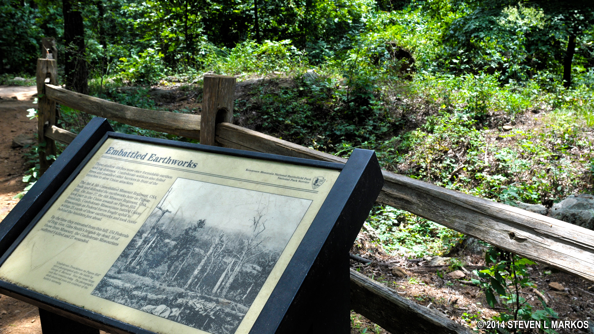
Earthworks, or trenches, at Pigeon Hill
Once you have cut across to the east side trail, follow the signs to the Visitor Center. The hike back along the East Trail is 2.5 miles. It is relatively easy and should take no more than 1.5 hours. Most of it follows an old, gravel fire road. One point of interest along the way is the 1930s site of the Civilian Conservation Corp. The CCC was created by the Roosevelt administration to put men to work after the Great Depression. Many National Park trails, including those at Kennesaw Mountain National Battlefield Park, were built by the CCC. All that remains of their headquarters is a stone wall and a foundation or two. Interpretive panels tell the story.

Ruins of a building built by the Civilian Conservation Corp in the 1930s
BE ALERT!
After the CCC there are two forks in the trail on your journey back to the Visitor Center. The first is marked with a sign pointing to the Visitor Center, while the second is unmarked. I took the trail to the right and it got me back to the Visitor Center, though after examining a detailed map I found that the left fork also goes to the Visitor Center, but may be hillier. If you take the fork to the right, you will spill out into an open field where you will find the final point of interest on the hike, the Georgia Memorial. It sits just a couple minutes away from the Visitor Center.

Unmarked intersection-take the fort to the right
With a few exceptions, use of any photograph on the National Park Planner website requires a paid Royalty Free Editorial Use License or Commercial Use License. See the Photo Usage page for details.
Last updated on February 16, 2020


