

Noses Creek in the central section of Kennesaw Mountain National Battlefield Park
Length: 3.7-mile loop
Time: 2.25 hours
Difficulty: Hardage Mill Trail is moderate to difficult, the Noses Creek Trail is easy
The Noses Creek Loop Hike covers the central area of Kennesaw Mountain National Battlefield Park. The hike utilizes the Noses Creek Trail, the Hardage Mill Trail North, and the Hardage Mill Trail South. The layout is a double loop with Noses Creek separating the two. A free trail map is available at the Visitor Center, so be sure to stop by and pick one up before beginning the hike.
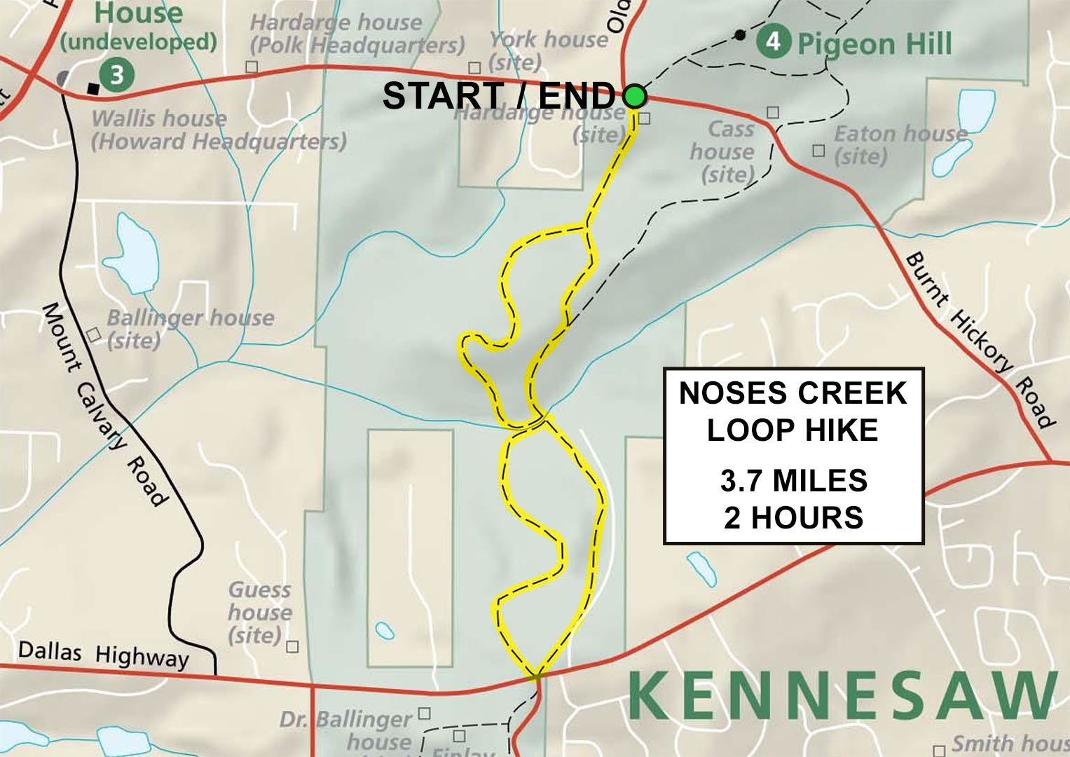
Noses Creek Loop Hike map (click to enlarge)
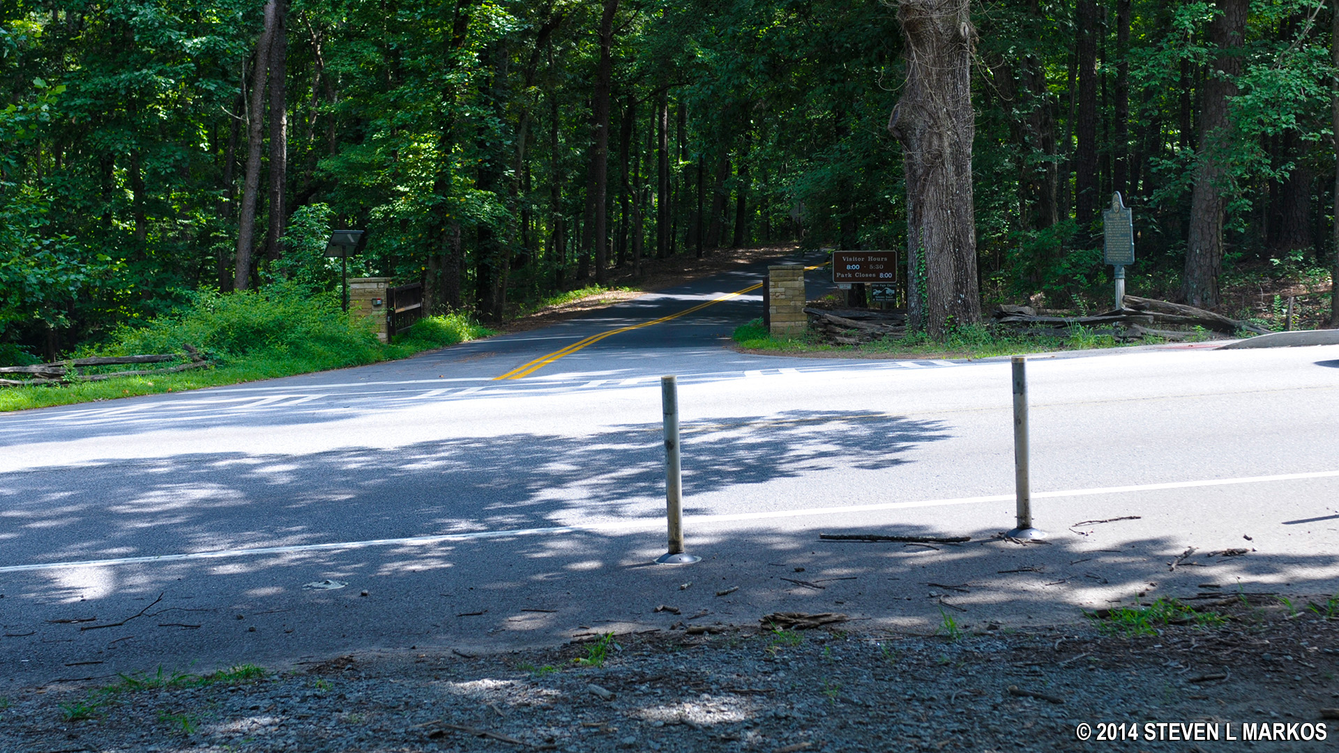
The only feasible place to start the Noses Creek Loop Hike is at the Pigeon Hill Parking Lot on Burnt Hickory Road, for it is the only parking lot near any of the trails. While large, this area of the park is popular with hikers, so the lot could fill up on a busy day. It is also the parking lot for those visiting Pigeon Hill. Keep in mind that a fee is required to park anywhere within Kennesaw Mountain National Battlefield Park, but if you don’t have a permit when you arrive, there is a credit card-operated pay station available.

Pigeon Hill Parking Lot on Burnt Hickory Road, Kennesaw Mountain National Battlefield Park
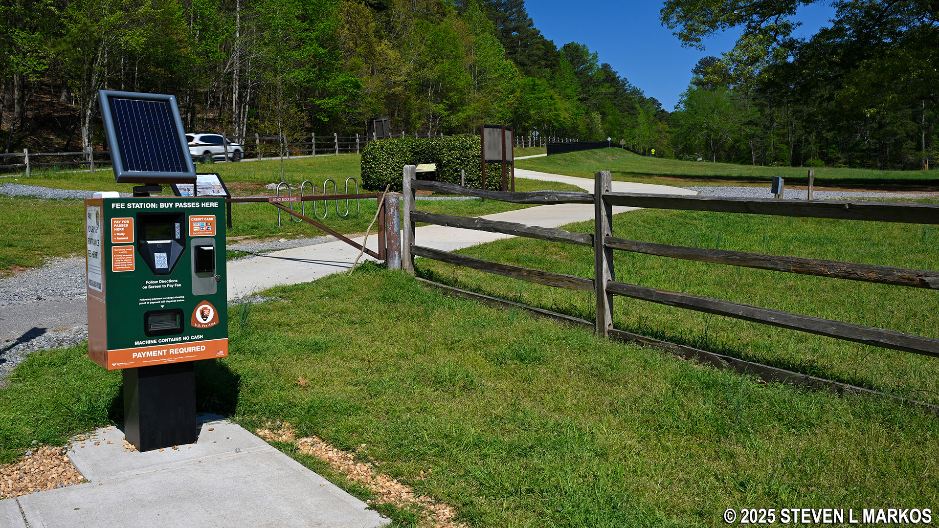
Pay station at the Pigeon Hill Parking Lot on Burnt Hickory Road in Kennesaw Mountain National Battlefield Park
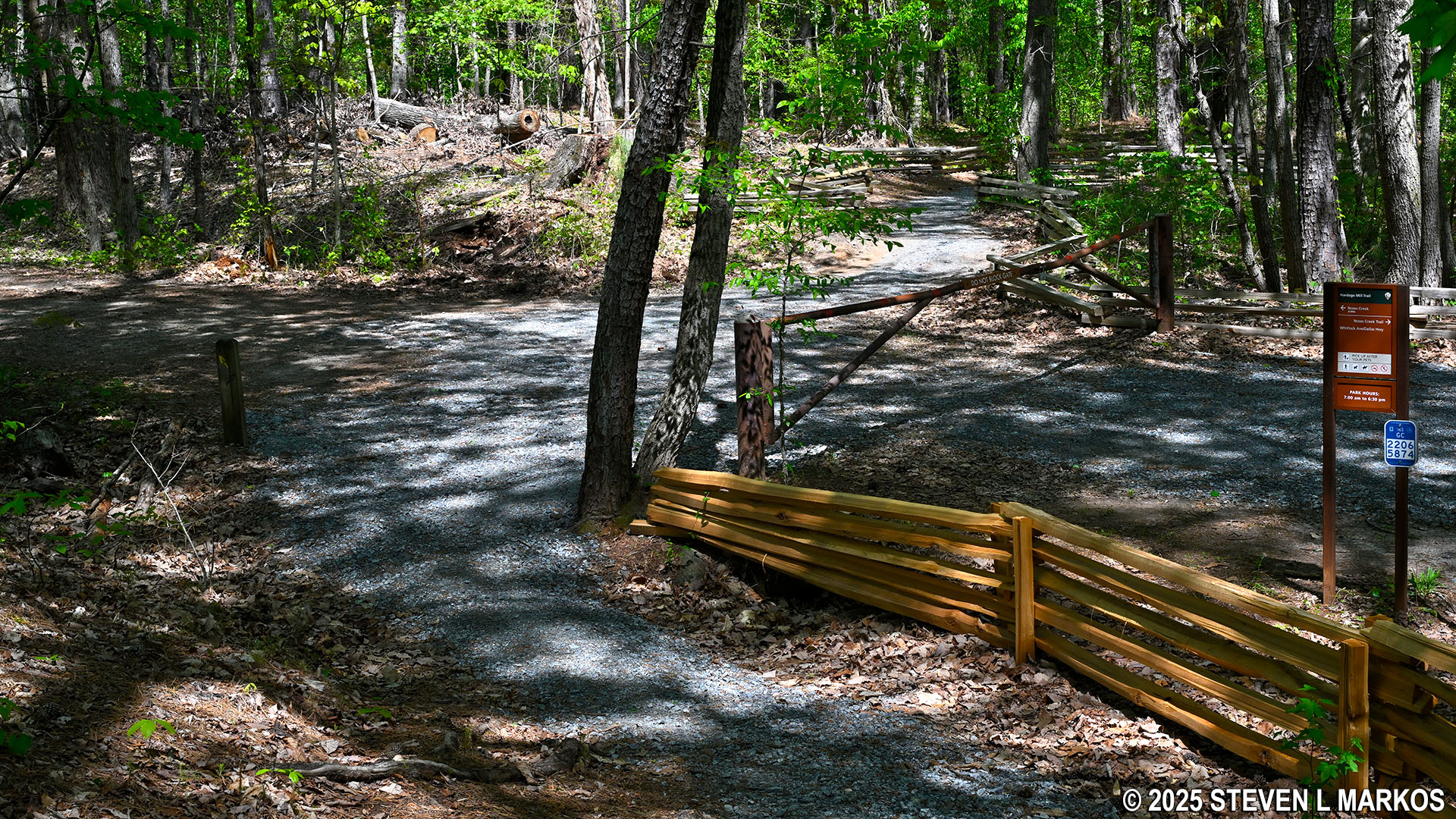
The loop hike starts on the Noses Creek Trail, which is located on the right side of the parking lot if you are facing the road. It begins as a wide, gravel road, then eventually narrows and turns to dirt, but its surface always remains smooth.
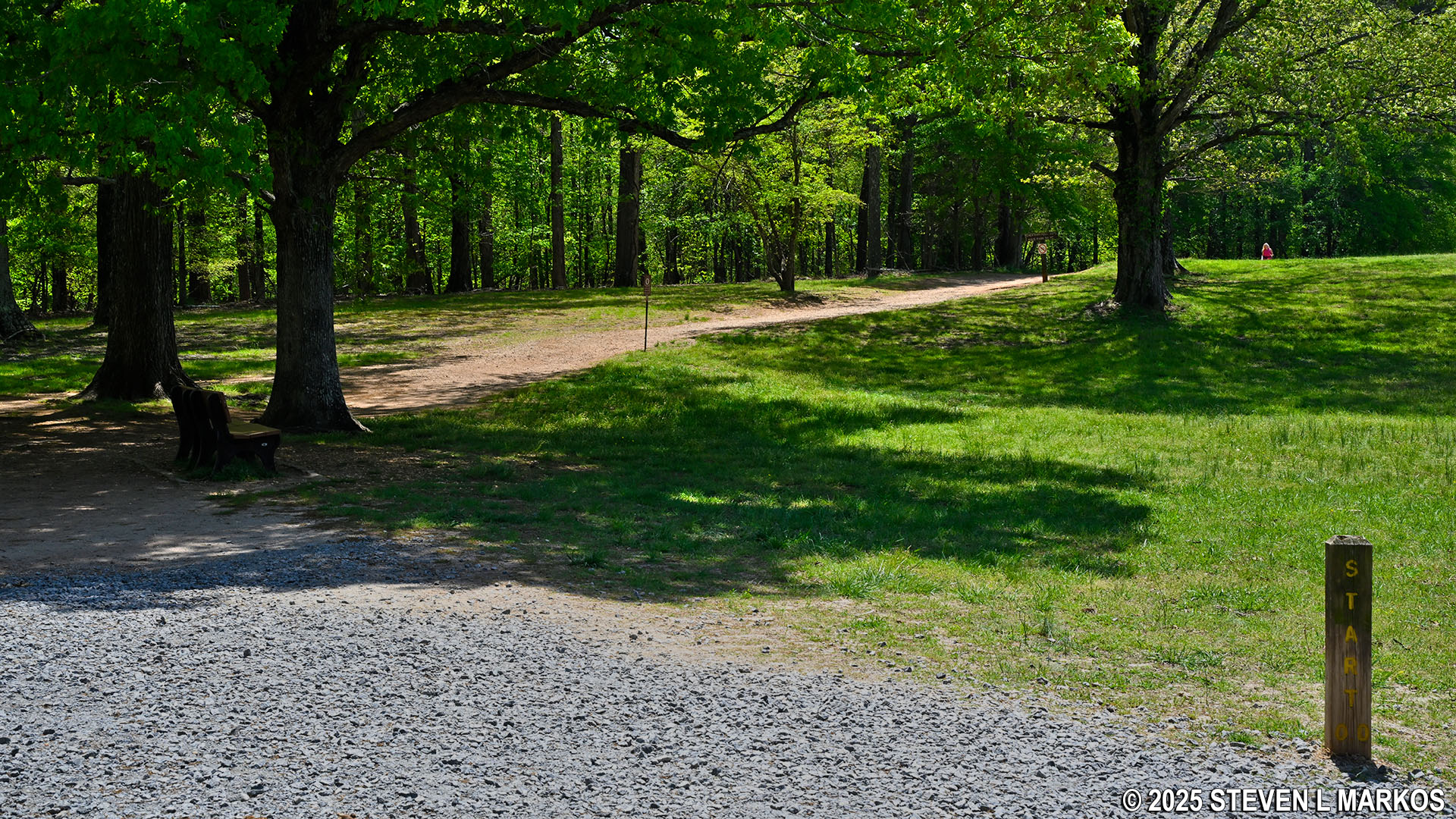
Start of the Noses Creek Loop Hike at the Pigeon Hill Parking Lot on Burnt Hickory Road, Kennesaw Mountain National Battlefield Park
The first quarter mile heads in and out of a ravine with a creek at the bottom. It begins downhill, but the slope is so gentle it might as well be flat. The hike out of the ravine is a little steeper, having an average grade of 14% (strenuous hiking starts at 15%). I do not know the name of the creek other than it is not Noses Creek.
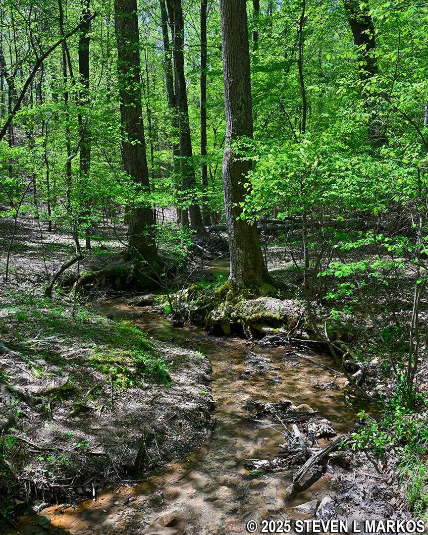
Creek at the northern end of the Noses Creek Trail in Kennesaw Mountain National Battlefield Park
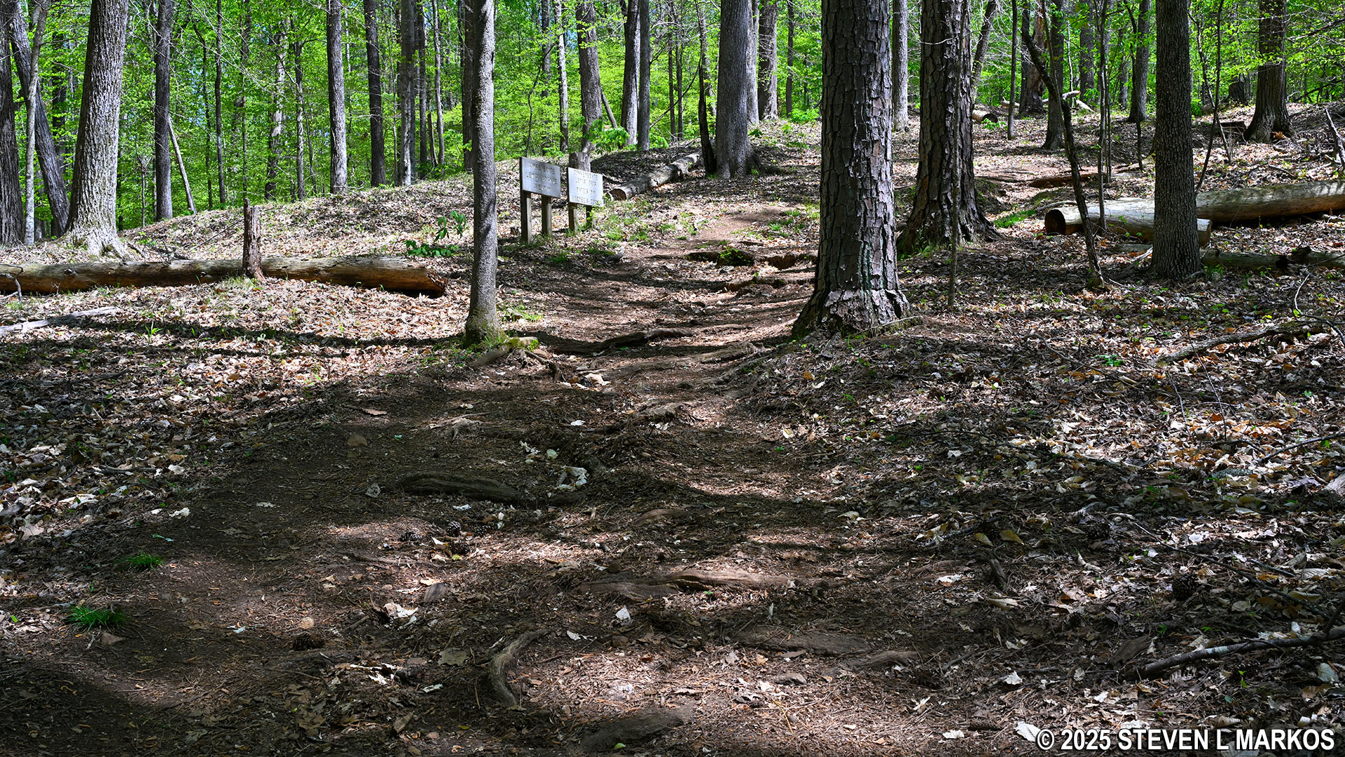
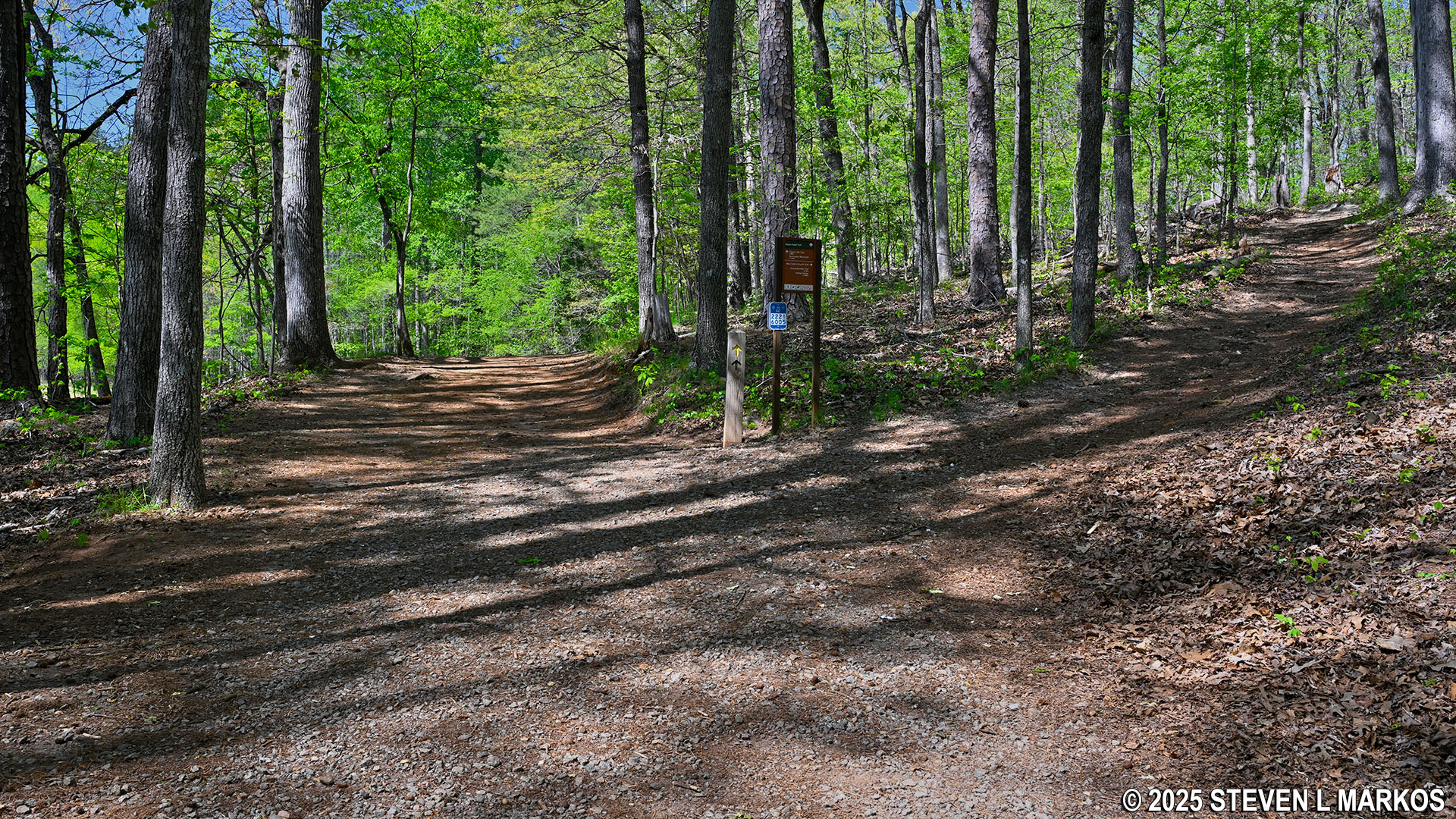
At the top of the hill is the intersection of the Noses Creek and Hardage Mill (North) trails where the upper loop begins. Most intersections on the trails at Kennesaw Mountain National Battlefield Park have directional signage, but this intersection does not. There is a post with a yellow arrow on it, which is the color designated for the Noses Creek Loop Hike.
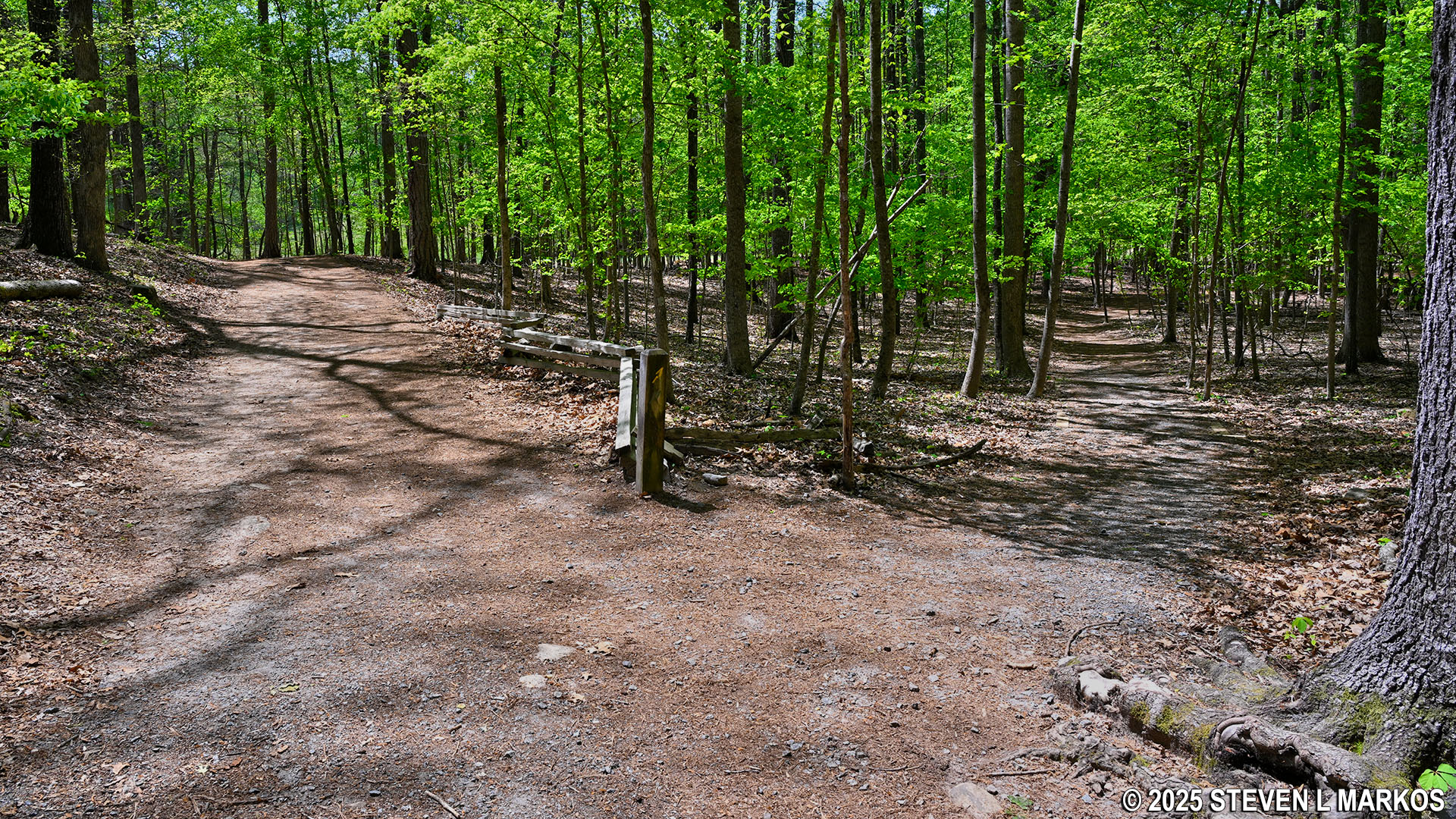
Intersection of the Noses Creek Trail and the northern trailhead for the Hardage Mill Trail North, Kennesaw Mountain National Battlefield Park
I took a right at the fork onto the Hardage Mill Trail North and proceeded around the loop in the counterclockwise direction. In fact, this is the way the Noses Creek Loop Hike is intended to be hiked, for the mileage markers, which are placed every half mile along the trail, track up in this direction. Note that there is a 16-mile loop trail that covers the entire park, from Kennesaw Mountain in the north to Kolb’s Farm in the south, and it uses the same trails as the Noses Creek Loop Hike. The mileage markers therefore have two numbers: the top (in yellow) is for the Noses Creek Loop Hike, and the bottom number (in green) is for the full park loop hike.
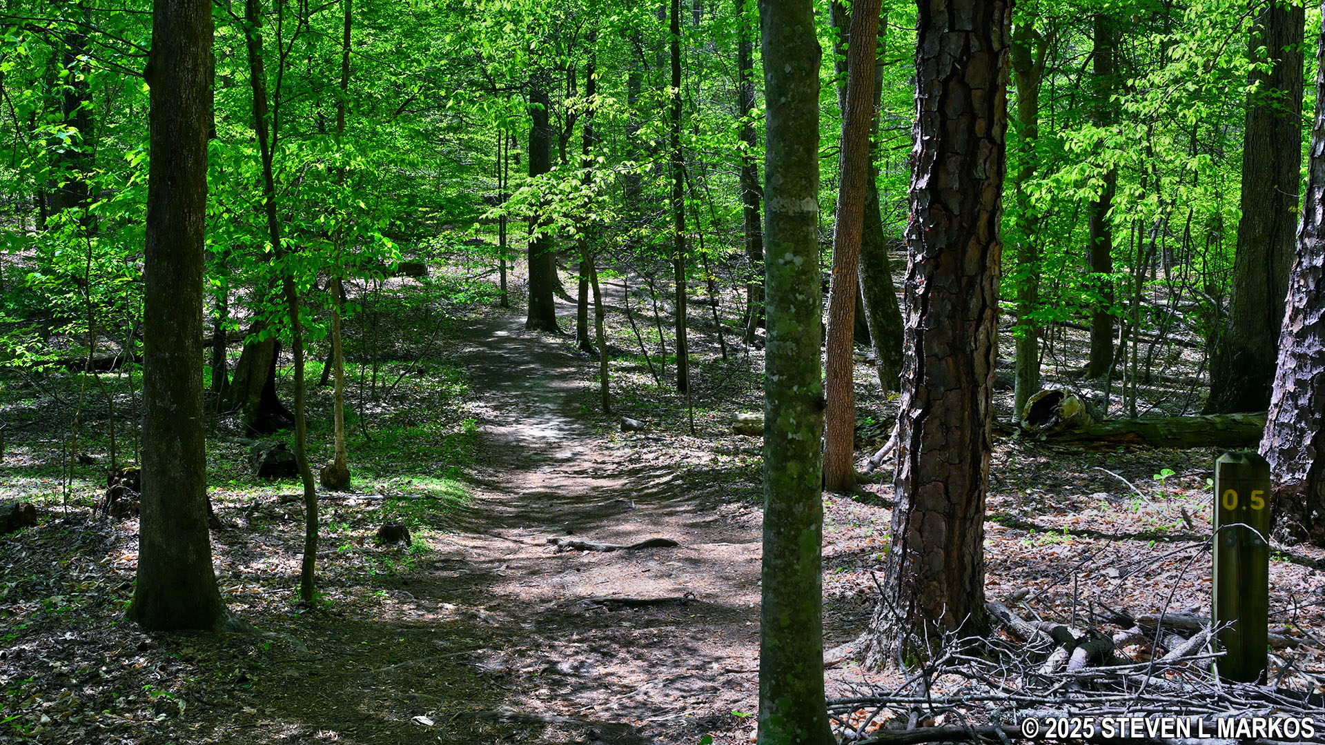
Mileage post at the .5-mile mark on the Noses Creek Loop Hike in Kennesaw Mountain National Battlefield Park
The Hardage Mill Trail takes its name from a sawmill built by George Washington Hardage and his brother John Hardage on Noses Creek in 1853. It is not clear what happened to the mill, but it is believed to have been destroyed during the fighting at Kennesaw Mountain in June 1864. Buildings were often torn down by soldiers who then used the wood to shore up their defensive structures, and historians believe that is what most likely happened to the Hardage Mill.
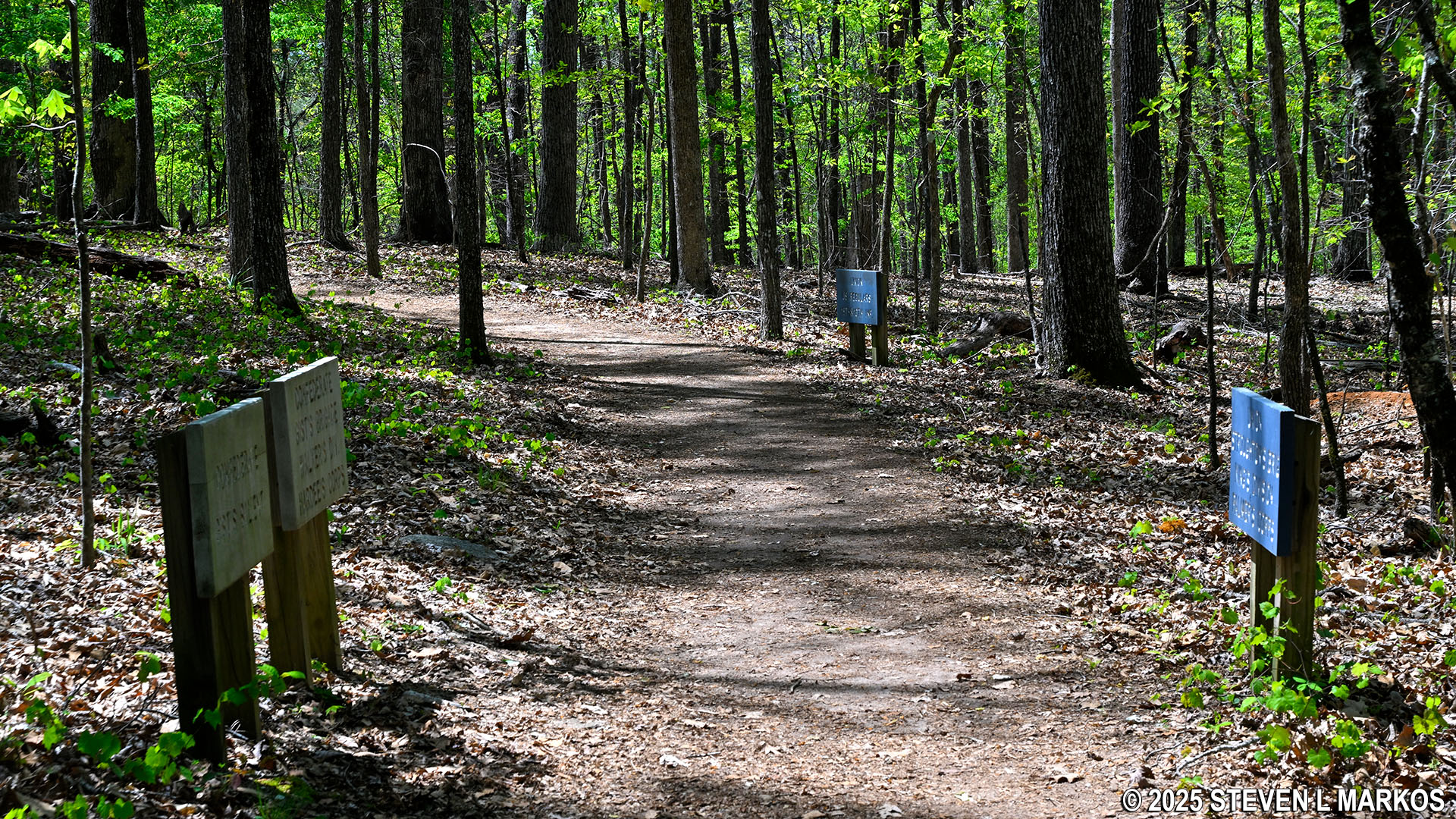
The northern section of the Hardage Mill Trail runs for .9 mile, ending at a bridge over Noses Creek. Two tenths from the start is an X-shaped intersection that is not on the map. A post with a yellow arrow is at the intersection, but it is positioned in such a way that it is hard to tell if it is pointing left or right. A left leads out to a field, whereas a right continues through the forest. Right is the correct way to go to stay on the trail. The left trail crosses the field and cuts over to the Noses Creek Trail, effectively making it a shortcut for those who have had enough and want to head back to the parking lot, yet don’t want to return the same way they just came.
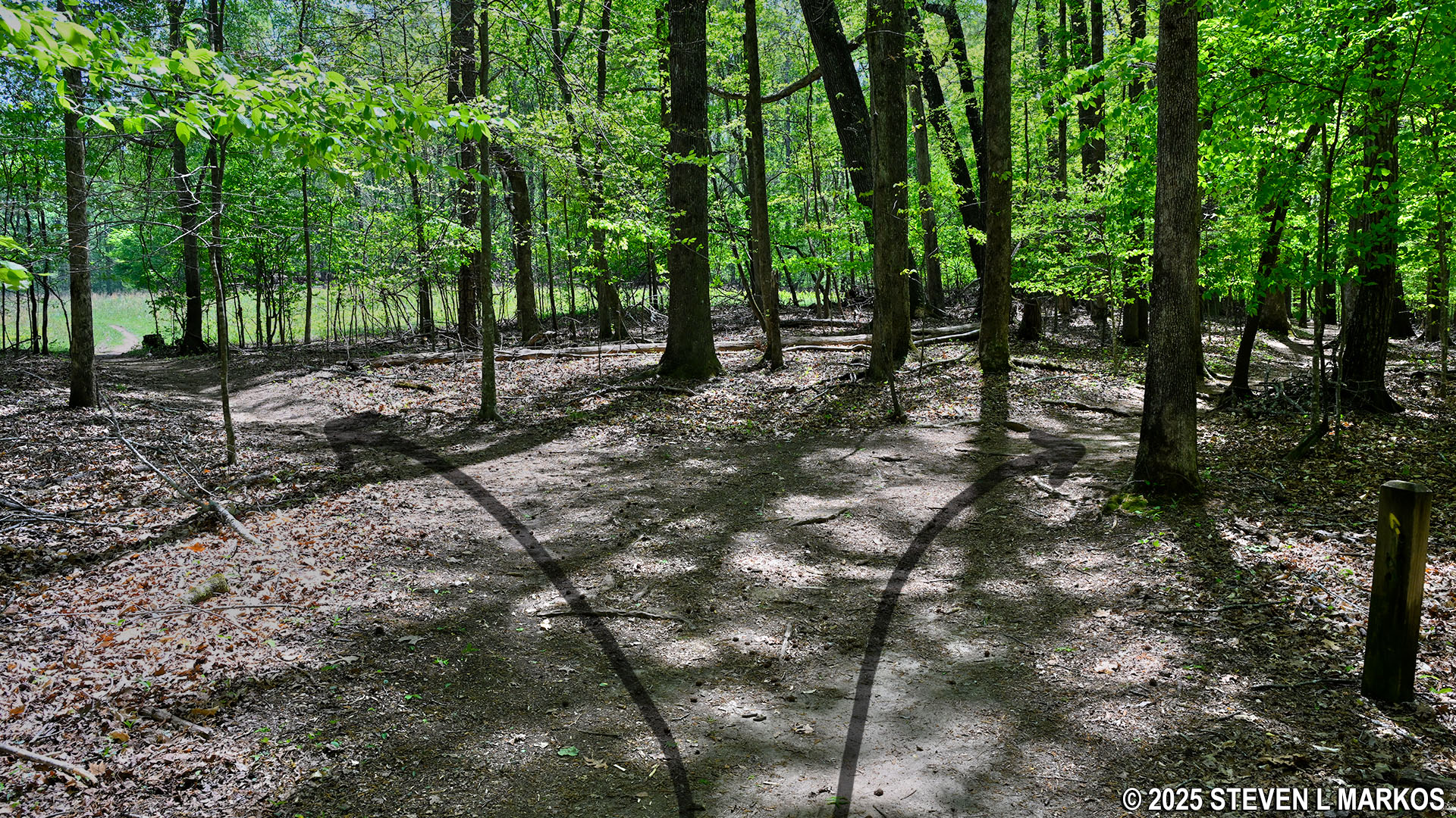
Intersection at the northern end of the Hardage Mill Trail that is not on the trail map, Kennesaw Mountain National Battlefield Park
Three tenths of a mile into the Hardage Mill Trail is the start of a climb up and over a large hill (or a small mountain). The climb up is moderate in difficulty, with an average grade of 13%. Once at the top, there is a quarter-mile level section before the trail heads down one of the steepest hills in the park outside of the climb up Kennesaw Mountain, and it is definitely the steepest hill on the Noses Creek Loop Hike. It is a tenth of a mile walk to the bottom, and while the overall average grade is only 13%, midway is a 200-foot segment with an average grade of 27%. The following photo was taken looking up the hill. Photos taken looking downhill do not show depth properly.
Steep hill on the Hardage Mill Trail North at Kennesaw Mountain National Battlefield Park
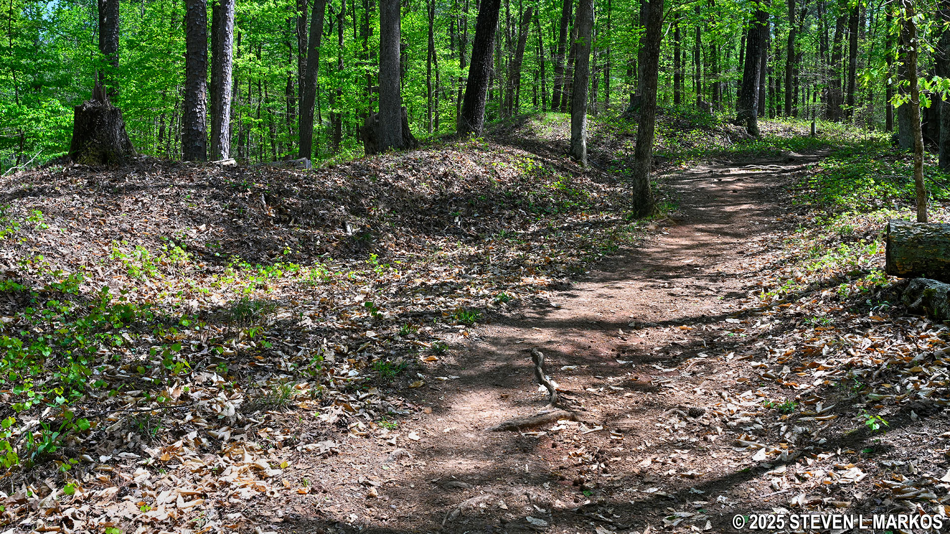
At the top of the hill is a sign that marks Confederate troop positions during the fighting at Kennesaw Mountain. There is also a wayside exhibit about the earthworks—defensive trenches and earthen walls—built by the troops. Fighting took place all over Kennesaw Mountain National Battlefield Park, and historic earthworks crisscross the area. When originally created, the trenches and walls were typically four to eight feet in height. Over the 160-plus years since the Civil War, those that were not completely destroyed by farmers and real estate developers have eroded away, so now most resemble nothing more than shallow gullies and small, natural hills. To the average hiker, remnants of the earthworks go unnoticed, and wayside exhibits and other markers are needed to point them out. However, once you know what to look for, they are quite obvious.
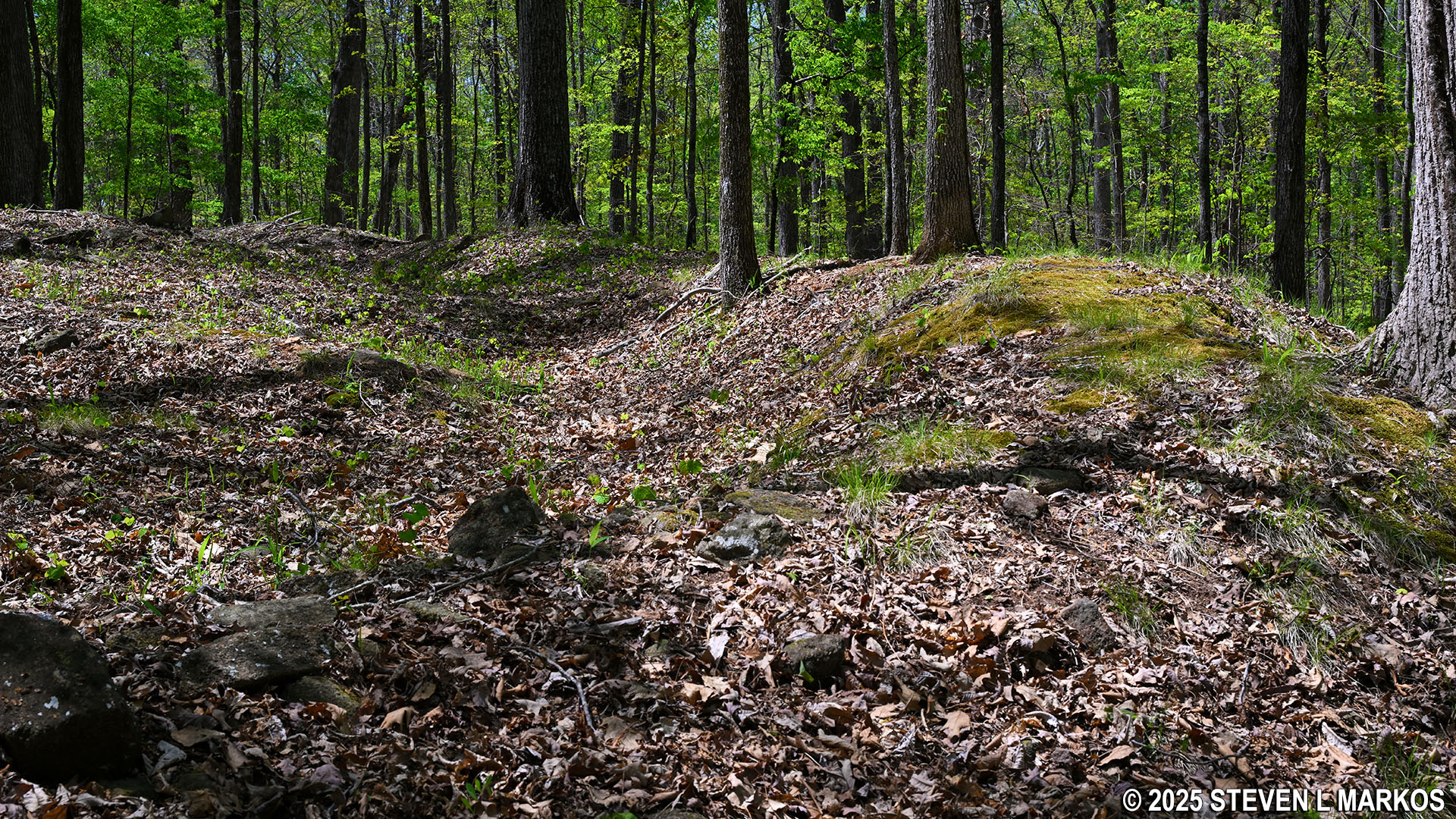
Civil War earthworks at the midway point of the Hardage Mill Trail North, Kennesaw Mountain National Battlefield Park
Notice that there are Confederate troop markers (gray signs) on one side of the trail and Union markers (blue) on the other. Union soldiers charged up the hill towards the Confederates during the Battle of Kennesaw Mountain on June 27, 1864.
Signs along the Hardage Mill Trail North mark Confederate and Union troop positions during the Battle of Kennesaw Mountain, Kennesaw Mountain National Battlefield Park
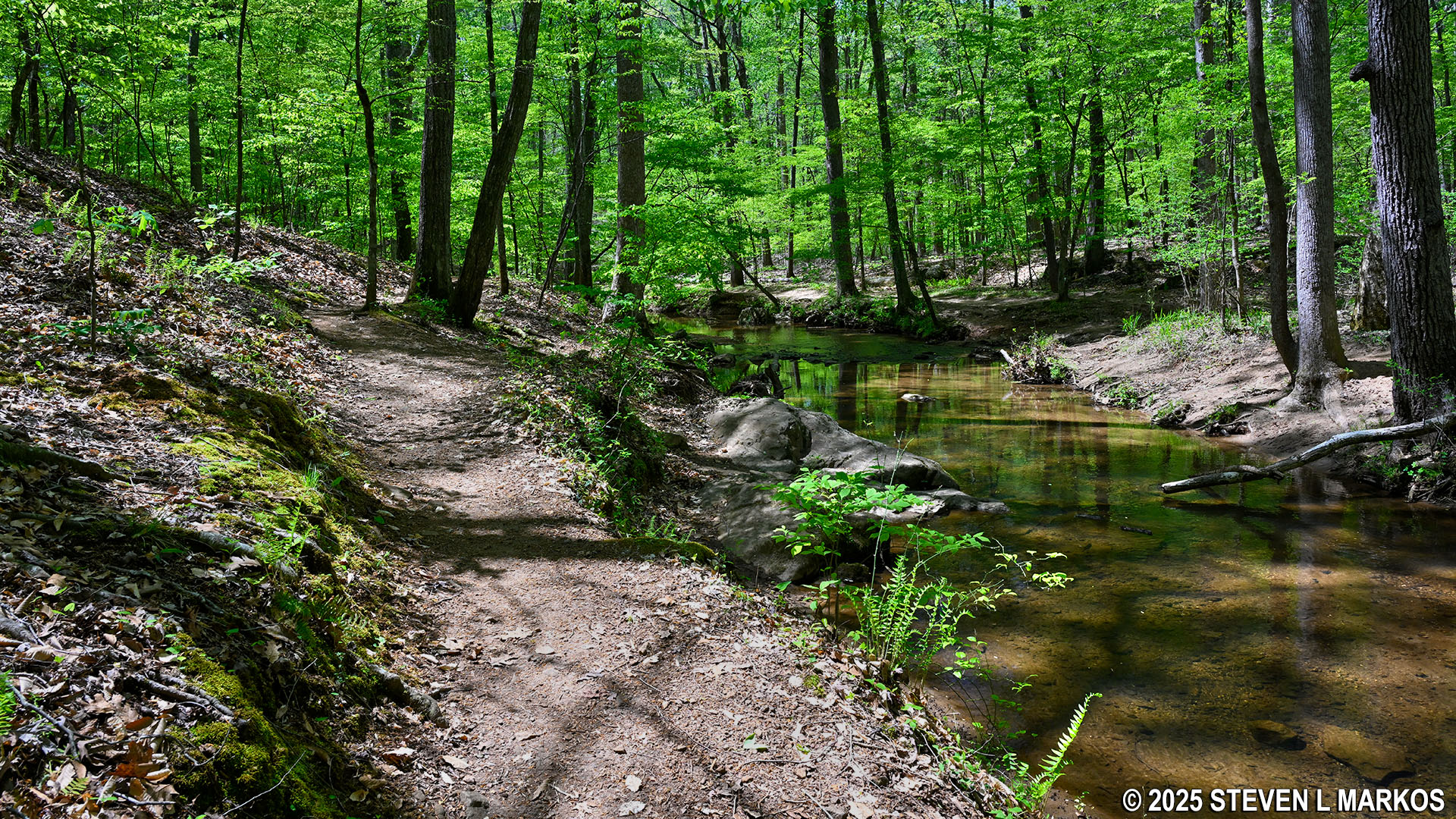
The Hardage Mill Trail levels out a mile into the overall hike (from the parking lot) and soon thereafter comes to Noses Creek. At this point it turns east, runs along the creek for 100 yards, and dead ends into the Noses Creek Trail at a bridge over Noses Creek.
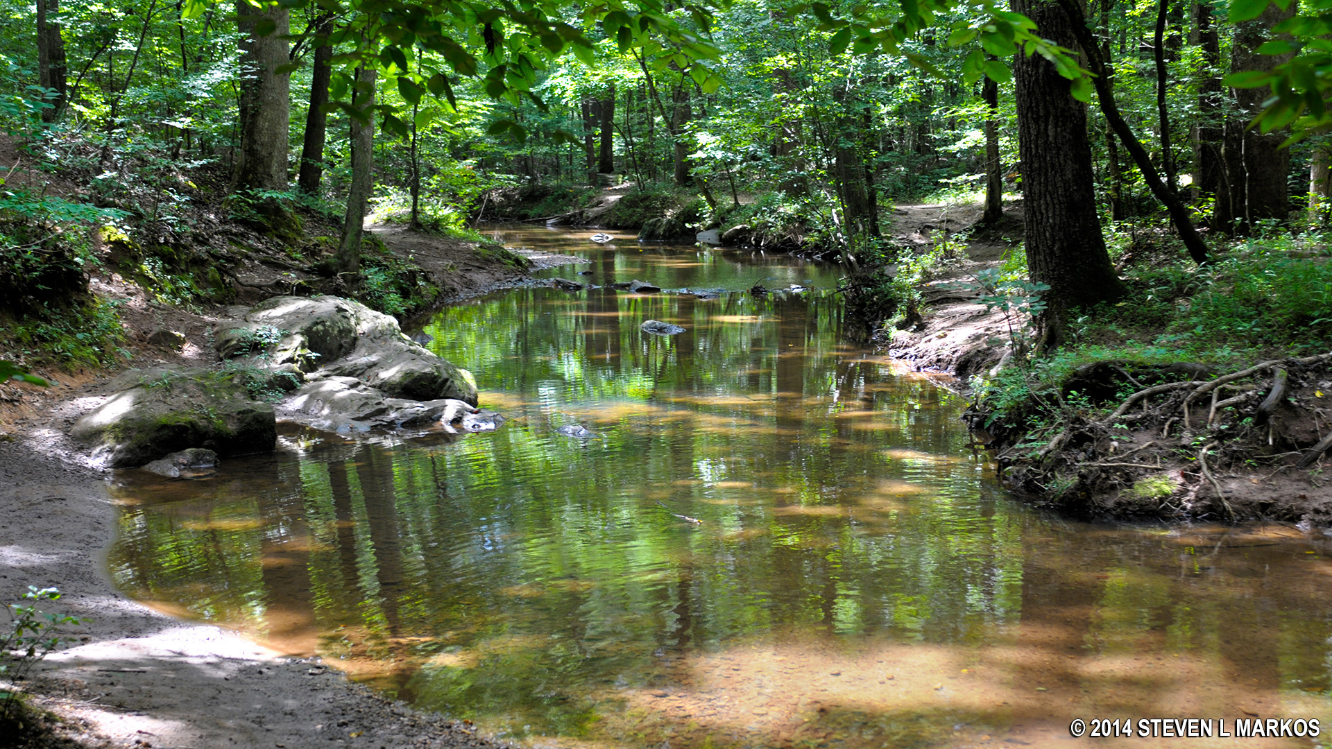
Noses Creek at Kennesaw Mountain National Battlefield Park
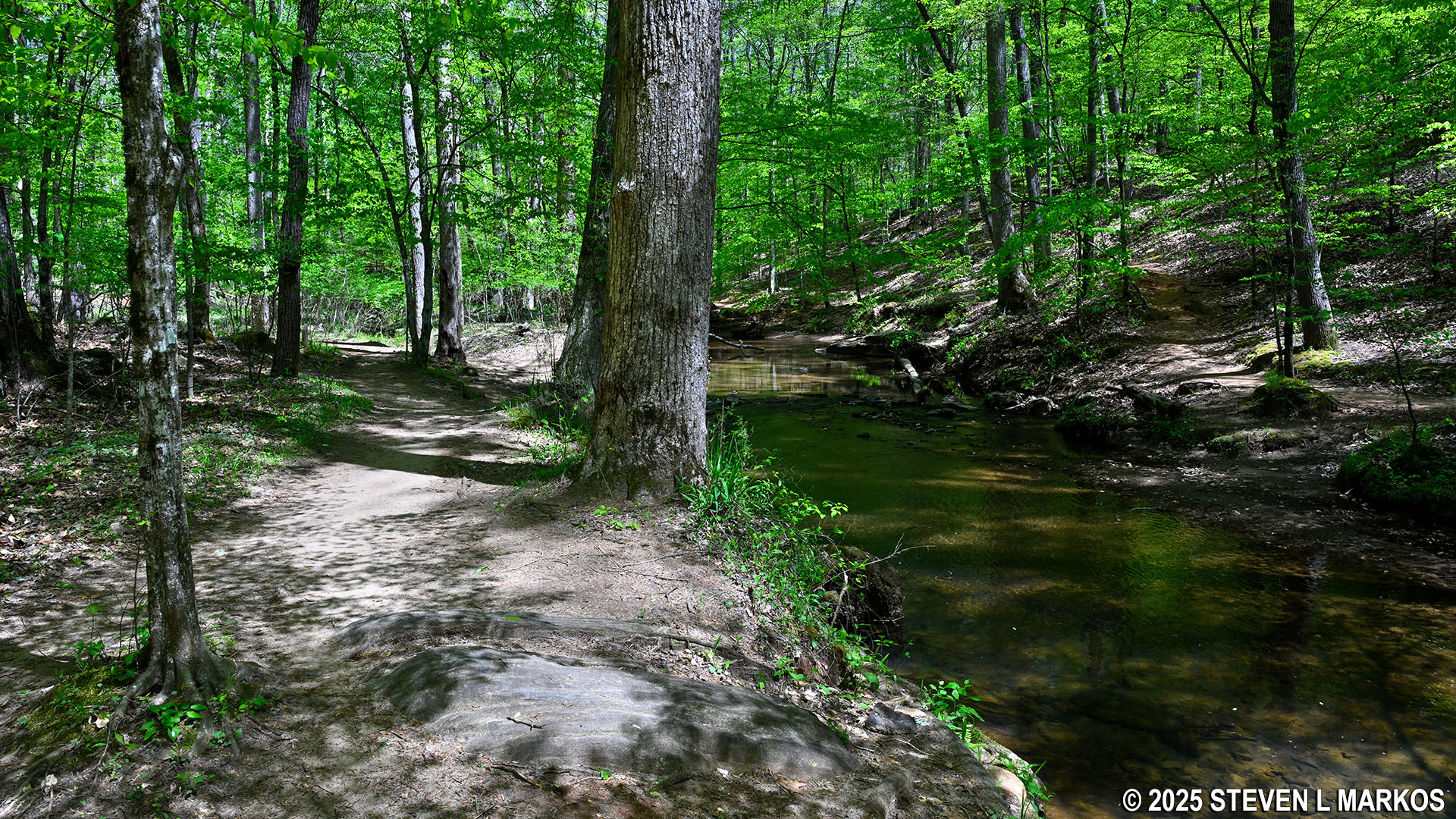
Hardage Mill Trail North runs along Noses Creek at its southern end, Kennesaw Mountain National Battlefield Park
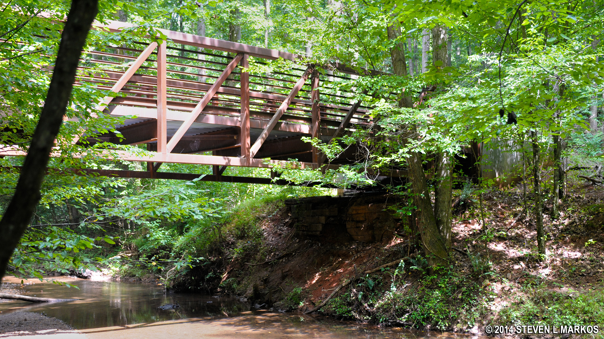
Bridge across Noses Creek at Kennesaw Mountain National Battlefield Park
Cross the bridge to continue the hike on the Hardage Mill Trail South. Directly on the other side is the trailhead. There is no signage, so you must know what to look for. The trail starts off following right along the creek as well, only this time on the other side.
Bridge over Noses Creek, Kennesaw Mountain National Battlefield Park
Start of the Hardage Mill Trail South at the southern end of the Noses Creek Bridge, Kennesaw Mountain National Battlefield Park
Northern end of the Hardage Mill Trail South starts off following Noses Creek, Kennesaw Mountain National Battlefield Park
The Hardage Mill Trail South is also .9 mile long. It follows Noses Creek just as far as the trail on the other side does, then turns sharply to the south. When it veers from the creek, it heads uphill for a quarter mile, with the climb broken into two segments with a short level reprieve in between. The first half of the climb is quite steep.

Hardage Mill Trail South veers from Noses Creek, Kennesaw Mountain National Battlefield
Steep hill at the northern end of the Hardage Mill Trail South, Kennesaw Mountain National Battlefield Park
At the top of the hill, which comes 1.6 mile into the overall hike, are more earthworks. This makes sense, for the Confederates, who were on the defensive during the battle, would have dug in at the top of the hills so they had a great view of the surrounding area, plus the Union troops would have to charge uphill to overrun their positions. As it turned out, these superior positions are the reason why the Union lost the Battle of Kennesaw Mountain.
Confederate earthworks just south of Noses Creek along the Hardage Mill Trail, Kennesaw Mountain National Battlefield Park
The level terrain at the top does not last long, and soon you will be heading back downhill for about a tenth of a mile, dropping 75 feet in elevation in the process. There is a 100-yard stretch with an average grade of 19%, so the terrain remains quite difficult. The forest isn’t that dense, so it is possible to see a creek at the bottom. No sooner do you cross it than you will be heading back uphill out of the ravine, this time via a switchback for the first 100 feet (25% average grade even with the help of the switchback).
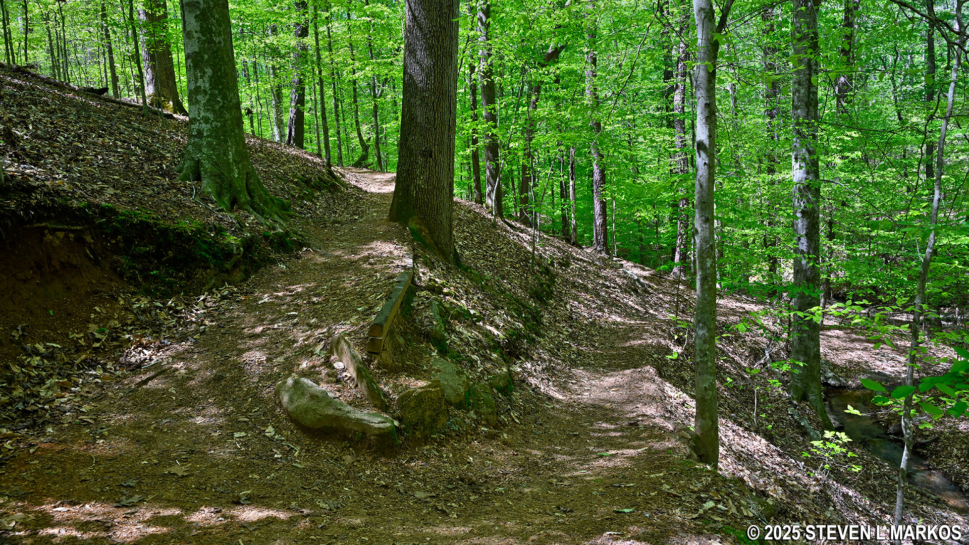
Switchback up a steep hill on the Hardage Mill Trail South, Kennesaw Mountain National Battlefield Park
Once beyond the switchback, it is a .4-mile hike to the end of the Hardage Mill Trail at Dallas Highway. It is uphill most of the way, and there is one more short-but-steep section not long after the switchback, but beyond that the hike gets much easier. In fact, despite the ascent, if you aren’t paying attention, you would think you were hiking on level ground.
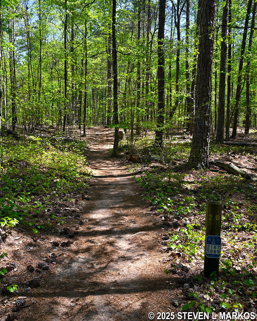
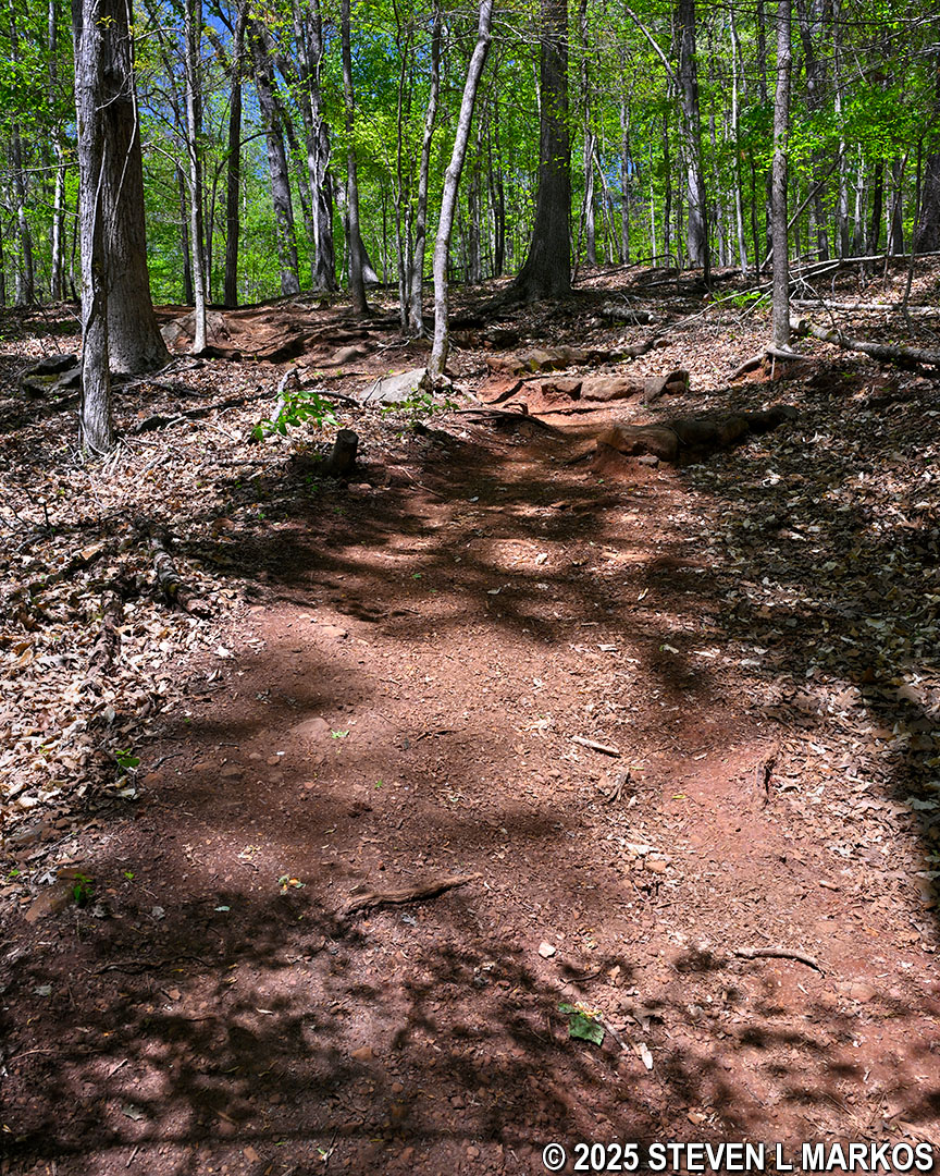
Typical terrain at the southern end of the Hardage Mill Trail South, Kennesaw Mountain National Battlefield Park
At 2.1 miles into the hike, Dallas Highway can be seen through the trees, and moments later the Hardage Mill Trail South ends at the Noses Creek Trail. If you wish to hike to Cheatham Hill, a little over a mile away, the Cease Fire Trail starts on the opposite side of the highway, as does the vehicle road to Cheatham Hill.
Noses Creek Loop Hike meets Dallas Highway at its southern end, Kennesaw Mountain National Battlefield Park
Intersection of the Hardage Mill Trail South and the Noses Creek Trail at the southern end of the Noses Creek Loop Hike, Kennesaw Mountain National Battlefield Park
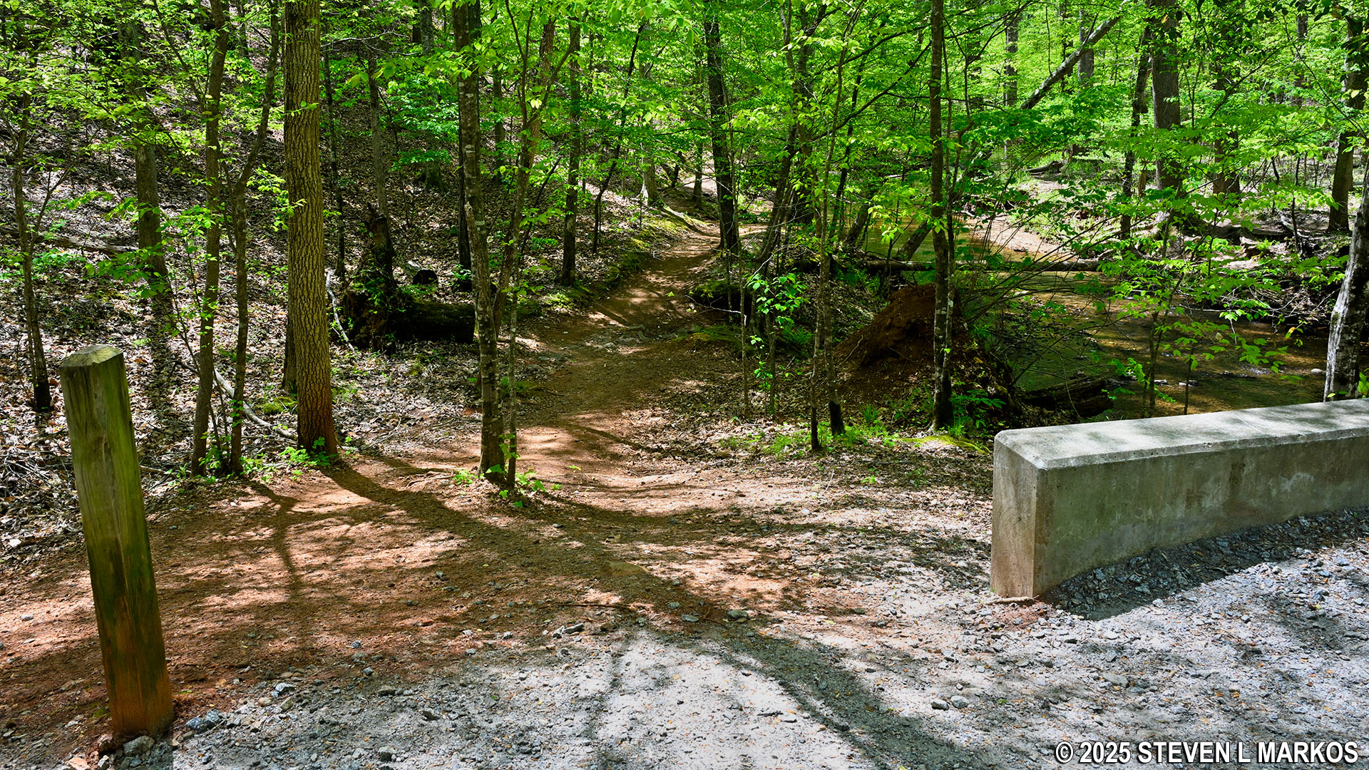
The Noses Creek Trail is nothing but an old dirt road, and it is an easy hike all the way back to the parking lot. While the general trajectory is downhill to the Noses Creek Bridge and uphill to where the loop started at Hardage Mill Trail North, the slopes are long and gradual. This is just like walking around the neighborhood.
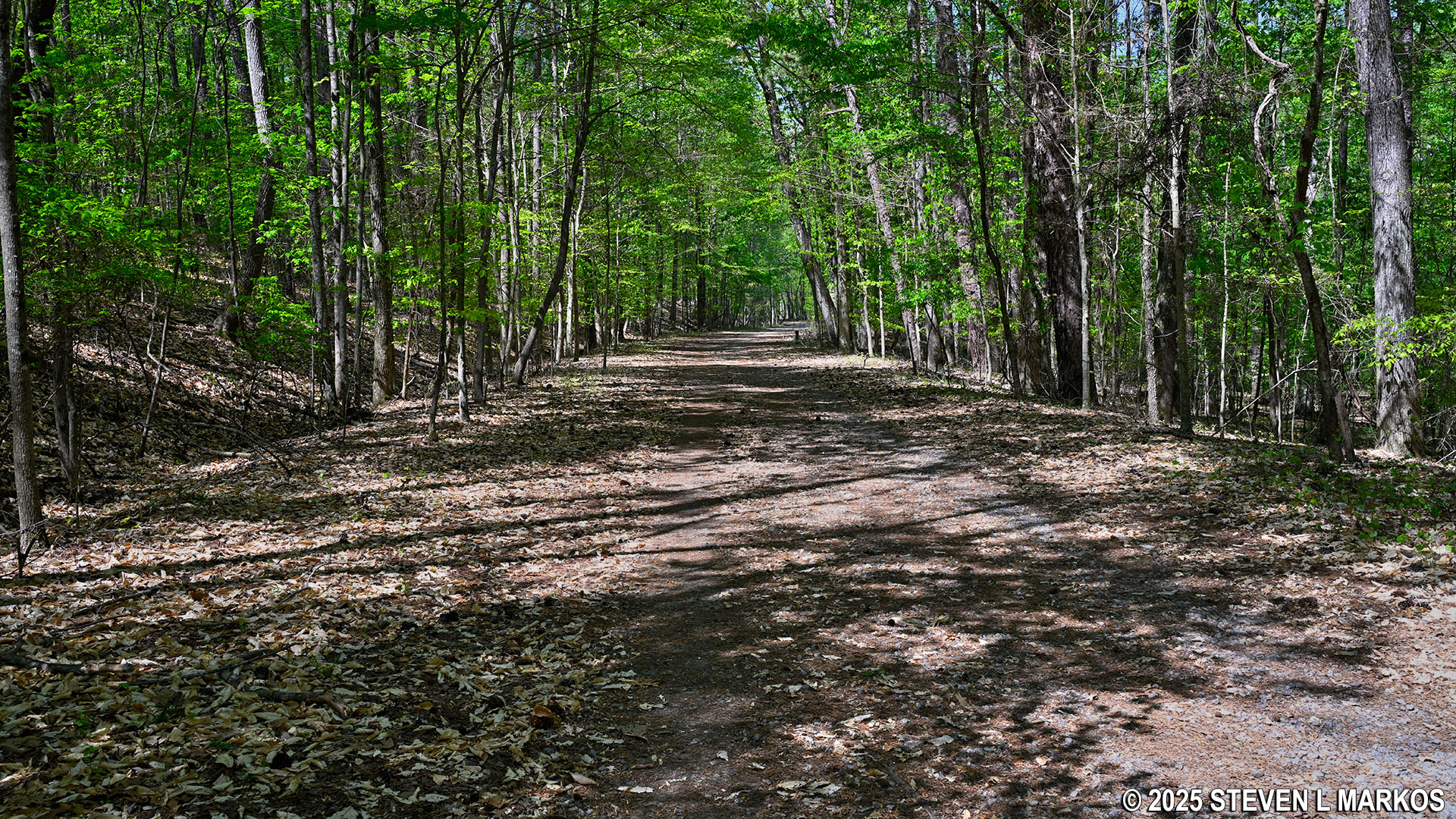
Typical terrain on the Noses Creek Trail, Kennesaw Mountain National Battlefield Park
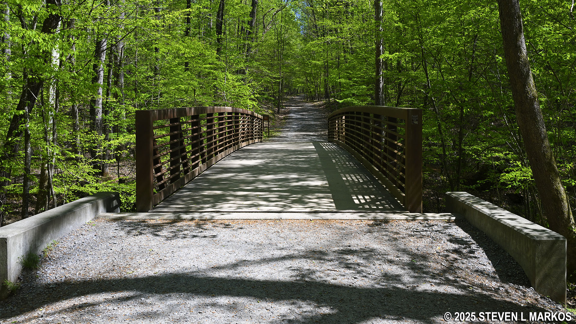
The Noses Creek Bridge comes .6 mile from the start at Dallas Highway (2.75 miles into the overall hike). Cross it and keep walking straight ahead.
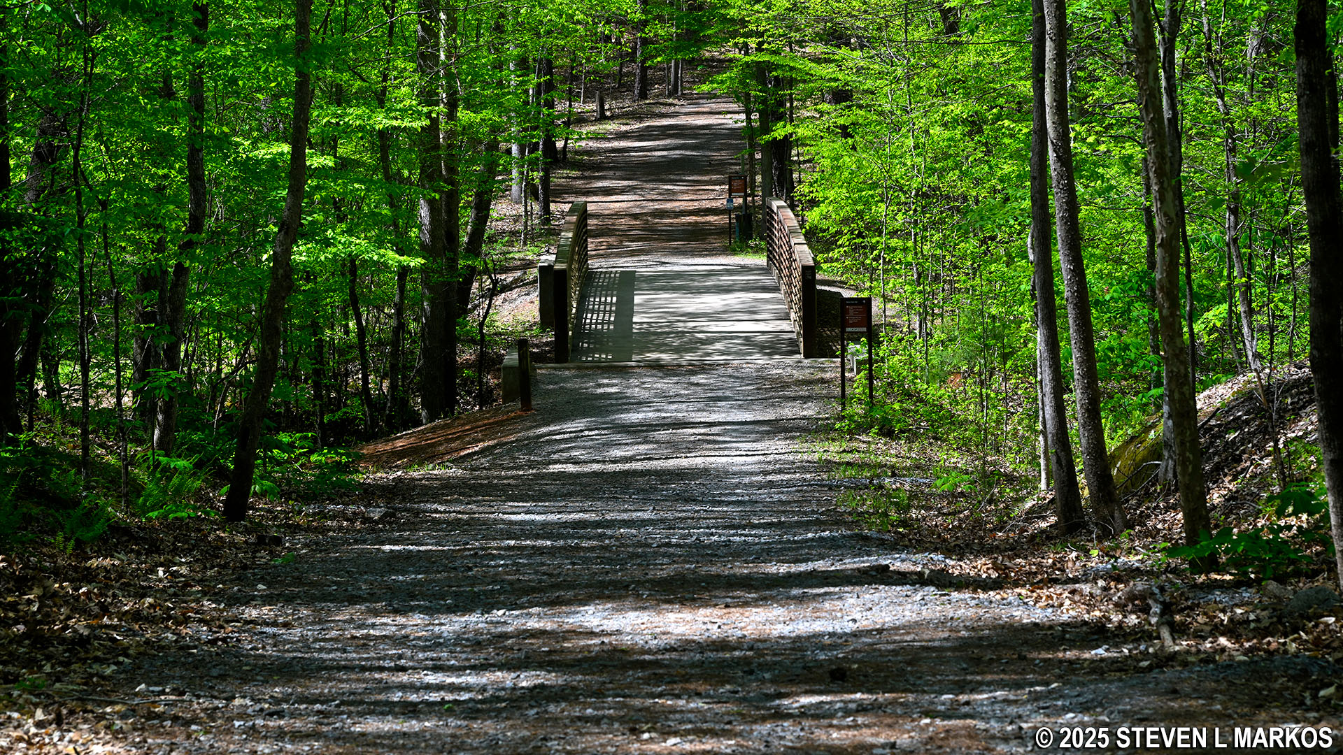
Approaching the Noses Creek Bridge from the south on the Noses Creek Trail, Kennesaw Mountain National Battlefield Park
In .4 mile from the bridge is the intersection with the New Salem Church Trail, and a tenth of a mile beyond that is the intersection of the Noses Creek and Hardage Mill trails where the loop portion of the hike began. If you remain on the Noses Creek Trail, you will be hiking back to the Pigeon Hill Parking Lot on ground you have already covered, which is fine for most people. The hike back is a quarter mile. However, if you don’t want to see the same things twice, you can take the New Salem Church Trail to Burnt Hickory Road, which is .7 mile, and then walk .2 mile back along the road to the parking lot on a paved, multi-use path. This alternate route ends up adding an extra half mile to the hike. See the New Salem Church Trail report here on National Park Planner for complete details.
Intersection of the Noses Creek Trail and the New Salem Church Trail, Kennesaw Mountain National Battlefield Park
Just beyond the New Salem Church Trail intersection is a large field on the left with a worn foot path running through it. If you recall the X-shaped intersection at the beginning of the hike along the Hardage Mill Trail North and the trail to the left that led to a field, this is the field, and this is the trail.
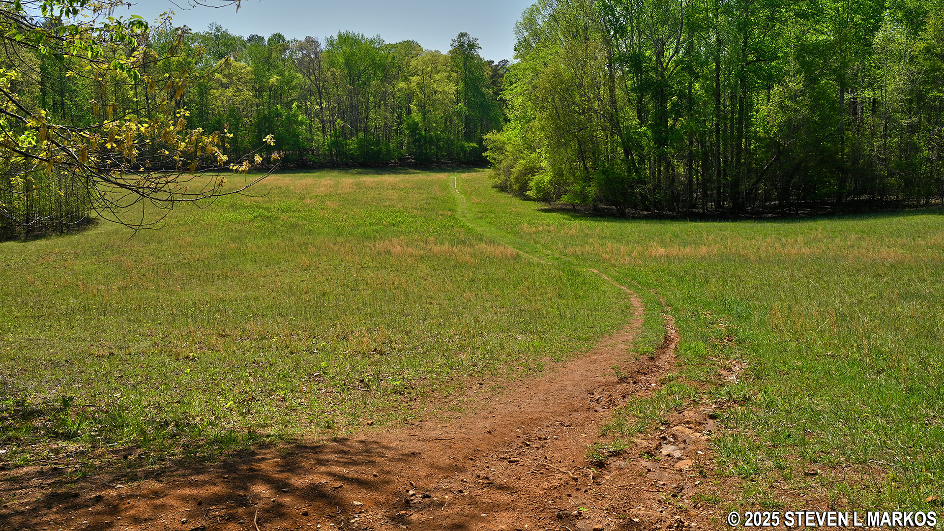
Field near the northern intersection of the Noses Creek Trail and Hardage Mill Trail North, Kennesaw Mountain National Battlefield Park
The Noses Creek Loop Hike is an enjoyable way to spend some time outdoors, provided the temperatures and humidity aren’t too high. The terrain is very diverse, and there are some well-defined earthworks, some nearly as tall as they were when built. I hiked all the major trails at Kennesaw Mountain National Battlefield Park, and I believe that the earthworks in the central section of the park are some of the best preserved.
With a few exceptions, use of any photograph on the National Park Planner website requires a paid Royalty Free Editorial Use License or Commercial Use License. See the Photo Usage page for details.
Last updated on April 23, 2025


