
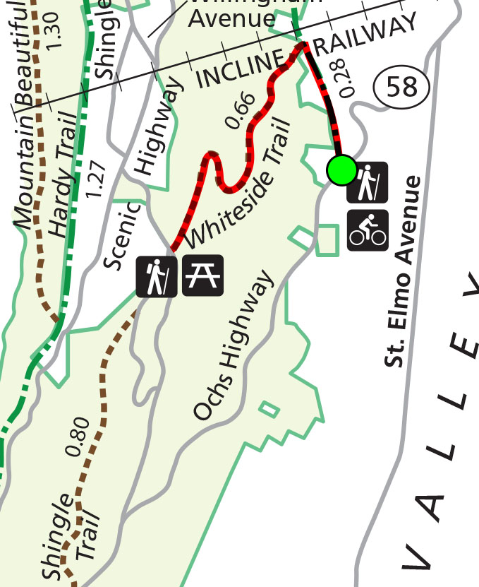
Whiteside Trail Map (click to enlarge)
See the Chattanooga Hiking Trails web page for a trail map of the entire park.
Length: 1.2 miles round trip, out-and-back trail (from parking lot)
Time: 1 to 1.5 hours
Difficulty: Very strenuous, straight up and straight down the mountain
The Whiteside Trail is located on the slopes of Lookout Mountain in the Chattanooga Unit of Chickamauga and Chattanooga National Military Park. If you feel like climbing straight up a mountain for a half hour, then heading straight back down, the Whiteside Trail is for you. Other than for exercise, I found this trail to be the most pointless of all the trails I hiked in the park, for not only is there nothing new to see, you have to strain yourself to see it. Walk one hundred feet up the trail and what you see at that point is what you will see the rest of the way up.

Typical terrain on the Whiteside Trail on Lookout Mountain in the Chattanooga Unit of Chickamauga and Chattanooga National Military Park
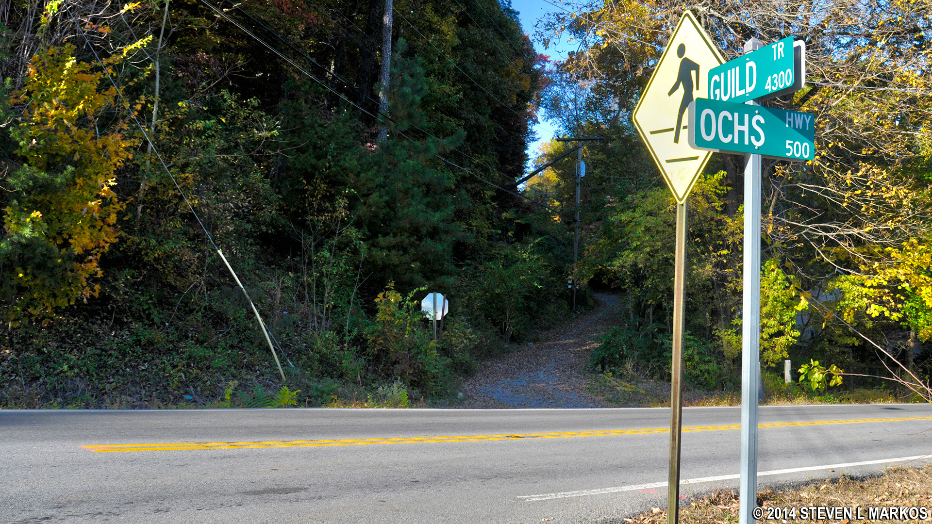
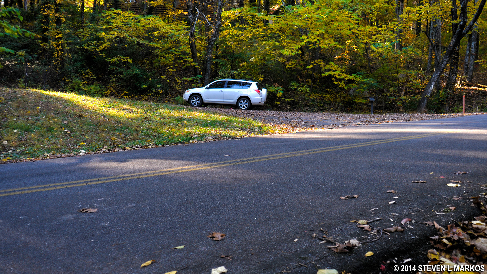
You can start the hike either at the now-closed picnic area on Sanders Road (top of the slope) or by first hiking a short segment of the Guild Trail (bottom of the slope). To stem any confusion, Guild Trail has a paved section that is an active road and a gravel, closed-to-traffic section that is open to hikers and bikers. I started from the Guild Trail, so this review describes the hike from there. To access the gavel portion of the road, park in the lot at the corner of Ochs Highway and Guild Trail. It sneaks up on you, so be on the lookout. If coming from Chattanooga, the parking lot will be on your left. (The location is identified on Google Maps—search “Guild-Hardy Trailhead”.) The gravel section starts on the other side of Ochs Highway from the parking lot.
Start of the gravel section of the Guild Trail in the Chattanooga Unit of Chickamauga and Chattanooga National Military Park
The walk to the Whiteside Trail trailhead takes less than ten minutes and is slightly uphill. When you see the Incline Railroad, start looking for the trailhead on your left.

Guild Trail passes under Chattanooga’s Incline Railroad to the top of Lookout Mountain
From this point it is a straightforward hike. When you get to Sanders Road (where the old picnic area is), turn around and come back down unless you want to continue your hike on the Shingle Trail, and from there even farther on the Glen Falls Trail. If you do this, DO NOT form a loop by walking back on the Ochs Highway because you will probably be killed. Cars zoom by and there is no shoulder to walk on. Return back via the trails.
If you want to hike the Shingle Trail, when you reach Sanders Road take a right. You will see the north entrance into the old picnic area. Walk up the road until you come to the first restroom building. The trailhead is behind the building.
Entrance to the Sanders Road Picnic Area, to the right of where the Whiteside Trail meets Sanders Road.
With a few exceptions, use of any photograph on the National Park Planner website requires a paid Royalty Free Editorial Use License or Commercial Use License. See the Photo Usage page for details.
Last updated on July 6, 2024


