VALLEY FORGE ENCAMPMENT TOUR STOP 6
Redoubt 3
The sixth stop on the Valley Forge Encampment Tour is the site of Redoubt 3 (aka Fort Washington), one of five earthen forts constructed at Valley Forge by the Continental Army during the winter of 1777-78. A redoubt is an enclosed fort usually built in an outlying area, sort of an outpost for soldiers sent to defend a strategic point. Redoubts can be earthen, temporary structures or permanent structures made of brick or stone. All redoubts at Valley Forge were earthen forts. They were constructed by digging dirt from one area and piling it high at another to form a tall, earthen wall. In most cases, the dirt was piled right next to the area being dug so that the ditch that was created ended up serving as a dry moat. The walls themselves were usually reinforced with wood or baskets filled with rock. Sharpened logs called abatis protruded from the fort walls and were embedded straight up in the moat to further deter attacking troops. The following photos are of the reconstructed Redoubt 2, which you can see at the second stop on the Valley Forge Encampment Tour, Muhlenberg Brigade.
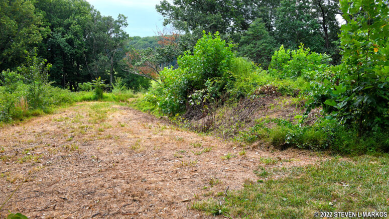
If you have seen Redoubt 2, don’t expect that at the Redoubt 3 tour stop. Today, there is very little left of the redoubts and defensive trenches at Valley Forge. After the Continental Army left on June 19, 1778, farmers began reclaiming their land by plowing down the earthworks on fertile farm land. Only those on land not suited for farming were left untouched, but after nearly 250 years of erosion, even these are now nothing more than small hills and gullies.
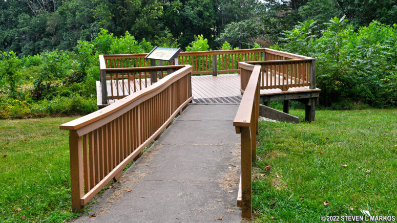
Redoubt 3 is supposedly the best preserved of all redoubts—which isn’t saying much. Though it is hard to tell, what you are looking at is a partial reconstruction of the fort on its original location, which I assume means that archeologists (or whoever was in charge) built up the eroded walls by adding more dirt. When I first visited, the site was overgrown, so it was hard to make out anything. I went back a year later expecting that perhaps the weeds had been cut back and that the shape of the redoubt would be more defined. Things were even worse—trees were now growing on it. As is, other than a cannon on display and one information panel, there’s not much to see here. Plan to spend no more than 5 minutes at the Redoubt 3 stop on the Valley Forge Encampment Tour.
If you are doing the Valley Forge Encampment Tour on bike or foot by following the Joseph Plumb Martin Trail, the trail does not lead to Redoubt 3, but a short detour will get you there. After passing the Wayne’s Woods Picnic Area, the J. P. Martin Trail makes a sharp right-hand turn at the next park road it intersects with and proceeds up a steep hill (I don’t know the name of this very short road). Instead of taking the trail up the hill, take the road next to it. At the top is the intersection with South Inner Line Drive. Take a left to get to Redoubt 3—you can see the parking lot from the intersection. If you stick to the trail, there is a sloping bank and a fence between the road and trail, so you won’t be able to get off the J. P. Martin Trail and onto the road. You won’t be able to get back on it either, so when done at Redoubt 3, just head back the way you came and take the road to Stop 7: Artillery Park. The J. P. Martin Trail runs right in front of it, so you can rejoin it there. The distance up the steep hill is a tenth of mile; the distance to Redoubt 3 is another tenth of a mile; and it’s .2 mile from Redoubt 3 to Artillery Park.
If you took South Outer Line Drive from the picnic area in order to get to Stop 3 on the tour, the Wayne Statue, continue down the road past the statue and you will come to the intersection where the J. P. Martin Trail turns up the hill. Follow the above instructions to Redoubt 3.
Tour Stop 7 | Tour Stop 5 | Encampment Tour Main Page
With a few exceptions, use of any photograph on the National Park Planner website requires a paid Royalty Free Editorial Use License or Commercial Use License. See the Photo Usage page for details.
Last updated on August 3, 2022


