

The Walk Through the Ruins Trail at Johnstown Flood National Memorial leads to the Little Conemaugh River
Length: .4 miles
Time: 30 minutes (includes reading all the wayside exhibits)
Difficulty: Easy to Moderate
The Walk Through the Ruins Trail at Johnstown Flood National Memorial is a loop that takes visitors from the south abutment overlook of the dam down into the dry lake bed of the former Lake Conemaugh and then through the gap in the dam caused by the flood waters of 1889. On the way you will see the Little Conemaugh River, the river that was dammed to create the lake. Wayside exhibits tell the story of how Elias Unger, John Parke Jr., and a group of Italian immigrants fought in vain to save the dam.
While visitors can hike the Walk Through the Ruins Trail any time the park is open, Rangers also lead guided walks along the trail from June through September on Fridays, Saturdays, and Sundays. Meet at the stairs at the proper time if you want to attend. You can get the schedule on the National Park Service’s Ranger Programs web page for Johnstown Flood National Memorial.
The trailheads for both the Walk Through the Ruins Trail and the Carriage Road Nature Trail are located at the South Abutment parking lot. If looking towards the dam from the Visitor Center, the south abutment is on the far side of the former lake. You cannot reach this side by foot (at least not in a timely manner), so you must drive to it. If you take the suggested Self-Guided Tour of Johnstown Flood National Memorial, this will be your last stop.
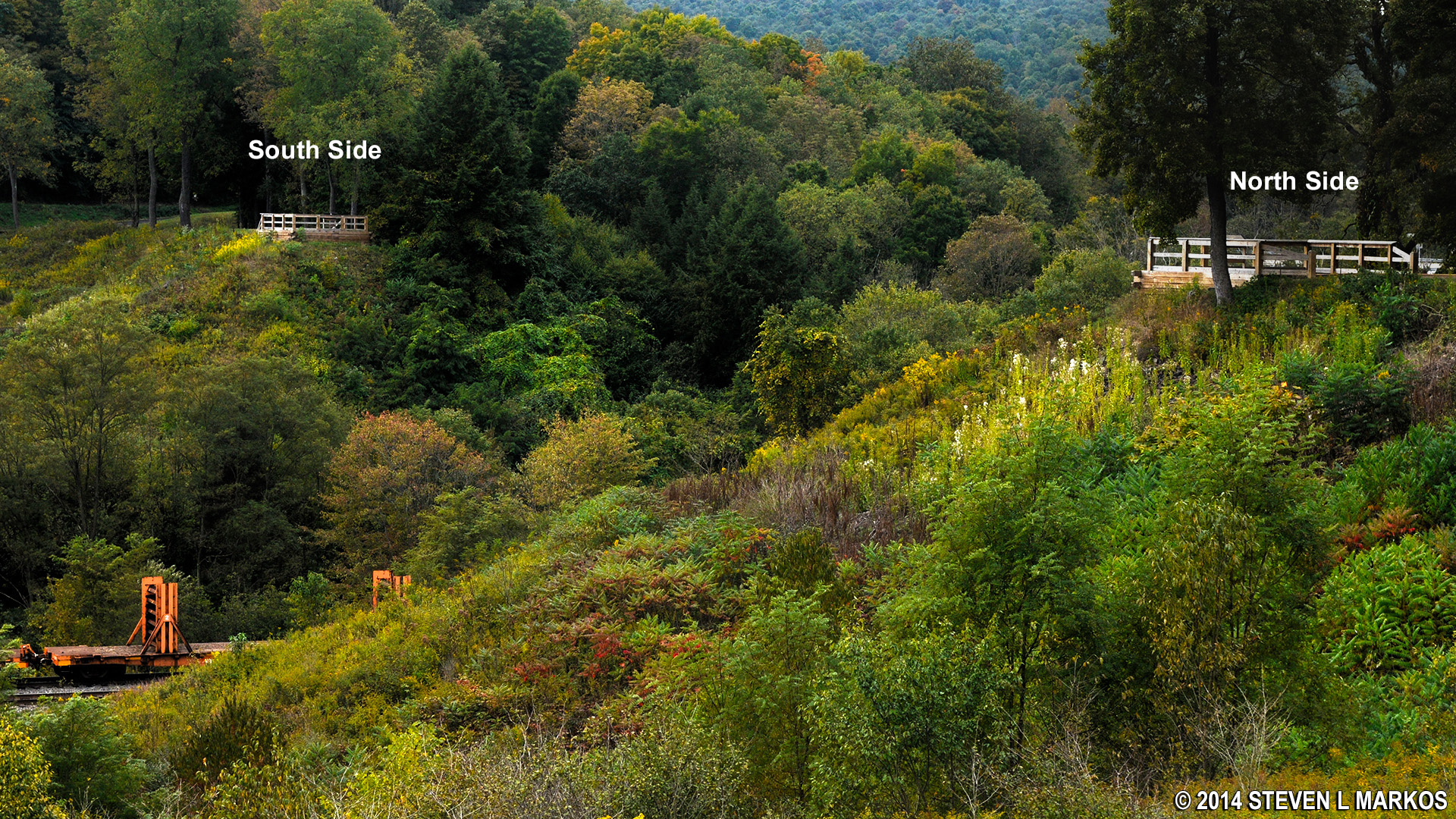
North and south overlooks of the gap in the South Fork Dam, Johnstown Flood National Memorial
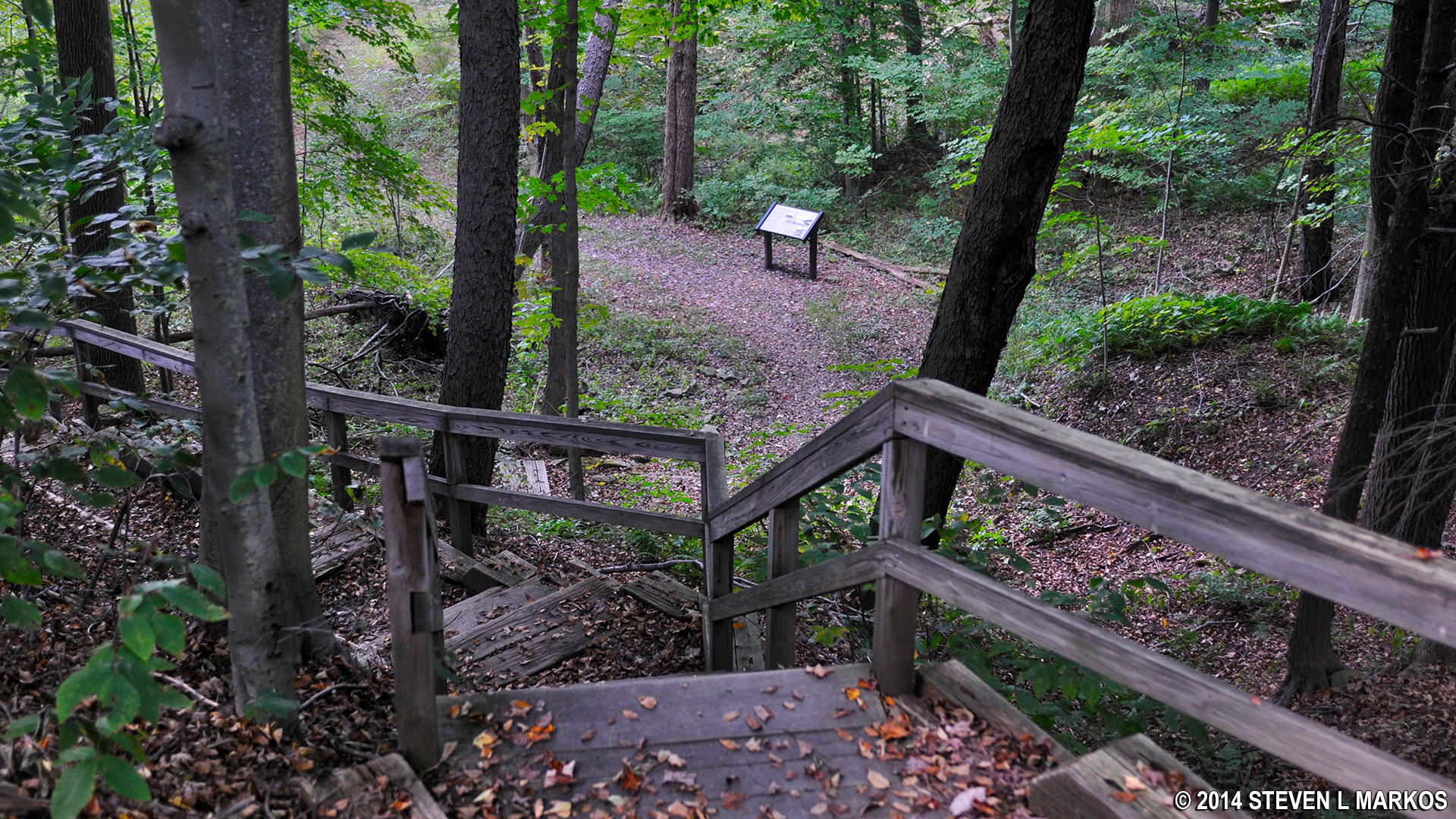
The trailhead is located to the right of the path that leads to the abutment overlook. Look for a staircase with a sign that reads WALK THROUGH THE RUINS STARTS HERE.
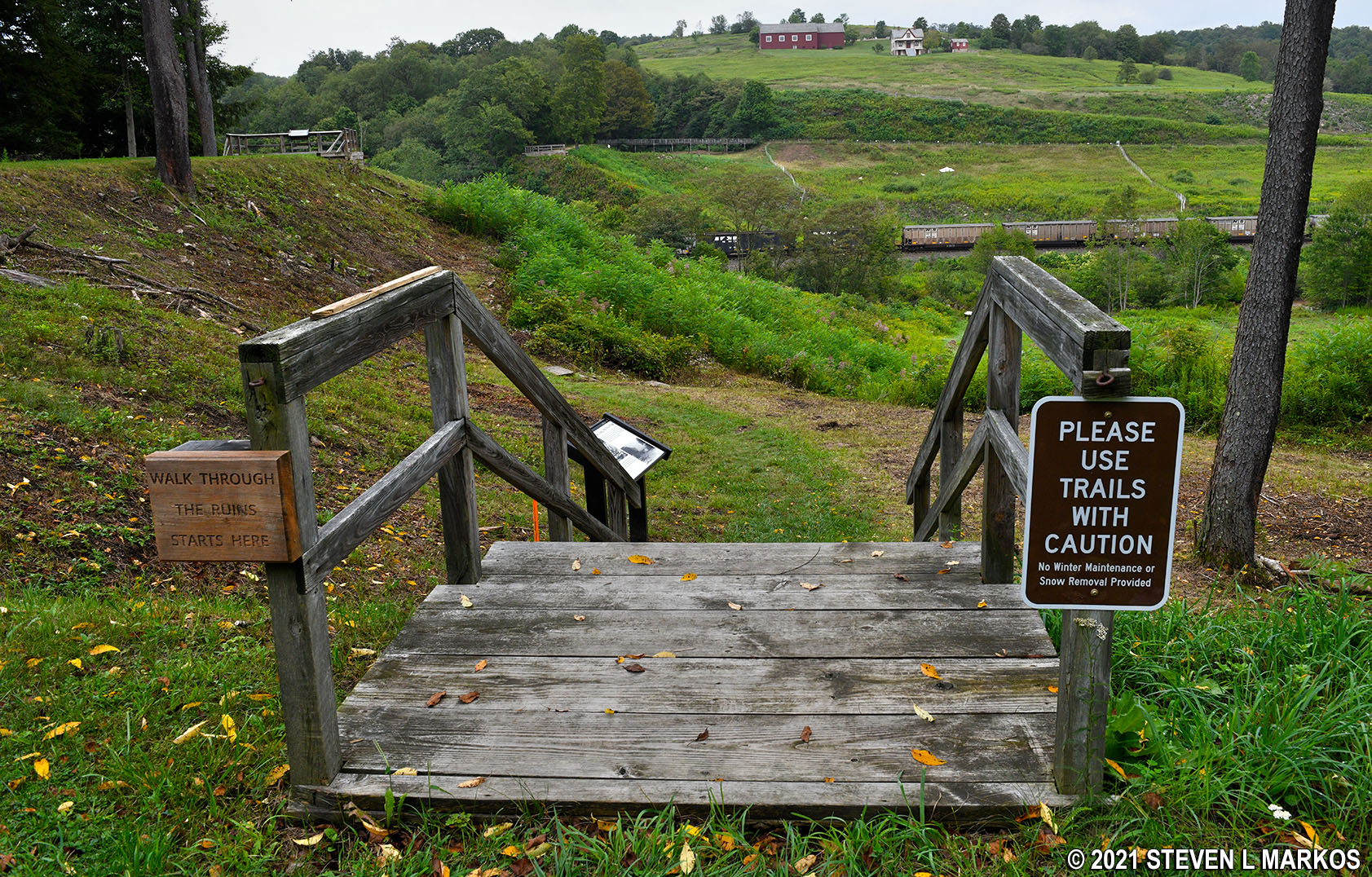
Start of the Walk Through the Ruins Trail at Johnstown Flood National Memorial
The stairs lead down to the dry lake bed, and from there the Walk Through the Ruins Trail follows a grass path towards the Little Conemaugh River. Wayside exhibits that tell the story of the Johnstown Flood are located along the trail.

Hike across the former Lake Conemaugh lake bed on the Walk Through the Ruins Trail at Johnstown Flood National Memorial
You will also have a nice view of the Visitor Center (painted red as of 2021) and the Unger House located on the ridge in front of you.
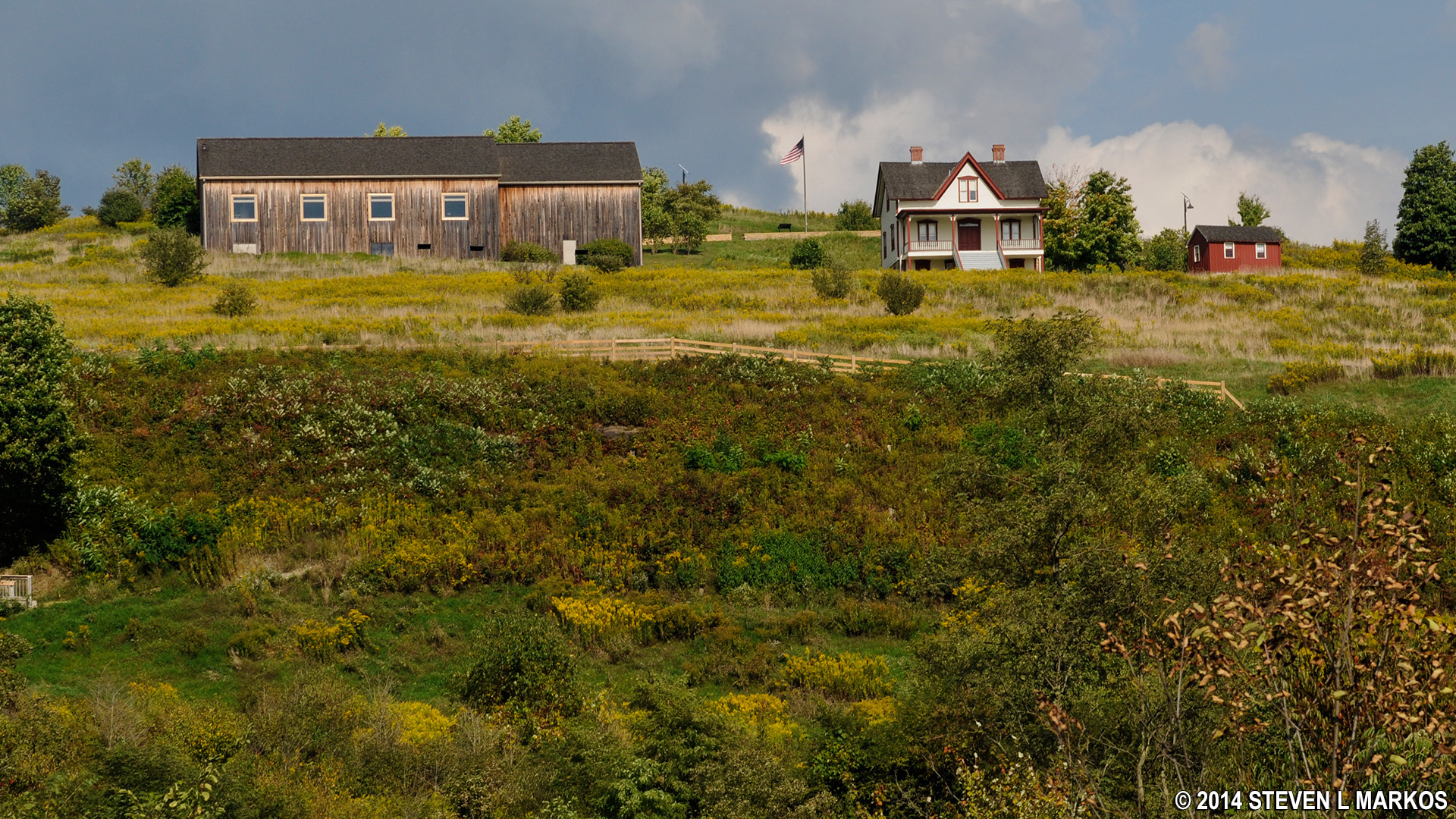
View of the Johnstown Flood National Memorial Visitor Center and Unger House from the former Lake Conemaugh lake bed
The trail crosses the lake bottom until coming to the Little Conemaugh River, then turns left and passes through the gap in the South Fork Dam. In the photos below, you can see where the original dam was. The missing piece is similar to the size of the open area underneath the current bridge on Highway 219, which passes just behind the original dam site. The highway itself is about the same height as the former dam.
Photo showing the gap in the South Fork Dam shortly after the collapse on May 31, 1899

Shaded area estimates the gap in the South Fork Dam cause by the flood waters, Johnstown Flood National Memorial
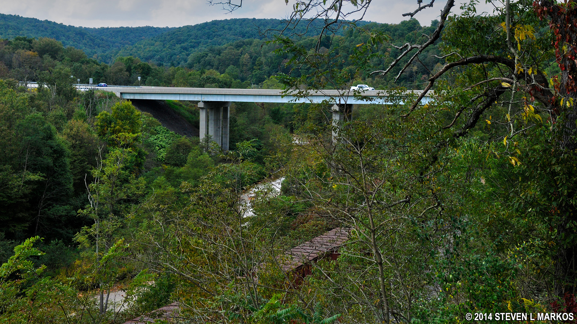
Highway 219 bridge spans the Little Conemaugh River near the former South Fork Dam at Johnstown Flood National Memorial
After walking through the dam you will begin the ascent back to the top. The final stretch is up a staircase, and you come out on the left side of the south abutment. Though less than a half mile, the hike takes about 30 minutes due to the number of wayside exhbibits along the way.
View from the top of the staircase at the end of the Walk Through the Woods Trail at Johnstown Flood National Memorial
Just to make sure you don’t start out hiking the trail in reverse, another sign on the exit staircase points you in the right direction.
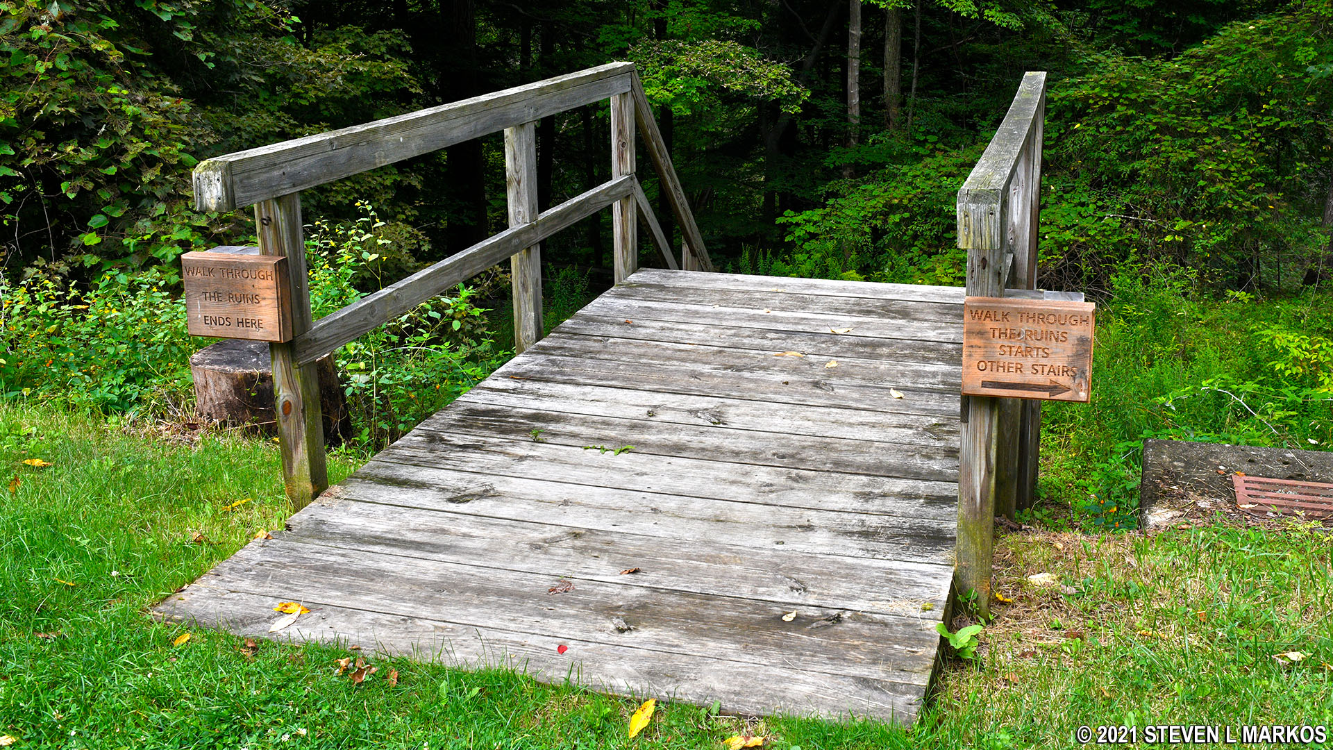
Exit staircase for the Walk Through the Ruins Trail at Johnstown Flood National Memorial
When I am at a history-based park such as Johnstown Flood National Memorial, I am not interested in trails that offer nothing but scenery and exercise. I want my hikes to add to the experience of being in a place where something important once happened. Because the Walk Through the Ruins Trail does offer a historical perspectives on the disaster from the Lake Conemaugh area point of view, I highly recommend hiking it. If you have time for only one hike, skip the Carriage Road Nature Trail (which also has historical ties) and do the Walk Through the Ruins Trail.
With a few exceptions, use of any photograph on the National Park Planner website requires a paid Royalty Free Editorial Use License or Commercial Use License. See the Photo Usage page for details.
Last updated on April 8, 2025


