DESCRIPTION
Back in the 1960s Elliott Key was slated for development. Since all other Florida Keys had been carpeted with hotels, restaurants, and neighborhoods, the developers ran into opposition by conservationists and local residents who wanted to see the area remain natural. The name “Spite” derives from the fact that the developers cut a six-lane highway right down the middle of the island in an attempt to destroy any of the natural appeal it might have—to spite the conservationists. However, this did not stop the popular anti-development movement, and in 1968 Biscayne National Monument was created, and plans for any further development came to an end.
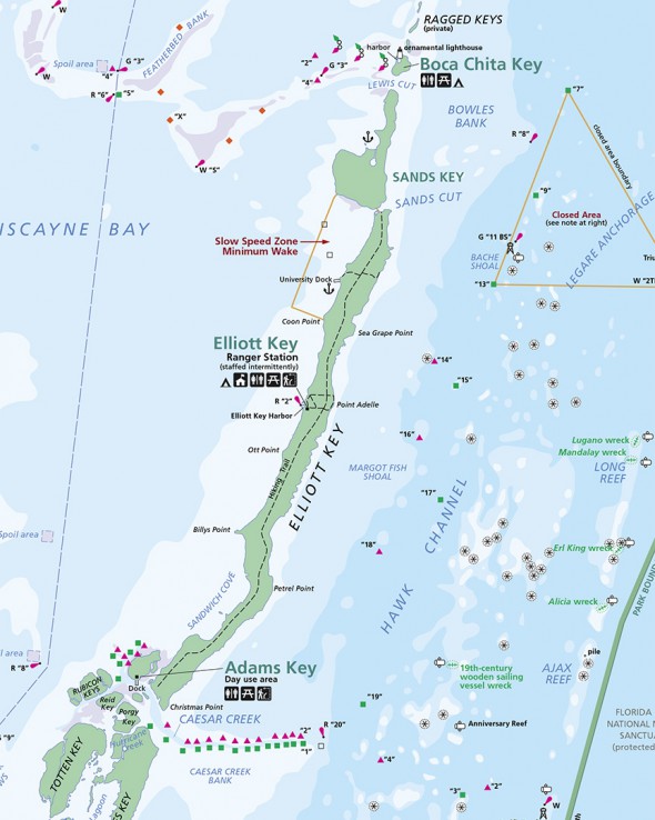
The National Park Service bills the Spite Highway Trail as the only true hiking trail in Biscayne National Park, with the other four being nothing more than short nature walks. The trail is no longer six lanes wide, but a one-lane wide swathe through the forest still runs right down the middle of Elliott Key.
TRAILHEAD LOCATION
Take the Elliott Key Loop Trail from the harbor about .2 mile from either trailhead and you will come to the intersection with the Spite Highway Trail. From there you can hike north or south.
LENGTH
7 miles, one way. I was told that the ends of the trail do not reach the ends of the island, so there is no way to have a boat pick you up at one end. Therefore, to hike the entire trail requires a 14-mile trek.
The Elliott Key Loop Trail does not intersect with the Spite Highway Trail right in the middle. It is roughly a 3-mile hike north and a 4-mile hike south. Double this distance to include the return trip.
TIME
Estimated 6-7 hours to hike the entire trail, 14 miles round trip.
DIFFICULTY
Easy
TERRAIN
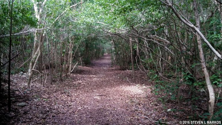
Flat and smooth, this wide trail runs though a tunnel-like hardwood forest.
HANDICAP ACCESSIBLE
Cannot say for sure, but probably not.
RECOMMENDATION
Though I did not hike this trail, I did hike the Elliott Key Loop Trail. The portions of that trail which run through the forest are uninteresting and infested with mosquitoes at all times of the day, year-round. What makes the Loop Trail somewhat appealing is that part of it runs along the Atlantic Ocean. The Spite Highway Trail comes nowhere near the ocean, so I can’t imagine anything worse than walking down the middle of Elliott Key while being eaten alive by mosquitoes, but to each his own.
With a few exceptions, use of any photograph on the National Park Planner website requires a paid Royalty Free Editorial Use License or Commercial Use License. See the Photo Usage page for details.
Last updated on July 1, 2025


