

Groveton Confederate Cemetery in Manassas National Battlefield Park
SECOND MANASSAS BATTLEFIELD TOUR
STOP 8: GROVETON CONFEDERATE CEMETERY
Allow 15 to 30 minutes
See the Second Manassas Battlefield Tour web page for a tour map.
GETTING THERE
The Groveton Confederate Cemetery stop on the Second Manassas Battlefield Tour is located on Highway 29 near the intersection with Groveton Road. If coming from Tour Stop 7 (Deep Cut), take a right out of the parking lot and head south on Featherbed Road, which is paved just past the parking lot, and then turn left onto Hwy 29. The parking lot is on the left just 200 yards from the turn.

Groveton Confederate Cemetery in Manassas, Virginia
WHAT TO SEE
The Groveton Confederate Cemetery was established in 1867 and contains the remains of roughly 500 men who were killed in both the First and Second Battles of Manassas. Only two are identified; the rest are buried in a mass grave under the Groveton Confederate Cemetery monument. Prior to the cemetery being created, dead soldiers were simply buried in shallow graves where they were found. Many graves were marked with simple wooden crosses, which is how they were found for reinterment and why they were not identified. It is impossible to know for sure if everyone was located, so there may still be men buried anonymously on the battlefield.

Groveton Confederate Cemetery monument was erected in 1904, Manassas National Battlefield Park

Grave of James Palmer, killed at Second Manassas on August 30, 1862, in the Groveton Confederate Cemetery, Manassas National Battlefield Park
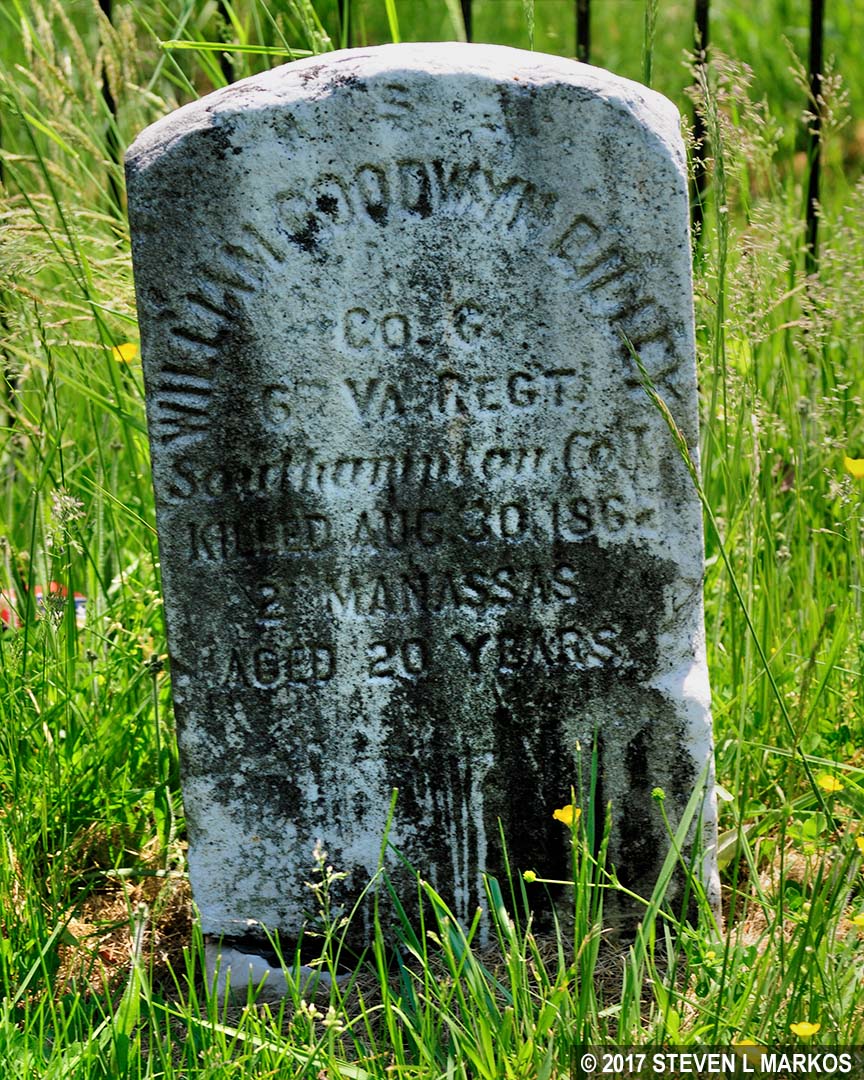
Grave of William Rilley, killed at Second Manassas on August 30, 1862, in the Groveton Confederate Cemetery, Manassas National Battlefield Park
You can also take a five-minute walk to the Lucinda Dogan House, one of three original Civil War-era structures at Manassas National Battlefield Park, and the only one left standing in Groveton (the others are the Thornberry House near Sudley Church and the Stone House). There is a path cut through the grass from the cemetery to the house. The Dogan House is only open a few times each year. Check the National Park Service’s Calendar web page for a schedule. (Enter DOGAN in the By Keyword search box.)
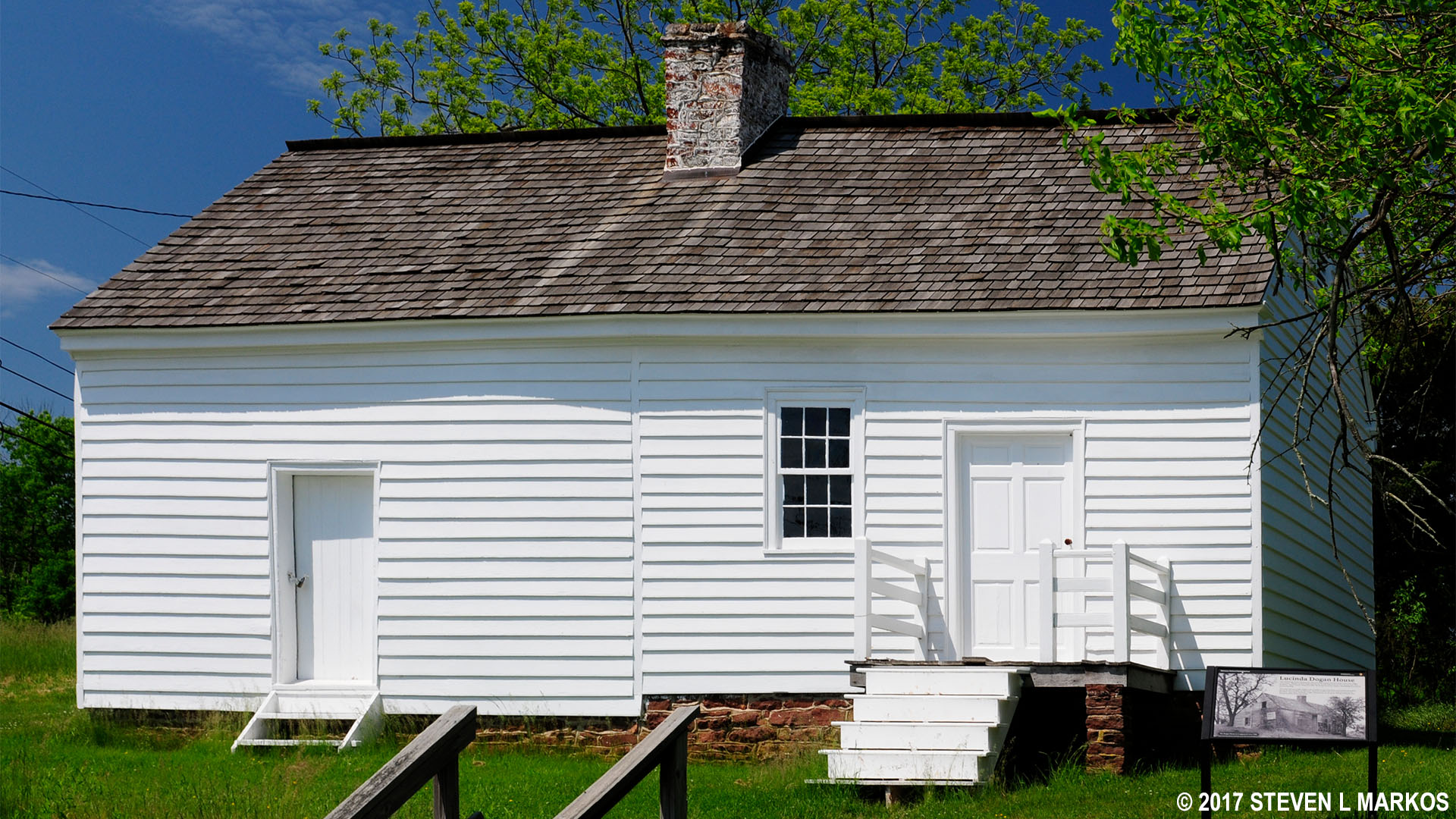
Dogan House near the Groveton Confederate Cemetery in Manassas National Battlefield Park
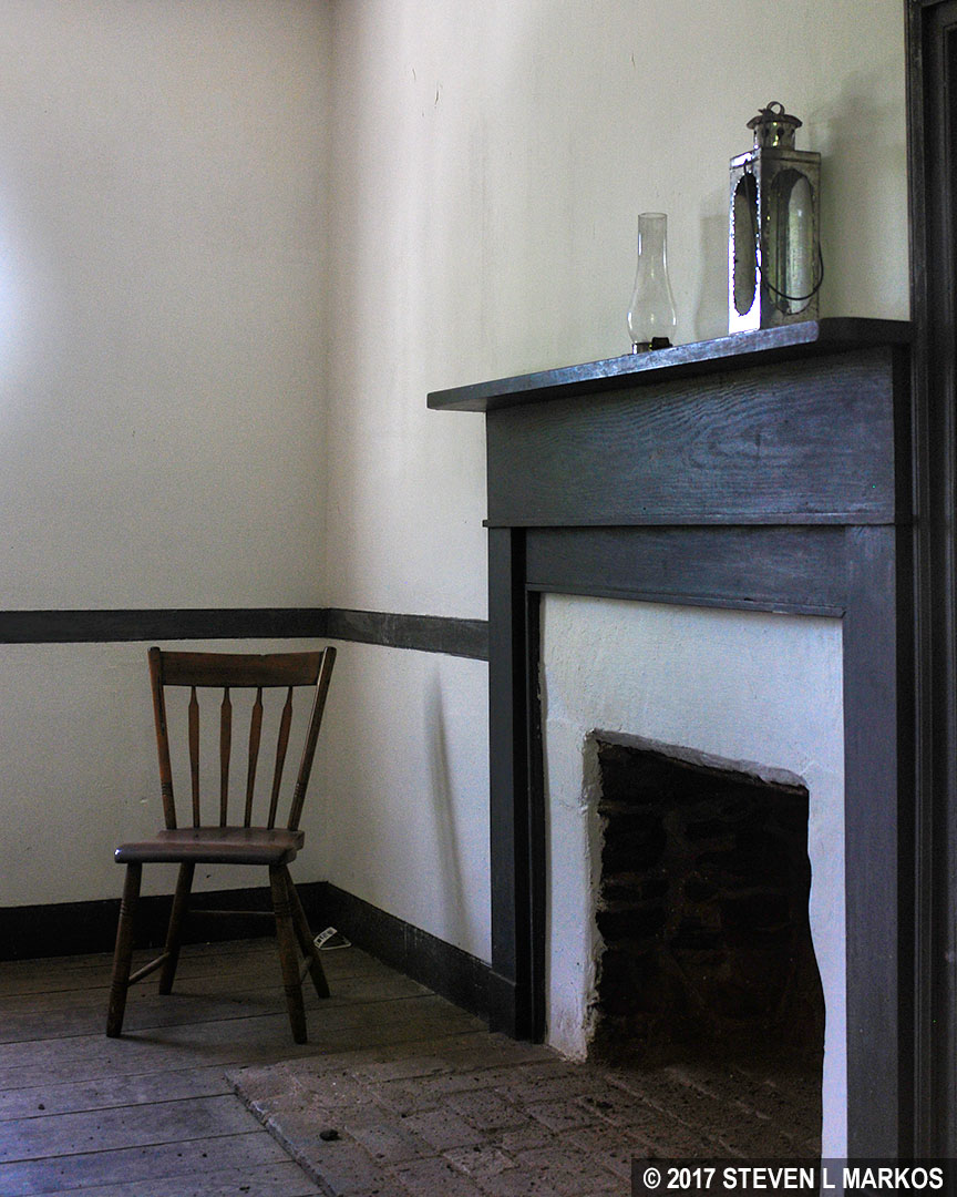
A peak inside the Dogan House near the Groveton Confederate Cemetery in Manassas National Battlefield Park
TRAILS
The only trail is the short path to the Dogan House.

Path from the Groveton Confederate Cemetery to the Dogan House, Manassas National Battlefield Park
SCHEDULING YOUR TIME
Allow 15 minutes for a visit to the cemetery—there are only two headstones and a mass grave under the monument. Add another 15 minutes if you walk to the Dogan House.
EVENTS NEAR GROVETON
Upon General James Longstreet’s arrival on August 29th with 30,000 men, the Confederate line formed an L-shape, with General Stonewall Jackson’s men perched along Stony Ridge and the Unfinished Railroad in an east to west array, and Longstreet’s men straddling the Warrenton Turnpike from north to south at Jackson’s right flank. A division of Union soldiers under the command of General John Reynolds faced Longstreet’s army south of the Turnpike. However, when Union General Irvin McDowell moved Reynolds’ men north to help in the frontal attack against Jackson at the Deep Cut, only 2,500 men remained to defend the Union left. This was the moment that General Robert E. Lee had been waiting for. With Reynolds out of the way, the Confederates launched one of the most massive flank attacks of the entire Civil War.
Lee’s plan was to take control of Henry Hill, which was a couple of miles from Longstreet’s north-south line near Brawner Farm. If successful, the Union would be stuck in the valley sandwiched between Jackson’s line along the Unfinished Railroad to the north, Longstreet’s men to the west and south, and Bull Run (creek) to the east. The creek would cut off any chance of a mass retreat. The Confederates would also take control of the intersection at Warrenton Turnpike (Hwy 29) and Sudley Road. It was along the north-south Sudley Road that the Union was moving troops in and out of the battle.
Stop 9: New York Monuments | Stop 7: Deep Cut
With a few exceptions, use of any photograph on the National Park Planner website requires a paid Royalty Free Editorial Use License or Commercial Use License. See the Photo Usage page for details.
Last updated on May 20, 2025


