

Delaware River at the Hancock, NY DEC Canoe Launch, Upper Delaware Scenic and Recreational River
Length: 5.5 miles
Water Level at Time of Trip: estimated 2 to 2.5 feet
Average moving speed: 3.8 MPH with two paddlers
Time: 1.5 hours
This river review covers the Delaware River from the Hancock, NY DEC Canoe Launch to the Buckingham Boat Ramp in Pennsylvania, a span of 5.5 miles. The Hancock canoe launch is for non-motorized watercraft only. It has a large parking area, and getting your boat and gear to the water is easy (100-foot walk). The water at the ramp is pretty shallow and the current quite calm. This is a very convenient place to start a trip on the Upper Delaware Scenic and Recreational River. There are even a few picnic tables at the ramp.

Hancock, NY DEC Canoe Launch, Upper Delaware Scenic and Recreational River
Before starting a trip on the Upper Delaware Scenic and Recreational River, it is a good idea to check the water levels so that you have an idea of the river conditions. Levels of 2.5 to 4 feet are average and provide plenty of water for a trip down the river with conditions suitable for paddlers of all skill levels. The water level was fairly low when I did the trip in late October—I could see the bottom the entire time. The USGS water level gauge at Lordville, New York, fifteen miles downstream, claimed the water was 6.3 feet deep, but I can guarantee you that there was no 6 feet of water anywhere between Hancock and Buckingham. In fact, I passed Lordville later in the day and there wasn’t 6 feet of water there either except at a large, deep pool just before the Equinunk-Lordville Bridge, so the gauge must be measuring this. However, this pool is not indicative of the rest of the river.
The only gauge north of Hancock is on the West Branch of the Delaware River at Hale Eddy, New York, and it measured the water level at 2 feet, which sounds more in line with the actual conditions. The gauge at Callicoon, New York, the next one south of Lordville (18 miles farther south) measured 1.3 feet, again, much more in line with what I experienced. I just checked all three gauges as I was editing this report, and the relationship between them was similar: 3.4 feet at Hale Eddy, 7.35 feet at Lordville, and 1.45 feet at Callicoon.
The observations made in this report are based on water levels of around 2 feet, so adjust your expectations according to the conditions on the day you do the trip. The lower the water, the more often you will hit rocks on the bottom of the riverbed and get stuck. The higher the water, the more paddling skills you need.
Assuming the water level was around 2 feet, there was enough water to go down the river without scaping bottom, but I certainly wouldn’t want to do a trip with anything less. There were no dangerous rapids of any sort and only a few spots with some small riffles. All instances of swifter water occur where the river narrows as it flows around an island.

Area of small riffles on the Delaware River between Hancock and Buckingham, Upper Delaware Scenic and Recreational River
Just downstream from the Hancock Canoe Launch is an island, so stay to the right of it on the larger of the two channels that flow around it. To do so, start heading over to the other side (Pennsylvania side) of the river as soon as you launch. In fact, any time you see an island on this section of the river—there are two others—stay to the right.
There is a gravel boat ramp about 2 miles from Hancock, but this is not the Buckingham Boat Ramp (which is concrete). It is on private property and there is a KEEP OUT sign posted. The National Park Service owns the river up to the high water mark, so you can get out at the ramp and take a break without trespassing. You just can’t go beyond the KEEP OUT sign.

Private boat ramp on the Delaware River two miles south of Hancock, Upper Delaware Scenic and Recreational River

Private boat ramp on the Delaware River two miles south of Hancock, Upper Delaware Scenic and Recreational River
The rest of the trip to the Buckingham Boat Ramp was calm and relaxing. This is a rural area with nice scenery. While there are a few large houses along the river, there are no commercial buildings or dumpy private residences.
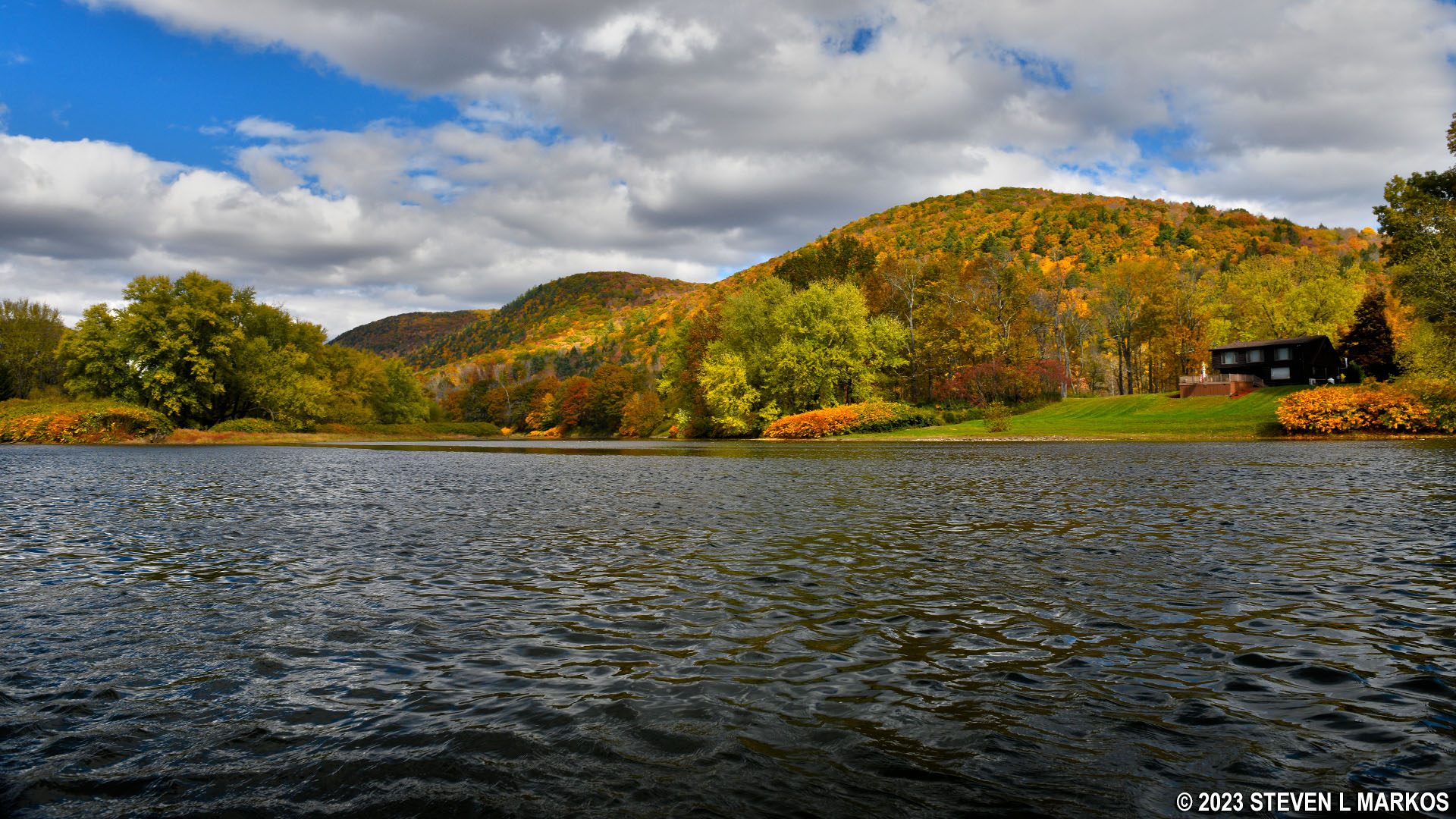
House along the Delaware River between Hancock and Buckingham, Upper Delaware Scenic and Recreational River
The Buckingham Boat Ramp is on the right side of the river in Pennsylvania. It is the only concrete ramp you will pass, so it is easy to spot. This ramp can accommodate all watercraft, including motorboats.

Buckingham Boat Ramp, Upper Delaware Scenic and Recreational River
Next River Section | River by Section Home Page
With a few exceptions, use of any photograph on the National Park Planner website requires a paid Royalty Free Editorial Use License or Commercial Use License. See the Photo Usage page for details.
Last updated on January 28, 2024


