
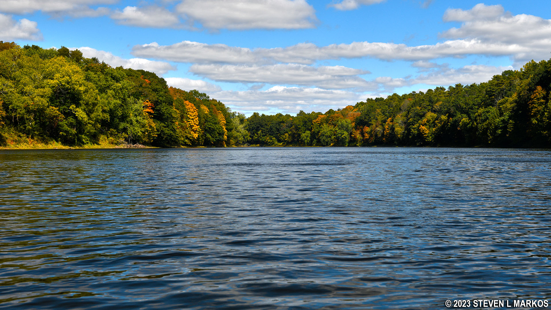
Delaware River between Namanock and Dingmans Ferry, Delaware Water Gap National Recreation Area
NAMANOCK TO DINGMANS FERRY RIVER TRIP
Length: 3 miles
Water Level at Time of Trip: 6.15 feet
Average moving speed: 4 MPH with two paddlers
Top Speed: 4.3 MPH
Time: 45 minutes
The Namanock Canoe Launch, which is for hand-launched watercraft only, is no place to start or end a trip on the Delaware River. From the water, it is impossible to spot unless you know when and where to look. You’d think the National Park Service could post a sign on the shore, but that would be asking too much.
Later on in my visit to Delaware Water Gap National Recreation Area, I drove out to the Namanock Recreation Area (a picnic area) to figure out what I missed. I found two possible sites, neither of which is convenient for launching a canoe or kayak. I have actually launched and taken out from worse places, so it can be done, but if you start a trip at Milford Beach, I highly suggest you skip Namanock and land at Dingmans Ferry, which has a concrete boat ramp. It is a nine-mile paddling trip between the two.
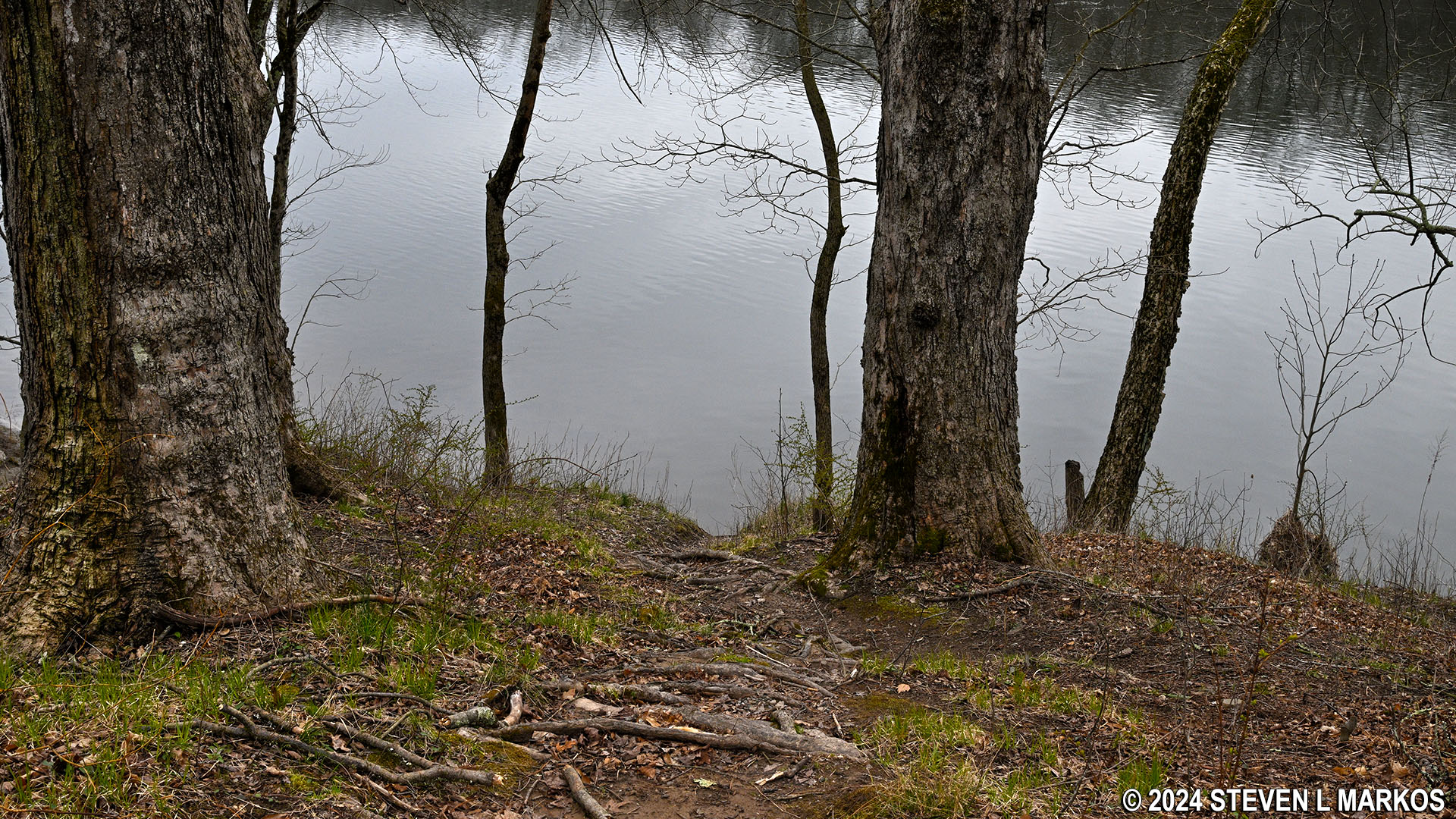
Path down a steep hill to the Namanock Canoe Launch in Delaware Water Gap National Recreation Area
Before starting a river trip through Delaware Water Gap National Recreation Area, it is a good idea to check the water levels so you are aware of the river conditions. At the northern end of the park, the USGS water level gauge at Montague (which is at Milford Beach) is the gauge used by the National Park Service to assess conditions. Levels between five and seven feet are typical and provide plenty of water for a trip down the river with conditions suitable for anyone with basic paddling skills. If the Montague gauge reads less than four feet, there may be spots on the river with very little water. Levels over seven feet require more paddling experience, and the river is closed due to extreme danger when water levels at Montague reach fifteen feet. Be aware that regardless of water levels, extreme winds can cause turbulent conditions that require advanced skills on water otherwise suited for all paddlers.
It had been raining heavily for a few days prior to my trip, so there was plenty of water. The gauge at Montague reported 6.15 feet, and the only other gauge within Delaware Water Gap National Recreation Area, the Water Gap gauge at the southern end of the park near Depue Island and the Worthington State Forest Campground, reported 6.25 feet of water. Keep in mind that the observations in my report are based on these water levels. If you do the trip when the levels are lower, you may be dragging your boat to deeper water in some places and probably won’t experience the same degree of rapids as I report (historically, water levels at Montague rarely dip below five feet). If the water levels are significantly higher, you may experience more intense rapids, and more of them.
There is not a lot to say about the trip between Namanock and Dingmans Ferry. There are no islands to go around, which results in the current being significantly slower than upriver from Namanock Island, and the water is calm other than in a few spots where it gets a little choppy (see the second photo below).
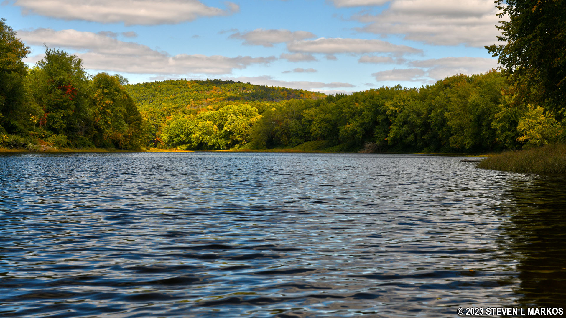
Delaware River just downstream from Namanock Island, Delaware Water Gap National Recreation Area
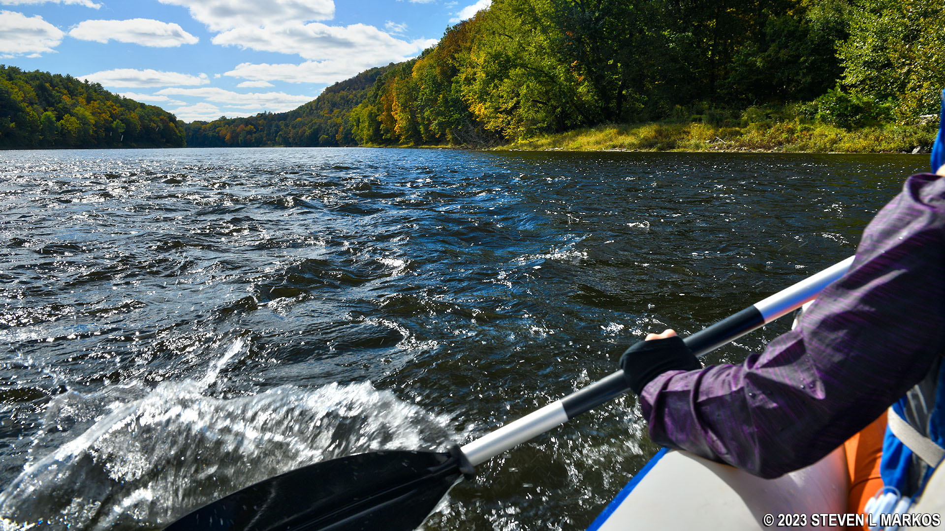
Choppy water on the Delaware River between Namanock and Dingmans Ferry, Delaware Water Gap National Recreation Area
The Dingmans Ferry Boat Ramp is three miles from Namanock (the National Park Service claims it is 4 miles, but I had two GPS units that gave the same 3-mile reading). The landmark to look for is the Dingmans Ferry Bridge, the only bridge south of Namanock. The ramp is on the Pennsylvania side (right) of the Delaware River just after passing under the bridge.
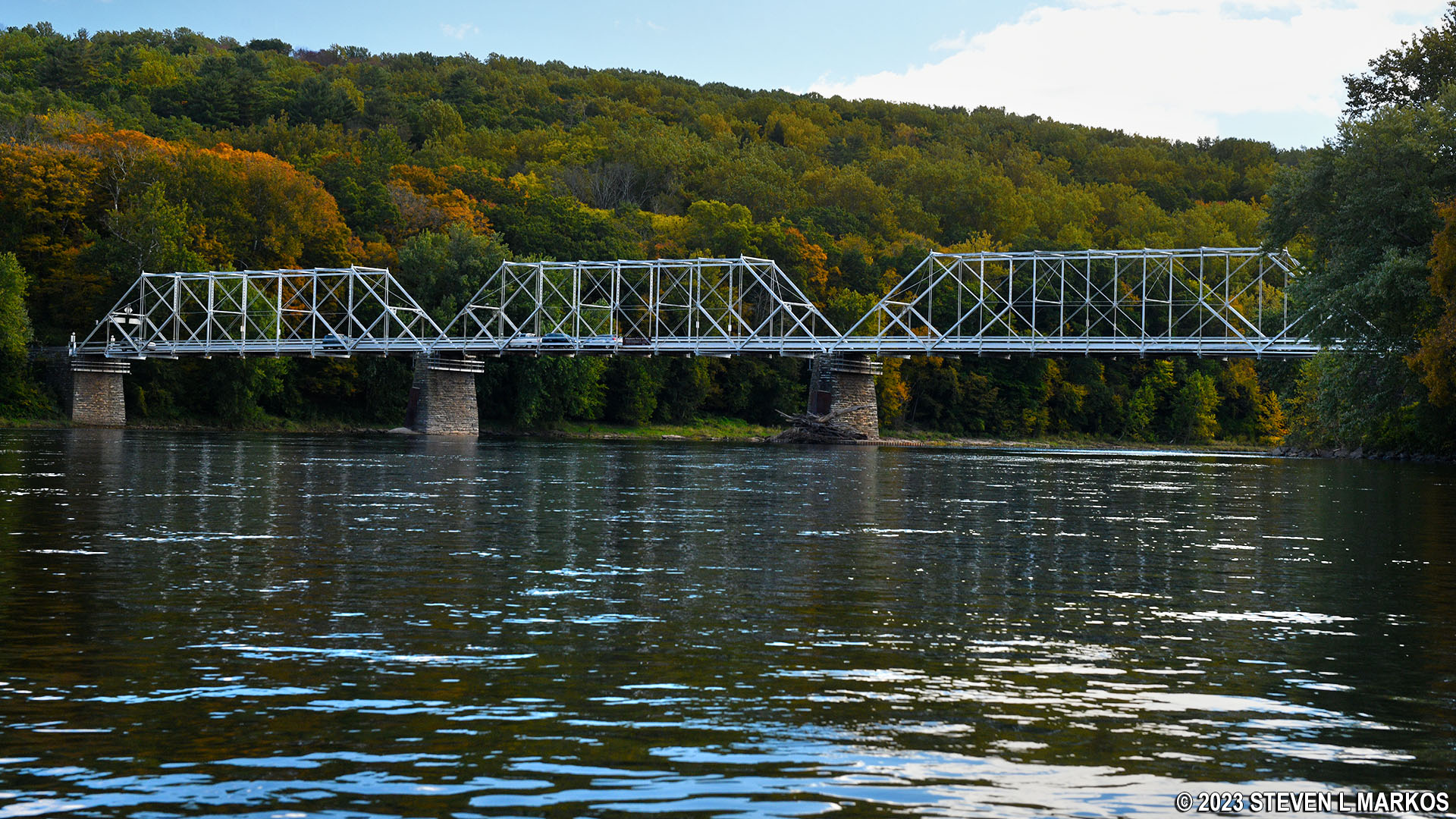
Dingmans Ferry Bridge, Delaware Water Gap National Recreation Area
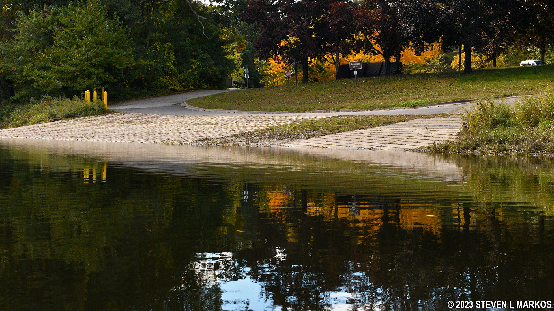
Dingmans Ferry Boat Ramp in Delaware Water Gap National Recreation Area
Next River Section | Previous River Section | Paddling Home Page
With a few exceptions, use of any photograph on the National Park Planner website requires a paid Royalty Free Editorial Use License or Commercial Use License. See the Photo Usage page for details.
Last updated on August 2, 2024


