
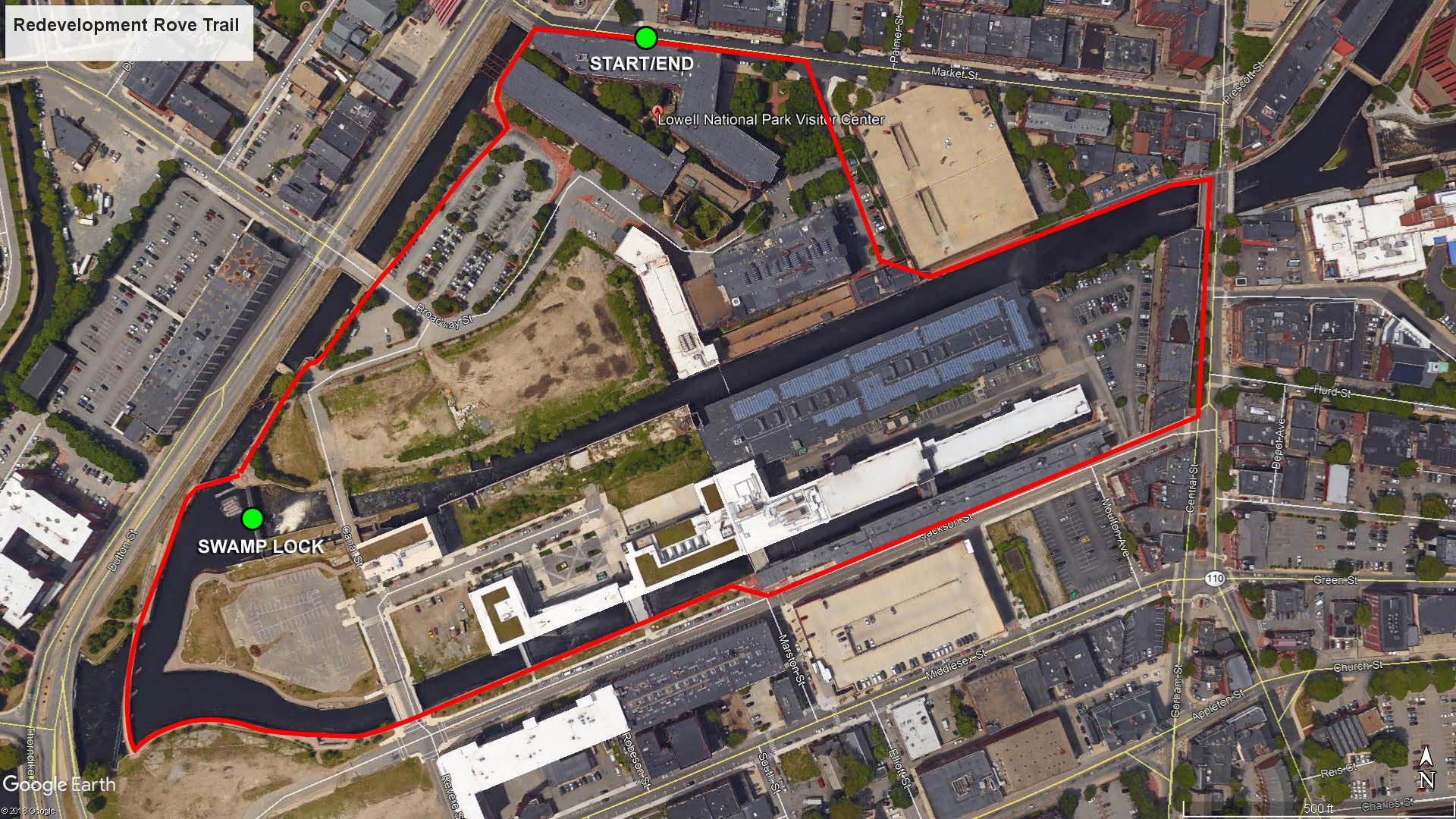
Redevelopment Rove map (click to enlarge)
Download the Canalway Walk Brochure
Length: 1.1-mile loop
Time: 45 minutes
The Redevelopment Rove is one of four urban trails at Lowell National Historical Park. It begins and ends at the Visitor Center, taking you along stretches of the Pawtucket, Merrimack, and Hamilton canals. You will also see the Swamp Locks and Gatehouse. It is a pleasant walk and a good way to see the historical downtown area of Lowell.
To begin the hike, walk out of the Visitor Center onto Market Street. Being a loop, you can start by taking a left or a right—I took a right and proceeded in a clockwise direction. Walk a short ways down the street and take another right between the Visitor Center building and a parking garage. You will be heading towards the Pawtucket Canal, but as you walk between the buildings it looks as if you are going to run into a dead end. A mill building that sits parallel to the canal appears to join with the parking garage to form an L-shape, but as it turns out, there is a gap between the buildings that allows you to get to the walkway along the canal.
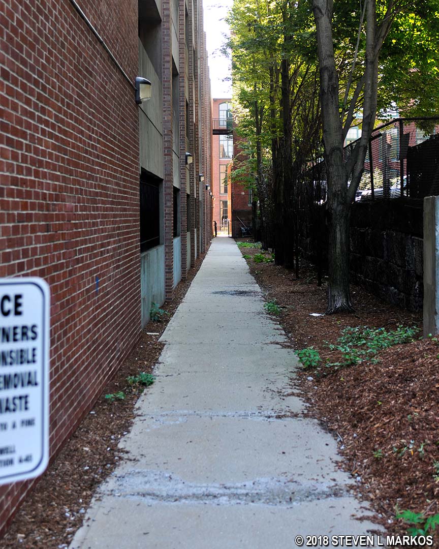
Walkway along the parking garage next to the Lowell National Historical Park Visitor Center
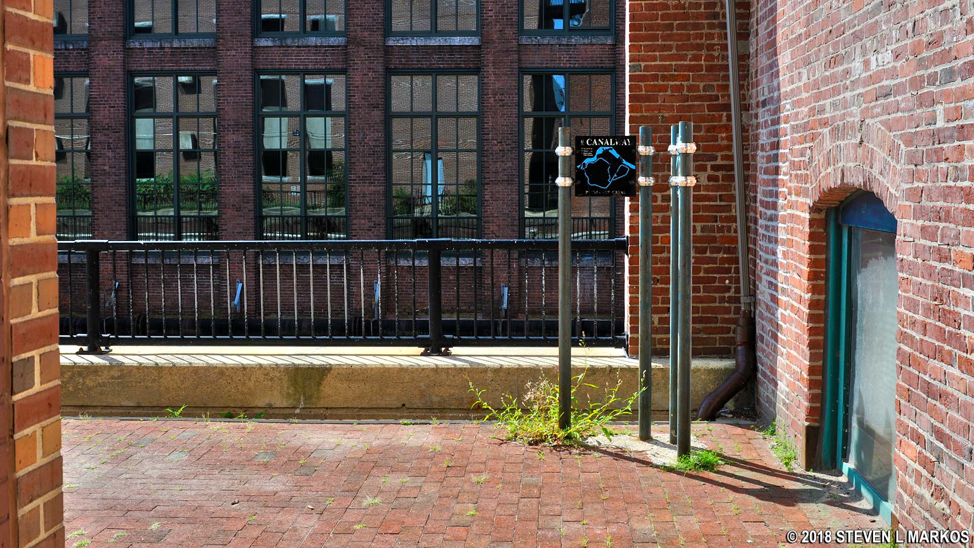
Gap between the parking garage and an old mill building on the Redevelopment Rove walk in downtown Lowell, Massachusetts
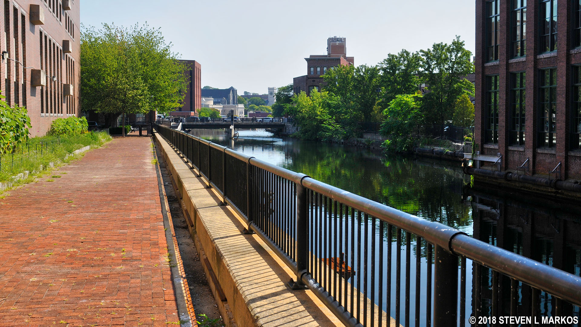
Walkway along the Pawtucket Canal on the Redevelopment Rove walk in downtown Lowell, Massachusetts
The building across the canal was built by the Hamilton Manufacturing Company between 1911 and 1920. Hamilton was the second mill company to set up shop in Lowell, operating in the city from 1825 to 1929. By the end of the 1920s, many of the mills had closed, and the city fell on hard times. The last of the original mills, Merrimack Mills, closed in 1958, and shortly thereafter the old buildings began falling victim to the wrecking ball. This mustered preservationists into action, sparking an urban renewal movement in the 1970s. Today, many of the surviving mills have been turned into offices, condos, and apartments. The Hamilton Mills building is now Loft 27, part of Jackson Street Lofts. You will see many more converted mill buildings along the Redevelopment Rove, which is the focus of the trail.

1911 Hamilton Mill building in Lowell, Massachusetts
Follow the walkway along the canal—there is only one way to go—down to the bridge at Central Street. Cross over the bridge and take another right on Jackson Street a block away. You will now be walking along two buildings constructed end to end that are also part of Hamilton Mills. The first building you pass is now the Counting House Lofts. The narrow building farther down Jackson Street is the 1870 Hamilton Counting House, the headquarters for the company. Today it is occupied by the Lowell Community Health Center. On the other side of the buildings is the Hamilton Canal, though you cannot see it from this point on Jackson Street.
There is also another row of mill buildings strung end to end between the Jackson Street buildings and the 1911 Hamilton Mills building, though, like the canal, they are blocked from view on the east end of Jackson Street. These are part of both Hamilton Mills and Appleton Mills. The portion you cannot see are Hamilton Mills buildings, which run as long as the Hamilton Counting House. You can see the Appleton Mills building, along with the Hamilton Canal, once you get past the Counting House. Appleton Mills opened in 1828 and operated until 1929. Though both companies opened in the mid-1820s, most of the buildings in this area were torn down in 1904 and rebuilt between 1905 and 1918. Obviously, neither company foresaw the coming of the Great Depression in 1929.
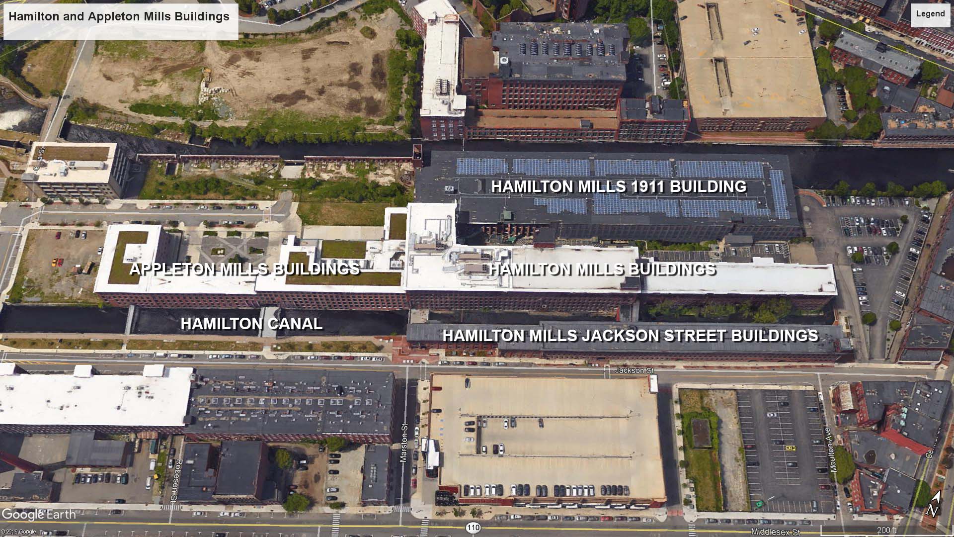
Hamilton and Appleton Mills buildings (click to enlarge)
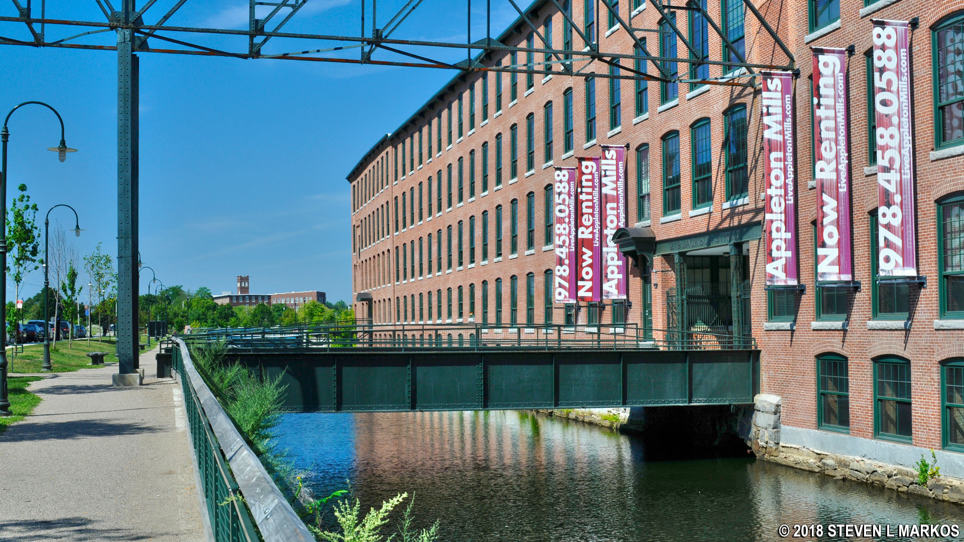
Appleton Mills building and the Hamilton Canal along Jackson Street in Lowell, Massachusetts
Once you get to the Appleton Mills building you can slide over from the street sidewalk to a walkway that runs right along the canal.

Walkway along the Hamilton Canal in Lowell, Massachusetts
The walkway eventually leads to a pedestrian bridge built in 2012 that takes you over the Pawtucket Canal to Dutton Street, the road that runs along the Merrimack Canal and passes the Visitor Center. However, prior to the pedestrian bridge an inviting turn onto a vehicle bridge (also built in 2012) that crosses the Hamilton Canal and leads to a large building identified as 110 Canal. This turn is not part of the Redevelopment Rove, so continue along the canal to the pedestrian bridge.

Pedestrian bridge across the Pawtucket Canal in Lowell, Massachusetts
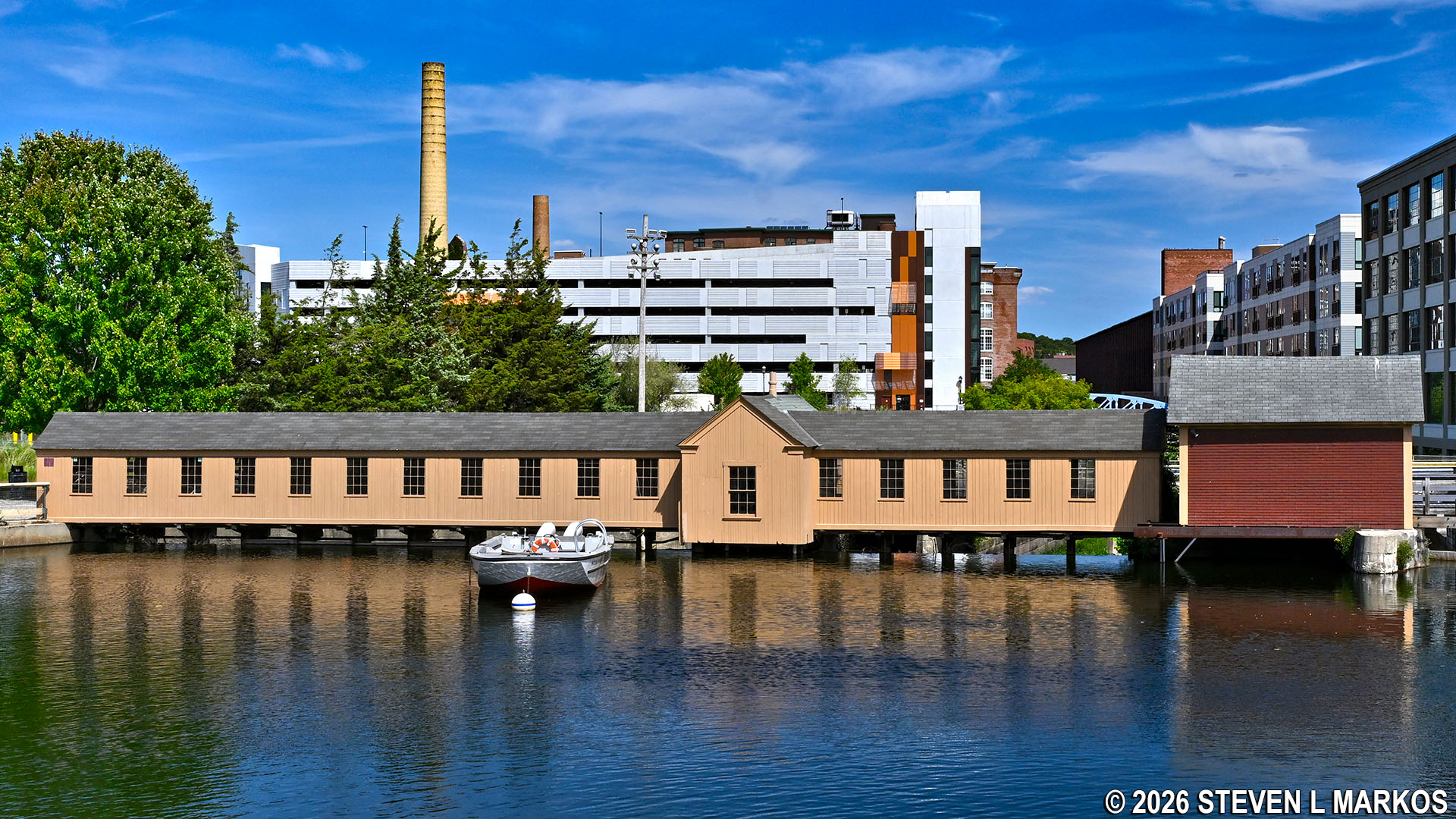
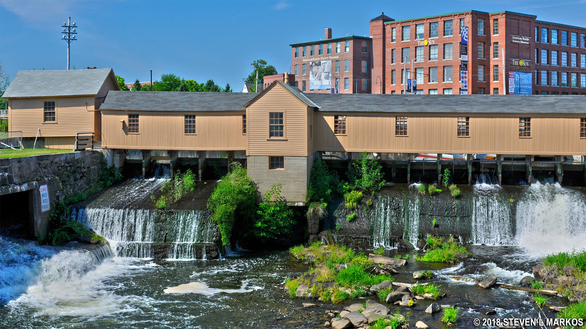
From the bridge you will get your first view of the Swamp Locks and the Swamp Locks Dam Gatehouse. The Swamp Locks, a double lock, are the middle of three locks on the Pawtucket Canal.
Upstream side of the Swamp Locks Dam Gatehouse, Lowell National Historical Park
You will soon come to another pedestrian bridge that crosses back over the canal from Dutton Street. Take this and you will find yourself standing with the Swamp Locks Dam Gatehouse to your right and the start of the Merrimack Canal to your left. Paths run in both directions, but I suggest taking a right so you can get a good look at the downstream side of the gatehouse.
Downstream side of the Swamp Locks Dam Gatehouse in Lowell, Massachusetts
The Pawtucket Canal was originally built to circumnavigate the Merrimack River’s Pawtucket Falls located on the northwest side of Lowell. The river, which begins in the lake region of New Hampshire, was used to transport lumber from the area to the shipyards of Newburyport, Massachusetts, where the river meets the Atlantic Ocean. Lumber could also be shipped down the coast to Boston, a journey of roughly 60 miles. The only problem was that boats could not get past the one-mile stretch of falls, rocks, and rapids that dropped 32 feet. Goods had to be unloaded just before the falls, carted a mile downriver, and then reloaded onto another boat, an obvious waste of time and money.

View of the Pawtucket Falls section of the Merrimack River in Lowell, Massachusetts
In 1792, a group of wealthy Boston merchants formed the Proprietors of Locks and Canals to build a canal around Pawtucket Falls. Completed in 1796, the result was a two-mile long canal that ran from just south of the falls to the east side of what was then the farming village of East Chelmsford (Lowell wasn’t incorporated as a town until 1826, and as a city until 1836).

Pawtucket Canal (click to enlarge)
In 1804, the Middlesex Canal opened, and it connected the Merrimack River directly to Boston (it started just a mile downriver from the Pawtucket Canal). This cut the distance of transporting goods to Boston in half, plus cargo could travel on the calm and controlled waters of a canal instead of on the open sea. Furthermore, while lumber was still needed for the shipbuilding industry in Newburyport during the first decade of the 1800s, in 1811 a fire destroyed the city, and the War of 1812 put a damper on trade, and thus the market for new merchant ships. As a result of these two factors, the Pawtucket Canal’s usefulness dwindled, and by 1820 it saw very little boat traffic.
When the war ended in 1815, wealthy mill owner Francis Cabot Lowell began looking for a place to build more mills. Realizing the potential of the little-used Pawtucket Canal as a source of water power, Lowell and fellow investors decided to focus their attention on developing East Chelmsford into an industrial center. The idea was to dig power canals—canals built for water power, not transportation—that branched off of the Pawtucket Canal and use the Pawtucket Canal to keep them filled. Massive textile mills could then be built right along the edges. When canal-side real estate ran out, simply dig a new canal and put up more mills. By the mid-1800s there were approximately ten major mill companies and dozens of smaller ones operating in Lowell.
Francis Cabot Lowell died suddenly in 1817 from pneumonia and never saw the results of his ideas—or the city named for him—but his Boston Manufacturing Company continued on with the Lowell project. The first power canal built was the Merrimack Canal in 1823, and more canals were built in the following years. The Hamilton Canal opened in 1825, and within ten years the Lowell, Western, Lawrence, and Eastern canals were in operation. The Northern Canal, the last one built in Lowell, opened in 1848. This canal connected directly to the Merrimack River at Pawtucket Falls and was 100 feet wide, so it not only provided power for the mills situated along its edge, it provided 50 percent more water for the entire canal system. In all, there are approximately 5.5 miles of canals in Lowell.
To provide the necessary water on a reliable basis, two other construction projects were undertaken. First off, the original Pawtucket Canal needed to be widened and deepened, for while it was perfect for canal boats, more water was required to power the mills. A typical transportation canal of the time was around 50 to 80 feet wide and only 3-4 feet deep. The Pawtucket Canal was enlarged to at least 75 feet wide and 12 feet deep. This expansion ran from the Merrimack River to the Swamp Locks. All of this, as well as the original work, was done by hand, and mainly by Irish immigrants.
The second project was to create holding ponds where multiple canals came together, such as at the Swamp Locks where the Merrimack Canal (and later the Hamilton and Western canals) branched off of the Pawtucket Canal, and at the Lower Locks where the Pawtucket and Eastern canals diverged. This was accomplished by building the Swamp Locks Dam and the Lower Locks Dam, and then constructing gatehouses over the top of them to control the flow of water. If you look underneath either of the Swamp Locks Dam Gatehouse or the Lower Locks Dam Gatehouse, you will see many sluice gates. If all are open, most of the water continues down the Pawtucket Canal. If they are all closed, the water is diverted into the side canals. The entire canal system was still owned by the Proprietors of Locks and Canals, but instead of charging canal boats a toll, the company now operated as a water company. Mill owners paid for the amount of water they used, and the gatehouses allowed for the release of just the right amount of water at any given time.

Sluice gates of the Swamp Locks Dam Gatehouse, Lowell National Historical Park
Because boats also needed to travel down the canal, the locks were left operational.
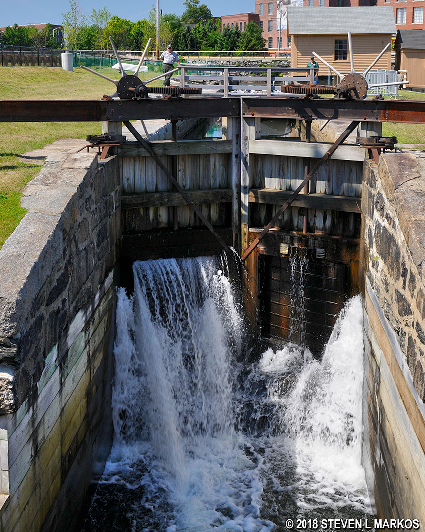
Lock gates of the Swamp Locks, Lowell National Historical Park
Once done taking a look at the gatehouse, just start walking in the direction of Ducket Street and the Merrimack Canal. As soon as you come to the water you will be at the southern end of the Visitor Center parking lot. There is a walkway for a short stretch, but for most of the way back you’ll just be walking through the parking lot. I continued all the way around to the starting point to determine the length of the Redevelopment Rove. The National Park Service claims it is a mile, but by the time you get done walking around you’ll have covered a little more than that. I ended up walking 1.4 miles.

Walk along the Merrimack Canal towards the Lowell National Historical Park Visitor Center parking lot
With a few exceptions, use of any photograph on the National Park Planner website requires a paid Royalty Free Editorial Use License or Commercial Use License. See the Photo Usage page for details.
Last updated on March 28, 2026


