

Trail to the top of Kennesaw Mountain starts at the Kennesaw Mountain National Battlefield Park Visitor Center
Length: 2 miles, round trip
Time: 1.5 hours, plus time spent at the top
Difficulty: Strenuous
The most popular hike at Kennesaw Mountain National Battlefield Park is by far the 2-mile round trip to the top of Kennesaw Mountain on the Kennesaw Mountain Trail. The trailhead is on the hill off to the right of the Visitor Center. On a busy day, just follow the crowd.
The hike up Kennesaw Mountain is as difficult as any hike up a mountain. It is distance that often sets two mountain trails apart. For example, the Kennesaw Mountain Trail rises roughly 700 feet in one mile. The trail to the top of Yosemite Falls in Yosemite National Park, which I have hiked, has a similar incline, 775 feet per mile. However, the Yosemite Falls trail is 3.5 miles long (2,700-foot climb in elevation), so the only difference between it and the Kennesaw Mountain Trail is 2.5 more miles of misery.
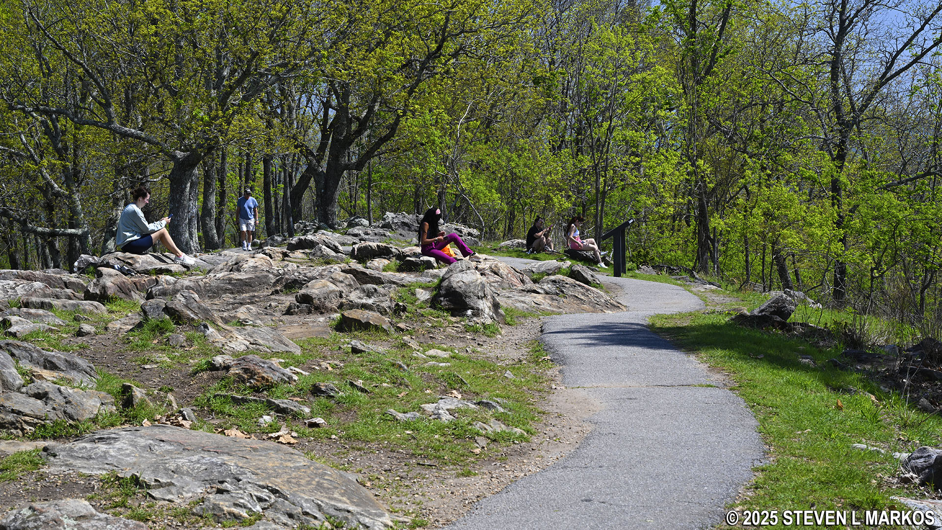
Much of the Kennesaw Mountain Trail is a fairly smooth dirt path, but there are sections with tree roots and large rocks, so watch your step. There are plenty of boulders to sit on if you need a break.

Typical terrain on the hike to the summit of Kennesaw Mountain, Kennesaw Mountain National Battlefield Park

Rocky section of the Kennesaw Mountain Trail, Kennesaw Mountain National Battlefield Park
There are a few signs along the trail that mark where various commanders and troops were stationed during the Battle of Kennesaw Mountain on June 27, 1864. You will see such signs on all the trails in the park, with gray denoting Confederate troop positions and blue, Union. All signs on Kennesaw Mountain mark Confederate positions.

Sign marking troop position along the Kennesaw Mountain Trail, Kennesaw Mountain National Battlefield Park
A tenth of a mile before the summit, the Kennesaw Mountain Trail comes to a parking lot at the end of Kennesaw Mountain Drive, the vehicle road to the top. Once there, climb the staircase to the adjacent observation platform for a view east towards Atlanta, which is located far off in the distance on the horizon.

Observation platform near the top of Kennesaw Mountain, Kennesaw Mountain National Battlefield Park
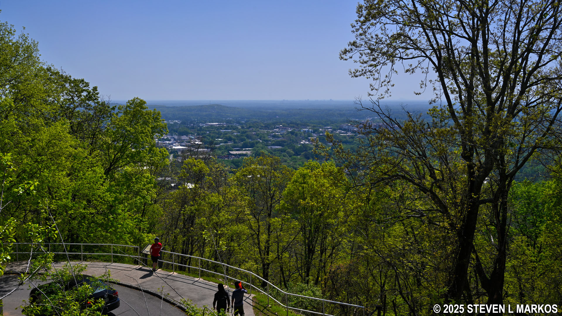
View from the observation platform near the top of Kennesaw Mountain, Kennesaw Mountain National Battlefield Park
To get to the summit of Kennesaw Mountain, continue on the paved path that begins at the observation platform. Unfortunately, there is no official marker for the exact summit, but once the trail levels out, you’ve pretty much reached the top.

Trail from the mountain-top parking lot to the summit of Kennesaw Mountain, Kennesaw Mountain National Battlefield Park
Summit of Kennesaw Mountain, Kennesaw Mountain National Battlefield Park

Cannon at the summit of Kennesaw Mountain, Kennesaw Mountain National Battlefield Park

Wayside exhibit and view towards Atlanta from the top of Kennesaw Mountain, Kennesaw Mountain National Battlefield Park
If hiking to the summit is all you set out to do, once done exploring, turn around and head back down. For those who want more exercise, it is possible to continue hiking on the Kennesaw Mountain Trail to Little Kennesaw Mountain. In fact, a 16-mile loop hike can be formed using various trails that will take you all the way to the Kolb Farm at the southern end of the park and back to the Visitor Center. While that is probably too much hiking for most people, a 5.4-mile loop between Kennesaw Mountain and Pigeon Hill is doable for many hikers. See the Kennesaw Mountain Loop Hike web page here on National Park Planner for details.
With a few exceptions, use of any photograph on the National Park Planner website requires a paid Royalty Free Editorial Use License or Commercial Use License. See the Photo Usage page for details.
Last updated on April 22, 2025


