
Kolb Farm Trail at Kennesaw Mountain National Battlefield Park
Length: 5.3-mile loop (add .5 mile total for side trips to Cheatham Hill and the Kolb Farm)
Time: 3 hours (add 1 hour to visit Cheatham Hill and the Kolb Farm)
Difficulty: Mostly easy but with two steep hills
The Kolb Farm Loop Hike circles the southern section of Kennesaw Mountain National Battlefield Park using the Kolb Farm East and Kolb Farm West trails. The loop passes both the Kolb Farm and Cheatham Hill, though visiting both requires short detours. The loop hike itself is 5.3 miles long, but if you venture off to Cheatham Hill and Kolb’s Farm, factor in another half mile. You should be able to hike the trails, see both historic sites, and take a few rests along the way in no more than four hours. At Cheatham Hill, this would include visiting the exhibits only at the Illinois Monument at the top of the hill and along the path to the parking lot, not the exhibits along the road coming in from Dallas Highway.

Kolb Farm Loop Hike map (click to enlarge)
While most of the hike is in the forest, the trail is as wide as a single-lane road, so more often than not, there is clear sky above. At noon the sun will be beating down on the trail, so if avoiding the sun is important to you, be sure to wear a hat and apply sunscreen.
There are three access points for getting onto the Kolb Farm trails, but the official start of the loop hike is at the Cheatham Hill Road Parking Lot. The other options are at the Kolb Farm and the Illinois Monument Parking Lot, but neither are located directly on the trail. From the Kolb Farm you must walk on the road and cross a busy intersection to get to the trail, and from the Illinois Monument there are a couple of options, so it is easy to get confused. The Cheatham Hill Road Parking Lot is right next to the trail, and there are plenty of parking spaces. Keep in mind that a fee is required to park anywhere within Kennesaw Mountain National Battlefield Park, but if you don’t have a permit when you arrive, there is a credit card-operated pay station at the parking lot.
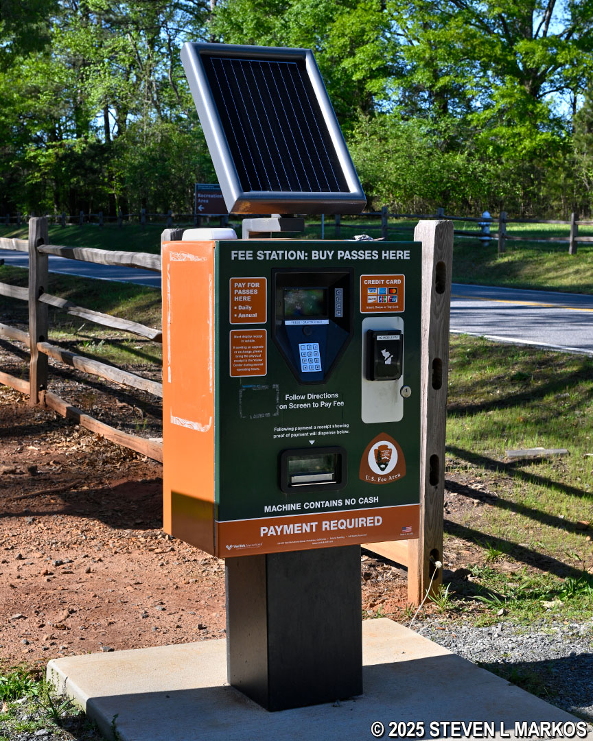
Fee pay station at the Cheatham Hill Road Parking Lot, Kennesaw Mountain National Battlefield Park
I started my hike at the Cheatham Hill Road Parking Lot on the Kolb Farm West Trail. To do so, walk to the parking lot exit and turn right onto the dirt path that runs along Cheatham Hill Road. The trailhead is fifty yards down the path.

Path from the Cheatham Hill Road Parking Lot to the Kolb Farm West Trail at Kennesaw Mountain National Battlefield Park
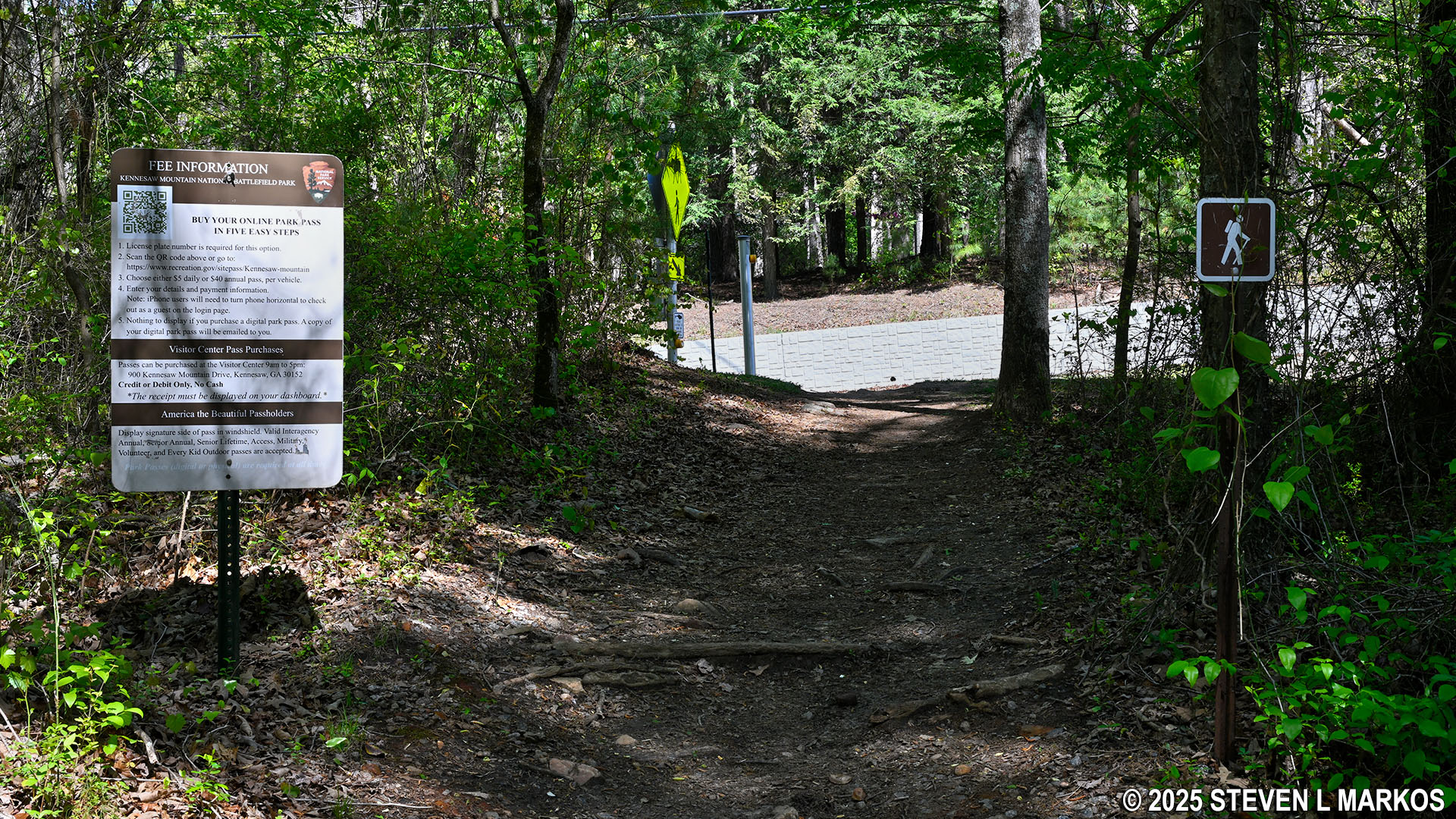
When you get on the trail at Cheatham Hill Road, you are directly on the Kolb Farm West Trail and hiking around the loop in the counterclockwise direction. The trailhead that takes you in the clockwise direction is on the other side of the road. I mention this because within eyesight of the start is a trail that branches off to the right, and I initially took this turn thinking it was the loop in the counterclockwise direction, but within a hundred feet I realized it was just leading to the parking lot. So from the start, stay straight ahead on the wide, gravel road.

Start of the Kolb Farm Loop Hike at the Cheatham Hill Road Parking Lot trailhead, Kennesaw Mountain National Battlefield Park
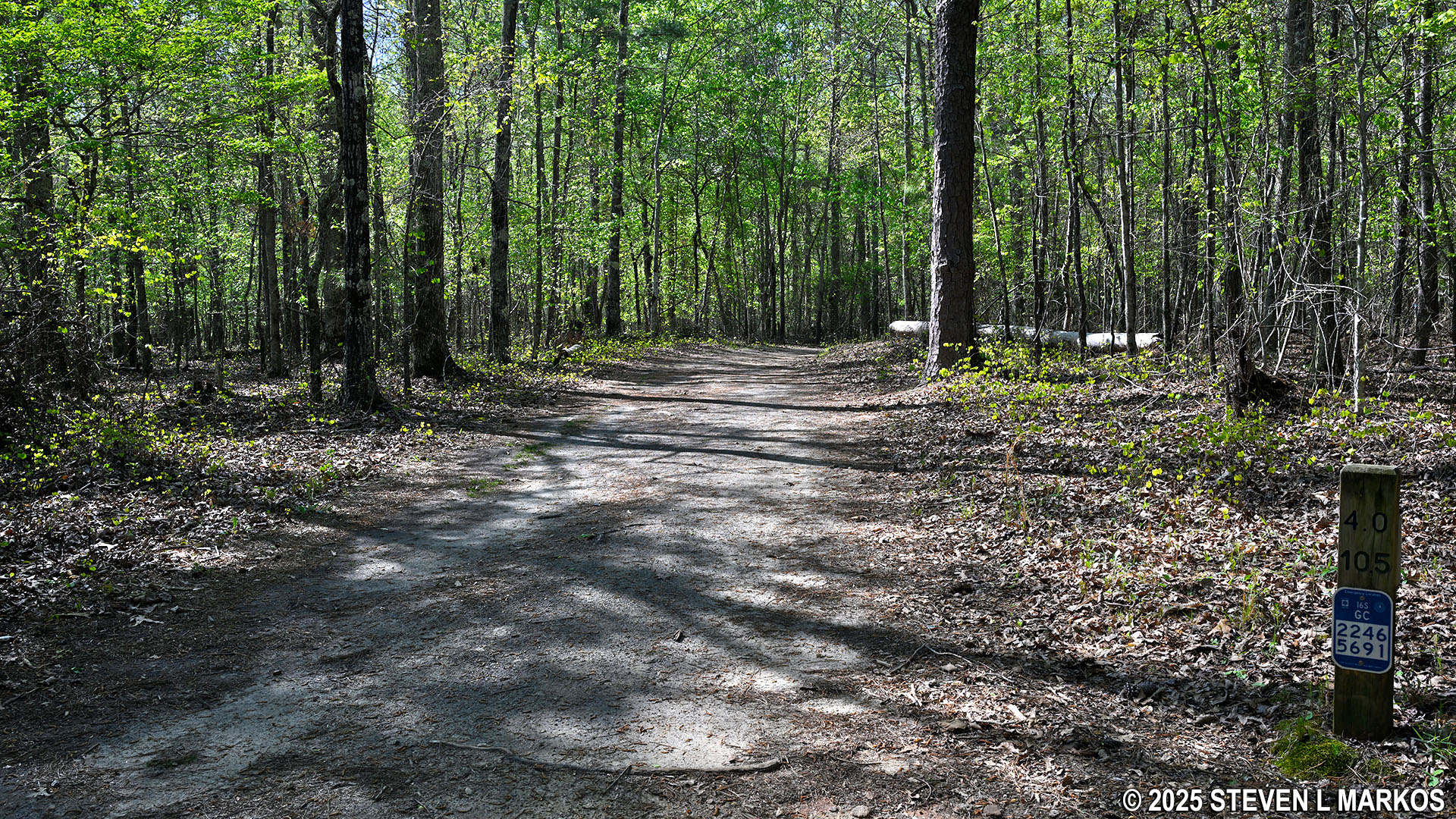
Along the trail are directional posts with colored arrows on them. Blue is the color for the Kolb Farm trails. You will also see green arrows on the posts. This is the color for a loop around the entire park (16 miles), from Kennesaw Mountain in the north to Kolb’s Farm in the south. There are also mile markers along the trail. The top number is the mileage for the Kolb Farm Loop Hike and the bottom number is for the Park Loop Hike.

Mileage marker along the Kolb Farm West Trail at Kennesaw Mountain National Battlefield Park
There are also signs along the trails that mark the positions of Union and Confederate troops during the fighting at Kolb’s Farm on June 22, 1864, and during the larger Battle of Kennesaw Mountain on the 27th. Blue signs mark Union positions and gray signs Confederate positions.
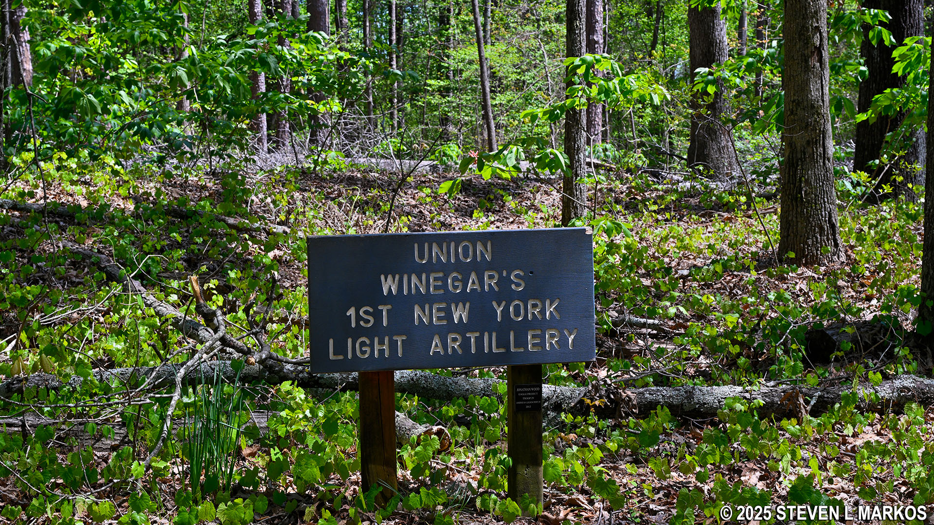
Marker for Union troop positions along the Kolb Farm Trail at Kennesaw Mountain National Battlefield Park
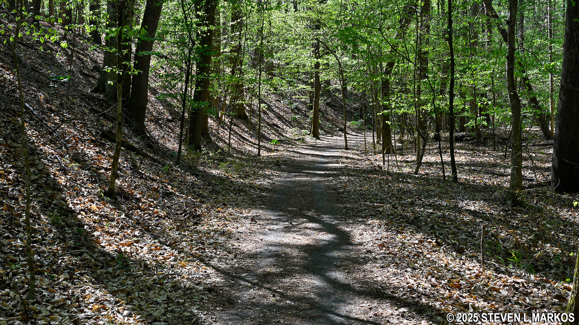
Most of the trail on the western half of the Kolb Farm Loop Hike is nothing but an old dirt road. There are a few narrower sections, but just when you think you are finally on a traditional hiking trail, the path reverts back to being a road. The first three quarters of a mile covers fairly level terrain, and the trail surface is smooth, free of rocks and roots that can trip you up.

Typical terrain at the northwestern side of the Kolb Farm Loop Hike at Kennesaw Mountain National Battlefield Park
At .75 mile into the hike is one of the few very steep hills on the loop. Heading counterclockwise as I was, you will be hiking downhill. The segment is a little over 100 yards in length and has an average grade is 17%, with some very short stretches having grades as steep as 40% (15% is considered the start of strenuous hiking). The photo below is taken looking up the hill, for it is impossible to show any depth when photographing downhill.

Steep hill on the western half of the Kolb Farm Loop Hike at Kennesaw Mountain National Battlefield Park
The reason for the downhill hike is that the Kolb Farm West Trail is descending into a ravine, and at the bottom is John Ward Creek (.9 mile into the hike). I’m not exactly sure who John Ward was, but the creek and a nearby road where already named after him at the time of the Civil War.

Bridge over John Ward Creek on the western side of the Kolb Farm Loop Hike in Kennesaw Mountain National Battlefield Park

John Ward Creek flows through Kennesaw Mountain National Battlefield Park
The general trajectory of the Kolb Farm West Trail for the next three quarters of a mile is uphill, but other than one very-short-but-very-steep hill, the incline is so gradual that if you aren’t paying attention, you would think you were walking on flat ground.

Typical terrain on the southwestern side of the Kolb Farm Loop Hike at Kennesaw Mountain National Battlefield Park
At the 1.4-mile mark, the trail temporarily narrows, and a few minutes later there is a wayside exhibit about the earthworks (aka trenches) built during the Civil War. Fighting took place all over Kennesaw Mountain National Battlefield Park, and earthworks crisscross the area. When originally created, the trenches were typically four to eight feet deep. Over the 160-plus years since the war, those that were not completely destroyed by farmers and real estate developers have eroded away, so now most resemble nothing more than shallow gullies or small, natural hills. Wayside exhibits and other markers are needed to point them out to the general public, but once you know what to look for, they are quite obvious.

Remnants of a Civil War earthwork along the Kolb Farm West Trail at Kennesaw Mountain National Battlefield Park
The trail soon widens back into a dirt road, and from the earthworks to where the trail comes to Powder Springs Road at its southern end, the terrain is as flat as a pancake.

Typical terrain on the southwestern side of the Kolb Farm Loop Hike near Powder Springs Road, Kennesaw Mountain National Battlefield Park
At Powder Springs Road, the Kolb Farm West Trail turns east. There is a water fountain for both humans and dogs, and just beyond that is a wayside exhibit about the Union Army’s goal of taking control of Powder Springs Road, which leads into Marietta. If you look over the top of the exhibit, the roof of the house you see is that of the Kolb Farmhouse. At this point you have hiked two miles.

Southern end of the Kolb Farm Loop Hike at Powder Springs Road, Kennesaw Mountain National Battlefield Park
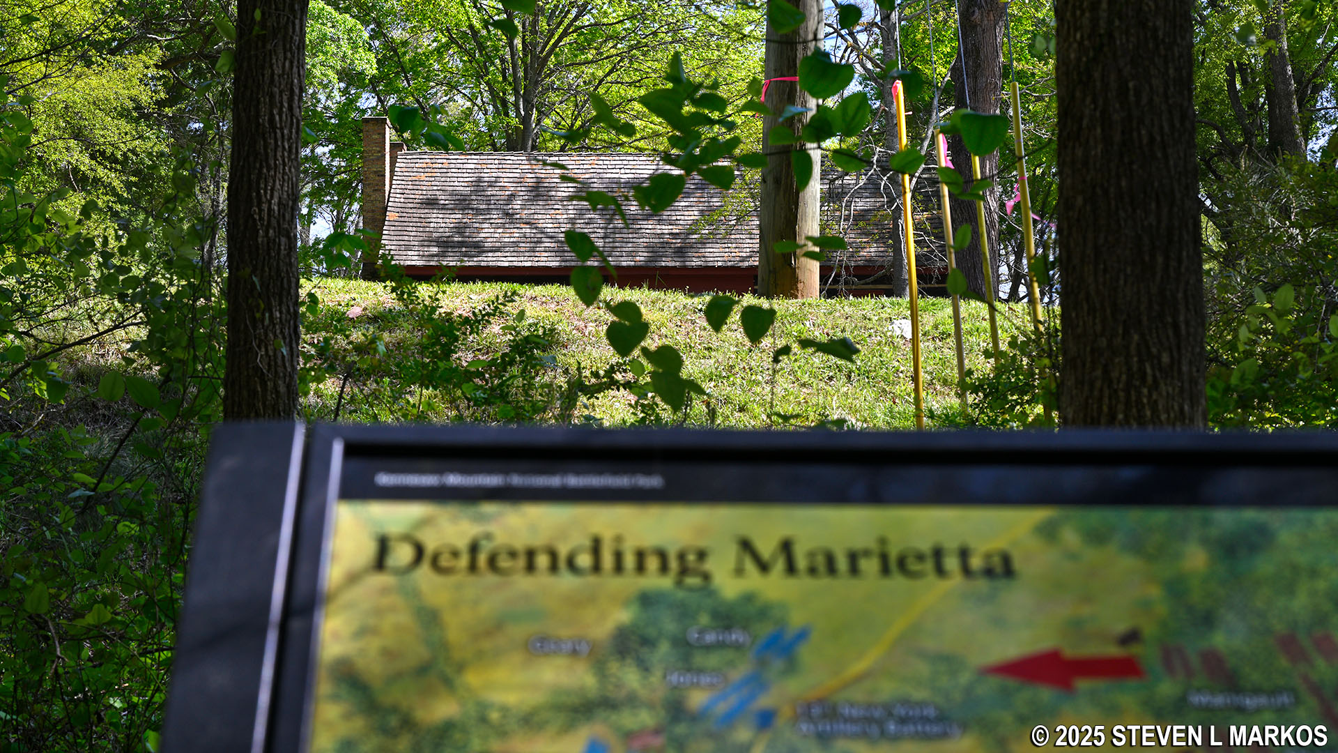
Roof of the Kolb Farm as seen from the southern end of the Kolb Farm Loop Hike, Kennesaw Mountain National Battlefield Park
If you really want to see the farmhouse, in truth, it is easier to drive to it. However, if you insist on hiking to it, there is a side trail just past the wayside exhibit that leads up to Powder Springs Road. The farmhouse is across the street, but this is a four-lane highway with a center turn lane. If you can get across safely, go for it. Otherwise, walk down to the intersection with Cheatham Hill Road and cross at the light, then walk back to the farm. If you miss the side trail, in just another tenth of a mile the Kolb Farm West Trail intersects with Cheatham Hill Road, and from there you can walk up to the intersection and cross over to the farm.

Side trail to Powder Springs Road at the southern end of the Kolb Farm Loop Hike, Kennesaw Mountain National Battlefield Park
Before coming to Cheatham Hill Road, the trail crosses the driveway for the horse trailer parking lot. People with their own horses can ride on the Kolb Farm trails. You will see two roads and may mistake the second for the hiking trail, but both are for the parking lot, which forms a long, oval loop.

Road into the horse trailer parking lot at Kennesaw Mountain National Battlefield Park
To continue the hike, look for a narrow hiking trail with directional signage that leads to Cheatham Hill Road. Once at the road, there is a crosswalk, and the trail continues on the other side at your two o’clock position.
Hiker trail to Cheatham Hill Road at the horse trailer parking lot for Kennesaw Mountain National Battlefield Park

Kolb Farm Loop Hike continues on the east side of Cheatham Hill Road, Kennesaw Mountain National Battlefield Park
Once across the road you will be on the Kolb Farm East Trail. This is a little narrower than the westside trail, but it is never so narrow that you are brushing up against vegetation where ticks like to hide. It runs right along the road for a quarter mile, so there is a lot of traffic noise. However, at the 2.5-mile mark on the overall hike, the trail turns north and leaves the road behind. Also at this point is an intersection with a trail that connects to Powder Springs Road. There is no parking at the road, and no sidewalk either, so I’m not sure why anyone would want to exit the Kolb Farm Loop Hike at this point.

Kolb Farm East Trail at the intersection with a connector to Powder Springs Road, Kennesaw Mountain National Battlefield Park
At the three-mile point, the Kolb Farm East Trail runs along a ridge high above another creek, and over the next 200 yards it works its way down and eventually crosses the creek. Just after crossing is a fork in the trail that is not on the National Park Service trail map, and there is no directional signage at the intersection. Take a right to remain on the Kolb Farm Loop Hike. The fork to the left heads out of the park to a residential neighborhood. The park in this area is like a large donut, and the hole in the donut that the Kolb Farm Loop Hike circles is not part of Kennesaw Mountain National Battlefield Park.

Unmarked fork in the Kolb Farm East Trail after a creek crossing on the southeastern side of the trail, Kennesaw Mountain National Battlefield Park
The trail then heads up and out of the ravine for a tenth of a mile before reaching the top, then dips back down once again to what I believe is the same creek that was previously crossed, only here the water has worn the creek bed deep into the ground. The trail follows this creek for .4 mile, and the terrain is really interesting. At some points the creek has collapsed part of the trail, and at other points is comes right up to the edge where it makes horseshoe-like bends. Millions of years from now, this is going to be a canyon. It probably won’t be too long into the future before the trail needs to be rerouted due to erosion.

Creek on the east side of the Kolb Farm Loop Hike in Kennesaw Mountain National Battlefield Park

Erosion caused by a creek on the east side of the Kolb Farm Loop Hike in Kennesaw Mountain National Battlefield Park
At 3.75 miles in the hike, the Kolb Farm East Trail crosses the creek but still follows along it. A minute later the creek merges with the larger John Ward Creek. This is the lowest elevation on the eastern side of the loop.

Bridge across a small creek on the east side of the Kolb Farm Loop Hike in Kennesaw Mountain National Battlefield Park

Bridge across John Ward Creek on the east side of the Kolb Farm Loop Hike in Kennesaw Mountain National Battlefield Park
Just past John Ward Creek is another intersection with a trail that is not on the map. I don’t know its purpose, but all it does is form a C shape and reconnects to the main trail a little farther ahead, so be aware that the next unmapped side trail you see is this one. Ultimately it doesn’t matter which way you go, but the official Kolb Farm East Trail continues to the left.
At this point the trail widens back into an obvious dirt road, and for the next .6 mile the terrain might as well be flat, though technically it is sloping uphill.
Typical terrain on the northeastern side of the Kolb Farm Loop Hike north of John Ward Creek, Kennesaw Mountain National Battlefield Park
At the 4.5-mile mark is the first of three intersections with trails that lead to Cheatham Hill. The first is for the Illinois Monument Parking Lot. This is not where you want to go to see the historical sites, so skip past it unless you started your hike here and just want to get back to your car.
The second intersection is billed as the way to the Grave of the Unknown Soldier. This trail not only leads to the grave, but if you keep walking, it also leads to the Illinois Monument. The grave site is just 100 yards up the trail. The monument is another 500 feet, and it is at the top of a steep hill. The segment to the grave site is fairly level.

Grave of an Unknown Soldier near Cheatham Hill, Kennesaw Mountain National Battlefield Park

Steep climb on the Unknown Soldier side trail to the Illinois Monument at Cheatham Hill, Kennesaw Mountain National Battlefield Park
The third intersection is with the Cease Fire Trail, which also leads to the Illinois Monument but does not pass the grave. When it intersects with the Assault Trail, take a right to get to the monument.

Illinois Monument at Cheatham Hill, Kennesaw Mountain National Battlefield Park
If you stopped at Cheatham Hill, make your way back to the Kolb Farm East Trail and continue west, following signs to the Kolb Farm West Trail. It is about a half mile back to the parking lot from the Cease Fire Trail intersection. The trail heads downhill to one last creek, and then uphill all the way to where it comes out at Cheatham Hill Road. The climb to the road entails tackling three more very-short-but-steep hills with grades ranging from 10% to 15% and lengths between 100 and 200 feet. If you recall the steep downhill segment at the start of the hike, this is similar, only uphill.
Final uphill climb to Cheatham Hill Road at the end of the Kolb Farm Loop Hike in Kennesaw Mountain National Battlefield Park
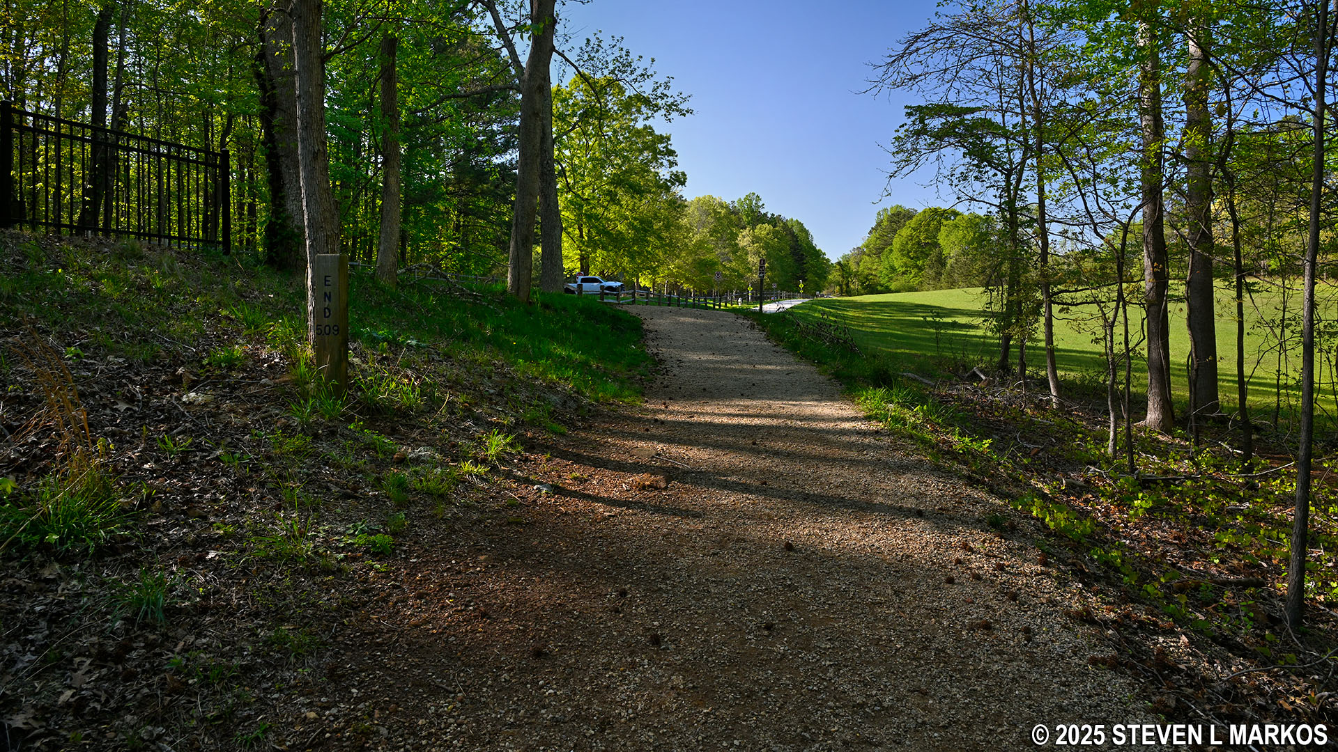
While the Kolb Farm East Trail officially ends at Cheatham Hill Road across from the parking lot, a fence is in place to deter crossing the road at this point. A crosswalk specifically for the parking lot is located a tenth of a mile down the paved, multi-use trail that follows along the road.

Multi-use path on the east side of Cheatham Hill Road, Kennesaw Mountain National Battlefield Park
With a few exceptions, use of any photograph on the National Park Planner website requires a paid Royalty Free Editorial Use License or Commercial Use License. See the Photo Usage page for details.
Last updated on April 23, 2025


