

Bowmans Island Southern Loop Hike Map (click to enlarge)
Bowmans Island Hiking Trails Main Page
Southern Loop Trail
Distance: 1.25-mile loop
Time: 45 minutes
Difficulty: moderate, somewhat hilly
Download the Bowmans Island Trail Map (PDF).
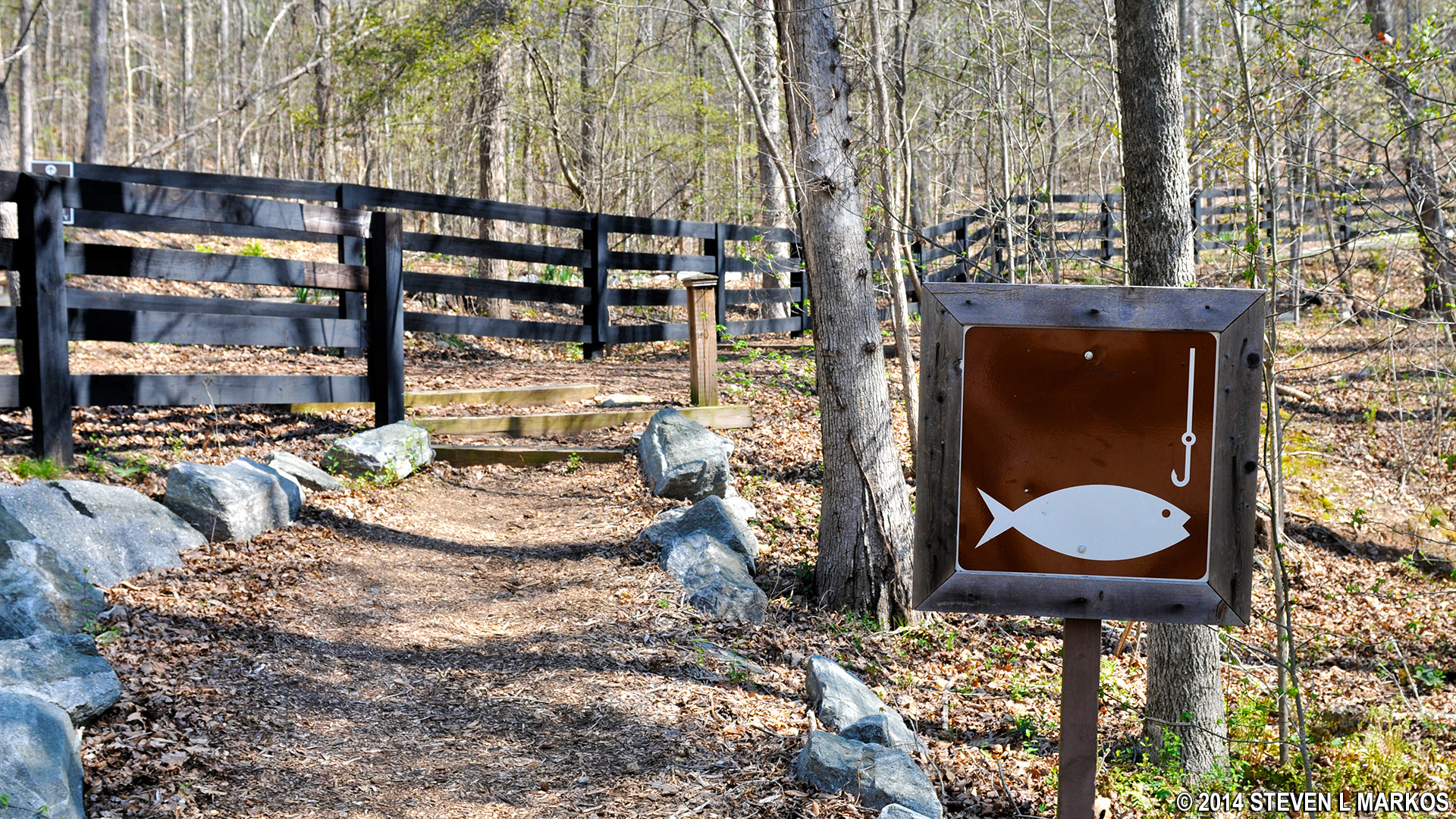
To access the Southern Loop Trail at the Bowmans Island Unit of Chattahoochee River National Recreation Area, park along Trout Place Road. The trailhead is marked by a brown sign with a fish and hook. If you can’t find a spot—doubtful—you can also park at the Buford Trout Hatchery just down the street and then walk back to the trailhead. The gates to the hatchery close at 4:30 PM on weekdays and 3 PM on weekends, so you must be done hiking and get back to your car before then or else it will be locked in for the night.
The Southern Loop Trail is for exercise only. It does not go near the Chattahoochee River, and it does not offer anything remotely scenic. If you want a better hike, albeit a much longer one, try my West Side Loop hike, which does follow the Chattahoochee part of the way.
Trailhead on Trout Place Road for the Bowmans Island Unit of the Chattahoochee River National Recreation Area
A trail from the road leads into the Bowmans Island Unit, passing a private residence on the way. When you get to the first intersection at BI 24, you can turn either right or left; I turned left and hiked the trail in a clockwise direction towards BI 25.

Bowman’s Island Unit trail at intersection BI 24, Chattahoochee River National Recreation Area

Hilly terrain of the Southern Loop Trail in the Bowmans Island Unit of Chattahoochee River National Recreation Area
It is a half mile to BI 25. Here you will find an exit trail that runs alongside a house and leads to East Timberline Trail in the Chattahoochee River Club subdivision. Once in the subdivision you can connect to trails that take you to the northern end of the park. For this hike, however, do not exit, but instead continue to the right on the main trail towards BI 21. It is a quarter-mile walk along a gradual, downhill sloping trail.

Intersection BI 21 on the Bowmans Island Unit trail looking back up the trail to BI 25, Chattahoochee River National Recreation Area
The trail becomes a gravel road at intersection BI 21. Turn right and head towards BI 22, then continue straight to BI 23. At this intersection, if you keep straight on the gravel road instead of turning right and hiking uphill towards BI 24, you will come to the backside of the Buford Trout Hatchery. There is no public access at this point.

Bowmans Island trail is a gravel road from BI 21 to BI 23, Chattahoochee River National Recreation Area
To complete the hike, take the steep hill from BI 23 back to the starting point at BI 24.

BI 23 intersection on the Bowmans Island trail in Chattahoochee River National Recreation Area
If you want a visit the hatchery, the entrance is just down the road from the trailhead on Trout Place Road. When the hatcher is open, visitor are welcome to walk around on their own to see the place. Staff is available to answer any questions. The hatchery is open from 8 AM to 4:30 PM during the week and 10 AM to 3 PM on weekends and holidays.

Buford Trout Hatchery in Cumming, Georgia

Eastern Tiger Swallowtail butterfly

Eastern Tiger Swallowtail butterfly
With a few exceptions, use of any photograph on the National Park Planner website requires a paid Royalty Free Editorial Use License or Commercial Use License. See the Photo Usage page for details.
Last updated on May 5, 2024


