
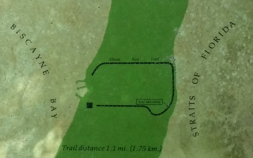
Elliott Key Loop Trail Map (click to enlarge)
DESCRIPTION
The Elliott Key Loop Trail at Biscayne National Park cuts across Elliott Key from the bay side to the Atlantic Ocean side, then runs along the shore on a boardwalk before returning back to the bay side of the island. Wayside exhibits about the natural history of the area are posted along the boardwalk. Those looking to use the Group Campground must also hike this trail (on the above map the Group Campground is located at the YOU ARE HERE spot). About halfway across the island the trail intersects with the Spite Highway Trail, which runs nearly the entire length of Elliott Key.
TRAILHEAD LOCATION
This trail is U-shaped and thus has two trailheads, one on each side of the harbor. The most obvious is located to the right side (if your back is to the water) and just past two large buildings, one being a Ranger station. It is marked with a sign sporting a Camping, Hiking, and Picnic Table icon, plus it is a wide swathe of cleared ground, so it is hard to miss. The other trailhead is to the left of the harbor near the picnic tables. It makes no difference which end you start at unless you are trying to get to the Group Campground. The wide path to the right will get you there the quickest, and as mentioned, this is the most obvious start of the trail, so you might as well begin there.

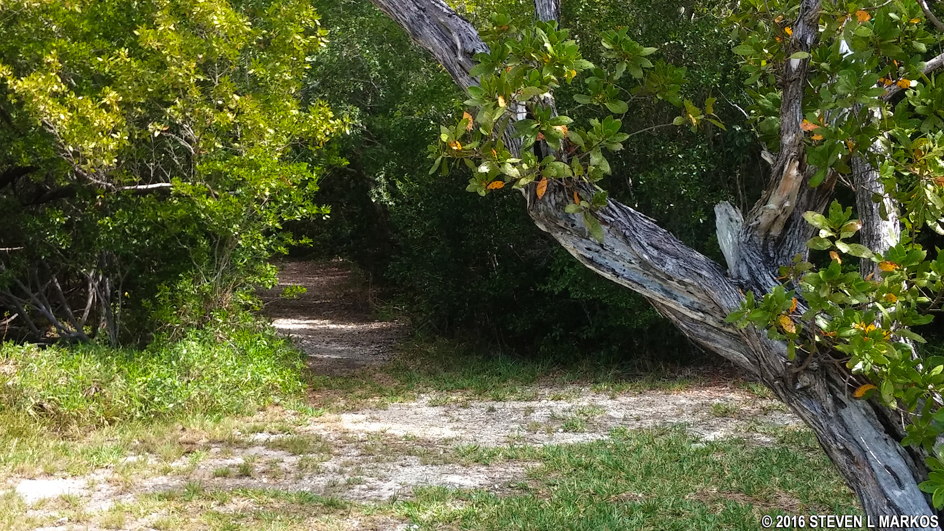
Start of the Elliott Key Loop Trail on Biscayne National Park’s Elliott Key
LENGTH
1.1-mile loop, though the trail begins and ends on opposite sides of the harbor, so you must walk back to some point once you finish. This extra trip is not included in the stated mileage, which counts the actual trail only. For those using the Group Campground, it is located about .4 mile down the trail.

Shoreline of Biscayne National Park’s Elliott Key along the Elliott Key Loop Trail
TIME
30-45 minutes
DIFFICULTY
Easy
POINTS OF CONFUSION
If hiking the trail in the counterclockwise direction starting from the right side of the harbor, when you get to the end of the boardwalk it looks as if the trail got washed away. Keep hiking straight through the rough section and you’ll see that the trail continues just up ahead.

Rough section of the Elliott Key Loop Trail on the ocean side of Biscayne National Park’s Elliott Key
TERRAIN
Most of the trail is a flat, dirt and sand surface. The portion along the Atlantic Ocean is a boardwalk.
Typical terrain on the earthen portion of the Elliott Key Loop Trail in Biscayne National Park

Boardwalk portion of the Elliott Key Loop Trail in Biscayne National Park
HANDICAP ACCESSIBLE
No, due to the aforementioned rough section of trail at the end of the boardwalk.
RECOMMENDATION
The wooded sections of the trail are so mosquito-infested that they pretty much nullify any pleasure you might get from walking the scenic boardwalk that runs along the Atlanta Ocean. You must lather yourself in insect repellent or wear protective clothes to hike this trail, even during the winter. Once you get to the ocean you won’t find any mosquitoes as long as a breeze is blowing, which is frequently. Other than the mosquitoes, it is an enjoyable trail with rewarding views at the far end, plus a chance to learn something by reading the wayside exhibits along the way.
With a few exceptions, use of any photograph on the National Park Planner website requires a paid Royalty Free Editorial Use License or Commercial Use License. See the Photo Usage page for details.
Last updated on July 1, 2025


