
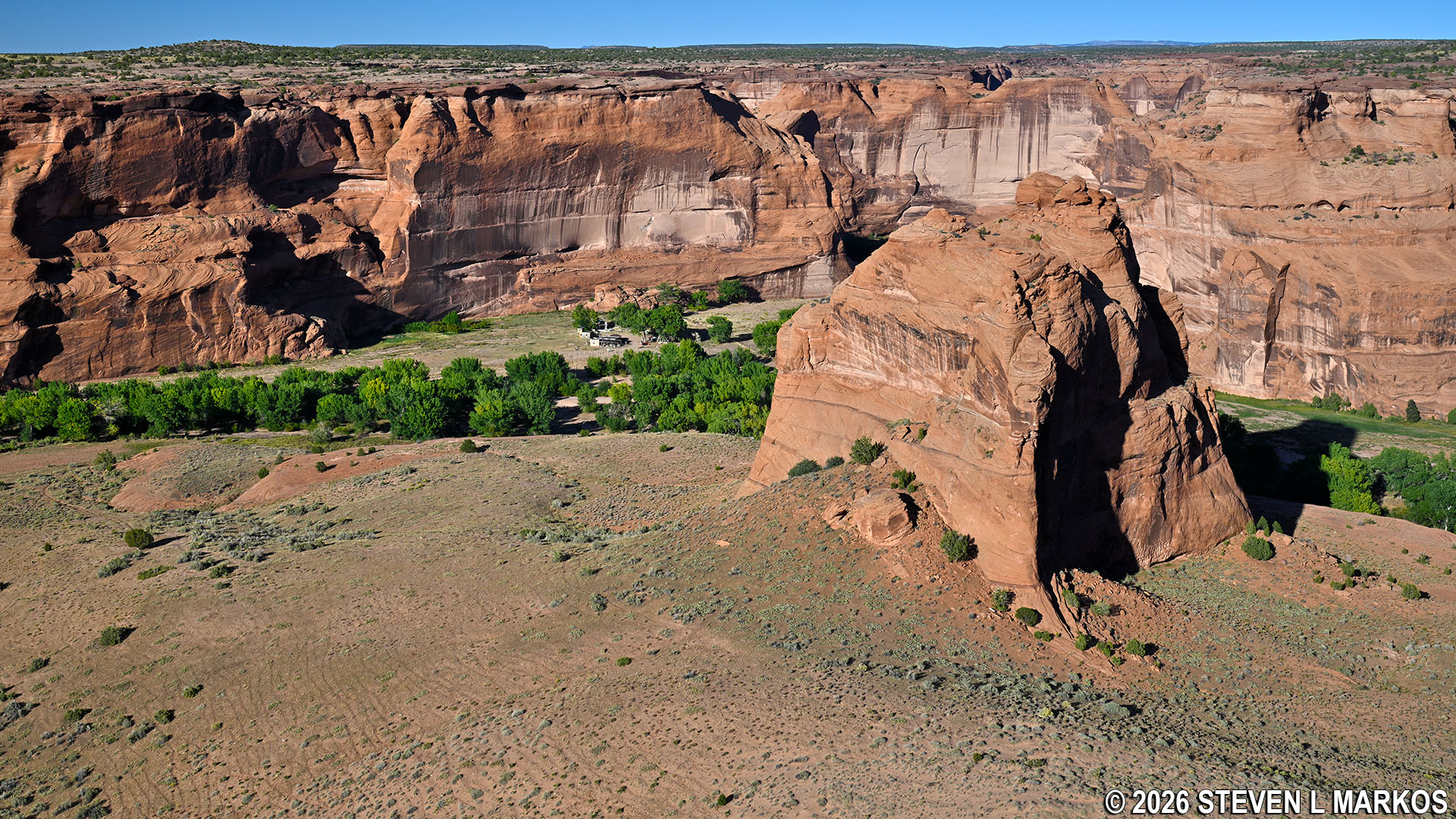
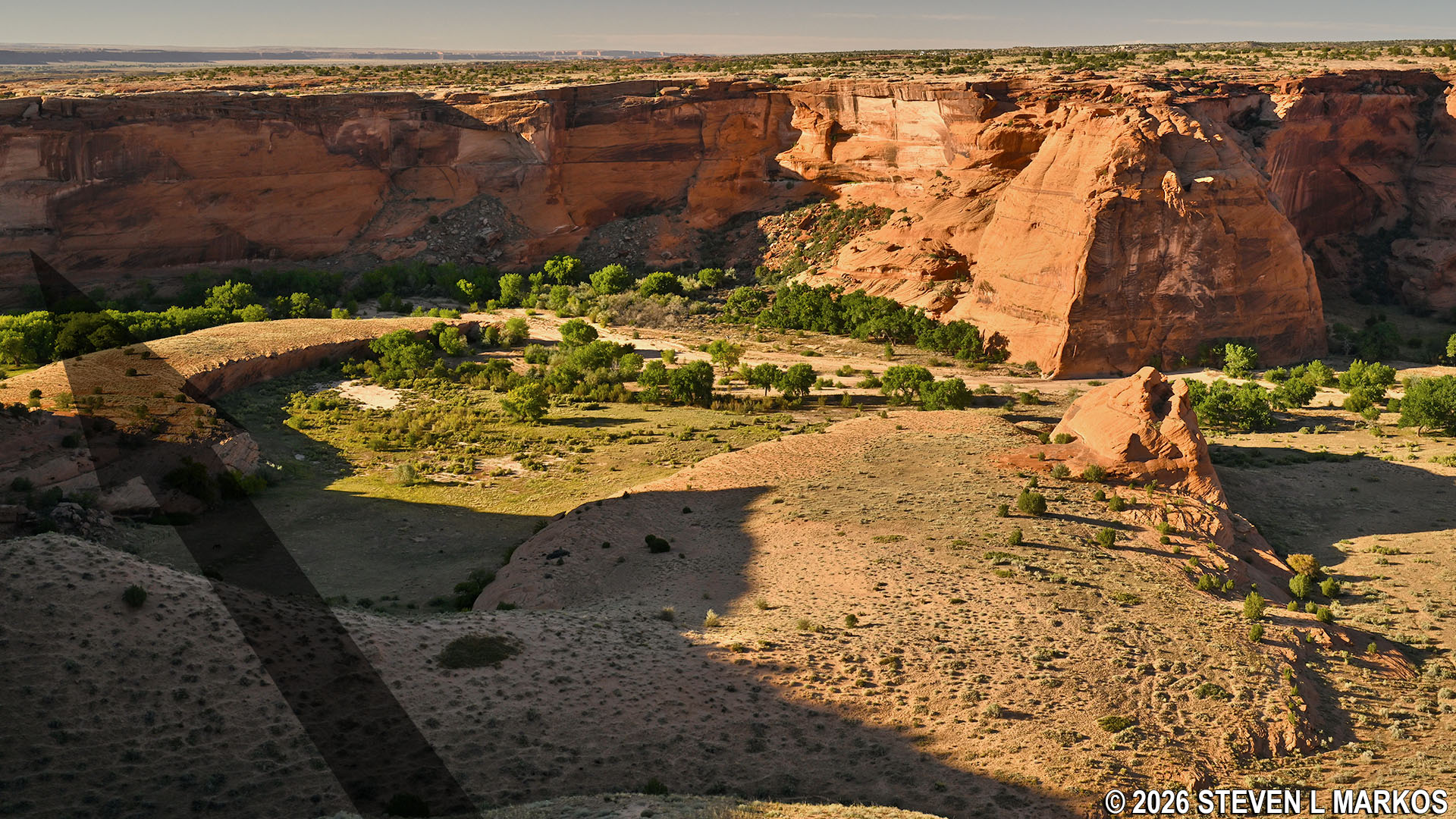
View of Dog Rock from the Junction Overlook on South Rim Drive, Canyon de Chelly National Monument
SOUTH RIM DRIVE
STOP 3: JUNCTION OVERLOOK
The third stop on the South Rim Drive at Canyon de Chelly National Monument (pronounced de Shay) is Junction Overlook. To understand where the overlook’s name comes from, it is necessary to understand the canyon’s layout. It is shaped like a sideways Y with the mouth of the Y facing east. Canyon de Chelly is the southeastern fork of the Y and Canyon del Muerto the northeastern fork. Junction Overlook is where the fork of the two canyons is located.
To get to the overlook area, take the concrete path at the north end of the parking lot loop. The path is short, and those in wheelchairs or who have trouble walking should be able to make the trip without problem.
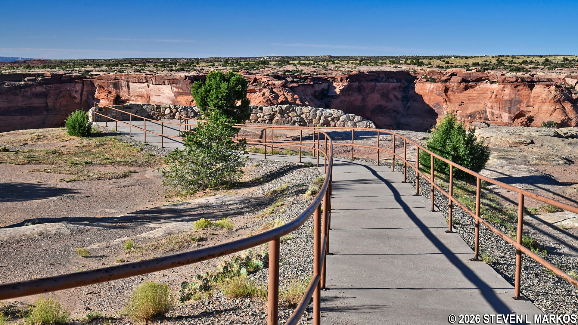
Path leading to Junction Overlook on the South Rim Drive at Canyon de Chelly National Monument
If you want to see more of the canyon, there is plenty of room to walk along the rim in either direction from the overlook. However, there is no rock wall or other barriers to keep idiots from falling into the canyon, so if you are an idiot, stick to the official overlook.
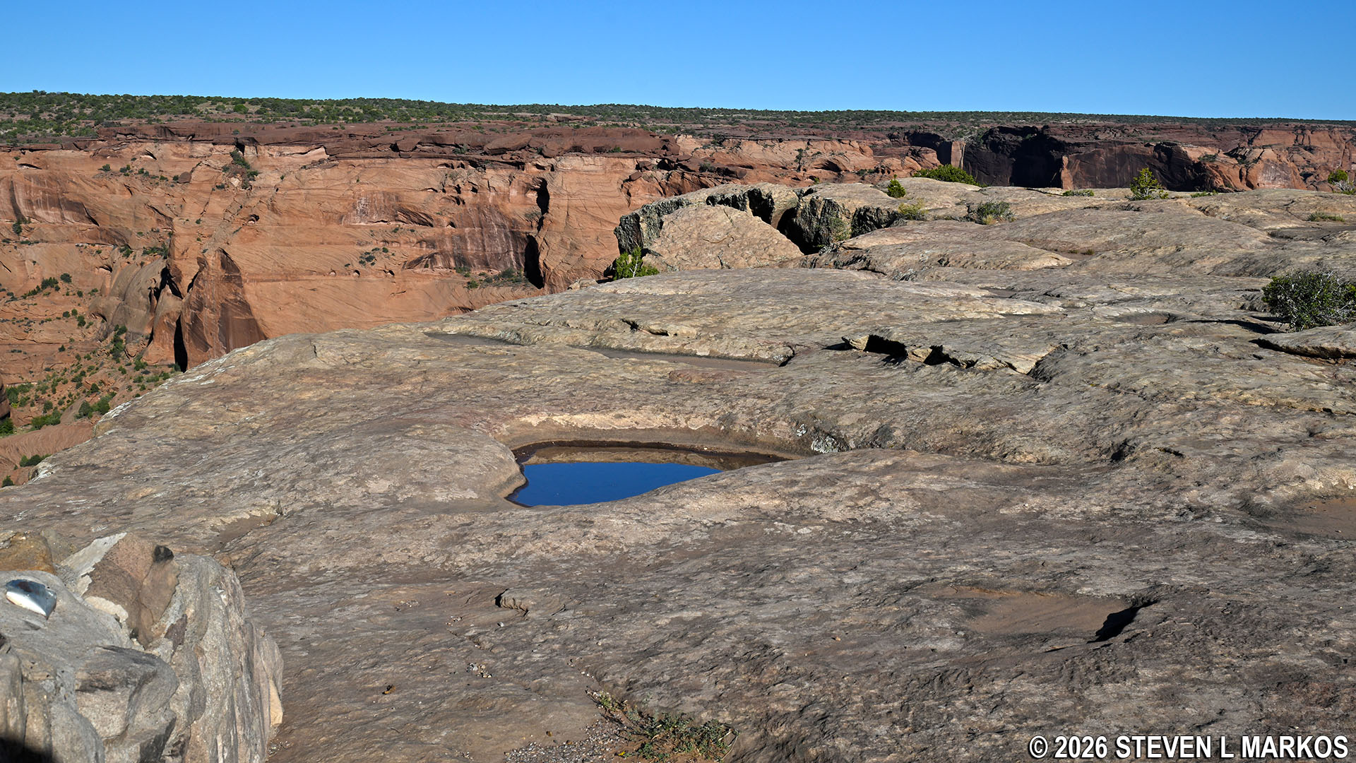
Typical terrain along the rim of the canyons at Canyon de Chelly National Monument
Dominating the view is a block of sandstone called Dog Rock, which gets its name because it looks like a dog when viewed from the canyon floor. It is situated at the fork of the two canyons, and it actually blocks the view of the entrance into Canyon del Muerto, so it is hard to see that this is indeed the junction. Canyon de Chelly is the canyon to the right that South Rim Drive follows. North Rim Drive follows Canyon del Muerto.
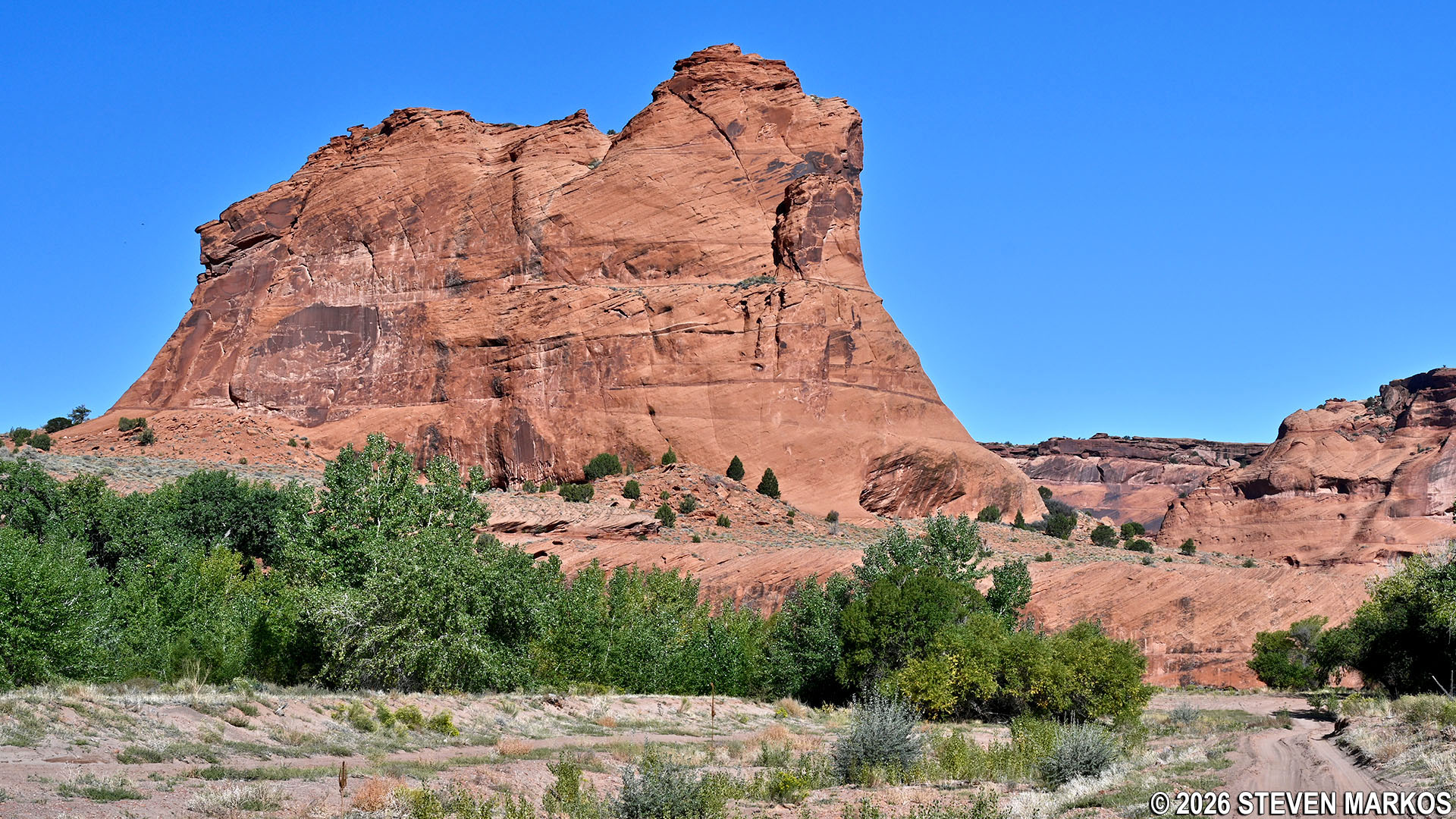
View of Dog Rock from the canyon floor at Canyon de Chelly National Monument
There are also two archeological sites (former Ancestral Puebloan housing complexes) visible from Junction Overlook, but unless you have binoculars and know where to look (which you won’t since there are no wayside exhibits at any of the overlooks), you will never see them. Note that the close-up photos below of the ruins were taken from the canyon floor during a 4-wheel drive vehicle tour that was given by an authorized Navajo guide. Other than hiking into Canyon de Chelly on the White House Trail, exploring the canyon floor is only permitted on such tours. I highly recommend that if you have the time and money to take one (hiking and horseback tours are also offered). See the Guided Canyon Tours web page here on National Park Planner for more information.
To the left, on the far, far, far, far side of the canyon, is First Ruin. It is perched on a long, narrow ledge and has twenty-two rooms and two kivas (circular rooms, usually below ground, used for ceremonies). The name dates back to 1882 when Colonel James Stevenson (an executive officer with the United States Geological Survey) led an archeological expedition into the canyon. Stevenson was surveying the area for the Smithsonian Institute, and this was the “first ruin” he encountered.
Location of First Ruin when standing at the Junction Overlook on South Rim Drive, Canyon de Chelly National Monument
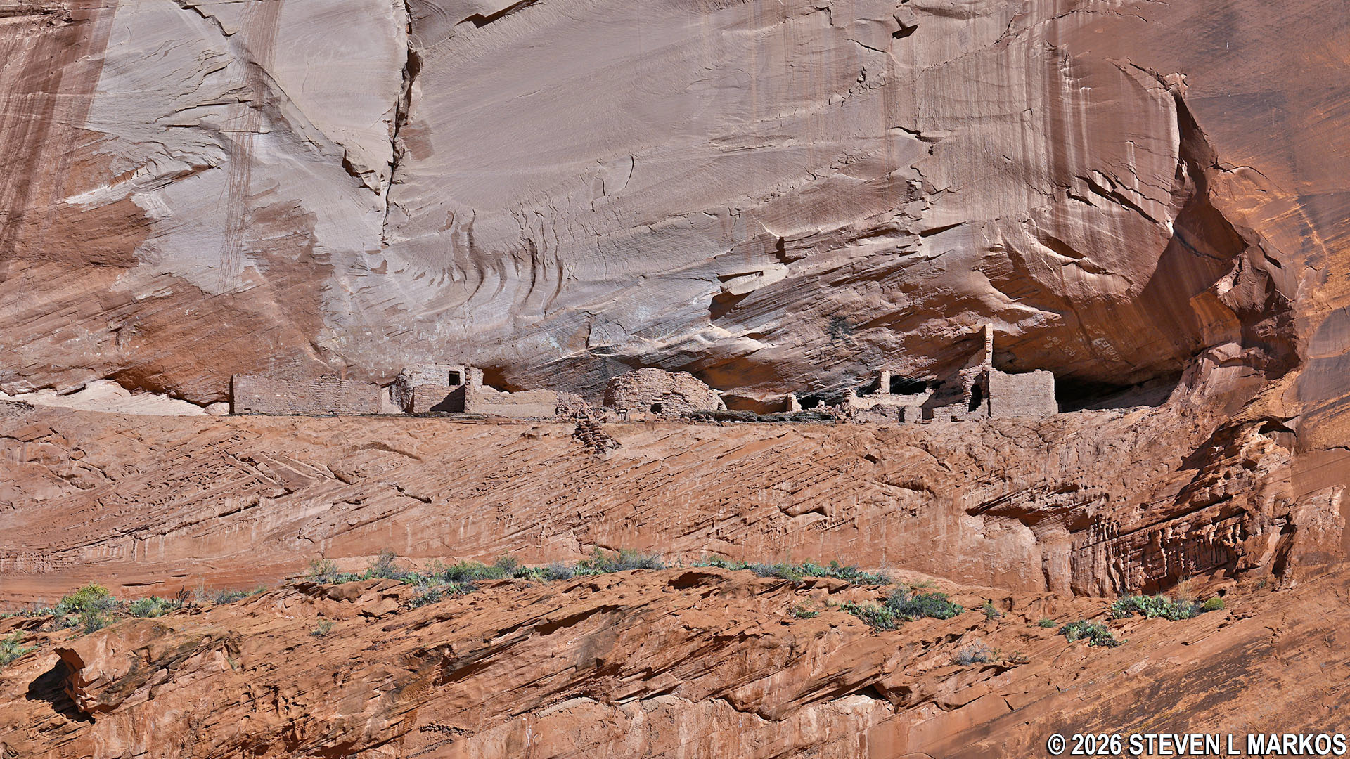
View from the canyon floor of First Ruin, Canyon de Chelly National Monument
A little more easy to spot is Junction Ruin, which is to the left of Dog Rock on the far wall of the canyon. This housing complex had ten rooms and one kiva. The ruin received its name due to the location at the junction of the two canyons. Ancestral Puebloans occupied it during the Great Pueblo period (also known as Pueblo III), which lasted from around 1100 until shortly before 1300 AD.
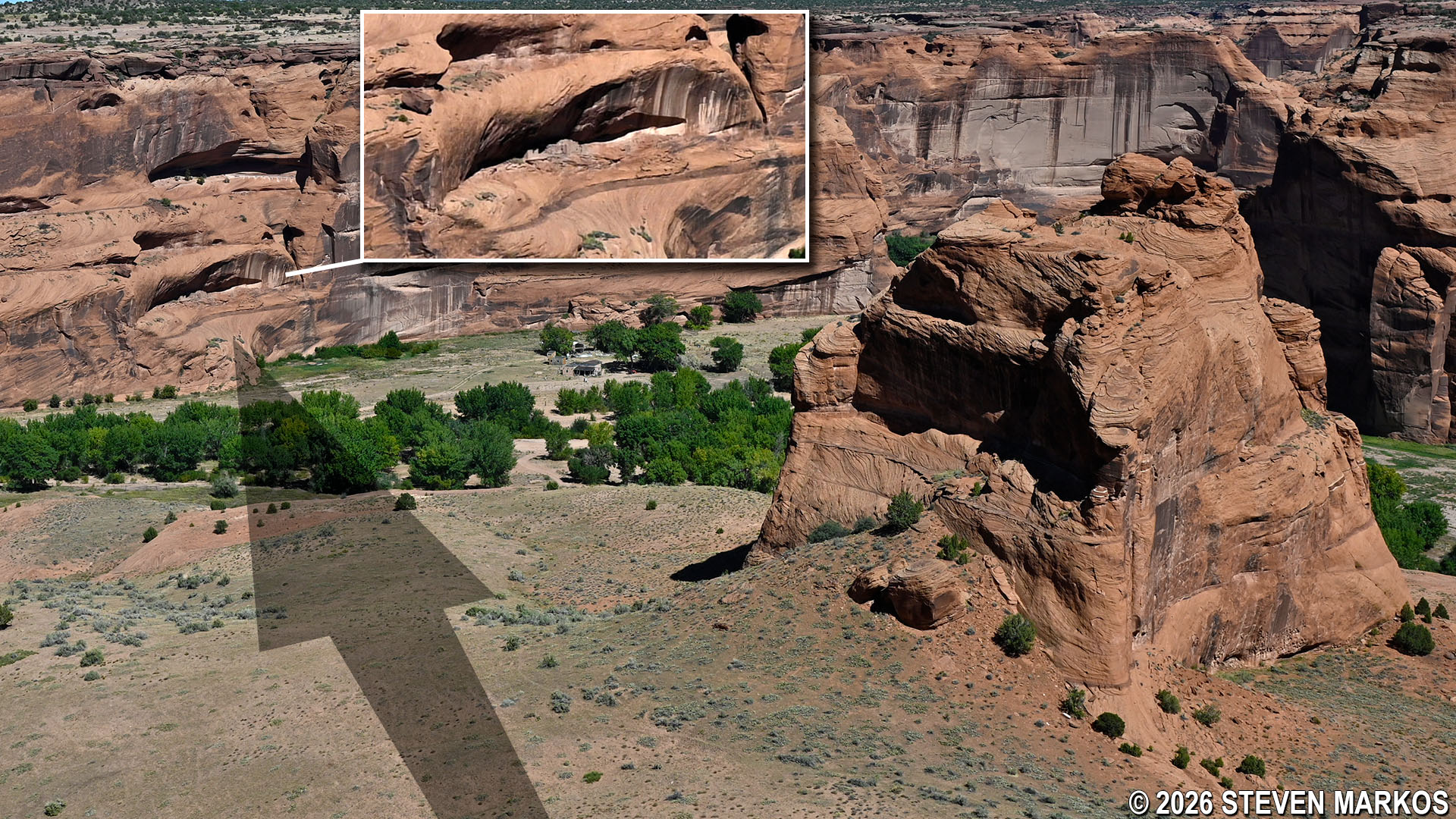
Location of Junction Ruin when standing at the Junction Overlook on South Rim Drive, Canyon de Chelly National Monument
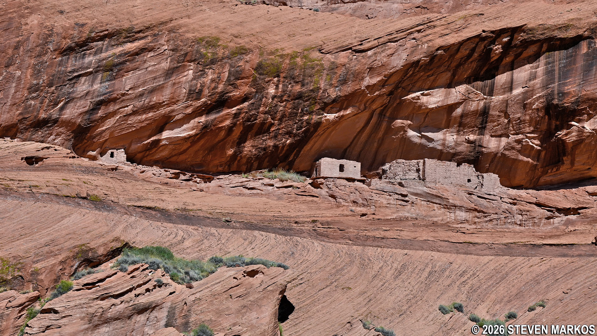
View from the canyon floor of Junction Ruin, Canyon de Chelly National Monument
Next Stop | Previous Stop | South Rim Drive Home Page
With a few exceptions, use of any photograph on the National Park Planner website requires a paid Royalty Free Editorial Use License or Commercial Use License. See the Photo Usage page for details.
Last updated on March 17, 2026


