

Sunken Road (aka Bloody Lane) at Antietam National Battlefield
ANTIETAM NATIONAL BATTLEFIELD TOUR
STOP 7: BLOODY LANE
Allow 30 minutes for a visit
The seventh stop on the Antietam National Battlefield Tour is at a section of an old farm road now known as Bloody Lane. This is one of the more interesting stops on the tour, as there are plenty of monuments, a mortuary cannon, and a 60-foot tall observation tower that you can climb.
There are two parking lots along Bloody Lane, one at the tower and one a quarter mile down the road to the west. The official stop on the tour is at the one farthest from the tower, though it doesn’t really matter where you park. To get the full experience of Bloody Lane you’ll want to walk it if possible, and if you do, you’ll end up traveling between the two parking lots on foot.

Bloody Lane at Antietam National Battlefield
As the fighting at The Cornfield began to subside around 9 AM, Union general Edwin Sumner’s 2nd Corps was called to join the battle. Comprised of three divisions, each with between 4,000 and 5,000 men, the 2nd Corps crossed Antietam Creek at Pry Ford and marched east towards the East Woods. General John Sedgwick’s division was at the front and was soon outpacing the others, which were commanded by generals William French and Israel Richardson. Sedgwick encountered remnants of Confederate general Thomas “Stonewall” Jackson’s men at The Cornfield and ended up pursuing them into the West Woods. By the time French’s and Richardson’s divisions emerged from the East Woods, Sedgwick was nowhere in sight, so they instead headed southwest towards an old farm road that had been worn into the ground over the years by pedestrians, horses, carriages, and wagons. The local residents called it the Sunken Road.
The Union divisions passed through the Mumma and Roulette farms, terrain made up of a series of rolling hills, so there was no way to know exactly what lay ahead from one hill to the next. What did lay ahead was 2,300 Confederate infantrymen under the command of generals Robert Rodes and George B. Anderson, part of General David H. Hill’s division, who were concealed along the banks of the Sunken Road.

Bloody Lane Battle Map
Around 9:30 AM, French’s division crested the last hill before the Sunken Road. The minute they got to the top they came under fire, and nearly the entire front line of men were killed or wounded. While the Confederates were heavily outnumbered, due to the cover provided by the banks of the Sunken Road, they were able to hold the road for three hours.
A division of Confederate reinforcements (approximately 3,400 men) commanded by General Richard Anderson arrived, but the extra firepower was soon negated when Richardson’s 4,000 men came over the hill around 10:30 AM. The Confederates were eventually overwhelmed by superior numbers, and by 1 PM Union troops had broken through their defensive line, forcing Hill and Anderson to retreat south from the Sunken Road to the Piper Farm. The Confederates did mount a counterattack but failed to retake the road.
Approximately 5,500 men were killed or wounded at what was soon called Bloody Lane. General Israel Richardson died from a wound he received late in the battle. The non-life threatening wound became infected, and he died later that year in November. A Confederate general, George B. Anderson, also died from a wound that became infected.
For the best perspective of the fighting at Bloody Lane, hike the 1.7-mile Bloody Lane Trail. It starts near the Antietam National Battlefield Visitor Center, passes through both the Mumma and Roulette Farms, and takes hikers up the same hill the Union soldiers climbed before being pummeled by Confederate mini balls.

Bloody Lane Trail follows in the footsteps of the Union attack at Bloody Lane, Antietam National Battlefield
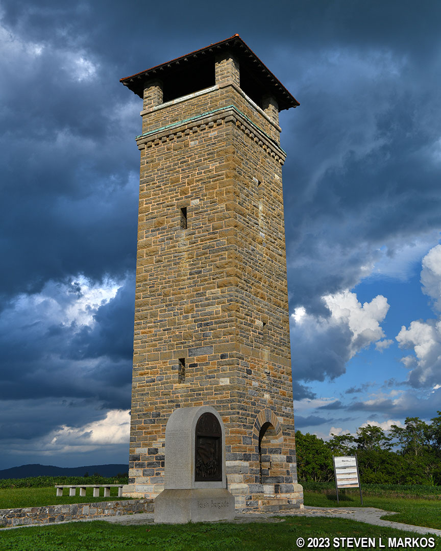
The observation tower at the Bloody Lane tour stop was built by the United States War Department in 1896. It is open to the public for climbing. There are 67 steps to the top, and from there you can see the battlefield in all directions.
Observation tower along Bloody Lane at Antietam National Battlefield
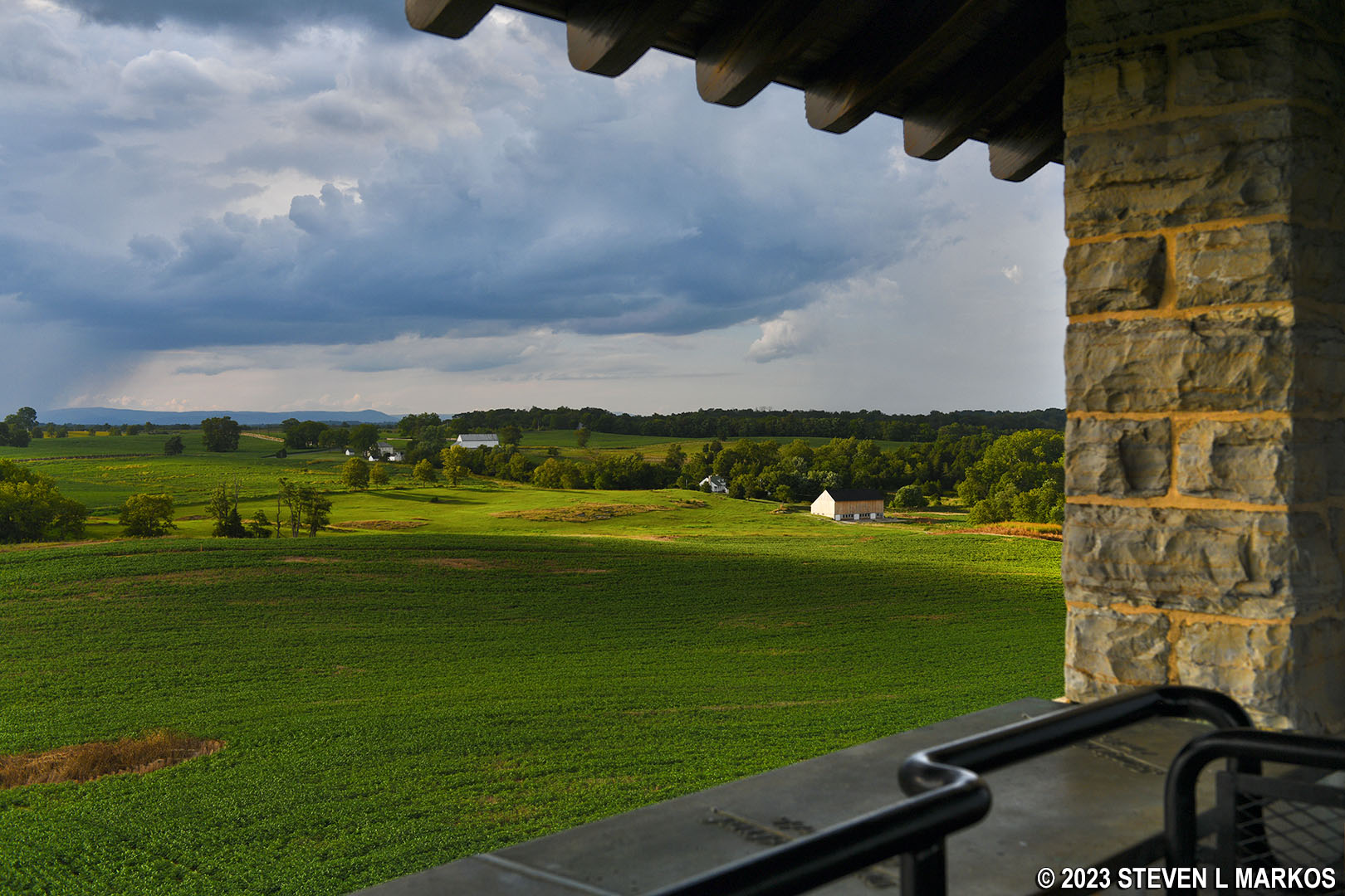
View towards the Mumma and Roulette farms from the observation tower along Bloody Lane at Antietam National Battlefield
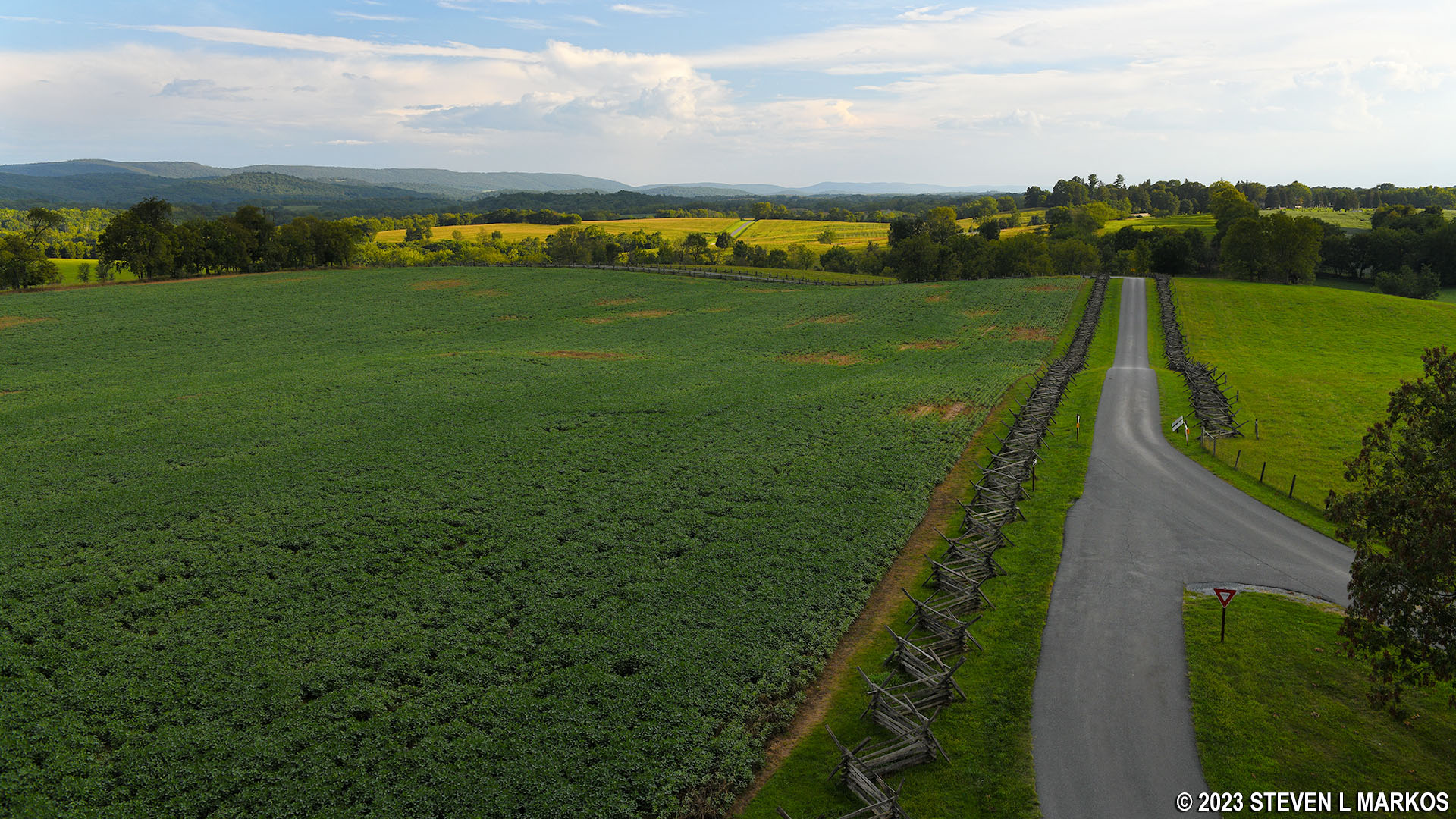
View to the south from the observation tower along Bloody Lane at Antietam National Battlefield
A mortuary cannon for Israel Richardson sits next to the observation tower. This type of monument marks the approximate location of where a general was killed or mortally wounded. The Richardson mortuary cannon is one of six such memorials at Antietam. Three are for Confederate generals (George B. Anderson, Lawrence O’Bryan Branch, and William E. Starke) and three are for Union generals (Isaac P. Rodman, Joseph Mansfield, and Richardson).
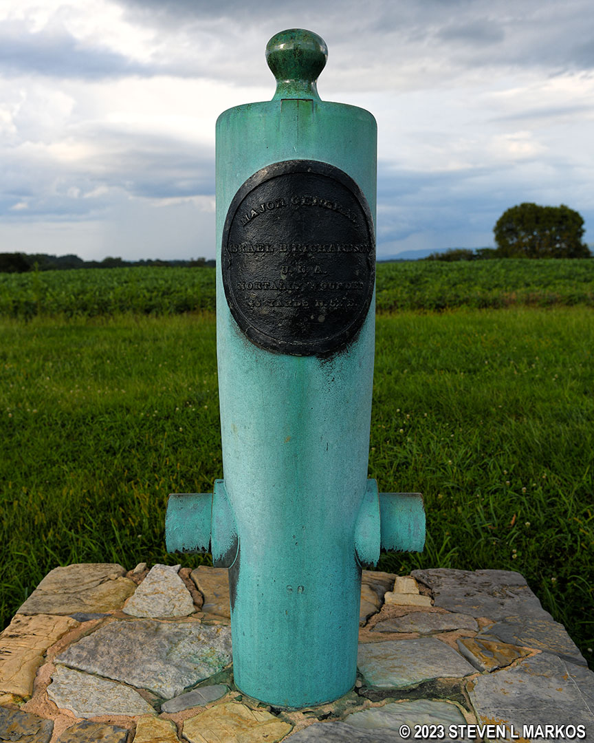
General Israel Richardson mortuary cannon at Antietam National Battlefield
There are plenty of monuments along the Sunken Road, though how many you see depends on how far you willing to walk along the road.
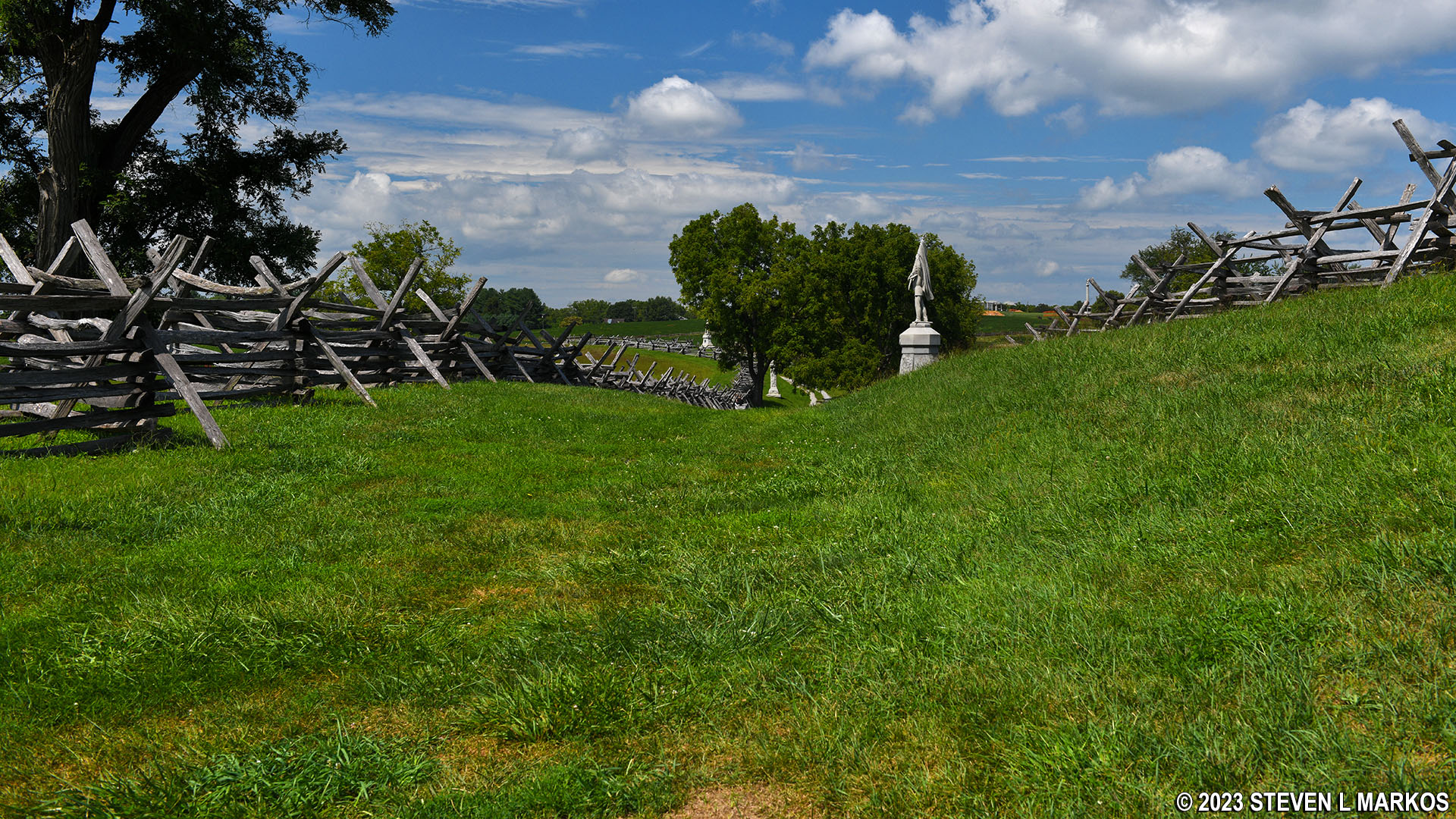
Sunken Road at Antietam National Battlefield
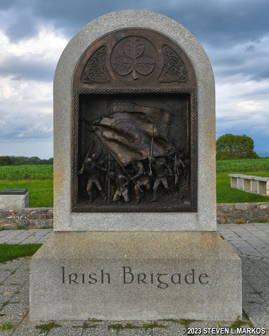
Irish Brigade Monument next to the Bloody Lane observation tower at Antietam National Battlefield
Stop 8: Burnside Bridge | Stop 6: Mumma Farm | Battlefield Tour Home Page
With a few exceptions, use of any photograph on the National Park Planner website requires a paid Royalty Free Editorial Use License or Commercial Use License. See the Photo Usage page for details.
Last updated on May 23, 2023


