

Vickery Creek North Loop Trail (click to enlarge)
Northern Trail Loop Hike
Distance: 3.8 miles
Time: 2.5 hours
Difficulty: Easy with a few moderate climbs
Download the Vickery Creek Trail Map (PDF)
Trails in the northern section of Vickery Creek (aka Big Creek) crisscross the park. Since I take no pleasure in seeing the same thing twice if I can avoid it, I chose a nice 3.8-mile loop that alternates between following the creek and following the ridges above the creek, which rise as much as 100 feet above the water. Eighty percent of the hike is on flat and easy terrain, while the other twenty percent covers hills of moderate descent / ascent. I found the trails at the north section of Vickery Creek to be what I consider true hiking trails and not nature walks. The hike was interesting, and since it consisted of a decent amount of climbing up and down hills, I had the sense of hiking in the North Georgia mountains, all within earshot of Roswell, Georgia, a busy suburb 30 minutes from downtown Atlanta.
Trail maps are at each intersection in Vickery Creek. These intersections use the nomenclature of VC plus a number (i.e. VC 1). When on the trail and looking at a trail map stand, a “VC#” with a dark outline around it indicates the intersection you are at. I always recommend printing a copy of the trail map and taking it with you because you never know when some low-life will vandalize the trail map stands.

Trail map at an intersection of the Vickery Creek unit trails in Chattahoochee River National Recreation Area
I began my hike at the main parking lot off of Riverside Drive. Access to the trails begins at the end of the parking lot. The first intersection that you want to be on the lookout for is VC 2, which is less than a minute from the start. Take a right at VC 2 towards VC 4 to begin a .2-mile climb to the ridge above the creek, which gives you a nice view down into the valley. This is the hardest section of the hike, but you will find that it is not too bad, for it ascends via switchbacks instead of opting for a direct climb to the top. The trail levels out at the top of the hill and in another .3 mile you will arrive at the VC 4 intersection where the loop portion of the hike begins.
I hiked the loop in a clockwise manner, taking the trail to the left towards the creek and the Vickery Creek Dam. This route takes you to intersections VC 8, 9, 18, 17, 16, and finally to 19 at the dam. The total distance from VC 4 is less than a half mile, and other than a gradual decline starting at VC 9, the trail is flat and has a fairly smooth terrain. You must return back to VC 18 once you visit the dam, so you will have an uphill climb on the way back.
The Vickery Creek Dam forms a picturesque waterfall that makes for a great photograph. The dam does not alter the river’s course, create a lake or reservoir, or even appear to be the source of electricity, so its purpose seems lost to the modern viewer. As it turns out, the dam was actually built in the 1830s to be used as the water power source for a very large textile mill. The mill was burned down during the Civil War but was rebuilt and continued to operate until the 1970s. During my visit, the water of Big Creek was a murky greenish-yellow, and this created an interesting mix of colors as it spilled over the dam. It’s hard to resist describing it as raw sewage, for the waterfall was striped with both white water and the putrid greenish-yellow, but in reality it is actually very beautiful. I’ve seen other photos of the dam with the water being a solid white, so I’m guessing that the water is not always this color.

Vickery Creek Dam in Roswell, Georgia
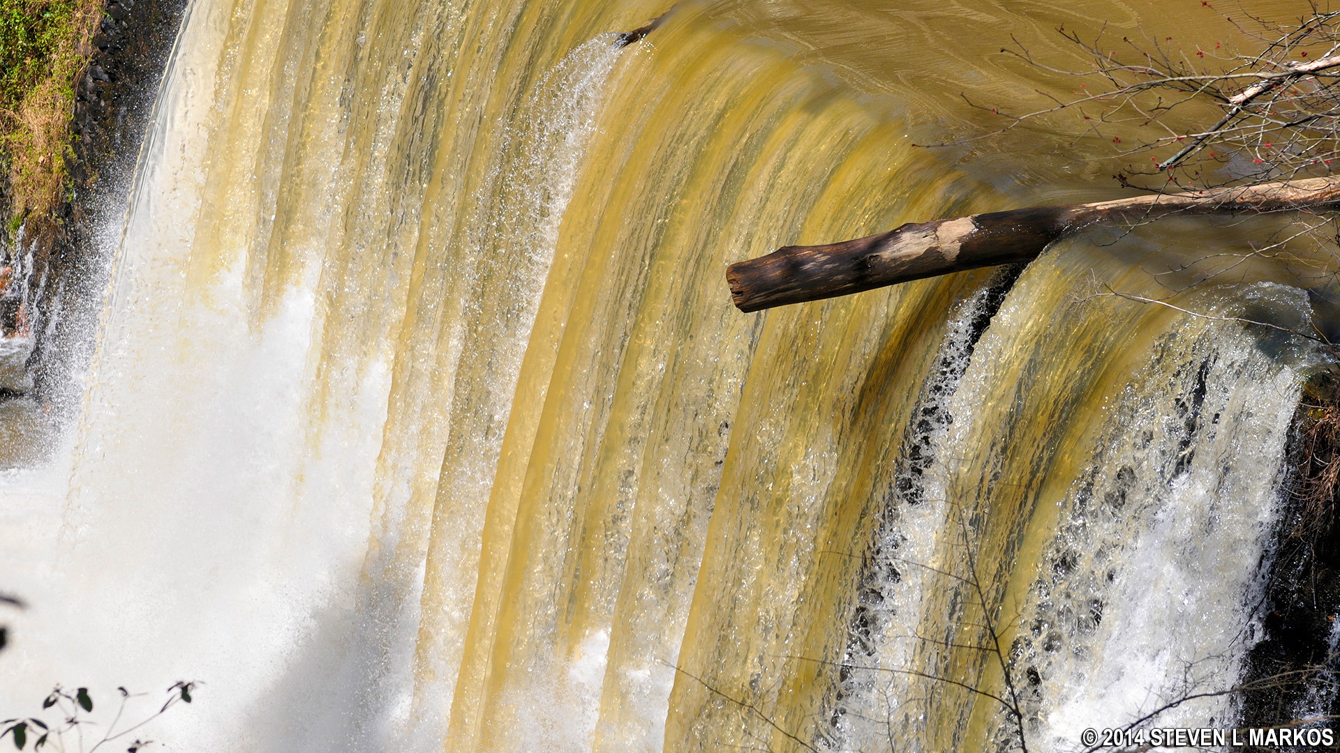
Close-up of the water flowing over Vickery Creek Dam in Roswell, Georgia
The water upriver is serene, but as it tumbles over the dam it becomes turbulent and forms a short run of Class 1 and 2 rapids on its one-mile journey to the Chattahoochee River. Canoeist and kayakers have been known to park at Roswell Mill, a site on the opposite side of the river a short distance down from the dam, and lug their boats to just below the dam. However, it sure is a lot of lugging for a very short run of rapids.
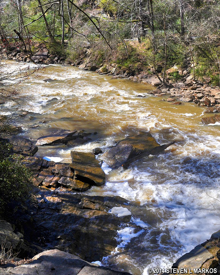
Rapids on Vickery Creek below the Vickery Creek Dam in Roswell, Georgia
When you are ready to resume your hike after viewing the dam you may be fooled into following what appears to be a trail that continues to run right along the riverbank. This is not the trail that is on the map. This trail runs precariously along a ledge about ten feet above the water, and it gets worse as you walk. If I were a kid looking for an Indiana Jones adventure, I’d take the path in heartbeat. But being 49-years-old and carrying $3500 worth of camera equipment, I didn’t relish the very good chance of falling into the water. If you are thinking like me, do not follow this path but instead turn around and head back to VC 18 and then take the fork to the left in the direction of VC 25. It is .35 mile between the two intersections.
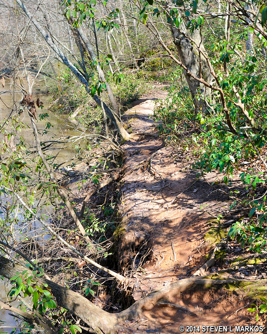
Trail along the river at Vickery Creek Dam in Roswell, Georgia
Stay straight at VC 25 and then turn left at VC 24. This will take you to a bridge over Vickery Creek that is part of the Historic Roswell Trail. For a longer hike along the creek, head to VC 27 instead and then on to the bridge. Regardless of which way you go, once at the bridge you do not want to cross it, other than for a photo, so take the trail that heads down towards the creek, just to the right of the bridge.
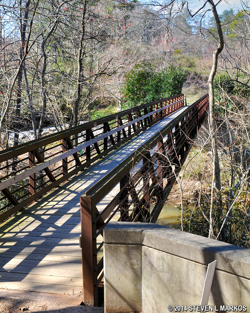
Bridge over Vickery Creek at Oxbo Road, part of the Historic Roswell Trail
The bridge marks the last major point of interest along the trail. From here on out, enjoy the scenery and the exercise. From VC 26 to VC 23, a .6-mile hike, the trail runs along Vickery Creek but often much too far away to get a decent view. The trail veers from the creek for good once you see Grimes Bridge Road, then continues on to VC 23.
From VC 23 onward there’s not much to see. You have about a mile hike back to VC 4, where the loop started, following the route of VC 21, 20, 7, and 6. The last half mile from VC 4 to the parking lot is the only portion of the hike that you have to repeat.
With a few exceptions, use of any photograph on the National Park Planner website requires a paid Royalty Free Editorial Use License or Commercial Use License. See the Photo Usage page for details.
Last updated on May 27, 2024


