
View of Dog Rock during a guided jeep tour on the canyon floor at Canyon de Chelly National Monument
Other than hiking into Canyon de Chelly on the White House Trail, exploring the canyon floor is only permitted on a tour given by a member of the Navajo Nation (unless you are a Navajo yourself). Tours include options to explore on foot, on horseback, and in 4-wheel drive vehicles. A list of authorized tour operators is available on the Navajo Nation Park’s Canyon de Chelly Tour Operators web page. (Note: On occasion, National Park Service Rangers also lead hikes into the canyon.)
I had the pleasure of taking a private 4-wheel-drive vehicle tour during my visit to Canyon de Chelly National Monument. I opted for a four-hour tour that covered roughly ten miles of the canyon. While there are a variety of vehicle tours given by the various companies, most are going to stop at the same popular locations. And of course in a vehicle you will see much more of the canyon than on foot or horseback, though hiking and horseback riding certainly have their benefits.

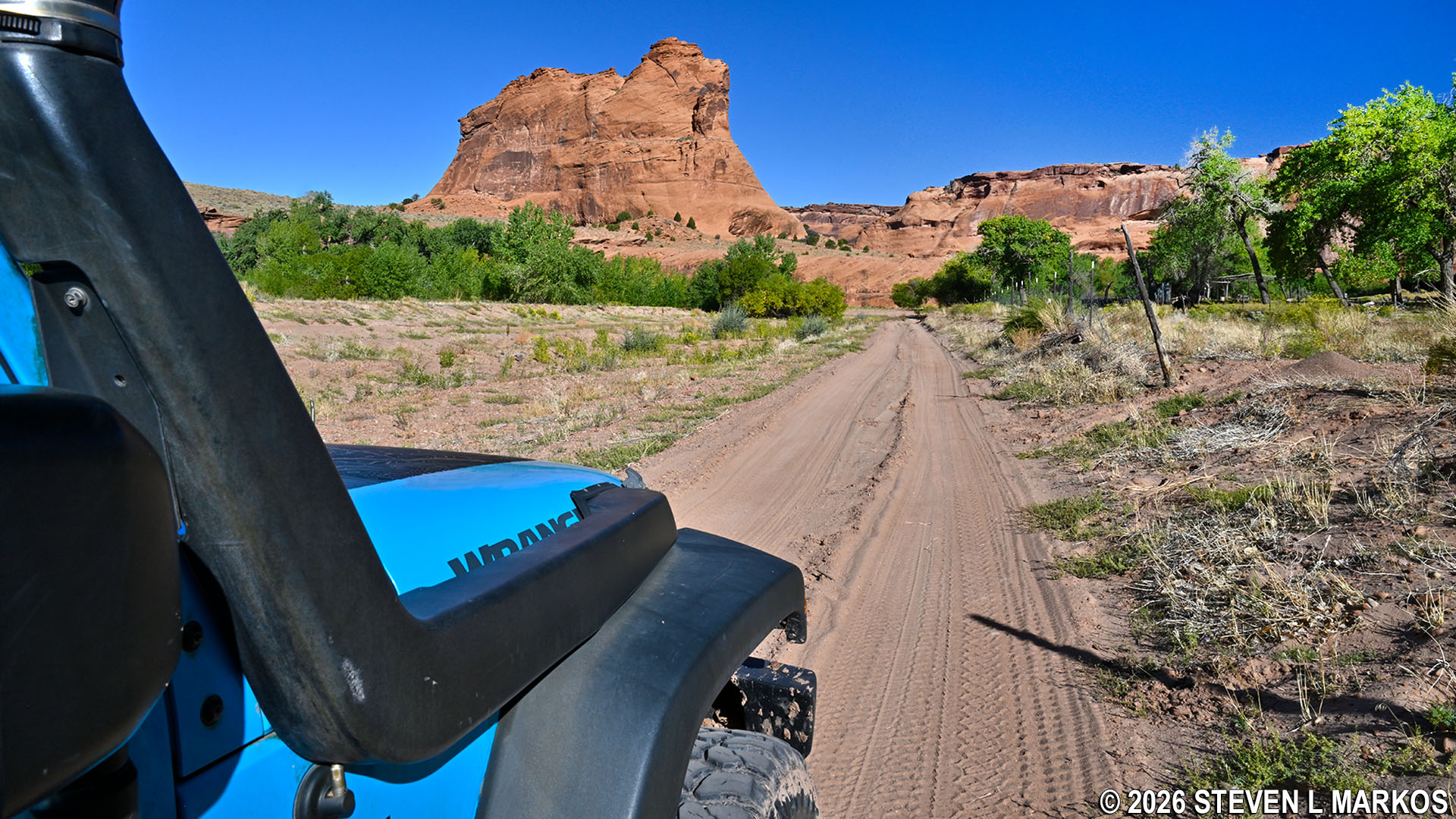
Rugged dirt road through the bottom of Canyon de Chelly
The canyon is shaped like a sideways Y with the mouth of the Y facing east. Canyon de Chelly is the southeastern fork of the Y and Canyon del Muerto the northeastern fork. My tour ventured into Canyon de Chelly to the White House archeological site and about four miles into Canyon del Muerto to Antelope House. Most of the vehicle tours cover similar terrain.
Located along the “stick” portion of the Y are numerous pictographs (rock paintings) and petroglyphs (rock etchings). A group of pictographs located near the start of the drive shows the fertility deity known as Kokopelli lying on his back and playing his flute. The Hopi describe him as carrying unborn children on his back to distribute them to the women, much like the story of how the stork delivers babies. The stick figure next to Kokopelli is presumed to represent a position related to childbirth, and the handprints surrounding it perhaps represent children. The handprints were painted two ways: positive prints (coating the hand with pigment and pressing it against a surface) and negative prints (placing the hand on a surface and painting around it, like a stencil).
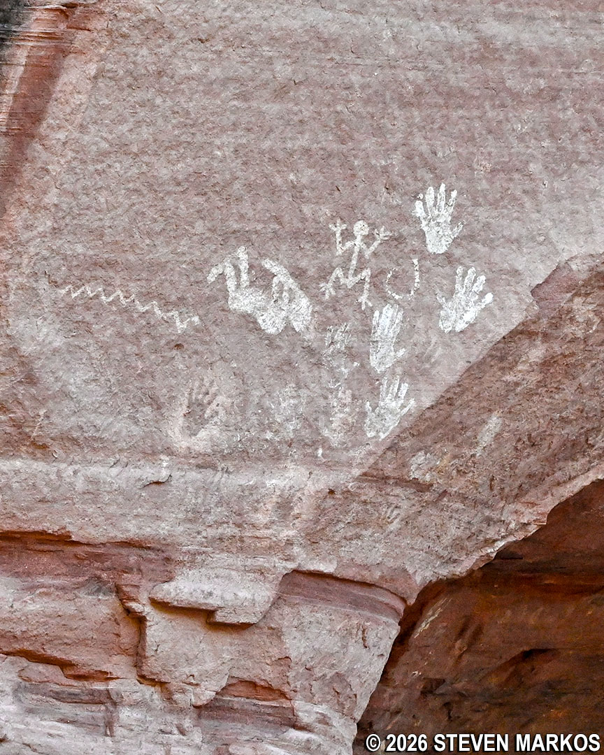
Pictograph on the canyon wall depicting the flute-playing fertility deity Kokopelli, Canyon de Chelly National Monument
A little less than a mile from the first group is what my tour guide referred to as “petroglyph rock.” High up on the canyon wall, the large grouping of petroglyphs depicts numerous people and antelopes. The grouping dates back approximately 3,000 years to the Early Basketmaker II period (1500 BC to 500 AD). According to the Navajo, it tells the story of a hunt. If you look closely at some of the antelopes, what looks like a tail sticking out actually represents a spear.
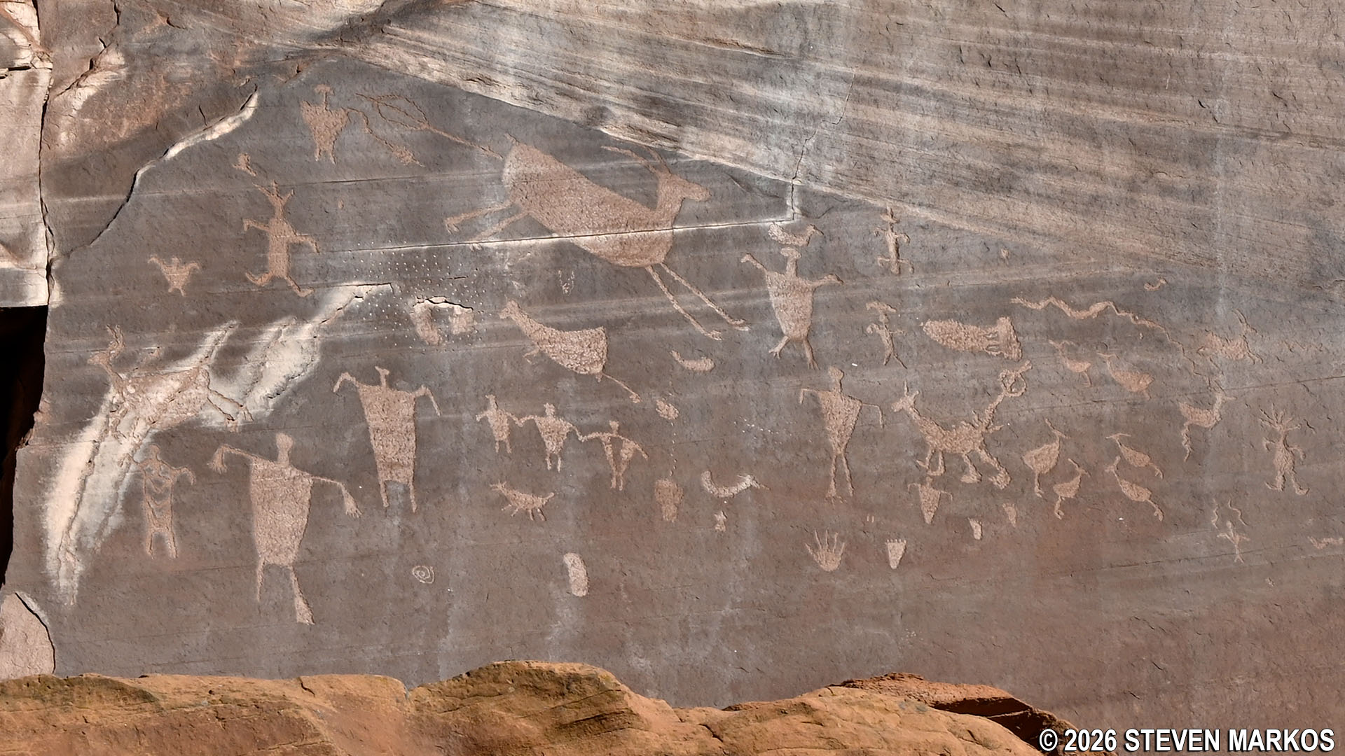
Petroglyphs high up on the wall of Canyon de Chelly at “petroglyph rock” depict a hunting scene, Canyon de Chelly National Monument
At the same location is another group of petroglyphs that show two Navajo men riding horses as they hunt a deer. These are thought to have been made as recently as the 1700s, after the Native tribes in the Southwest acquired horses from the Spanish following the Pueblo Uprising of 1680. (Recent studies suggest this acquisition might have actually happened in the early 1600s.)
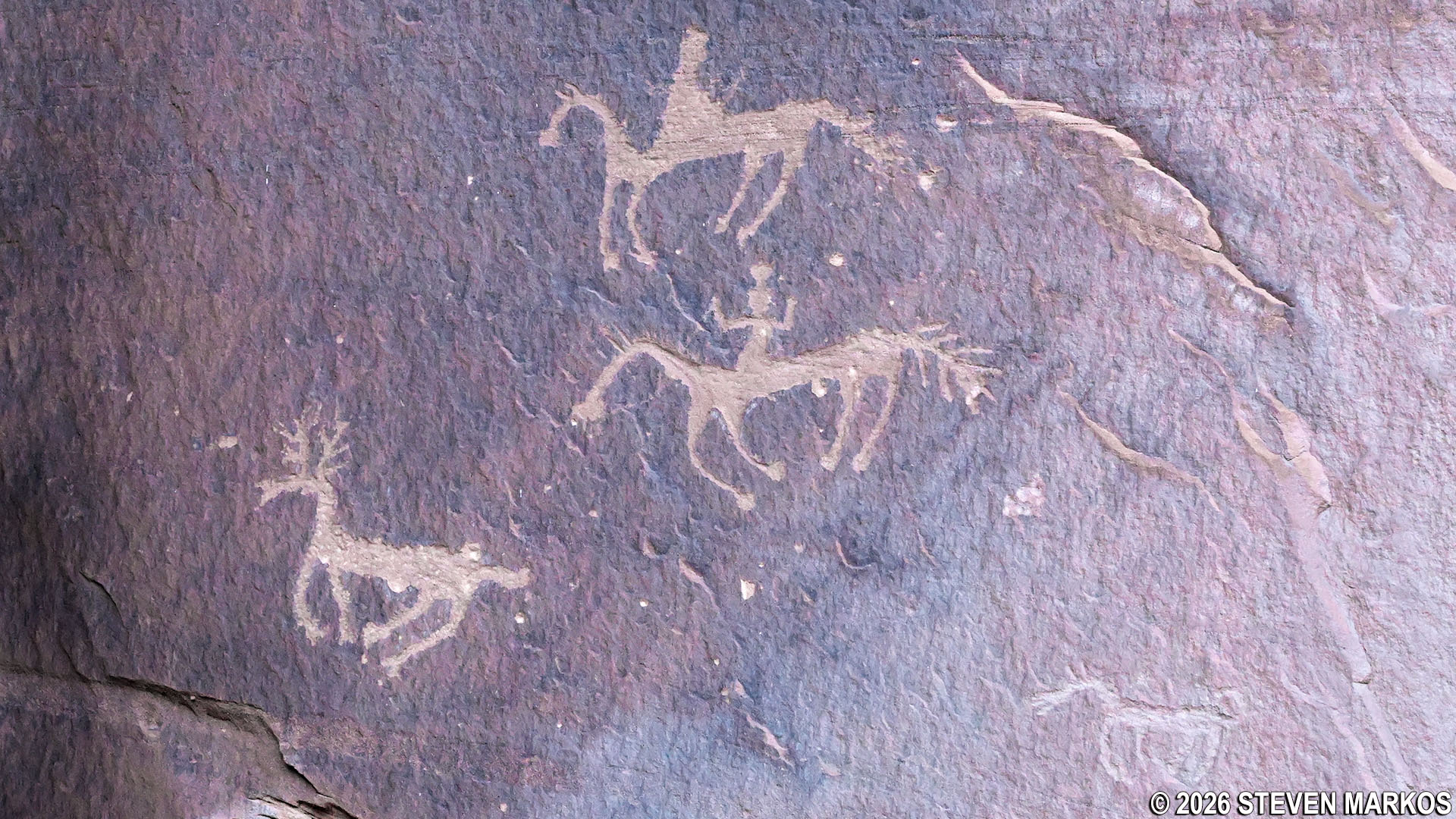
Navajo petroglyphs on the canyon wall at Canyon de Chelly National Monument
To the immediate right of the deer hunters is another interesting group of petroglyphs that are presumed to have been made by the Hopi people during their time in the area between the 1300s and the late 1600s. The connected diamonds are said to represent a diamondback rattlesnake, and the squiggly-legged figure represents a dancer. The Hopi, who today live in northeastern Arizona, still practice a snake dance (a type of rain dance) during the monsoon season from mid-June through the end of September.

Hopi petroglyphs at Canyon de Chelly National Monument
Another mile down the road, but still before the fork in the Y, is a large group of pictographs that is estimated to be over 700 years old. They were made using natural mineral pigments, such as colored clay, charcoal, and white calcium, ground into powders. A number of figures appear in the pictographs, with one painted orange standing out among the rest. There are a few that resemble animals, including the zigzags, which are said to represent snakes.
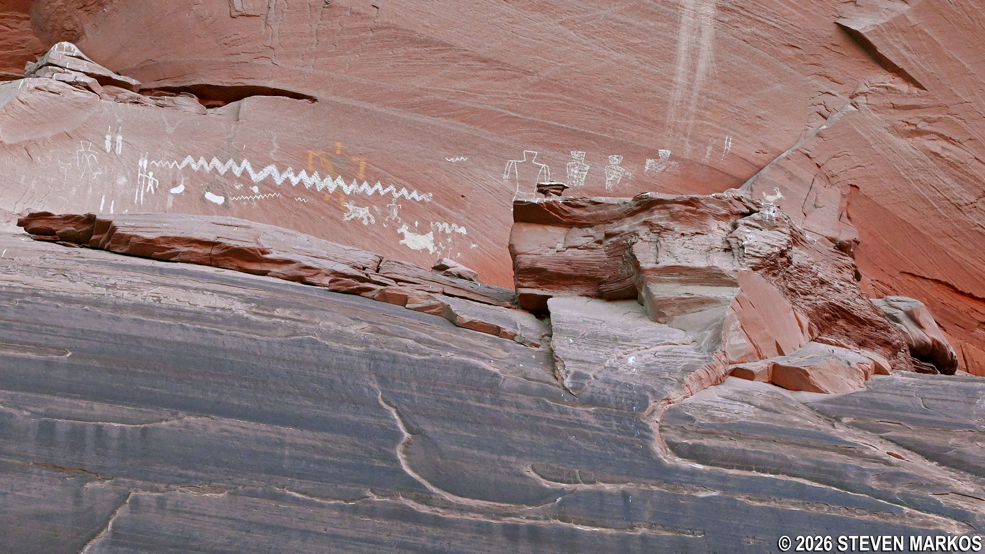
Pictographs created around 1300 AD at Canyon de Chelly National Monument
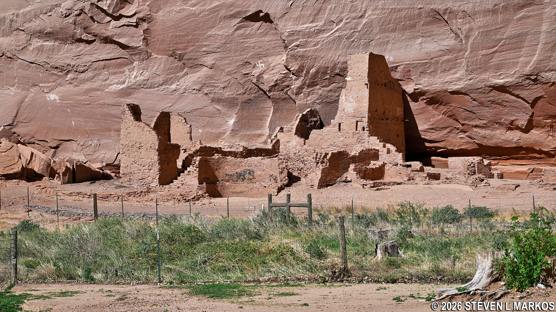
At the fork, my tour guide first headed southeast to a stop most every vehicle tour makes into Canyon de Chelly, the site of the White House ruins. This was first settled around 1050 and expanded as the population increased up until everyone left the area around 1300. The White House, a two-level dwelling site which got its name because of the white-plastered walls on the upper level, was home to 50 or so people when it was first built, and as many as 100 during its peak. Evidence of four kivas and almost eighty rooms, including ten on the cliff above, remains today.

White House archeological site at Canyon de Chelly National Monument
Pictographs on the canyon wall above the lower level were most likely drawn by standing on its roof, which indicates that at one time some of the lower-level rooms were less than five feet below the upper level.

Pictographs between the upper and lower levels on the White House at Canyon de Chelly National Monument
Though not really visible to the naked eye, if you have binoculars or a zoom lens on your camera, look closely at the back walls of the upper level and you will see quite a lot of modern “petroglyphs.” By modern, I mean graffiti, most of which was etched into the walls in the late 1800s.
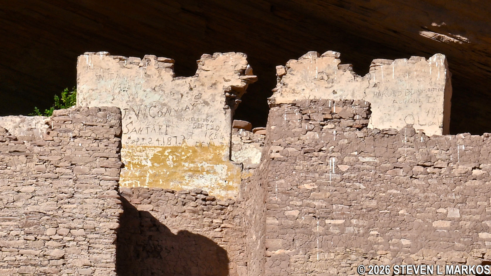
Graffiti from the late 1800s on the upper-level walls of the White House at Canyon de Chelly National Monument
There is a vending area under the shade trees near the White House that is operated by the Navajo. Here visitors can purchase handmade jewelry, artwork, and of course, traditional frybread (similar to funnel cakes). Portable restrooms are also available near the snack shop.
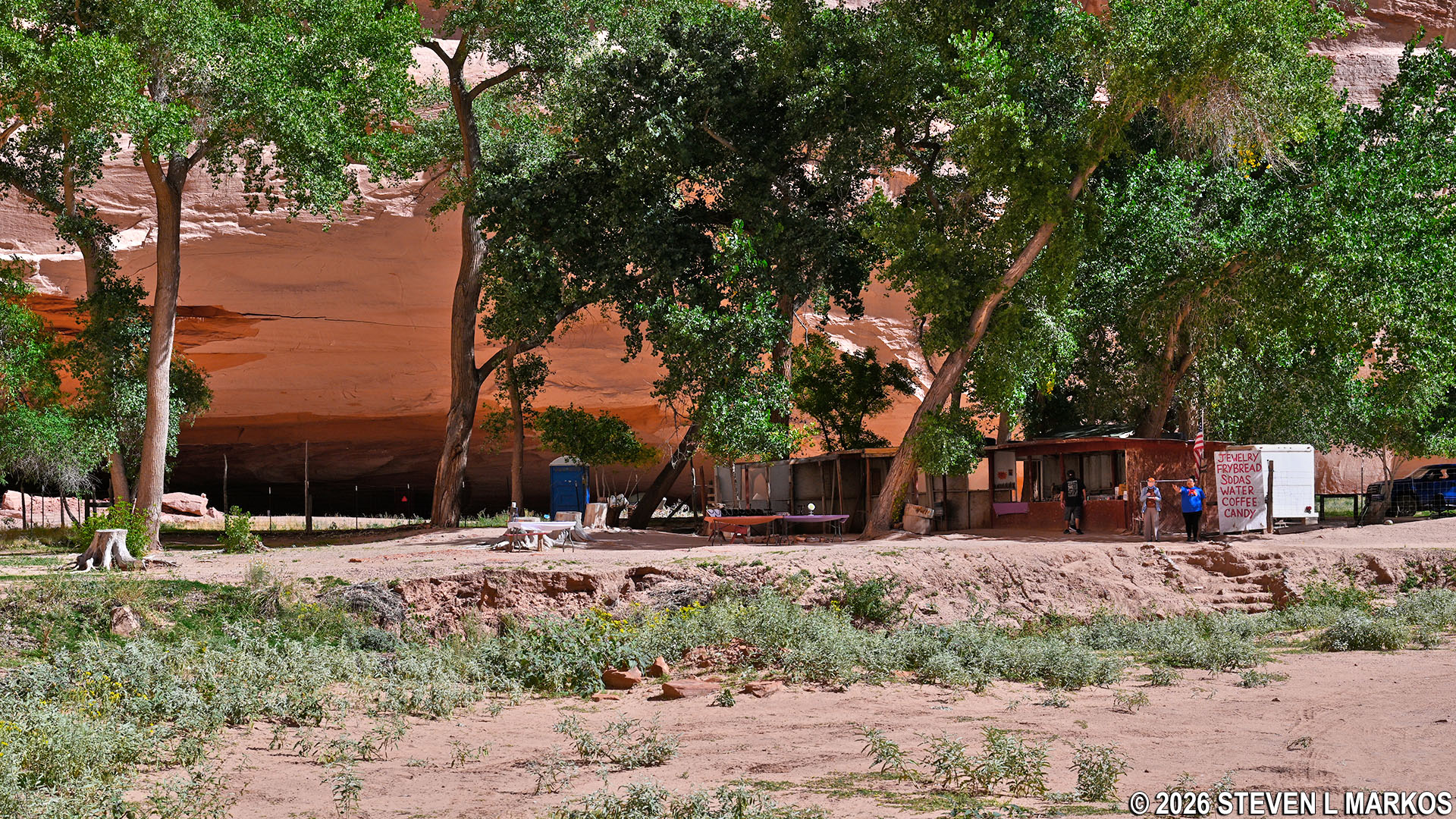
Navajo snack shop on the canyon floor at the White House archeological site, Canyon de Chelly National Monument
After the White House, my guide drove back to the fork and began the trip into Canyon del Muerto where more archeological sites are located, one being Ledge Ruin near the entrance into the canyon. In the past, visitors to Canyon de Chelly National Monument could see the archeological site from the Ledge Ruin Overlook on the scenic North Rim Drive, but it has been closed for many years, and there are no current plans for reopening it. Like most of the archeological sites in the canyon, Ledge Ruin was occupied between 1050 AD and 1300 AD by the Anasazi people (aka Ancestral Puebloans).
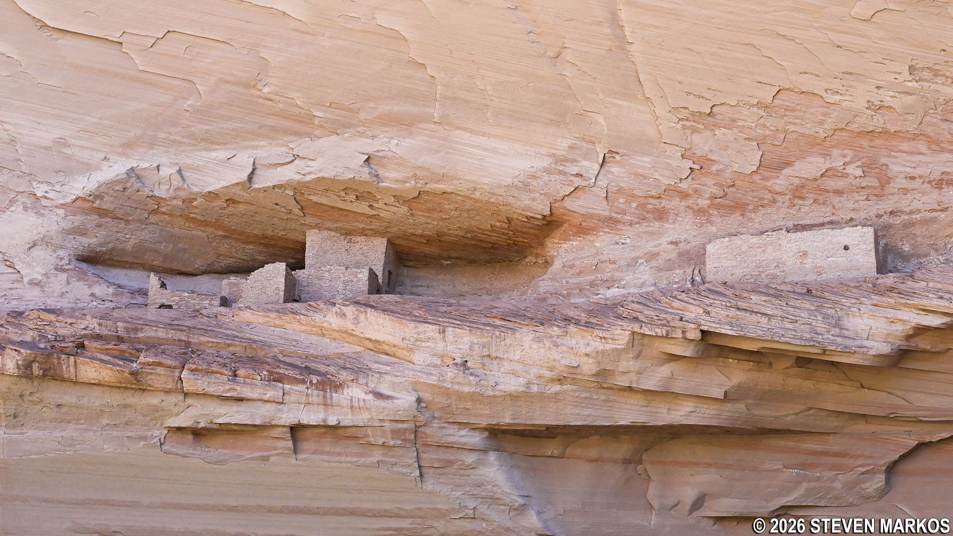
View of Ledge Ruin from the floor of Canyon del Muerto, Canyon de Chelly National Monument
Another popular stop in Canyon del Muerto is the Antelope House archeological site. It was occupied from around 700 AD to 1260 AD. This was as far into the canyon as my tour ventured. If you take a shorter vehicle tour, you might not get this far.
Antelope House archeological site at Canyon de Chelly National Monument
In addition to the archeological sites, the tour guide told many interesting stories about the Navajo history. It was such a neat experience, and I highly recommend taking one of the guided tours into the canyon when you visit Canyon de Chelly National Monument. I even got to witness a group of wild horses grazing on the canyon floor.

Wild horses grazing on the canyon floor at Canyon de Chelly National Monument
With a few exceptions, use of any photograph on the National Park Planner website requires a paid Royalty Free Editorial Use License or Commercial Use License. See the Photo Usage page for details.
Last updated on March 14, 2026


