
Crater Rim Trail at Capulin Volcano National Monument
Length: 1-mile loop
Time: 45 minutes
Difficulty: ★★★★☆
The Crater Rim Trail is Capulin Volcano National Monument’s signature hike—a paved, 1-mile loop that circles the rim of Capulin Volcano’s crater. To reach it, you must take Volcano Road to the top. Keep in mind that the road is only open to vehicles from 8:30 AM to 4 PM, which means you must be done with your hike and back down the volcano by 4 PM. The .3-mile (round trip) Crater Vent Trail is also located at the top of the volcano, and most people hike both. If that is your plan, allow at least an hour for your trip.
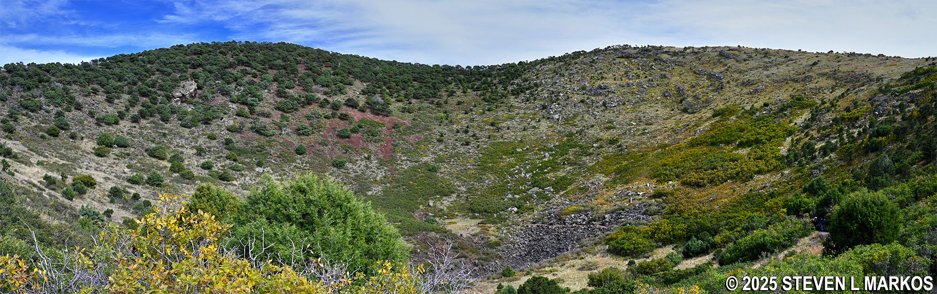
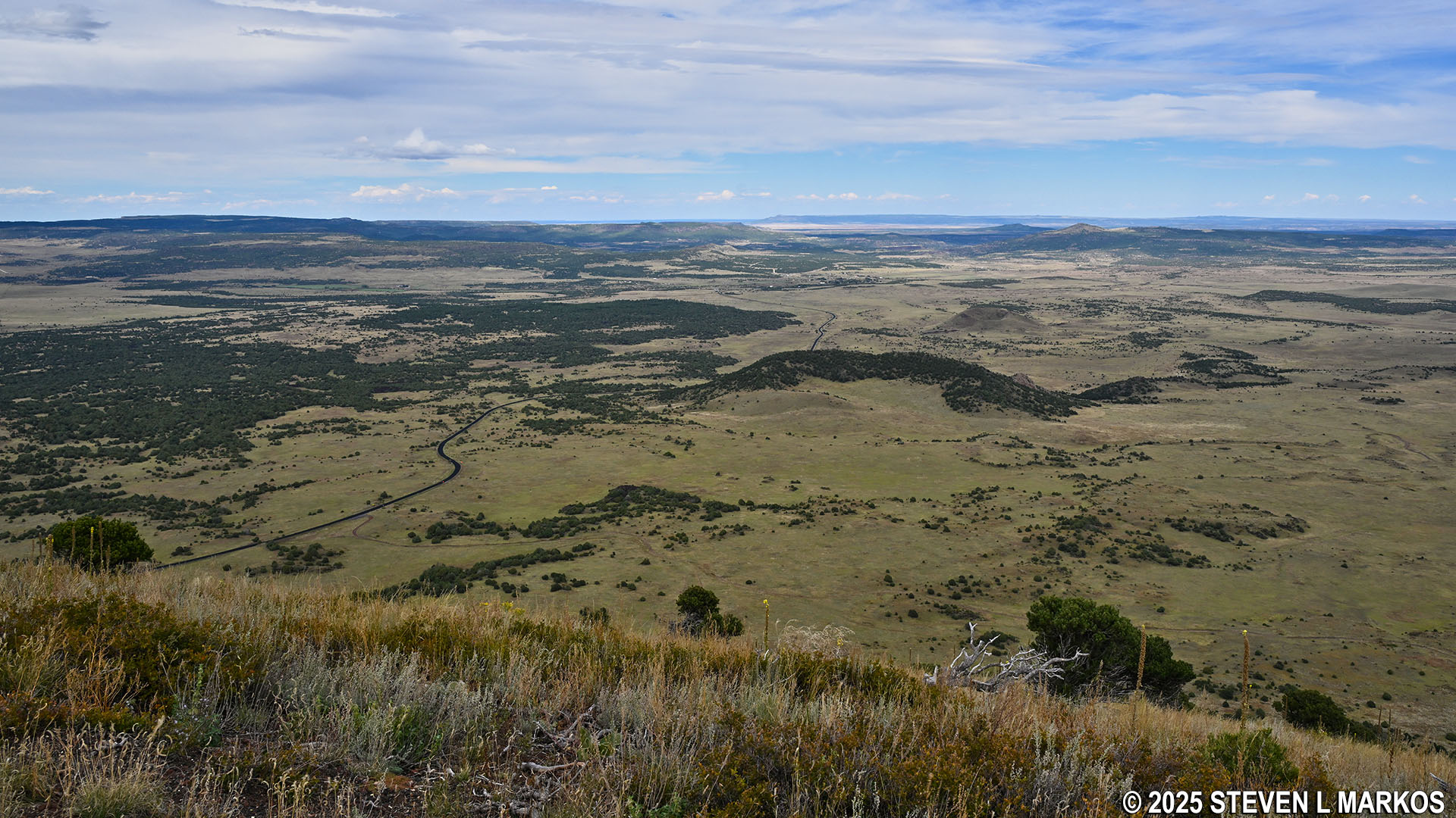
Situated around the parking lot are four wayside exhibits with information about the crater’s formation and the surrounding landscape. The view from here is of the Raton-Clayton Volcanic Field, an area in northeastern New Mexico that features over 100 cinder cones, domes, and other volcanic formations.
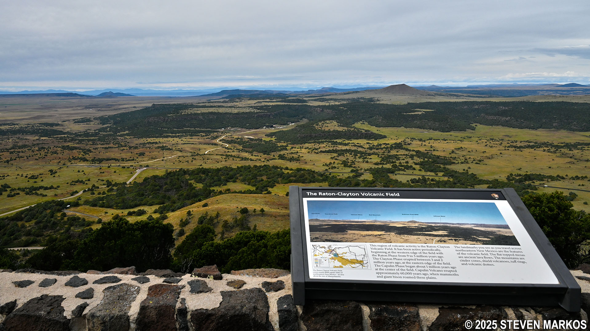
Westward view of the Raton-Clayton Volcanic Field from the Crater Rim Trail parking lot, Capulin Volcano National Monument
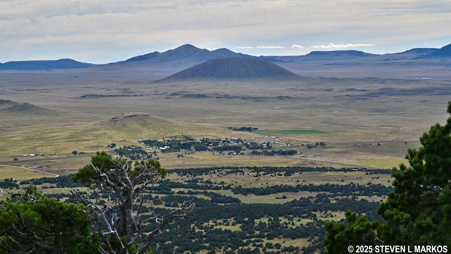
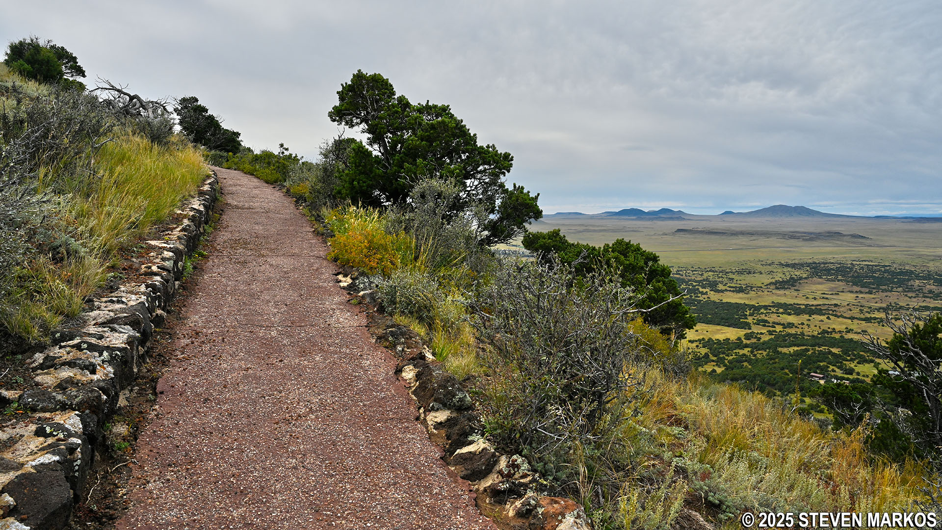
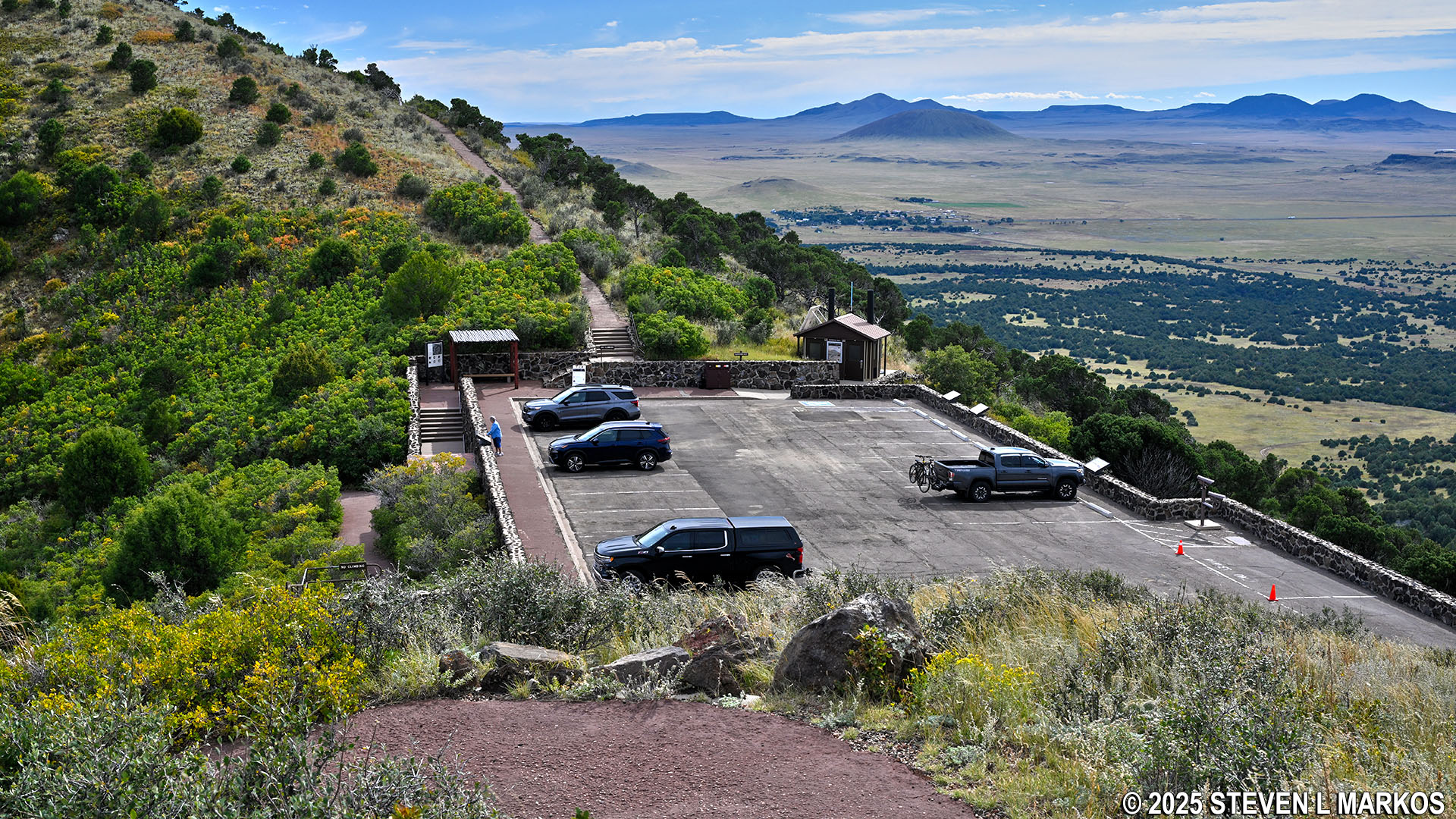
Westward view of the Raton-Clayton Volcanic Field and the town of Capulin, New Mexico, from the crater rim of Capulin Volcano, Capulin Volcano National Monument
Being a loop, you can go around the Crater Rim Trail in either direction. The most obvious starting point, and where most people begin, is at the stairs near the restrooms. This sets you off hiking uphill and in the counterclockwise direction. This is the way I hiked the trail, and this report is written from that perspective.
Stairs leading to the Crater Rim Trail at Capulin Volcano National Monument
Just because the Crater Rim Trail is a paved path doesn’t mean it’s easy. It scales two peaks along the rim, with the second being about 50 feet higher than the first. Overall it is an elevation change of about 275 feet from the parking lot to the summit of Capulin Volcano.
Two peaks on the rim of Capulin Volcano, Capulin Volcano National Monument
The Crater Rim Trail starts off with a steep, .3-mile climb to the top of the first peak. This hill has an average grade of 14%, which borders on strenuous hiking (most hikers agree 15% is where strenuous begins). There are even some short segments with average grades as high as 30%. Luckily there are multiple benches placed along the trail for those who may need them.
Steep terrain on the Crater Rim Trail at Capulin Volcano National Monument
Bench along the Crater Rim Trail at Capulin Volcano National Monument
When you get to the top of the hill, don’t think that things are going to get easier. After a 100-yard descent down a moderate hill, it is now time for the second climb to the actual summit at 8,182 feet in elevation. This is a much shorter ascent at only a tenth of a mile, but the average grade is still right around 14%.
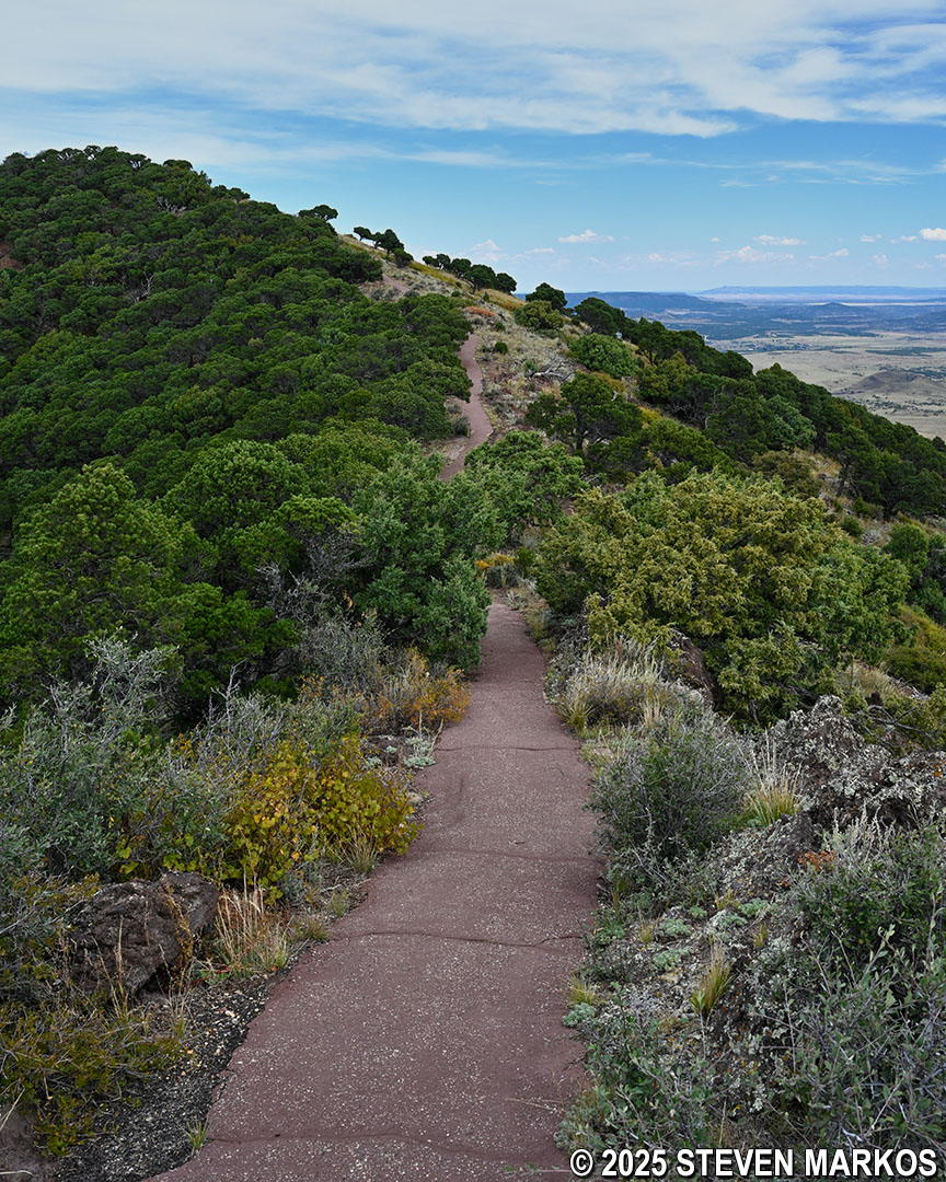
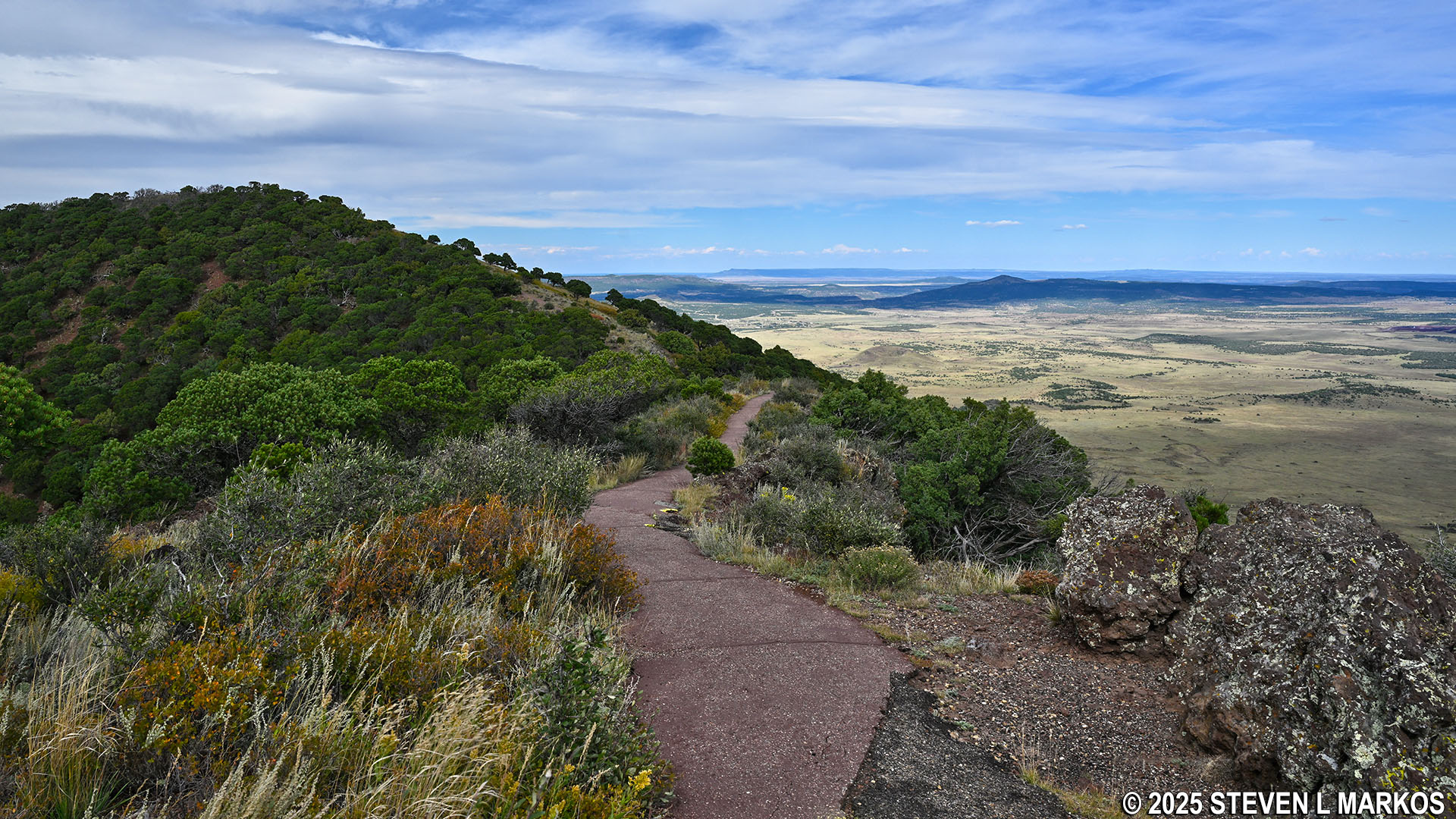
Section of the Crater Rim Trail that leads to the summit of Capulin Volcano, Capulin Volcano National Monument
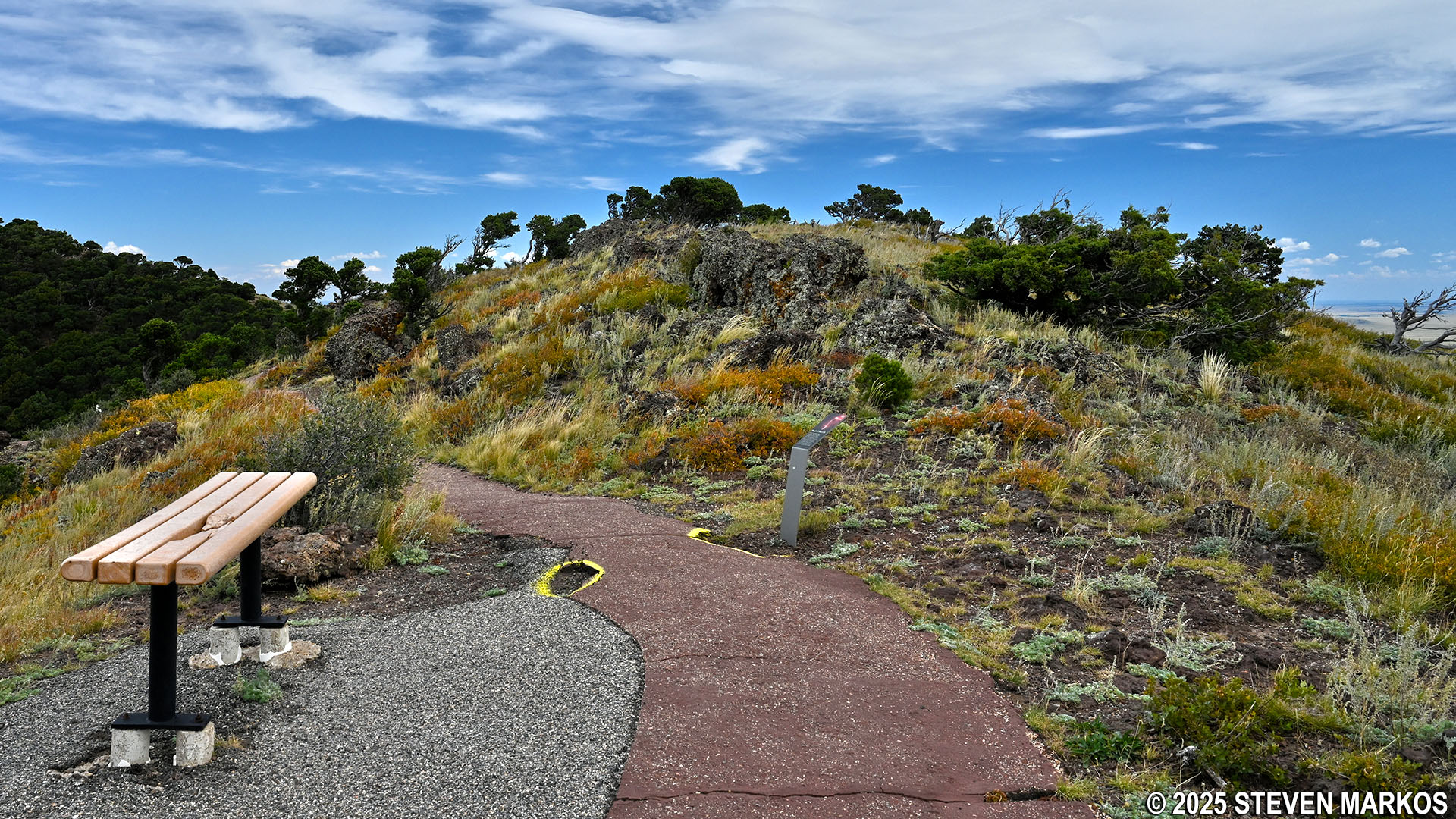
At the summit are three wayside exhibits and a few benches. Views from here are looking northeast across the Raton-Clayton Volcanic Field.
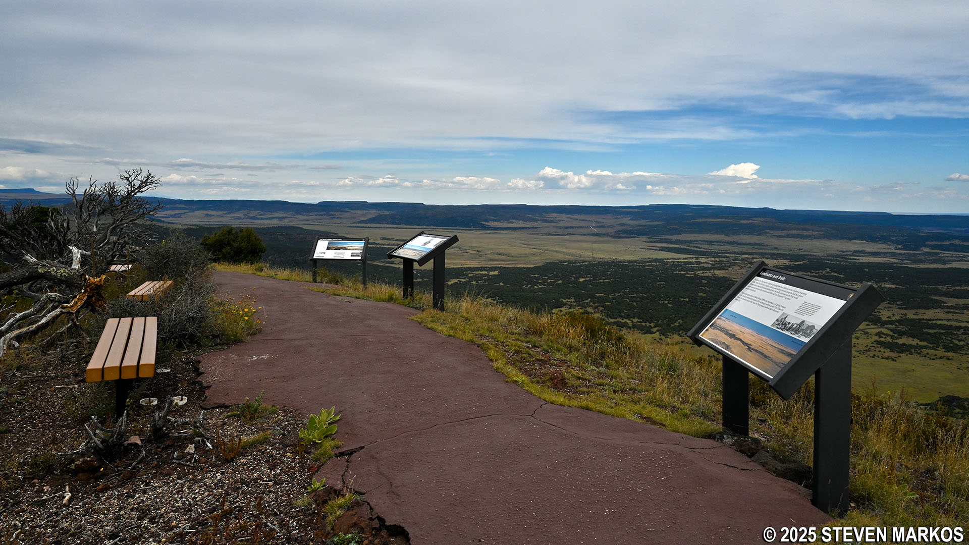
Wayside exhibits and benches at the summit of Capulin Volcano on the Crater Rim Trail, Capulin Volcano National Monument
Northeastern view of the Raton-Clayton Volcanic Field from the summit of Capulin Volcano, Capulin Volcano National Monument
From here, the rest of the hike is downhill on a slope as steep as the one you came up on. It is .4 mile to the bottom.

Crater Rim Trail heads down from the summit of Capulin Volcano, Capulin Volcano National Monument
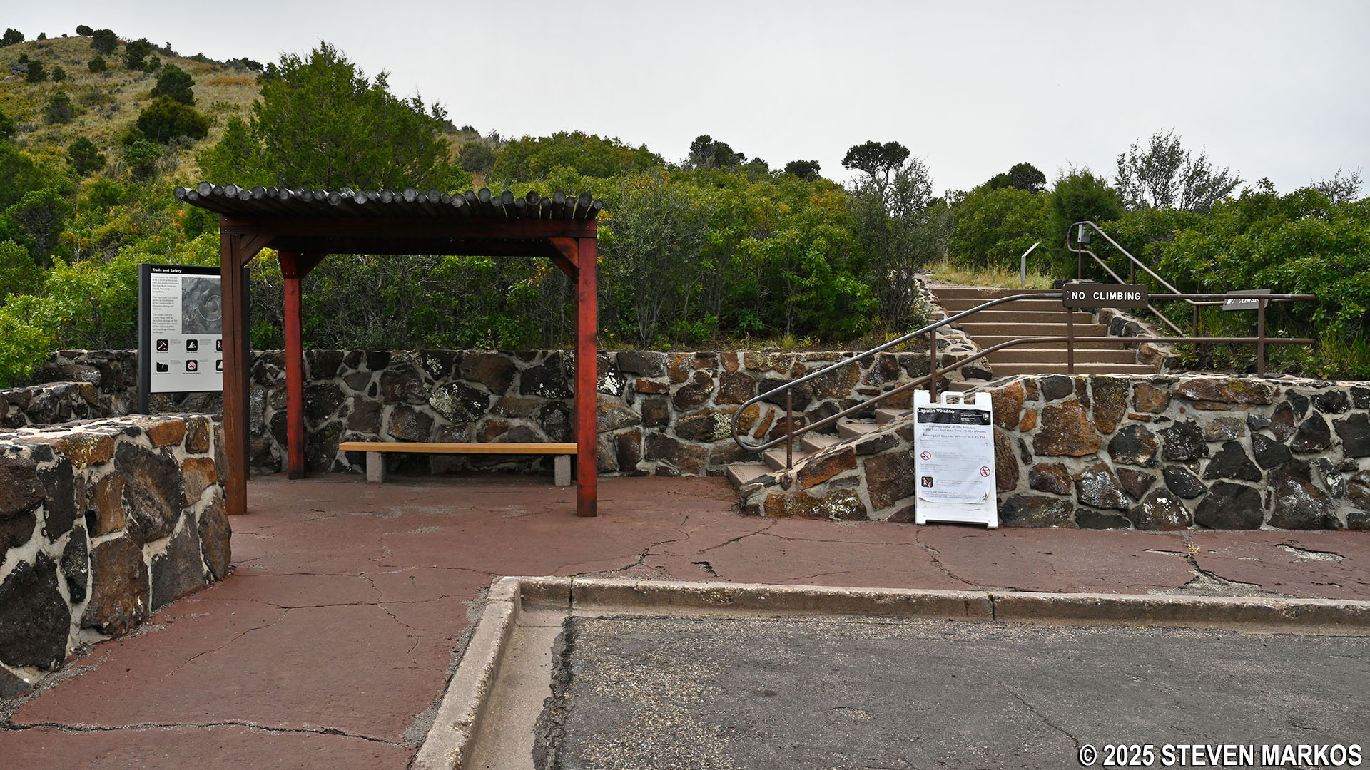
The hike ends right where the Crater Vent Trail begins. If you still have any energy, I recommend hiking this short trail to the bottom of the crater before taking the stairs back up to the parking lot.
Crater Rim Trail ends back at the parking lot, Capulin Volcano National Monument
With a few exceptions, use of any photograph on the National Park Planner website requires a paid Royalty Free Editorial Use License or Commercial Use License. See the Photo Usage page for details.
Last updated on October 30, 2025


