
Cobey Pond in Masthope, Pennsylvania
Length: 2.4-mile loop
Time: 1 hour
Difficulty: Easy with a couple of moderate hills
The Cobey Pond Trail is located on Pennsylvania Game Lands off of Masthope Plank Road in Masthope, Pennsylvania. If you use Google Maps for directions, it does not show the gravel side road that runs from Masthope Plank Road to the trailhead. It will simply tell you that “you are here” when you are still on the main road. There are no signs mentioning or pointing to the trail, but you must turn on the gravel road and drive all the way to the end to get to it. Don’t stop at the parking lots prior to the road ending at a gate—drive all the way to the end. There is parking at the gate.
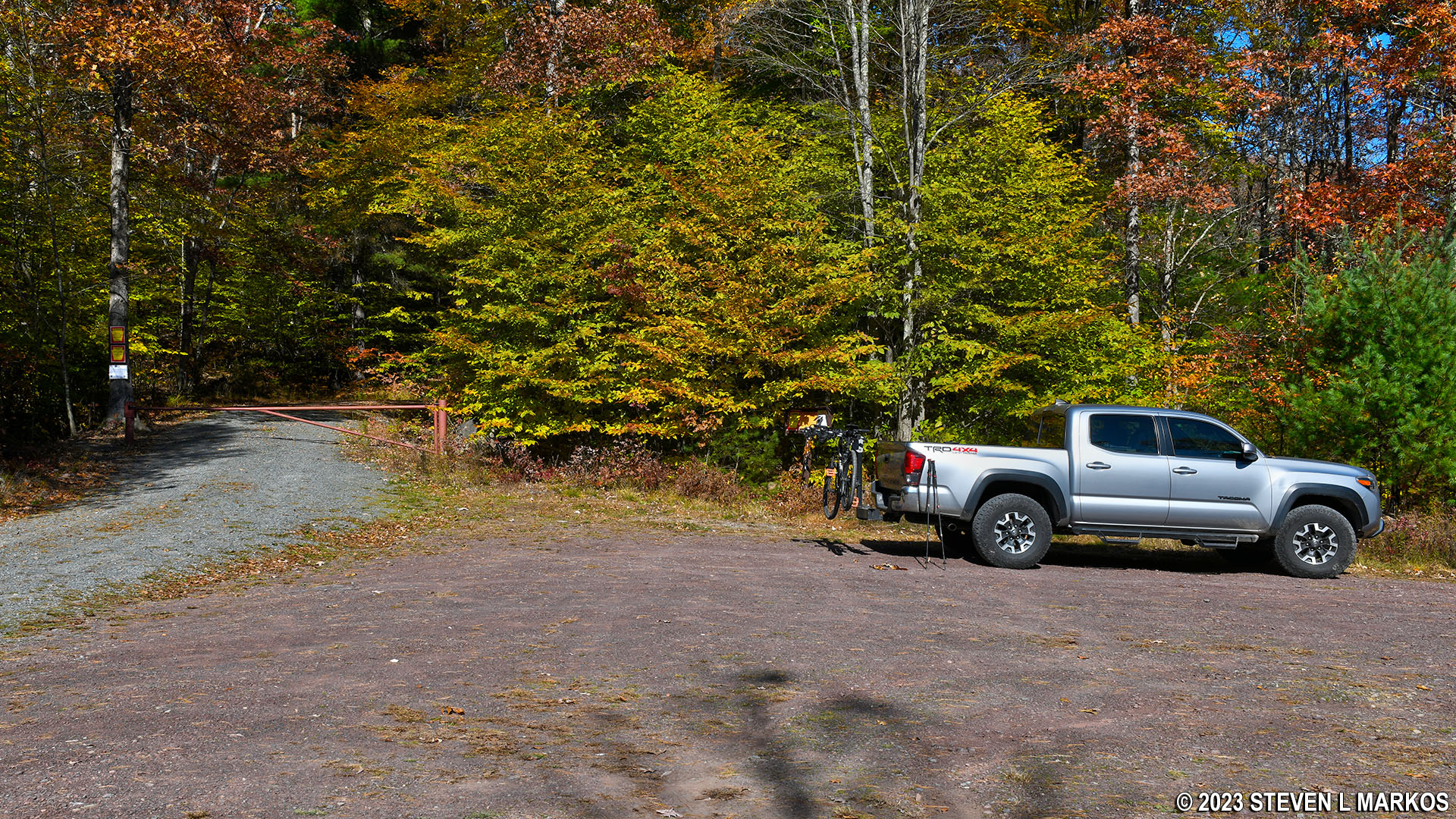
Closest parking for the Cobey Pond Trail in Masthope, Pennsylvania
I did the hike in late October when the temperature was 60° F, and the parking lot and road portion of the hike were gnat infested. This is the only time I recall encountering gnats at that low of a temperature. I’d hate to see what the place is like on a warm or hot day.
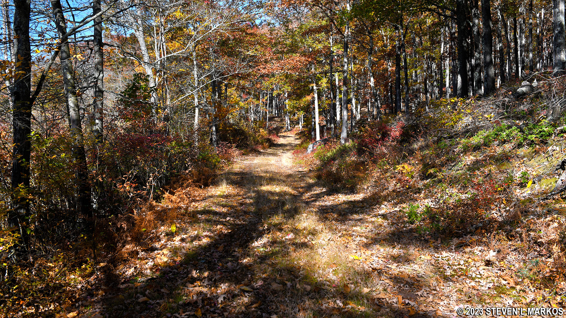
The Cobey Pond Trail is lollypop shaped, meaning you hike out on the stick portion before coming to the loop. In this case, the stick is the gravel road beyond the gate and the loop is the trail that actually circles the pond. To begin the hike, just start walking down the road for a half mile until reaching the pond. The road forks not long after starting out, and either way will get you to the pond, but stay right to come out on the south end. The hike is slightly uphill the entire way to the pond.
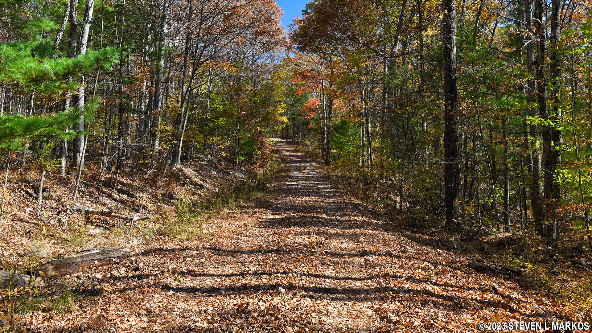
Dirt road portion of the Cobey Pond Trail from the parking lot to the pond
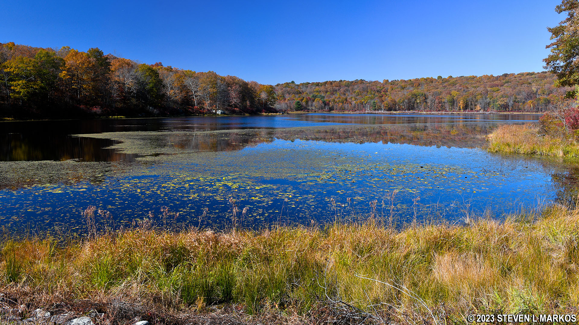
Once at the pond, you can hike around in either direction. I went counterclockwise, starting off over the dam that created the pond. This is the only place on the trail where you can get a really clear view of the water, so if photos are what you are after, this is the best spot to take them (assuming the sun is behind you).

Dirt road portion of the Cobey Pond Trail ends at the pond

Cobey Pond Dam
Panoramic view of Cobey Pond from the southern end of the Cobey Pond Trail (click to enlarge)
At the end of the dam, the road continues straight to destinations unknown, but you’ll obviously want to turn left and continue following the shoreline. This part of the trail is also a former road (in fact, the entire trail around the pond is a road). The terrain is relatively flat and the trail surface is smooth. There is another side trail / road at the northeast corner of the pond about .4 mile from the turnoff from the dam, but just stick to the trail that follows the shore.
Cobey Pond Trail along the eastern shore of the pond
As you travel along the east side of the pond, you are only fifty feet from the water. However, thick brush lies between the trail and pond, so you can’t get a good look at or photo of Cobey Pond from this side.
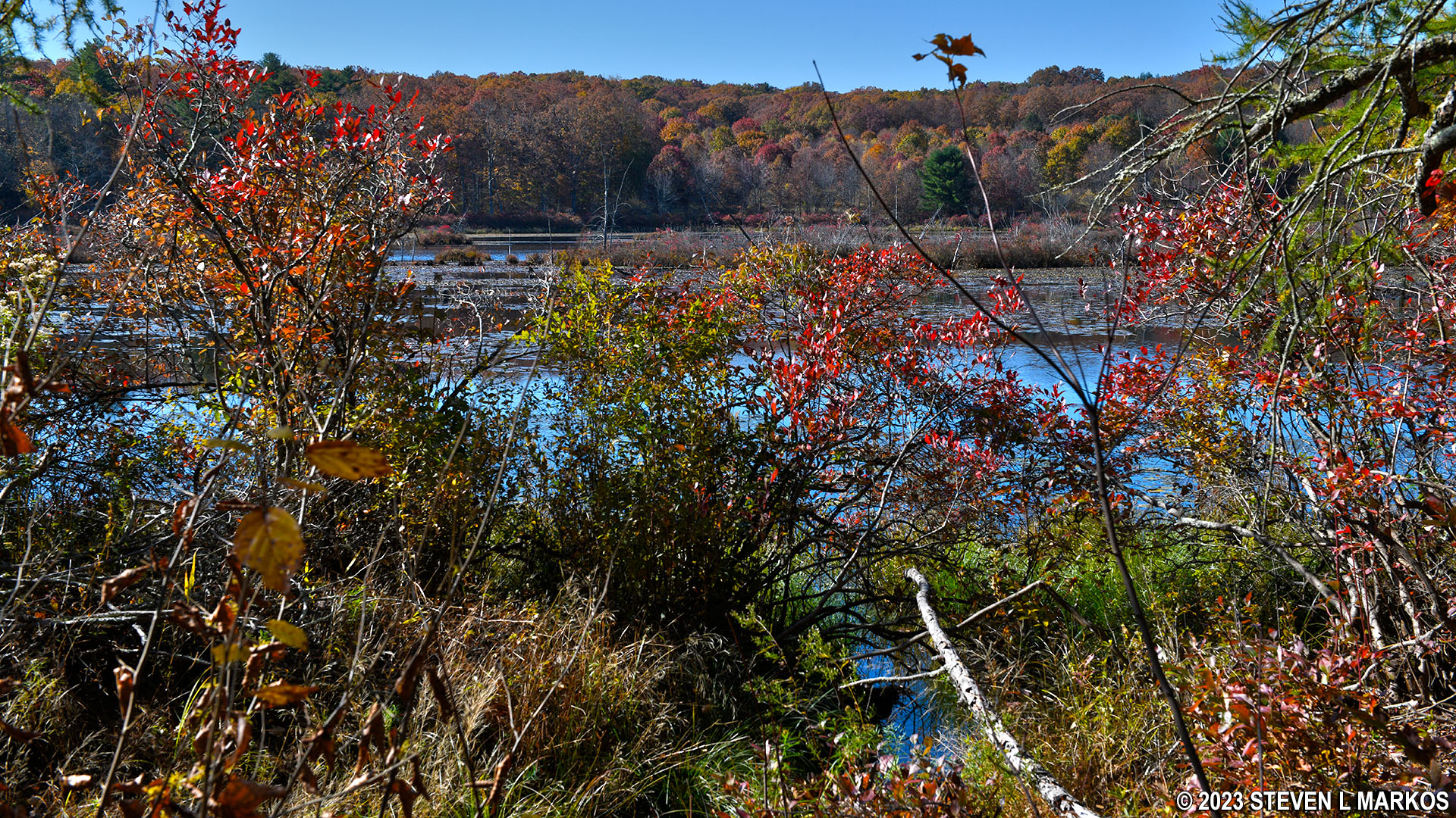
Vegetation blocks the view of Cobey Pond on the east side of the Cobey Pond Trail
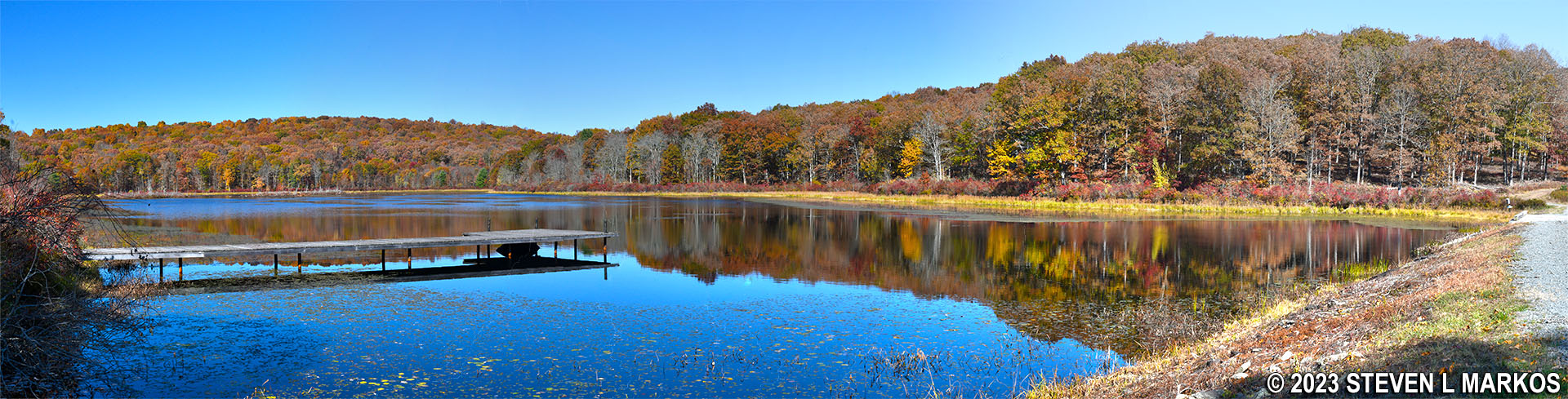
After a mile of hiking, you will be at the north end of the pond. There is not as much vegetation, and you can get nice photos from here. This area is out in the open, so if avoiding the sun is important to you, be sure to wear a hat and apply sunscreen.

View of Cobey Pond from the northern end of the Cobey Pond Trail
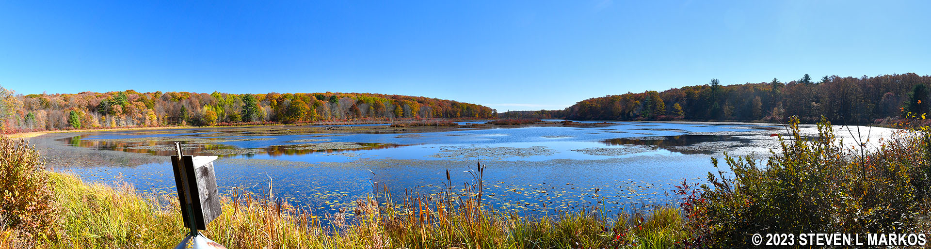
Panoramic view of Cobey Pond from the northern end of the Cobey Pond Trail (click to enlarge)
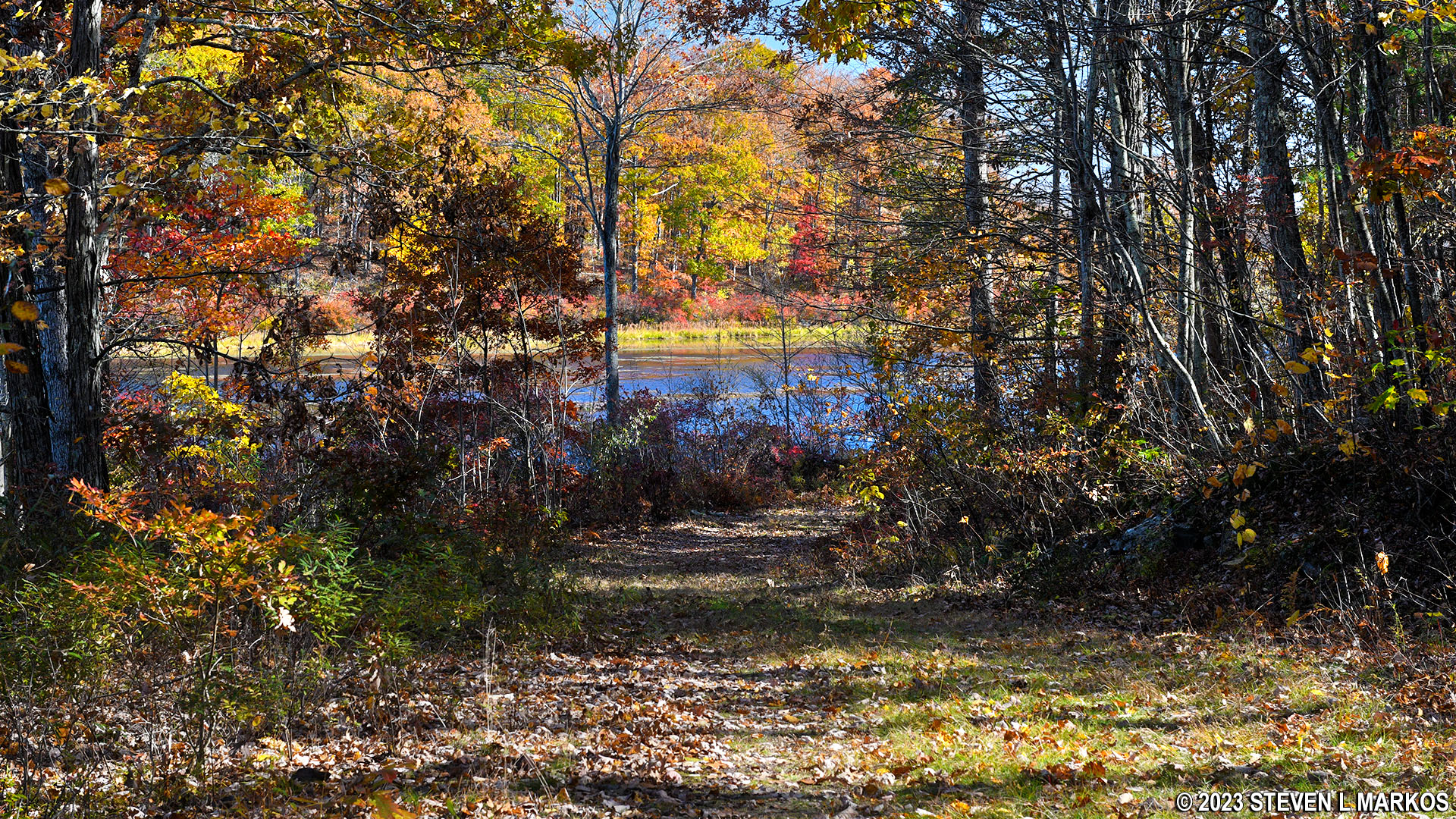
Once you get around to the west side of the pond, there is a fork to the right. If you recall the fork when you first started hiking along the dirt road from the parking lot, well this is what you would have been walking on if you took a left at that fork. In fact, this is the official Cobey Pond Trail, but who wants to walk back on the road far from the pond when you can walk right along side it? Not me. My suggestion is to forget the official route and just stick to the trail next to the pond. There is a second intersection with the road just a short distance beyond the first (the two form a triangle) just in case you change your mind.

Cobey Pond Trail on the west side of the pond
Just continue around the pond until you get back to where you started, and from there hike back to your vehicle on the stick portion of the trail, the old road. As on the east side, there are very few clear views of the pond due to the vegetation.
Near the end of the loop portion of the Cobey Pond Trail
The National Park Service brochure states that the Cobey Pond Trail is 3 miles long, but that’s if you take the road back instead of sticking to the pond. The hike around the pond along with the walk to and from the parking lot is 2.4 miles.
With a few exceptions, use of any photograph on the National Park Planner website requires a paid Royalty Free Editorial Use License or Commercial Use License. See the Photo Usage page for details.
Last updated on August 20, 2023


