
BOWMANS ISLAND DIRECTIONS
The Bowmans Island Unit of Chattahoochee River National Recreation Area is divided into a western and eastern section by the river. All trails, picnic areas, and boat ramps are located in the western section. The western section is further divided into a northern and southern section.
The eastern section allows easy access to a fishing bridge, but you can also get to the bridge from the western section along a short trail. Therefore, there is no pressing reason to park here.
WEST SIDE PARKING AREAS
There are distinct loop trails at both the north and south ends of the western section of Bowmans Island, so park accordingly. The two loops are connected, so it is possible to hike the entire west side without having to make two separate trips as long as you don’t mind a 5-mile hike. If that’s your plan, then I suggest using the Lower Pool parking lot.
Lower Pool West Park (north end)
Lower Pool West Park is at the northern end of Bowmans Island, and it is accessed via Lower Pool Road. If you are traveling east from Cumming along Buford Dam Road, Lower Pool is the first road to the right just before you start crossing the dam. The road and the parking lot are owned by the U. S. Army Corps of Engineers, but annual National Park and Chattahoochee River National Recreation Area passes are valid for entry. If you don’t have a pass, you must pay the standard entrance fee, which is currently $8. Payment is made at the manned entrance station.
To get to the trails, when driving down Lower Pool Road, look for a parking lot on the right side of the road. If you get to the end where the boat ramp and picnic area are, you’ve gone too far.
Trout Place Road (south end)
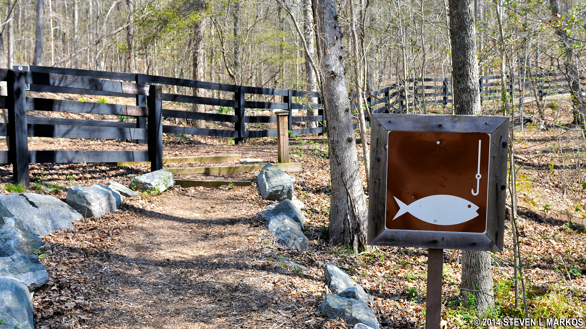
Trout Place Road is located off of River Club Drive in Cumming, Georgia. This road leads through a residential area comprised of many high-dollar subdivisions. However, Trout Place Road is owned by the Department of Natural Resources, which runs the Buford Trout Hatchery located at the end of the road. There is a Bowmans Island Unit trail entrance on Trout Place Road, and shoulder parking is allowed along much of its length (signs denote the beginning and ending of the authorized parking zone). A brown sign with a fish and hook on it marks the trailhead. This is next to a private-residence driveway, and it is easy to get confused as to which is which. Stay off the driveway and walk down the dirt path that runs just to the right of it. A fence separates the two.
Unless gold is discovered within the park, I can’t imagine all the parking spaces along the road being taken, but if so, you can also park at the trout hatchery. The hatchery is gated, and all cars must be out by 4:30 PM during the week and 3 PM on weekends or they will be locked in for the night (it opens at 8 AM during the week and 10 AM on weekends). For those who are interested, you can do a self-guided tour of the hatchery.
Trailhead on Trout Place Road for the Bowmans Island Unit of the Chattahoochee River National Recreation Area
EAST SIDE PARKING AREAS
Upper Pool
The Upper Pool parking lot is at the end of Powerhouse Road. If you are traveling east along Buford Dam Road from Cumming, it’s the first road on the right after you cross over the dam. As with the Lower Pool area, this is U. S. Army Corps of Engineers property. However, do not bother to park here unless you want to go fishing (there is a nice fishing bridge). There are no maintained trails or other amenities on the east side of the Bowmans Island Unit.

Fishing Bridge at Upper Pool in the Bowmans Island Unit of the Chattahoochee River National Recreation Area
With a few exceptions, use of any photograph on the National Park Planner website requires a paid Royalty Free Editorial Use License or Commercial Use License. See the Photo Usage page for details.
Last updated on May 5, 2024


