

De Soto National Memorial Map (click to enlarge)
Length: .6 mile (short loop) or 1.25 miles (long loop)
Time: 30 minutes (short loop) or 1 hour (long loop)
Difficulty: Easy
The De Soto Expedition Trail is a .6-mile loop that takes you out to De Soto Point before heading back to the start at the De Soto National Memorial Visitor Center. This is also known as the Nature Trail or the Memorial Trail, depending on what brochure you are reading. The entire trail is flat and comprised of both a finely crushed gravel and a wooden boardwalk, so those in wheelchairs can easily make it around.
A second loop hike is a longer version of the Expedition Trail and covers 95% of this trail in the process. Instead of heading back to the Visitor Center it turns south and proceeds out of the park and into Riverview Pointe Preserve, then returns to the park via 75th Street. Though Riverview Pointe is owned by Manatee County, since being purchased in 2000 it has been run jointly with the National Park Service. Signs you see along the way are stamped with the NPS logo. I highly recommend this route because it follows more of the Manatee River shoreline and passes two monuments. What’s more, it is barely over a mile long. My trail report is of this longer hike.
Regardless of the route you take, the hike starts off near the Visitor Center.
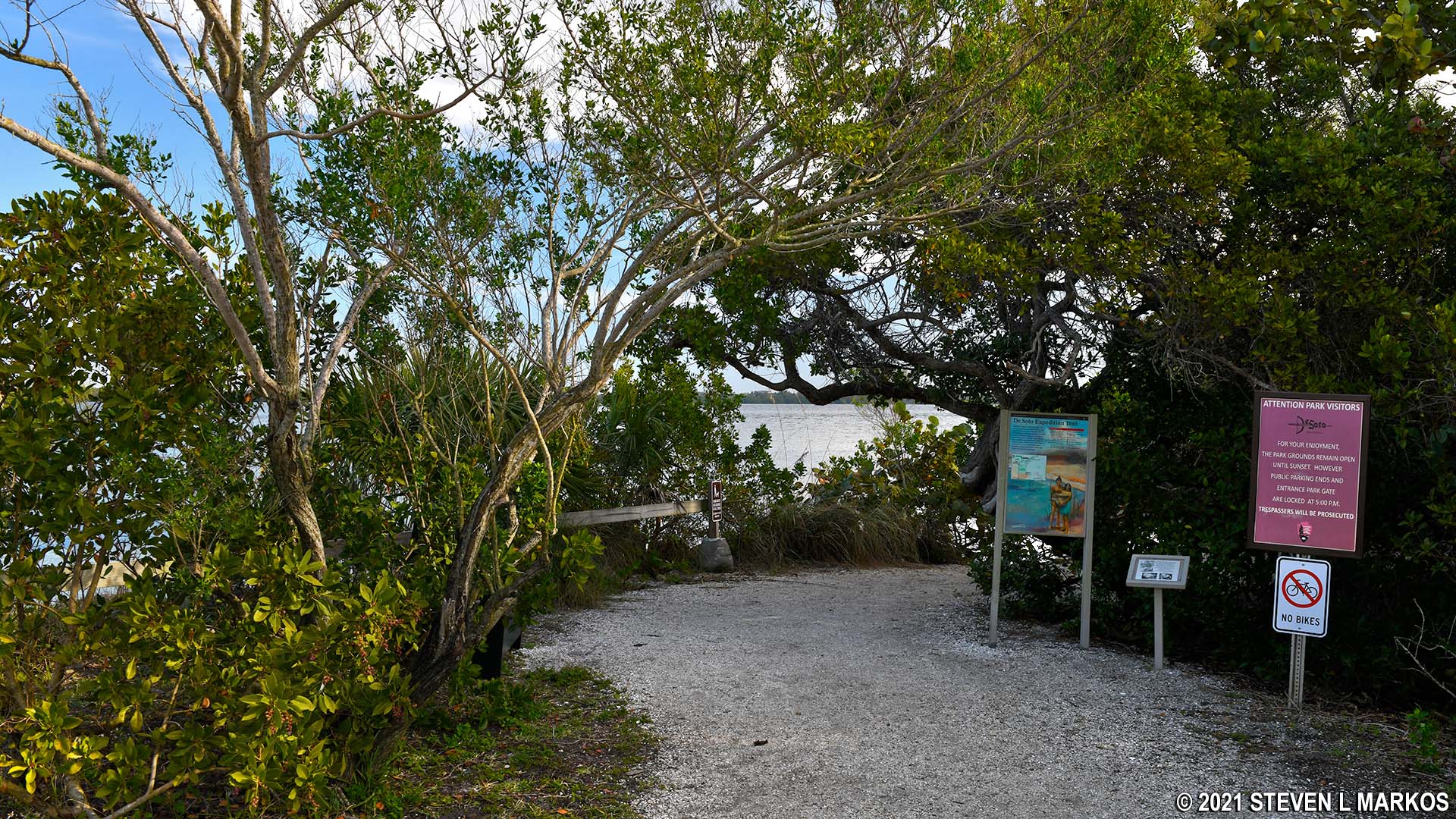
Start of the De Soto Expedition Trail at De Soto National Memorial
Once you depart, you will be on the gravel trail for about a tenth of a mile, all the while walking through a mangrove forest. Information panels and life-size cutouts of Spanish conquistadors and local Indians can be found along the way.
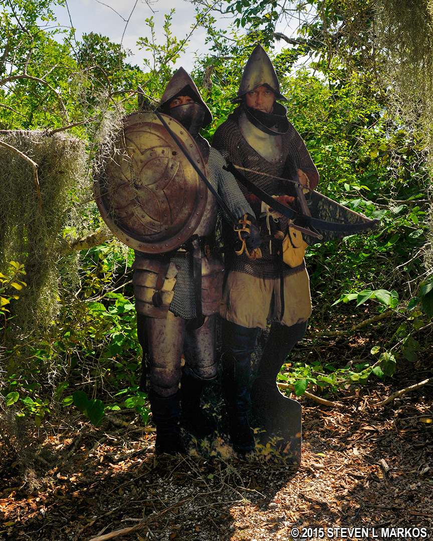
Conquistadors cutouts along the Expedition Trail at De Soto National Memorial
At .1 mile from the start the trail splits, with a boardwalk leading to the left and the gravel trail continuing straight ahead. This is the start of the loop, and you can go either way, but the trail was meant to be hiked in a clockwise direction starting out on the boardwalk. If you plan to hike the longer loop, you definitely need to head this way, so take a left onto the boardwalk.

Start of the boardwalk portion of the Expedition Trail at De Soto National Memorial
The boardwalk continues through the mangrove forest and after about five minutes comes to the ruins of the Tabby House. This has nothing to do with De Soto, for it was built around 1840 by William Shaw, a man who lived here with his family in a 16′ x 16′ home before moving in 1855 when trouble with the Seminole Indians erupted and made the area unsafe. The house was built with tabby blocks, which is a concrete like construction material made of crushed sea shells, sand, and water. The shells are obvious upon close inspection, while from afar the blocks look similar to ordinary concrete blocks. When Shaw moved, he took the tabby blocks that he could carry, leaving behind the larger and heavier ones. These are on display today. There is an information panel at the site.
Tabby House ruins along the De Soto Expedition Trail at De Soto National Memorial
The boardwalk ends not too far from the Tabby House, and from there you are back on the gravel trail. Benches are located at various places on the trail for those who want to sit and perhaps look out over the Manatee River.
End of the boardwalk on the De Soto Expedition Trail at De Soto National Memorial
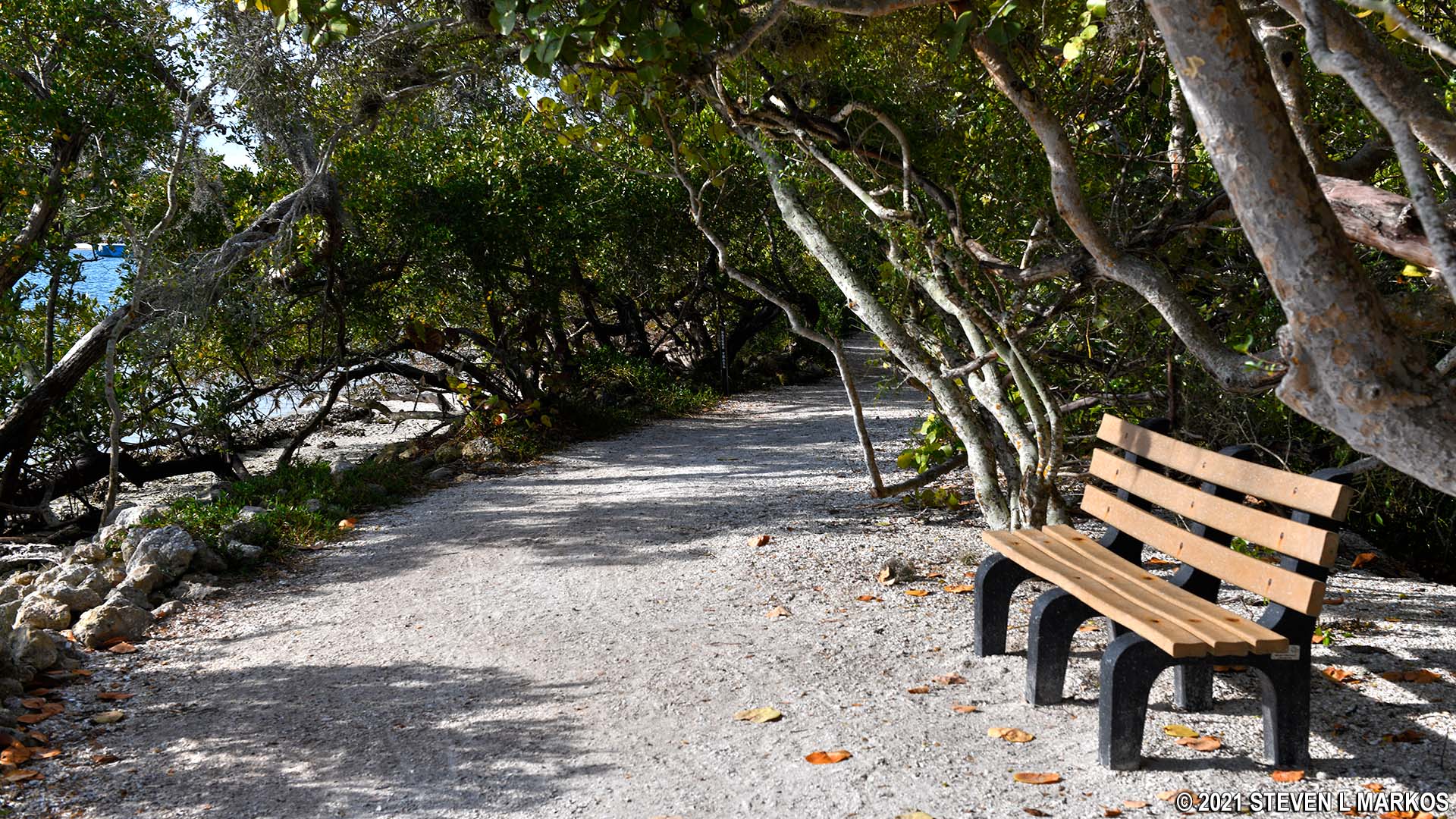
Bench along the De Soto Expedition Trail at De Soto National Memorial
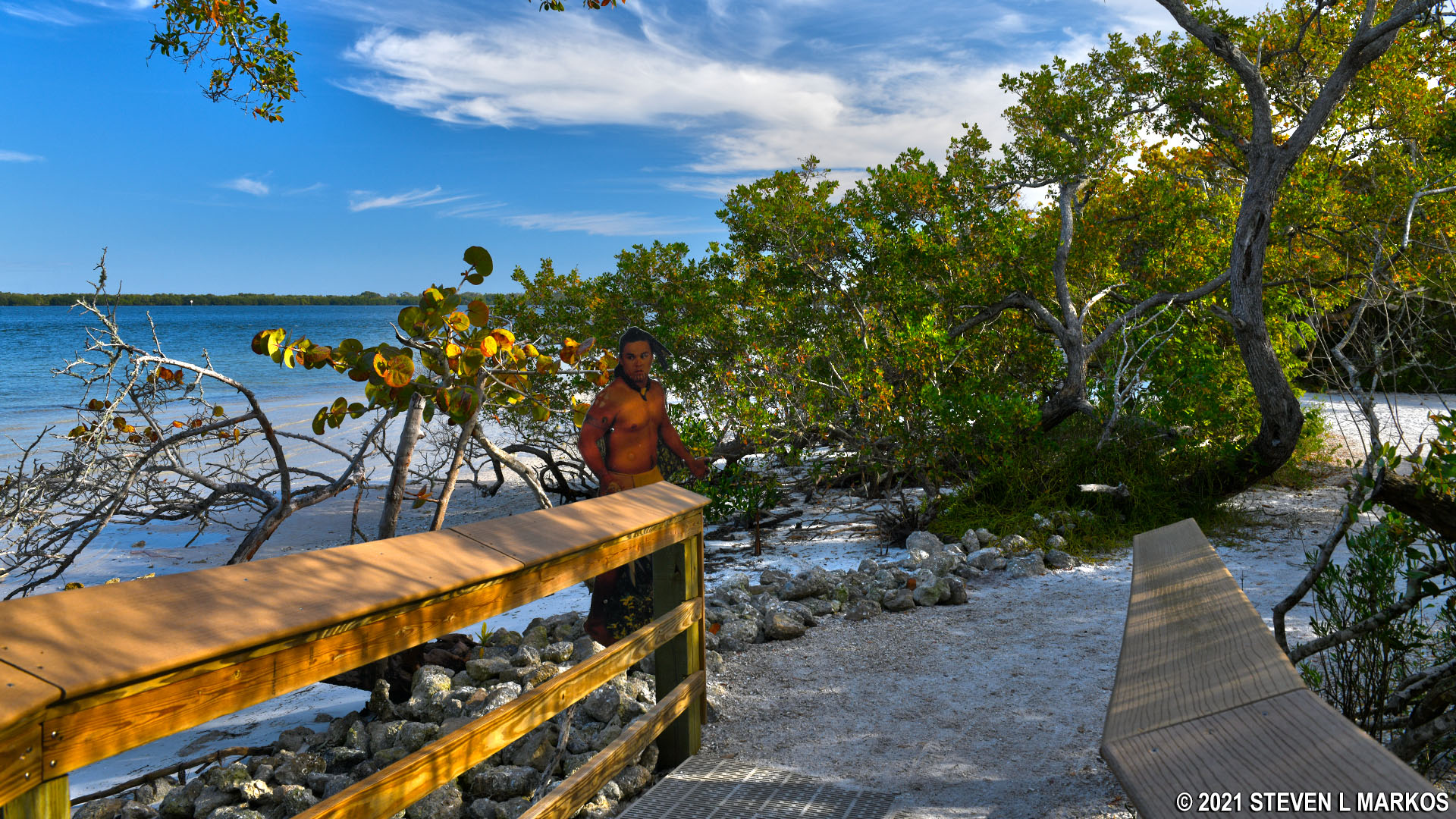
A little farther up the trail is De Soto Point, which is a quarter mile from the start and is marked with an information panel. Here you have a clear view of the Manatee River and Tampa Bay and are free to swim at your own risk. I didn’t see any swimmers, but there were plenty of fishermen out in the water. Fishing from park property with a rod and reel is allowed as well. You may also see herons and other water birds.

De Soto Point at De Soto National Memorial in Florida
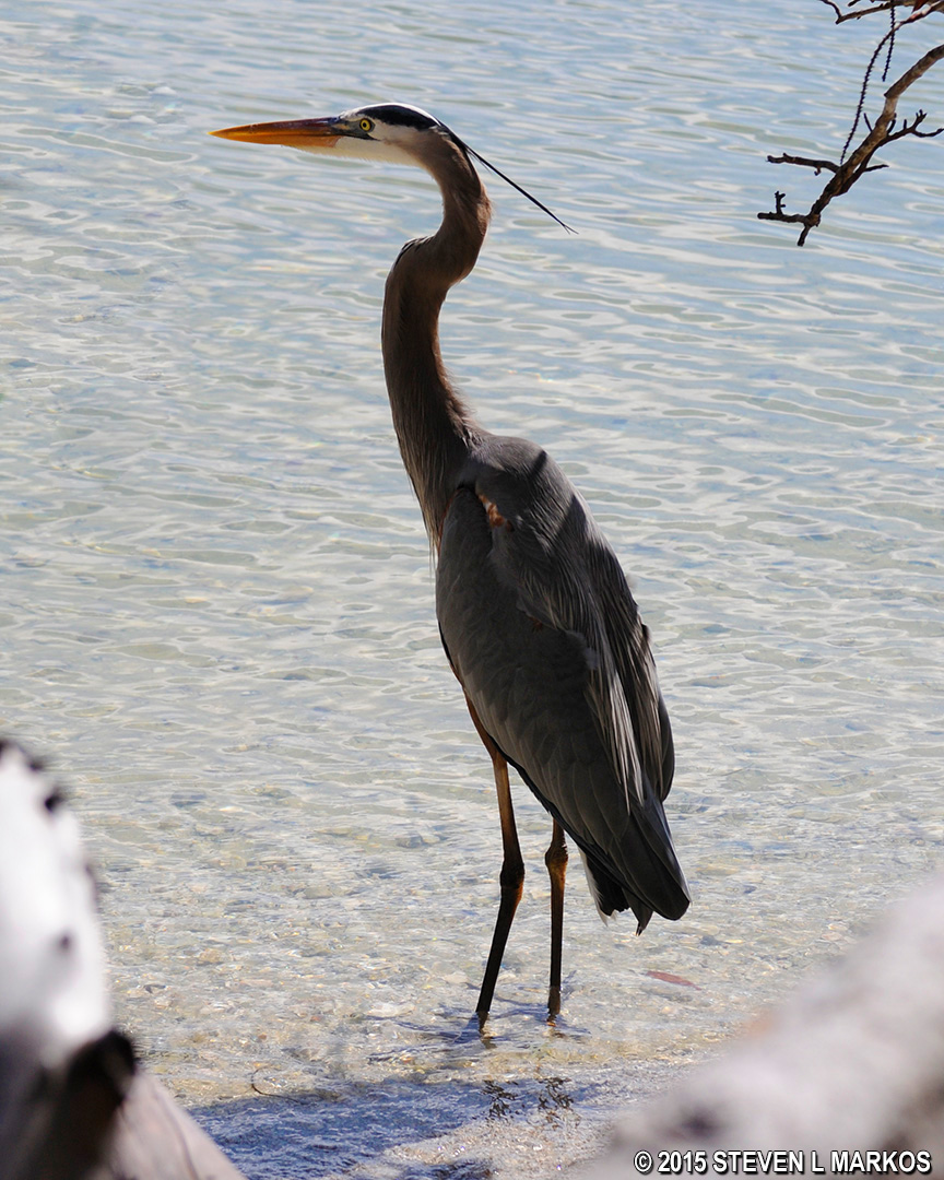
Heron wading in the Manatee River at De Soto National Memorial
About four-tenths of a mile into the hike is a T-intersection marked by a cutout conquistador and a sign about picking up your dog’s poop. To the left is a short path that leads to the river. There is a bench and picnic table for those who want to relax and take in the view. Take this left if you are hiking the long loop. If you plan to take the short loop and head back to the Visitor Center, turn to the right. Again, my hike follows the longer loop, but at this point you will have covered 95 percent of the De Soto Expedition Trail. All that remains is the short jaunt back to the Visitor Center.
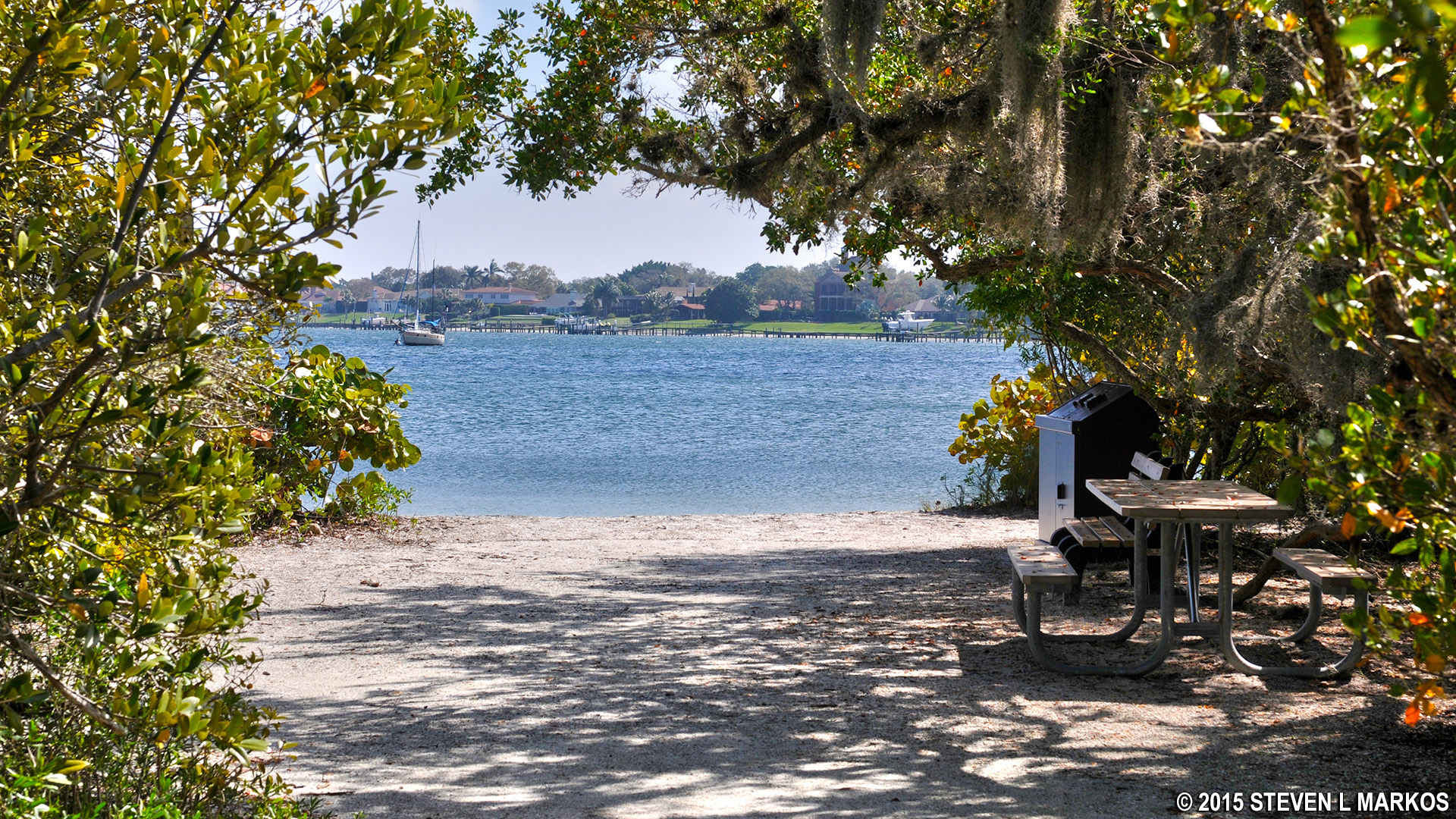
Path from the Expedition Trail to the Manatee River at De Soto National Memorial
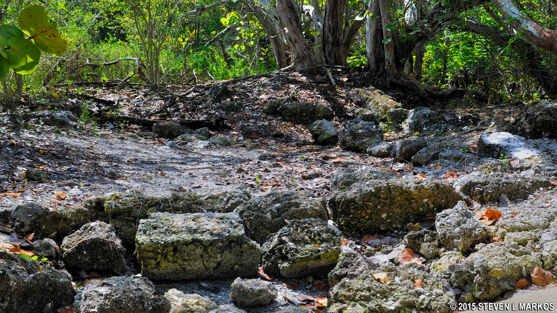
When turning left and walking towards the river, look for a trail on your right—this is the trail that heads south to Riverview Pointe. As mentioned earlier, this is the recommended route because you will have many access points to the beaches along the river and will pass two monuments. In addition, there is a short spur trail that overlooks what is known as a “shell midden.” These are basically garbage dumps of the Indians who lived here as long as 2,000 years before De Soto arrived. Their diets consisted mainly of shell fish, and when done eating they would simply toss the empty shells onto a refuse pile. The piles got so large they actually formed sizable hills. There aren’t many left intact because during modern times the shells were used for creating tabby and for land fill when constructing roads. I have seen some large mounds at other parks, but in most cases, the middens must be pointed out for the average person to recognize them because today most are just flat areas with some shells on the ground. This is the case here at De Soto National Memorial.

Indian shell midden along the De Soto Expedition Trail at De Soto National Memorial
Just a couple minutes past the shell midden exhibit you exit the National Park property and enter into Riverview Pointe. Here you will find two monuments erected by the Catholic Diocese of Venice (Florida). The Holy Eucharist Monument has been here since the 1960s, while the Memorial Cross was erected in 1995. Nice photos can be taken of both if you walk out to the beach area. For more information, see the Monuments web page here on National Park Planner.
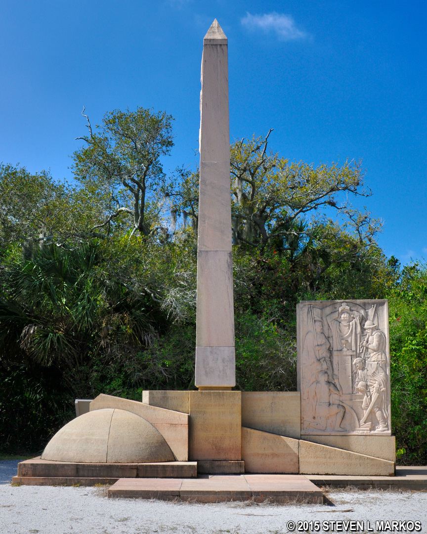
Holy Eucharist Monument at Riverview Point in Bradenton, Florida
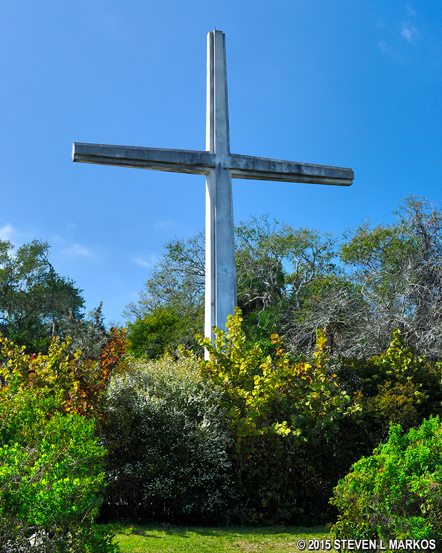
Memorial Cross at Riverview Point in Bradenton, Florida
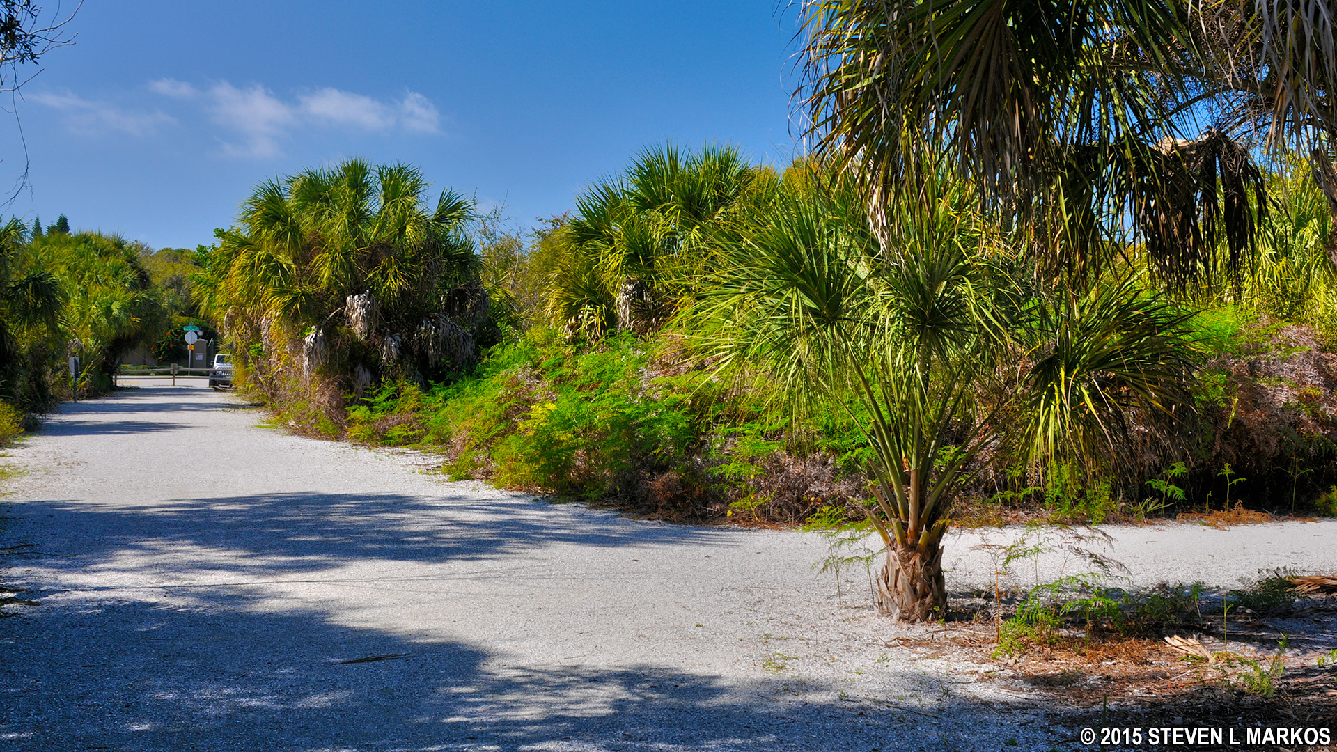
With the beach to your back when viewing the Memorial Cross, the main trail continues to your left. However, you may notice a trail that starts behind the cross. All this does is form a loop that ventures into the woods before coming out a little farther down on the main trail. (See the trail map at the top of this page). Those who stay on the main trail will pass the intersection with this trail shortly after going around a large, right-hand curve. I continued on the main trail, but you can choose either path. If you take the trail behind the cross, when you come to the main trail take a right. If your eyes are good, in the far distance you can see the Riverview Pointe parking lot on 75th Street.

Southbound trail through Riverview Pointe in Bradenton, Florida
Just before reaching the parking lot is another unmarked intersection with a trail to your right. I kept straight because at the time I had no idea where this trail led. If you continue to the parking lot you must turn right and walk back to De Soto National Memorial via 75th Street. The trail to the right is a short-cut that passes through the forest and comes out on 75th Street about 200 yards up from the parking lot. If I had to do it again, I would take this trail because a walk through nature is more pleasurable than a walk along a street, but in the overall scheme of things it doesn’t make much difference since you eventually come out at the same place.
Straight leads to the parking lot, while a right continues through the woods
Once on the main road, take a right to return to the park, which is about a quarter mile away. You’ll be back in less than ten minutes.
Road back to De Soto National Memorial
The De Soto Expedition Trail is definitely worth your time and effort, especially considering that it is one of only three main activities at De Soto National Memorial (the Visitor Center and Camp Uzita being the other two). You get plenty of opportunities to see the beaches and the Manatee River, and there are many information panels along the way that educate you about De Soto’s 1539 expedition. With time to see the sights and read the info, the 1.25-mile long hike takes about one hour, though if you are out for the exercise only, fast walkers can make it around in as little as 20 minutes.
With a few exceptions, use of any photograph on the National Park Planner website requires a paid Royalty Free Editorial Use License or Commercial Use License. See the Photo Usage page for details.
Last updated on February 16, 2021


