
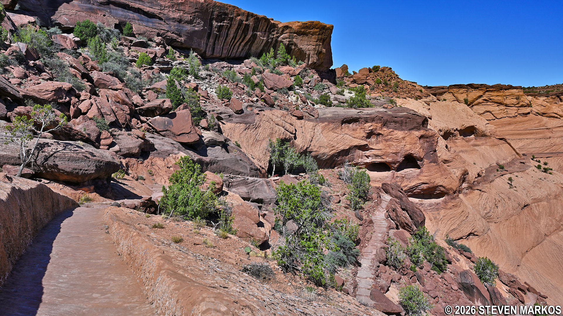
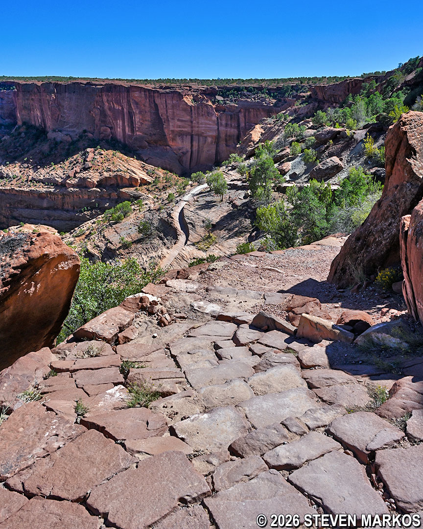
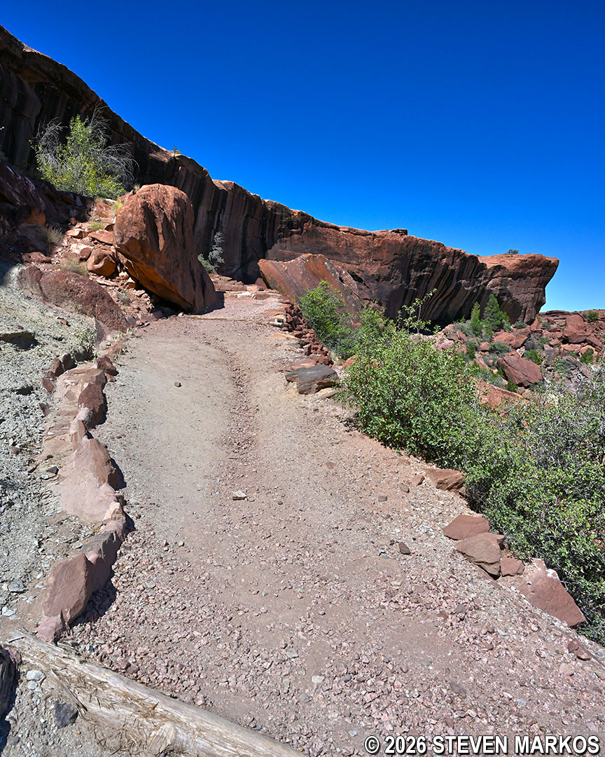
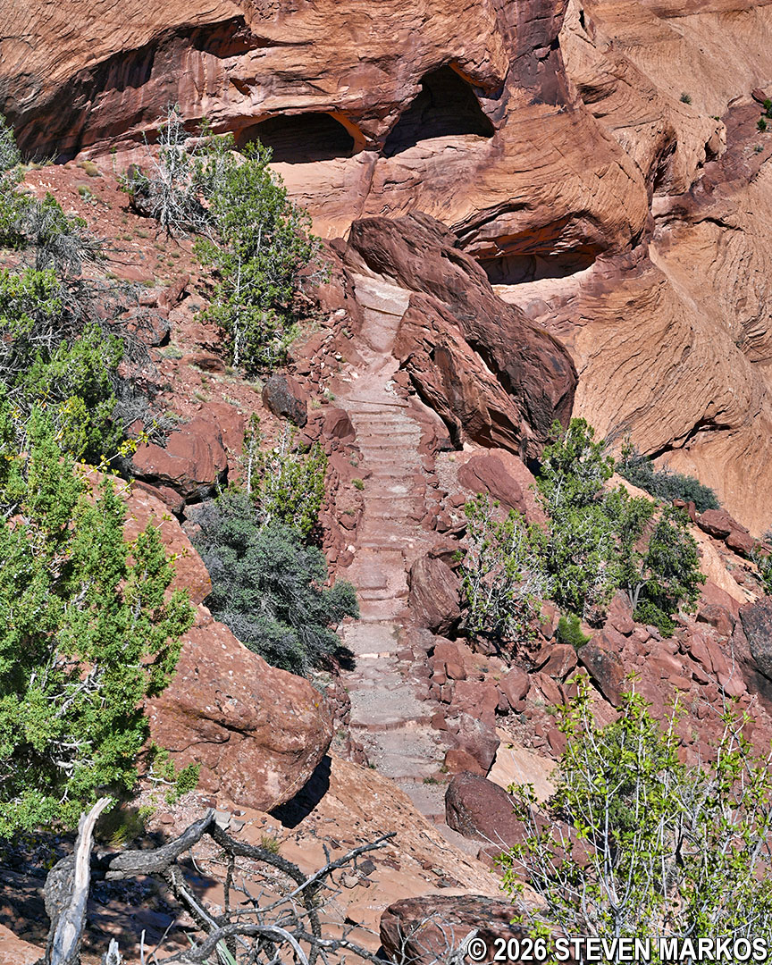
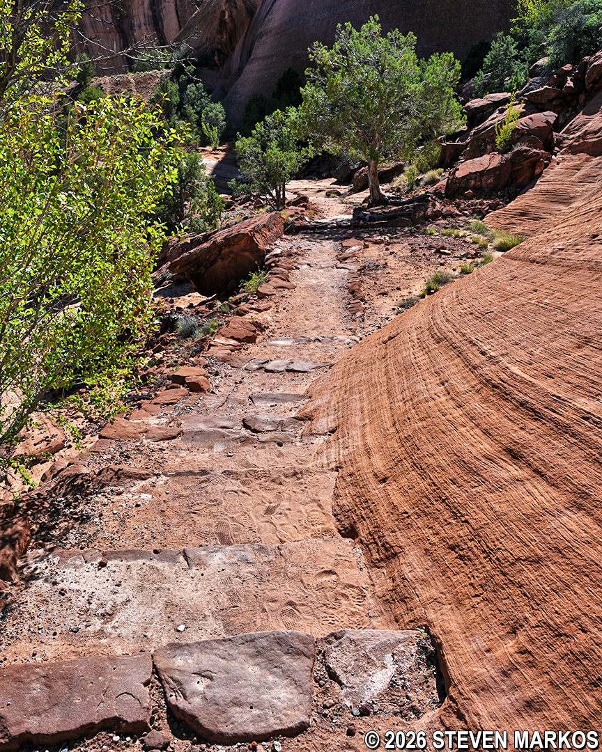
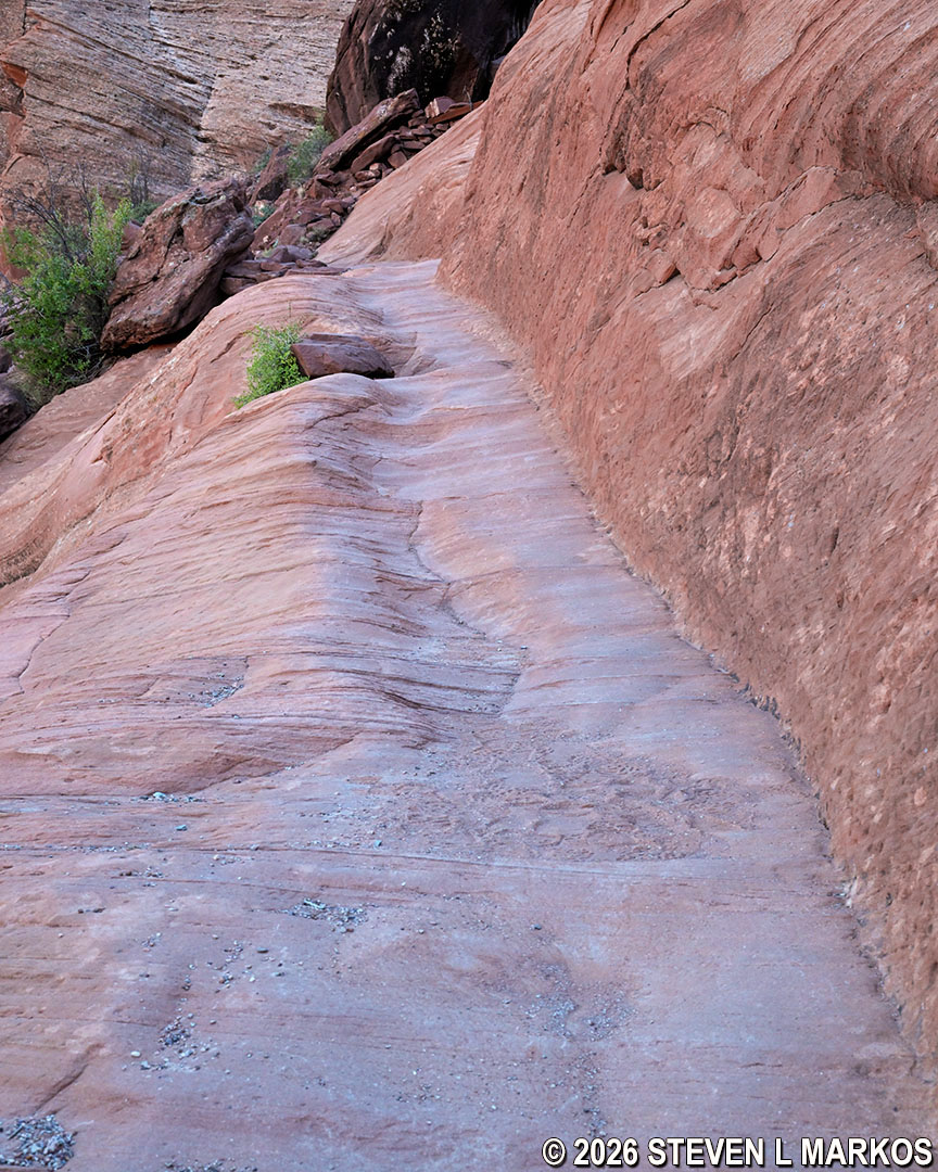
Part of the switchback path on the White House Trail at Canyon de Chelly National Monument
Length: 2.5 miles, round-trip
Time: 2 to 2.5 hours
Difficulty: ★★★★☆
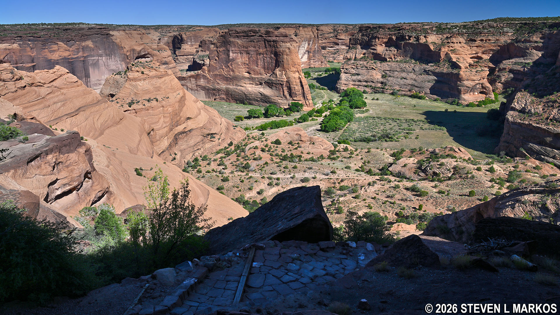
The White House Trail at Canyon de Chelly National Monument is a 1.25-mile out-and-back trail (2.5 miles, round trip) that leads to the White House archeological site on the canyon floor. This trail is the only way for non-Navajo visitors to hike into the canyon, and such visitors are only allowed on the trail itself. For those who want to see more of Canyon de Chelly, hiring a Navajo tour guide is required. Tours include options to explore on foot, on horseback, and via 4-wheel drive vehicles. See the Guided Canyon Tours web page here on National Park Planner for details.
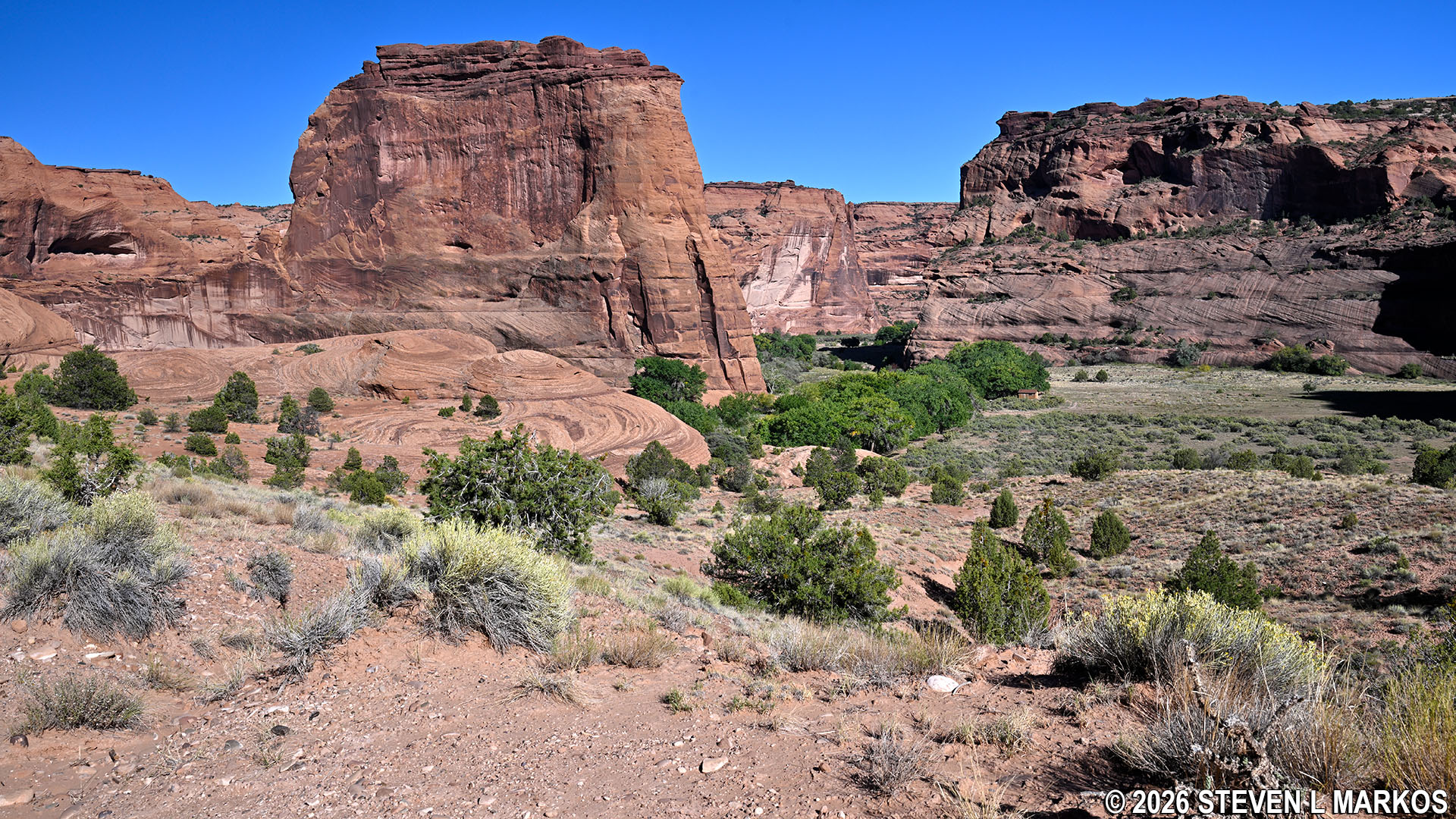
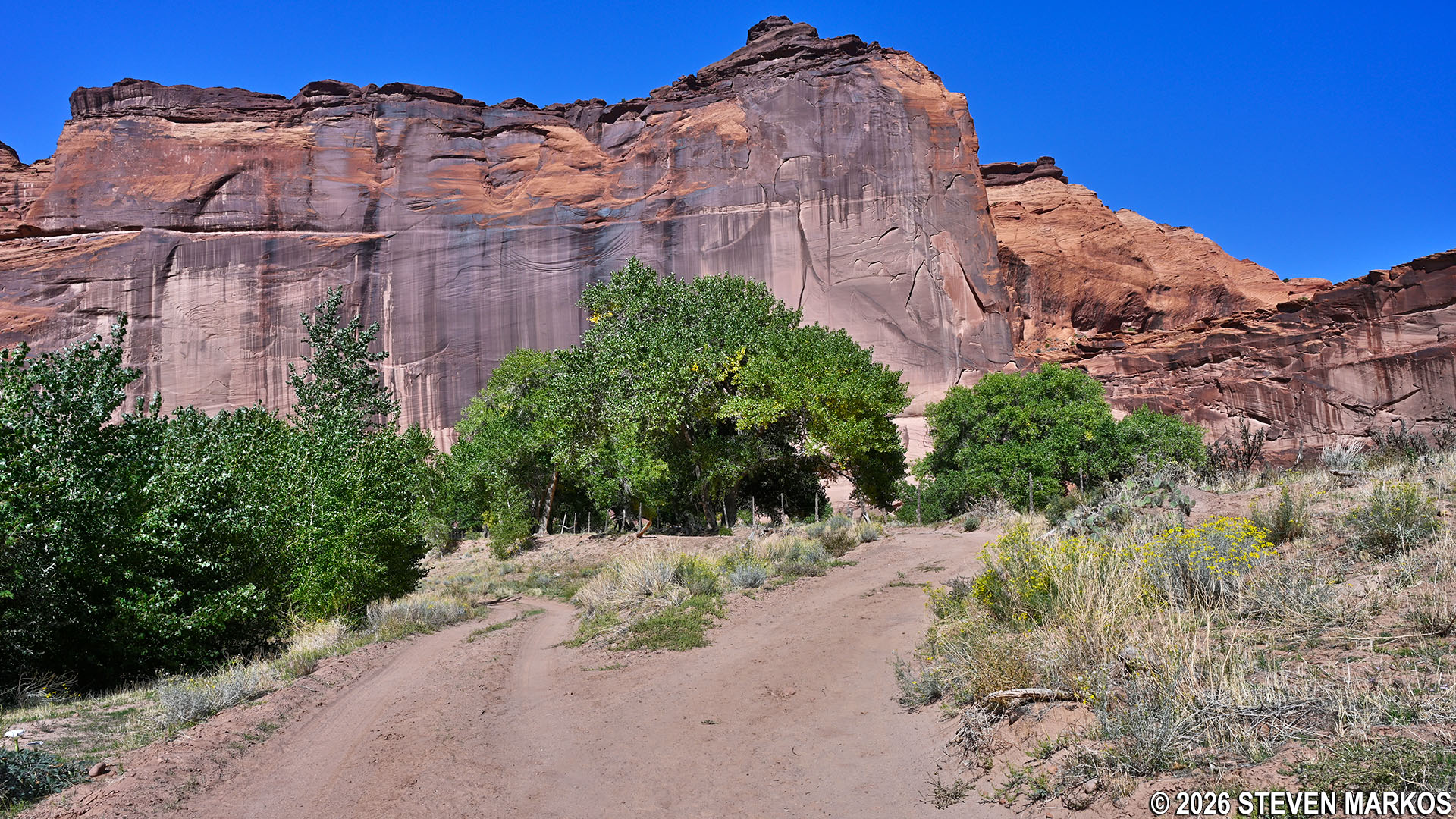
The trailhead is located at the White House Overlook (accessible along South Rim Drive). Most of the trail is out in the open, so if avoiding the sun is important to you, be sure to wear a hat and apply sunscreen. Also make sure to bring some water and wear sturdy shoes. Portable restrooms are available at the overlook parking lot and at the White House ruins.
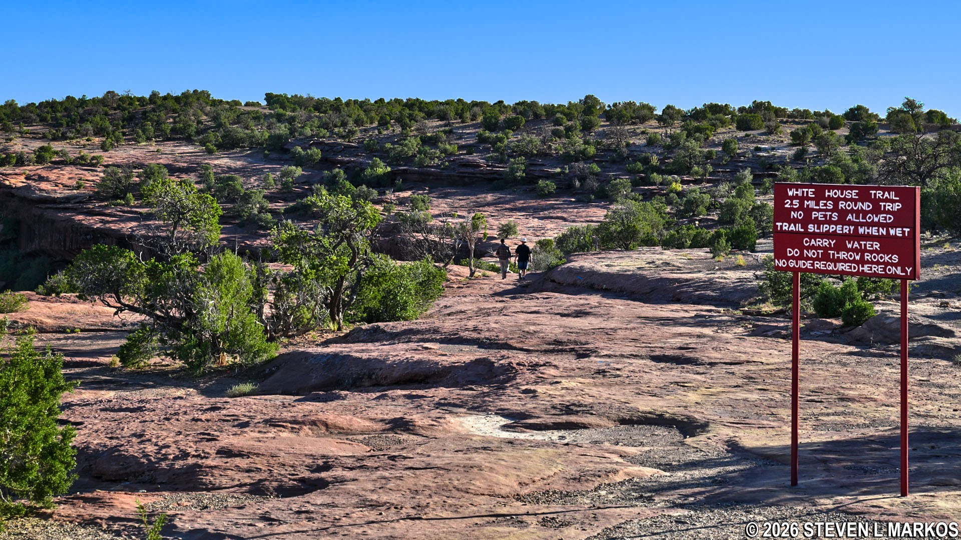
Trailhead for the White House Trail at Canyon de Chelly National Monument
The trail starts off on top of the canyon plateau along level but uneven terrain. Blue-painted arrows and footprints along the path point the way.
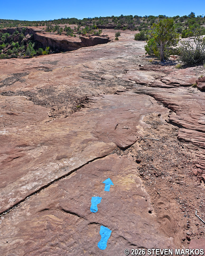
Painted markings along the path of the White House Trail at Canyon de Chelly National Monument
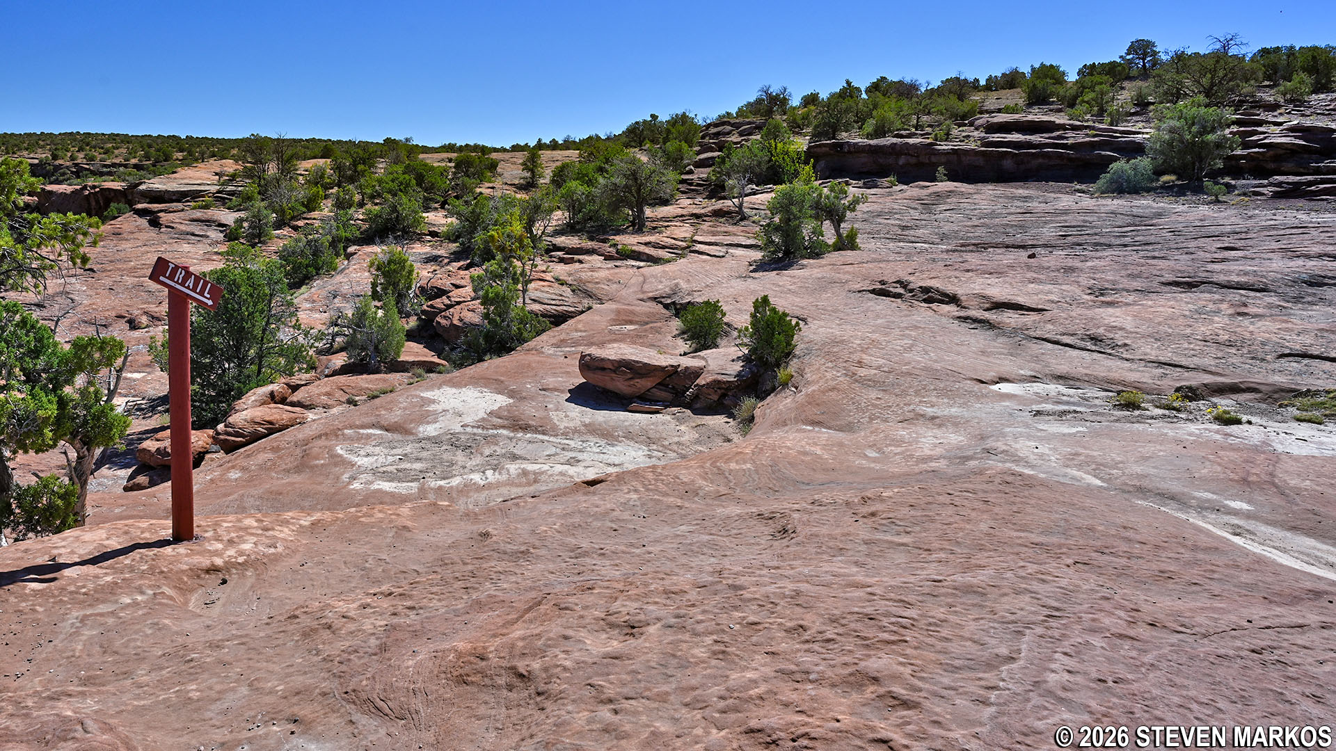
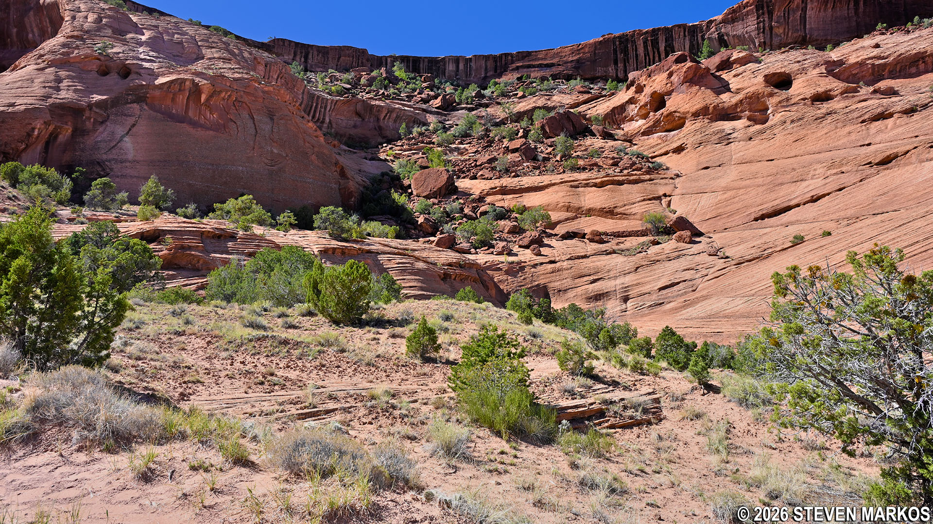
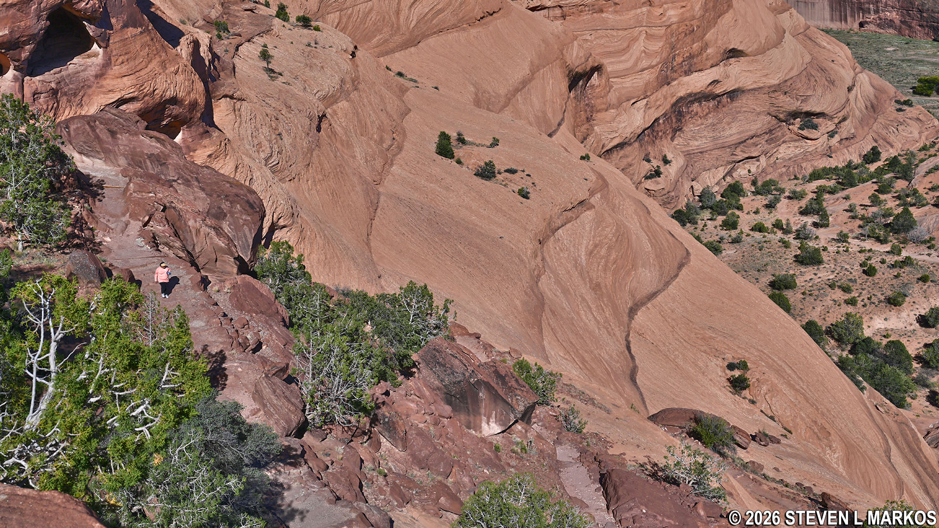
After hiking just under 300 yards, the trail makes a sharp left turn onto the first of eight switchbacks that take visitors down almost 600 feet to the canyon floor. While the bottom of the canyon certainly looks to be a long ways down, the White House Trail is only moderately steep on average. All of the straight legs between the switchbacks have an average grade of 12% to 15% (strenuous hiking is considered to start at 15%). Of course, you do have to hike out of the canyon, a prolonged uphill climb of one mile, so that itself makes the hike somewhere between moderate and strenuous in difficulty.
Trail sign at the first switchback on the White House Trail at Canyon de Chelly National Monument
A large warning sign is located at the start of the first switchback. This informs non-Navajo visitors that it is illegal to travel within the canyon without a Navajo guide except for along the White House Trail.
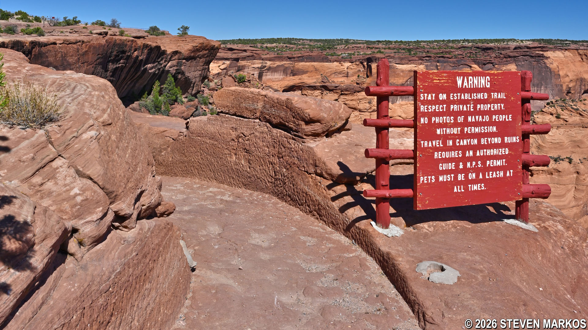
Sign at the start of the first switchback on the White House Trail at Canyon de Chelly National Monument
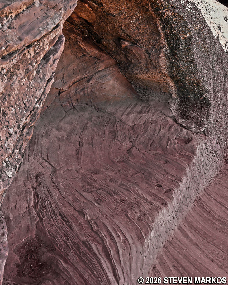
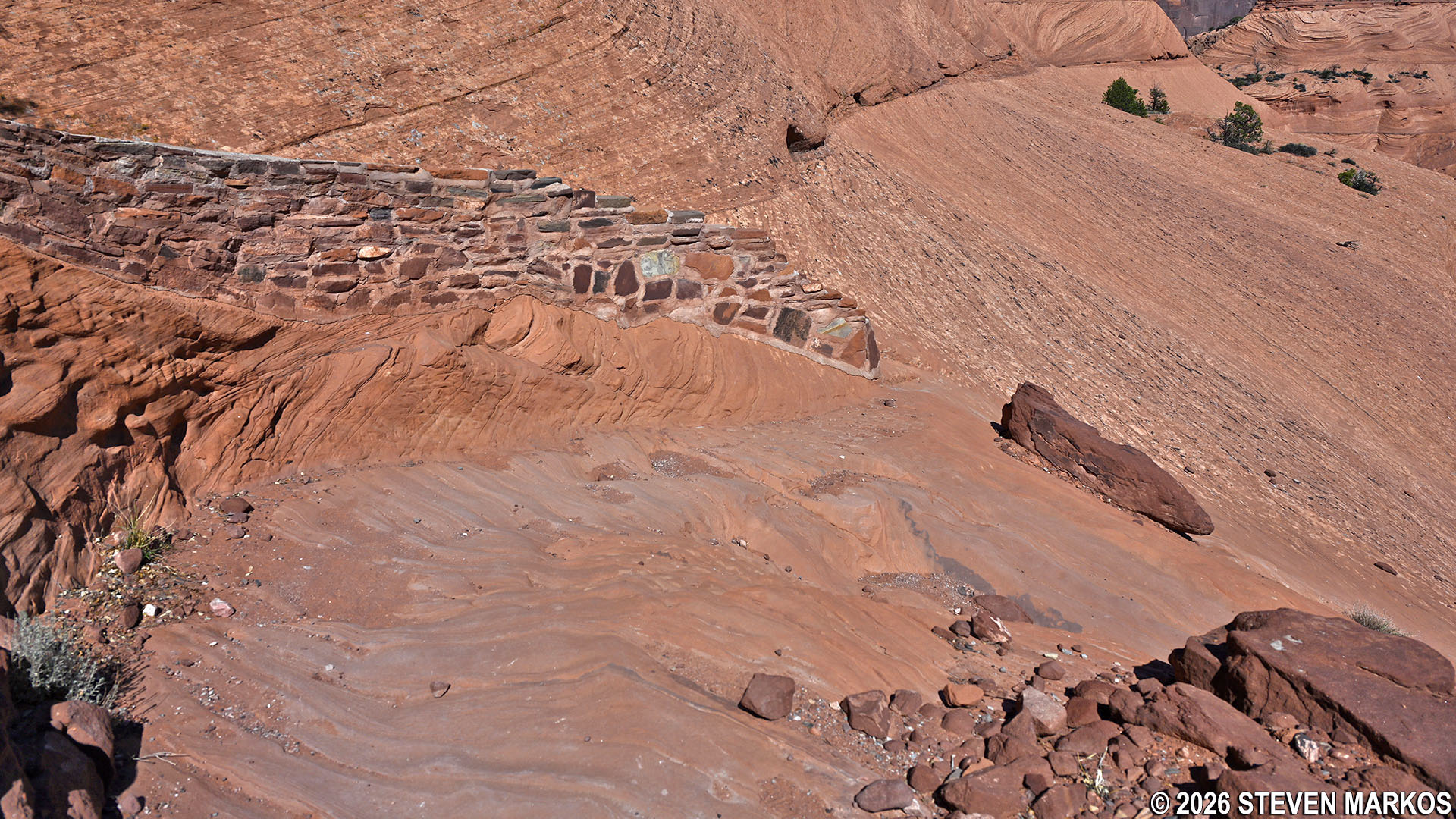
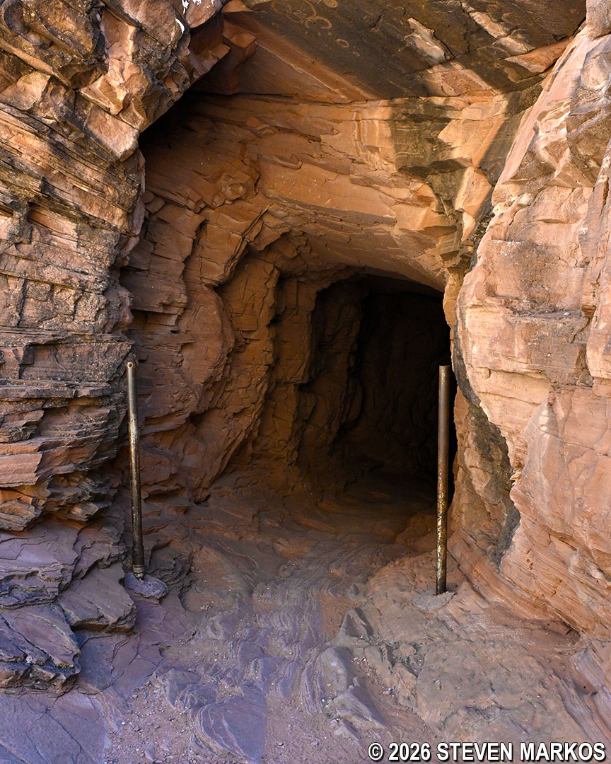
Just beyond the sign, the White House Trail passes through a tunnel that was formed by a huge block of Shinarump Conglomerate (a geological formation composed of coarse-grained sandstone and pebbles) that fell and landed against the smooth Canyon De Chelly cliff wall.
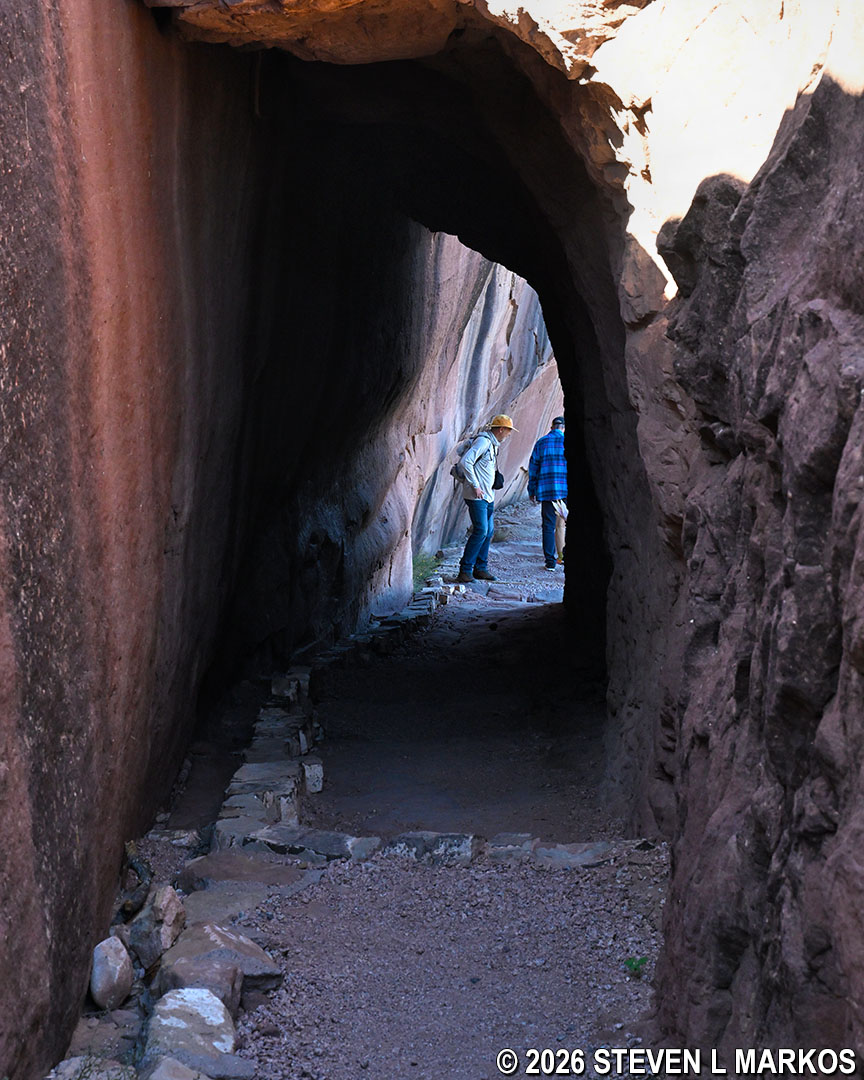
Tunnel after the first switchback on the White House Trail at Canyon de Chelly National Monument
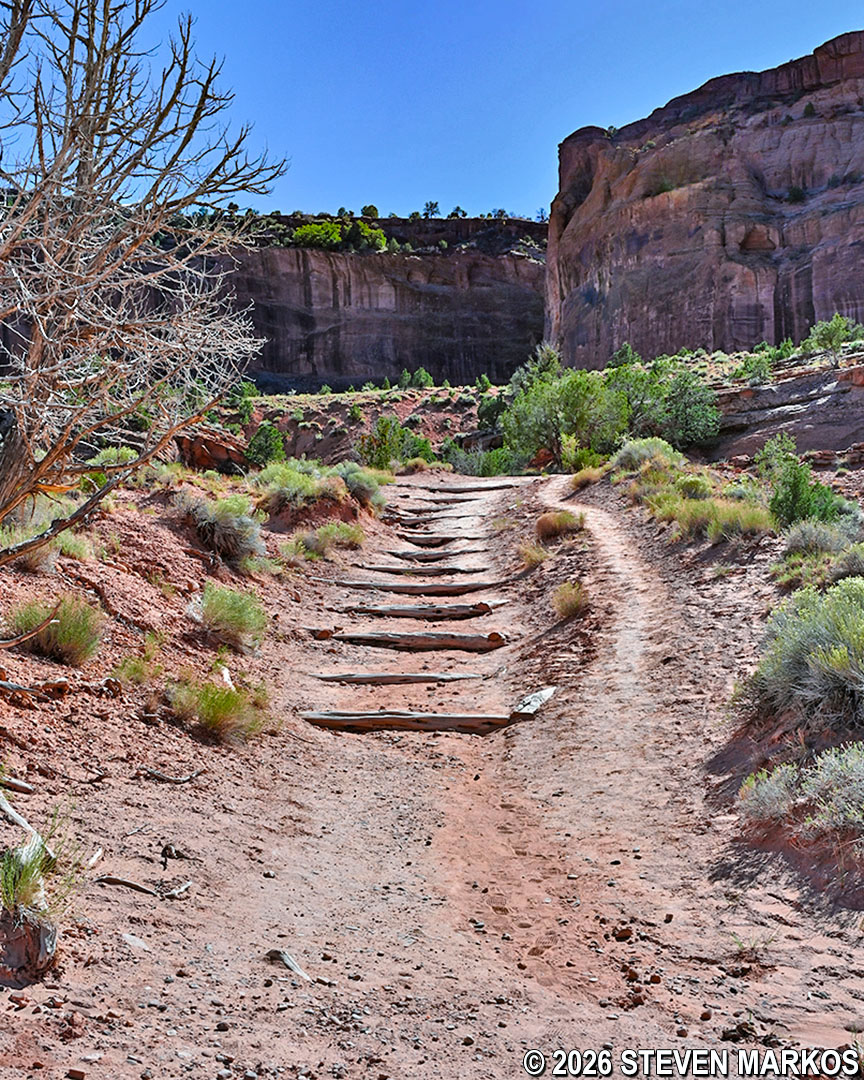
The trail surface is constantly changing. On the other side of the tunnel, it switches from smooth sandstone to rocky gravel for a short period. Roughly 200 feet later, at the start of the second switchback, it is back to a hard, sandstone surface, which at this point has been carved into a set of steps.
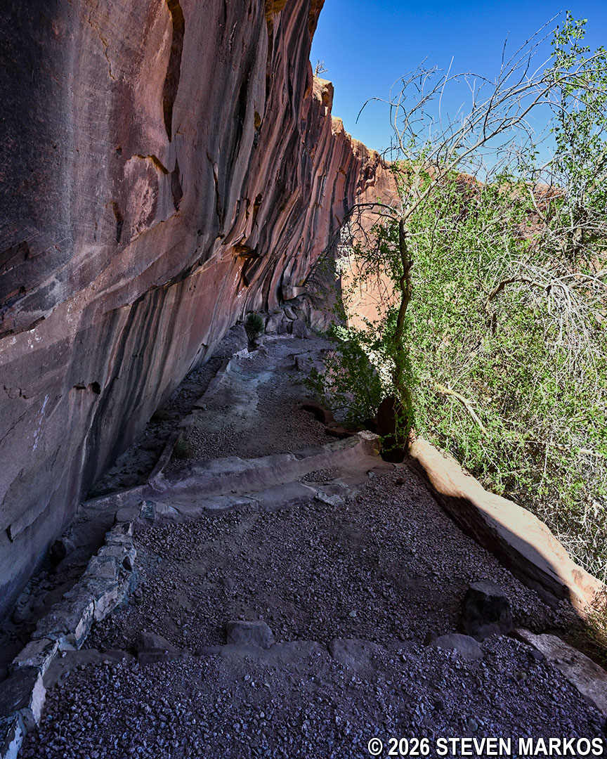
Gravel path on the downhill side of the tunnel at the end of the first switchback on the White House Trail, Canyon de Chelly National Monument
Sandstone steps at the second switchback on the White House Trail at Canyon de Chelly National Monument
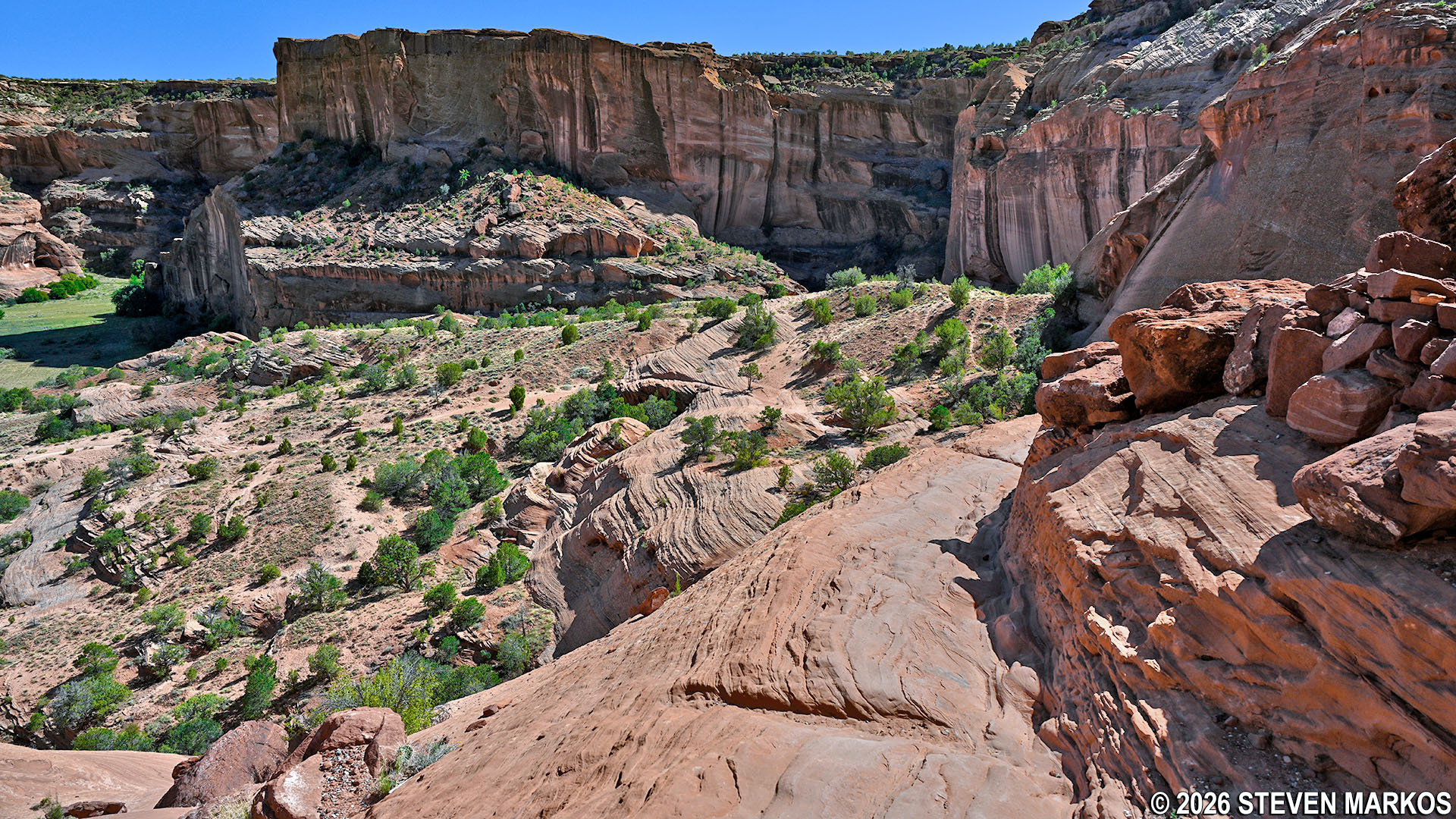
View of Canyon de Chelly from near the second switchback on the White House Trail, Canyon de Chelly National Monument
The next straight leg of the trail, between the second and third switchback, is the steepest part of the White House Trail. This 100-yard section has an average grade of 15%. (Note: the photo below is looking back up the hill.)
Steepest leg of the White House Trail between the second and third switchback, Canyon de Chelly National Monument
A couple of hundred feet before the fourth switchback is an alcove in the sandstone canyon wall. The alcove is one of the few spots along the trail where visitors can take a break and get some shade.
Alcove in the canyon wall on the White House Trail at Canyon de Chelly National Monument
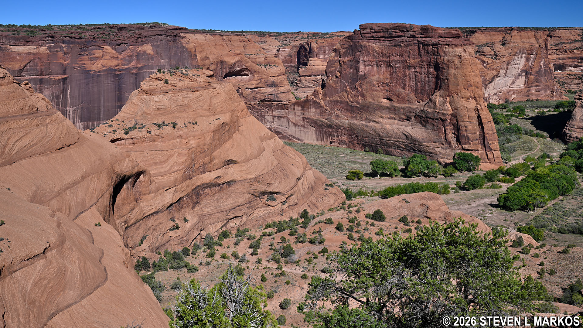
View of Canyon de Chelly from near the start of the fourth switchback on the White House Trail, Canyon de Chelly National Monument
After the fourth switchback, the straight legs of the White House Trail up until the six switchback are comprised of more sandstone-carved steps. Once past the sixth switchback, the trail reverts back into a sandstone path as it continues along the lower half of the canyon wall. These smooth sandstone areas can be slick when wet, so be careful when hiking after a rainstorm.
View of the steps after the fourth switchback on the White House Trail at Canyon de Chelly National Monument
Sandstone terrain before the sixth switchback on the White House Trail at Canyon de Chelly National Monument
The trail narrows to a ledge against the canyon wall before the seventh switchback. If you have a fear of heights, this section might make you a little leery. Just hug the wall and you’ll be fine. A bench is situated on the edge of the switchback if you need to catch your breath (two other benches are at the third and fourth switchbacks). For the next 250 yards, the terrain returns to a combination of loose gravel and sandstone steps as the trail utilizes the last two switchbacks before the bottom.
Narrow ledge path along the canyon wall on the White House Trail at Canyon de Chelly National Monument
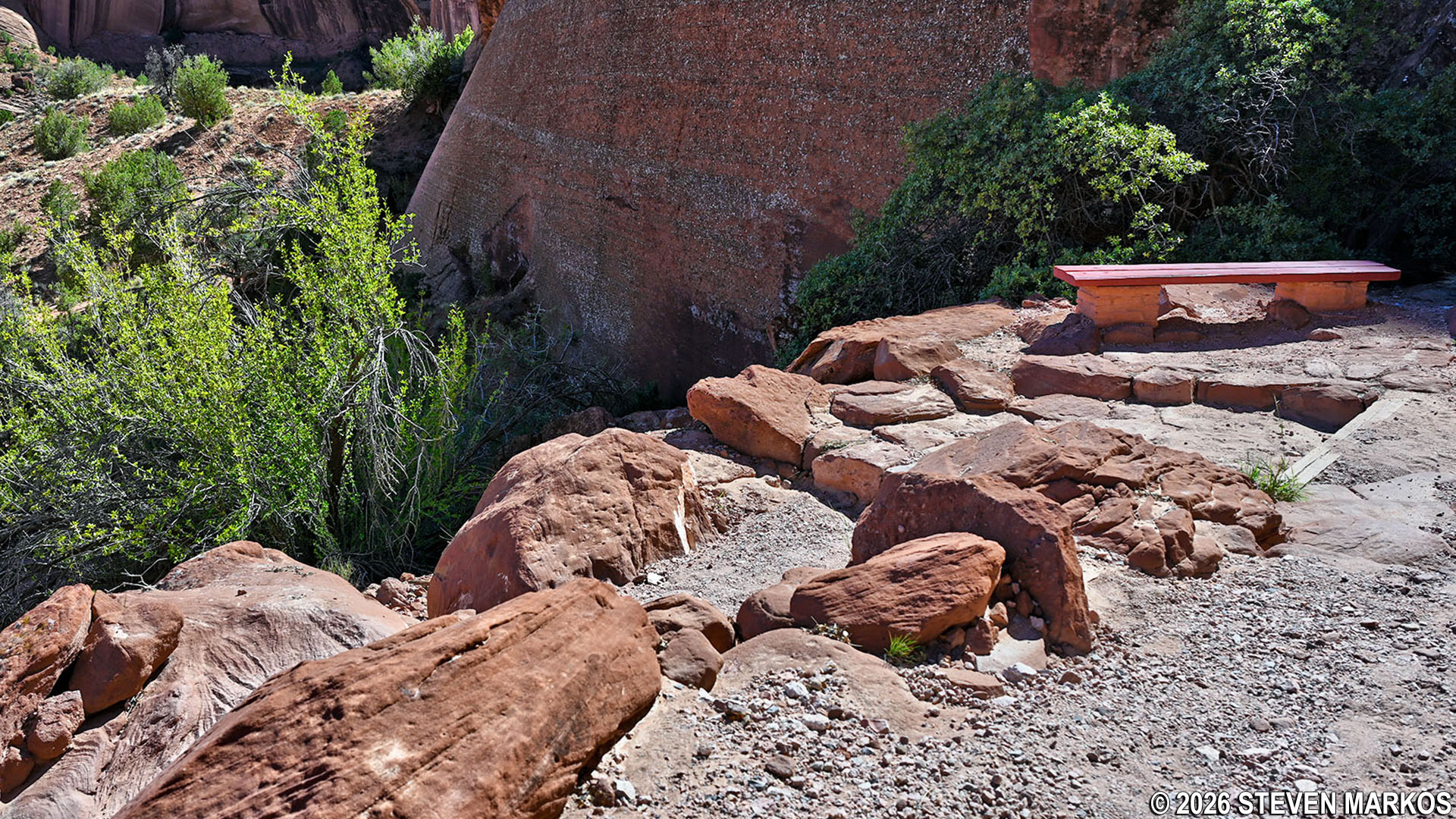
Bench at the seventh switchback on the White House Trail at Canyon de Chelly National Monument
Path after the last switchback on the White House Trail at Canyon de Chelly National Monument
The last switchback comes about a half mile into the hike. For the next tenth of a mile beyond it, the White House Trail continues along a ledge. The path is no longer clearly defined, but if you look to the left, you will see where to continue near the bottom of the ledge. There are typically a lot of people hiking the White House Trail, so you are likely to see somebody ahead of you and others coming back up, so just follow the crowd.
White House Trail after the switchbacks runs along a ledge, Canyon de Chelly National Monument
White House Trail after the switchbacks runs along a ledge, Canyon de Chelly National Monument
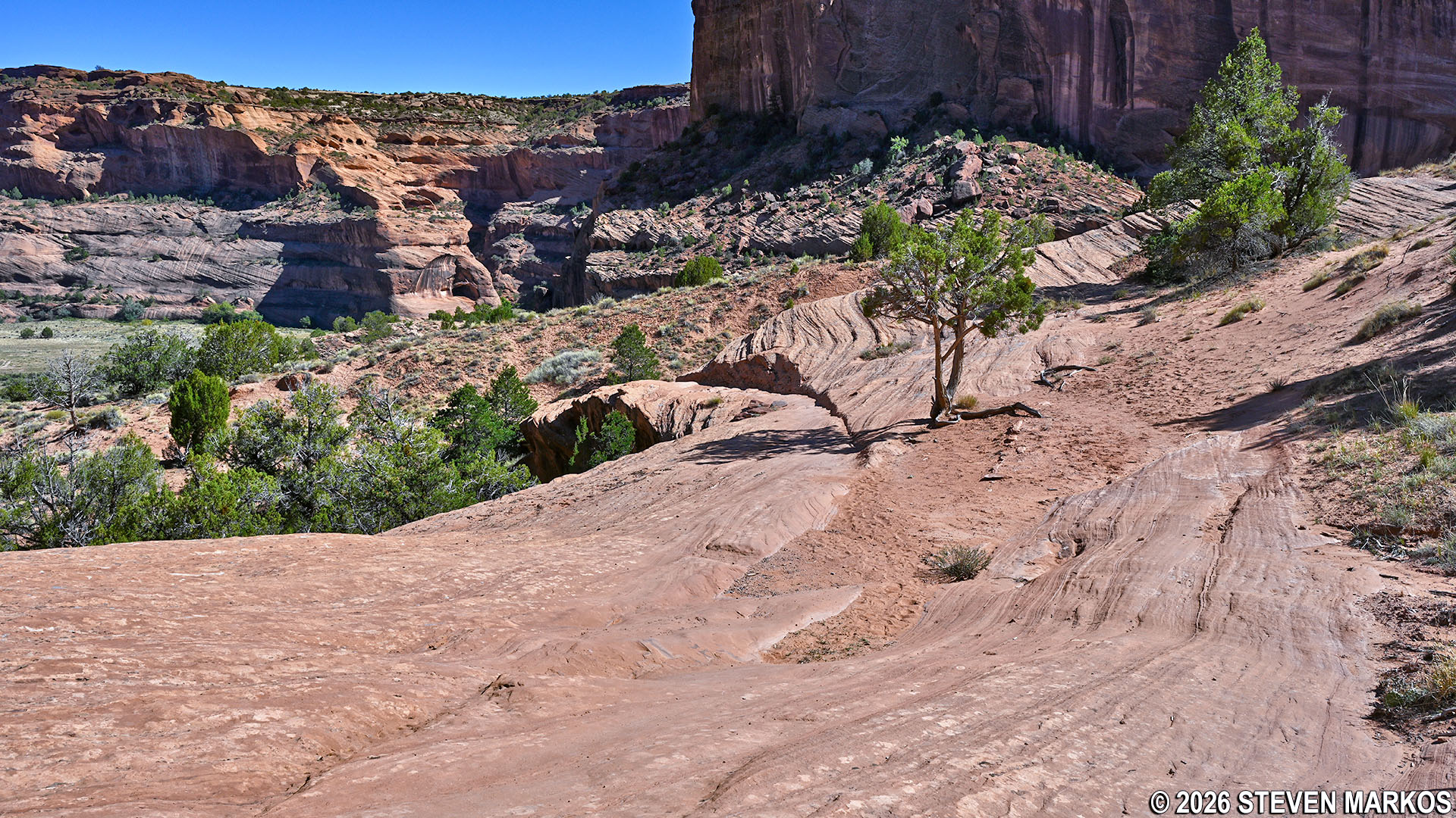
At .6 mile into the hike, the White House Trail moves away from the canyon wall and is more out in the open. At this point, the steep hiking is pretty much over. It is just .3 miles farther to the canyon floor, and this stretch of trail has a grade of only 8%, which is barely even moderate in difficulty. Furthermore, being only about 125 feet in elevation from the bottom, the spectacular views that you get from farther up begin to fade away.
Open area of the White House Trail towards the bottom of Canyon de Chelly, Canyon de Chelly National Monument
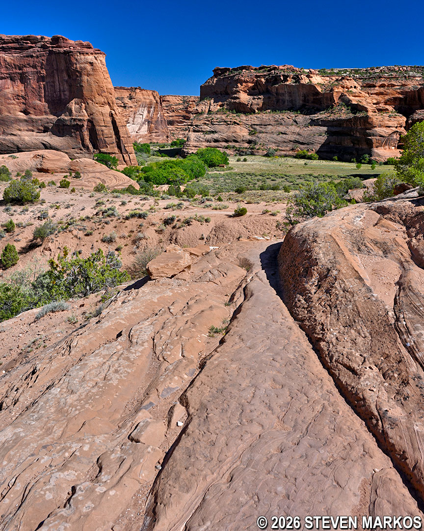
View of Canyon de Chelly from near the bottom of the White House Trail, Canyon de Chelly National Monument
At the .9-mile mark, the trail goes through another short tunnel. When you get to the other end, you will be at the bottom of Canyon de Chelly.
Tunnel on the path of the White House Trail before the canyon floor at Canyon de Chelly National Monument
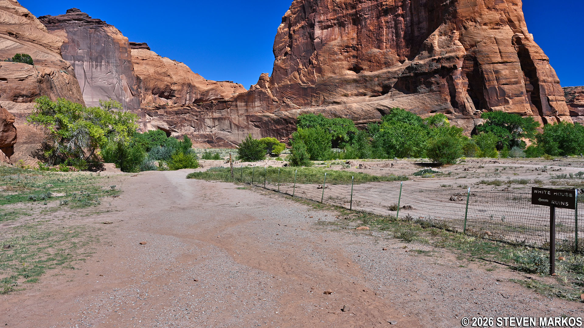
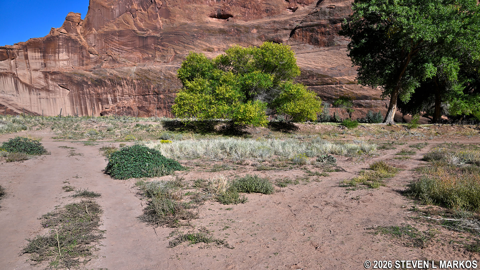
To the right is a plot of land still owned by a Navajo family that is bounded by a fence to keep people out. A sign points hikers towards White House Ruin. Another sign asks visitors not to enter or photograph anything on private property such as people and houses. The building you will see is a hogan. These are typically octagonal or dome-shaped with timber walls and a roof covered with packed earth. They are built with the door facing east to welcome the rising sun, which is believed to bring good fortune.
Path leading to the ruins on the White House Trail at Canyon de Chelly National Monument
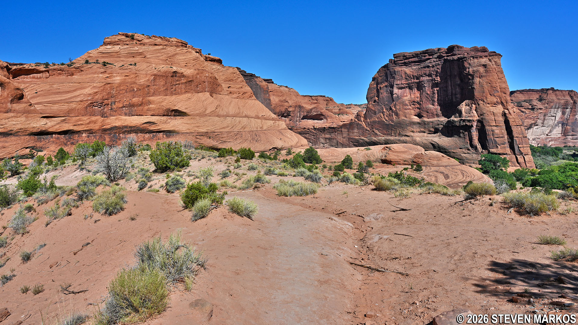
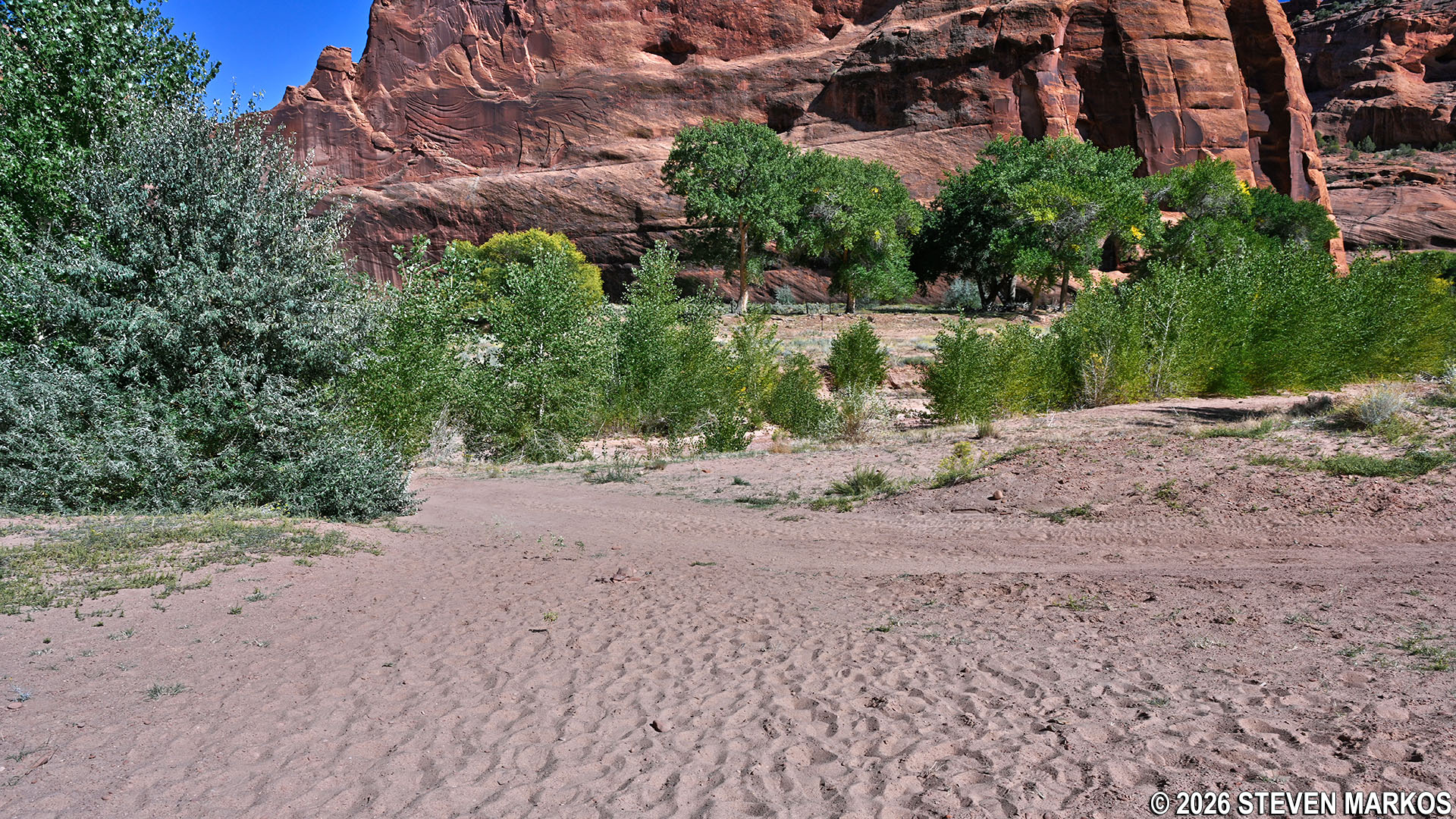
Two hundred and fifty yards ahead (right at 1 mile into the hike), the trail comes to a T-intersection with a dirt road. There is no directional signage pointing which way to go, but left is the correct turn. A right just leads back to the private property. The trail surface in this area is sandy, much of which is caused by the Jeeps and other 4-wheel-drive vehicles churning up the earth. The road is regularly used by private tour guides and the Navajo living in the area, so keep your eyes peeled for oncoming vehicles.
Path of the White House Trail merges with the dirt road on the canyon floor at Canyon de Chelly National Monument
There is another T-intersection with a dirt road 100 yards farther ahead. Again, there is no directional signage, but follow the road to the left. To the right is a sign stating that no visitors are allowed beyond this point without a Navajo guide.
Second intersection of the White House Trail and a dirt road at the bottom of Canyon de Chelly.
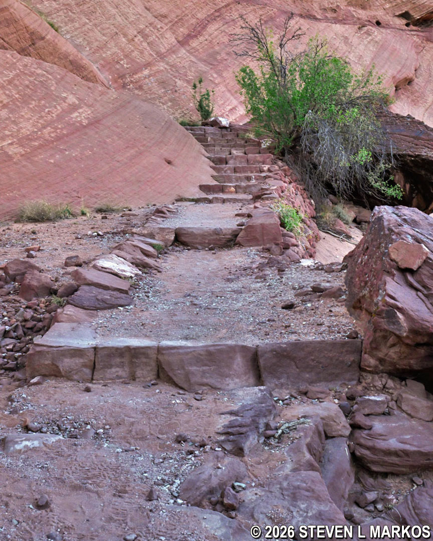
The dirt road splits 100 feet after the left turn. Both directions lead to the White House ruins. While you can stay left and walk along the dirt road where 4-wheel drive vehicles are often traveling, the path to the right is for hikers. It leads up to a dirt ledge that follows the road but is slightly above it. A fence separates the path from more private property. If you are in a hurry to use the restroom, the vehicle road to the left passes by them before reaching the ruins.
Split of the dirt road and pedestrian path portion of the White House Trail on the way to the White House ruins at Canyon de Chelly National Monument
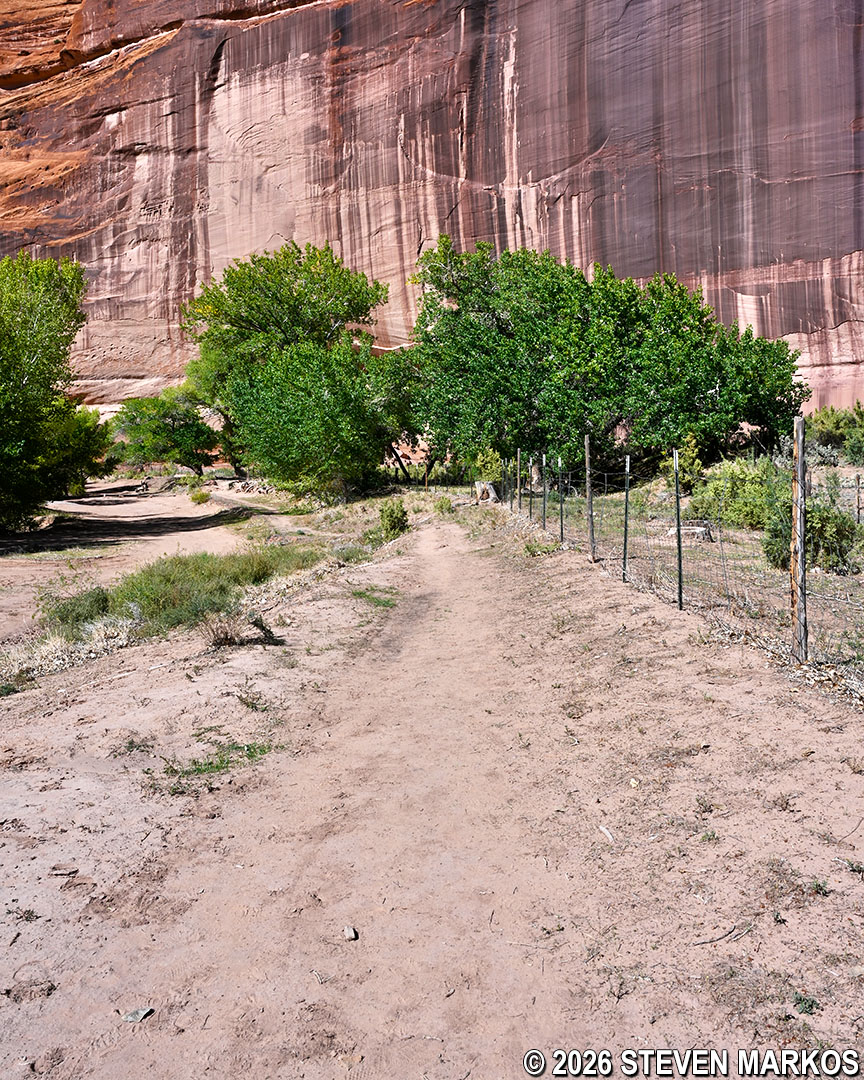
Pedestrian path along the fence that leads to the ruins on the White House Trail at Canyon de Chelly National Monument
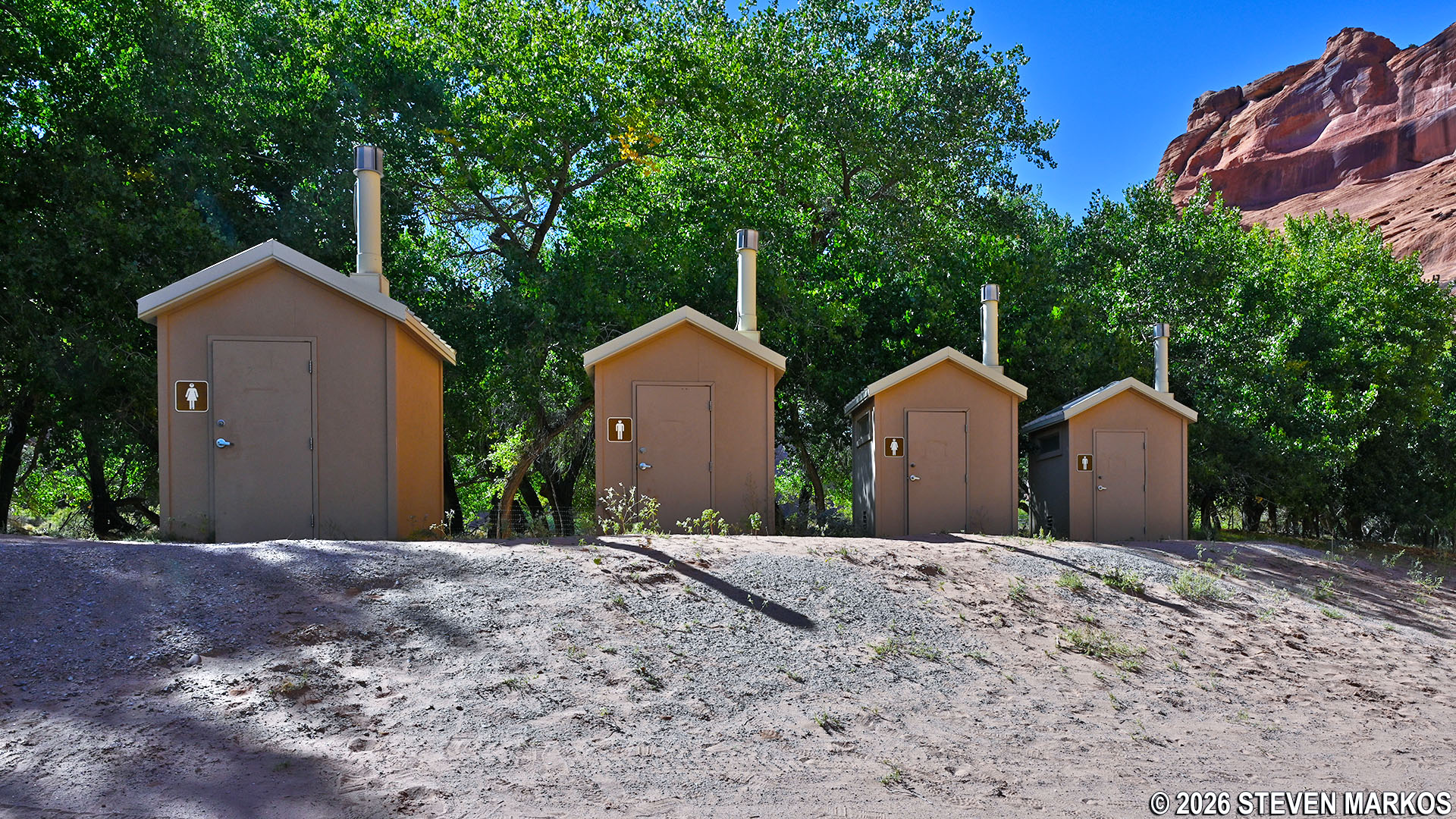
Restrooms at the White House archeological site, Canyon de Chelly National Monument
Two-tenths of a mile after the dirt road splits, the trail ends at the White House archeological site. These are the ruins of buildings once used as housing by the Ancestral Puebloans who lived in the area for over 4,000 years. They are thought to have been built around 1050 and occupied until 1300. The site received its name because of the white-plastered walls on the upper portion. The ruins were first discovered during an 1849 military expedition led by Army Lieutenant James H. Simpson. He described them as being a “style of structure similar to that of the pueblos found on the Chaco—the building material being of small, thin sandstones embedded in mud mortar.”
Between 50 and 60 people lived at White House when it was first built, and as many as 100 lived here at its peak. Evidence of four kivas and almost eighty rooms, including ten on the cliff above, remains today. Pictographs on the canyon wall indicate that at one time some rooms on the lower level were less than five feet below the upper level.
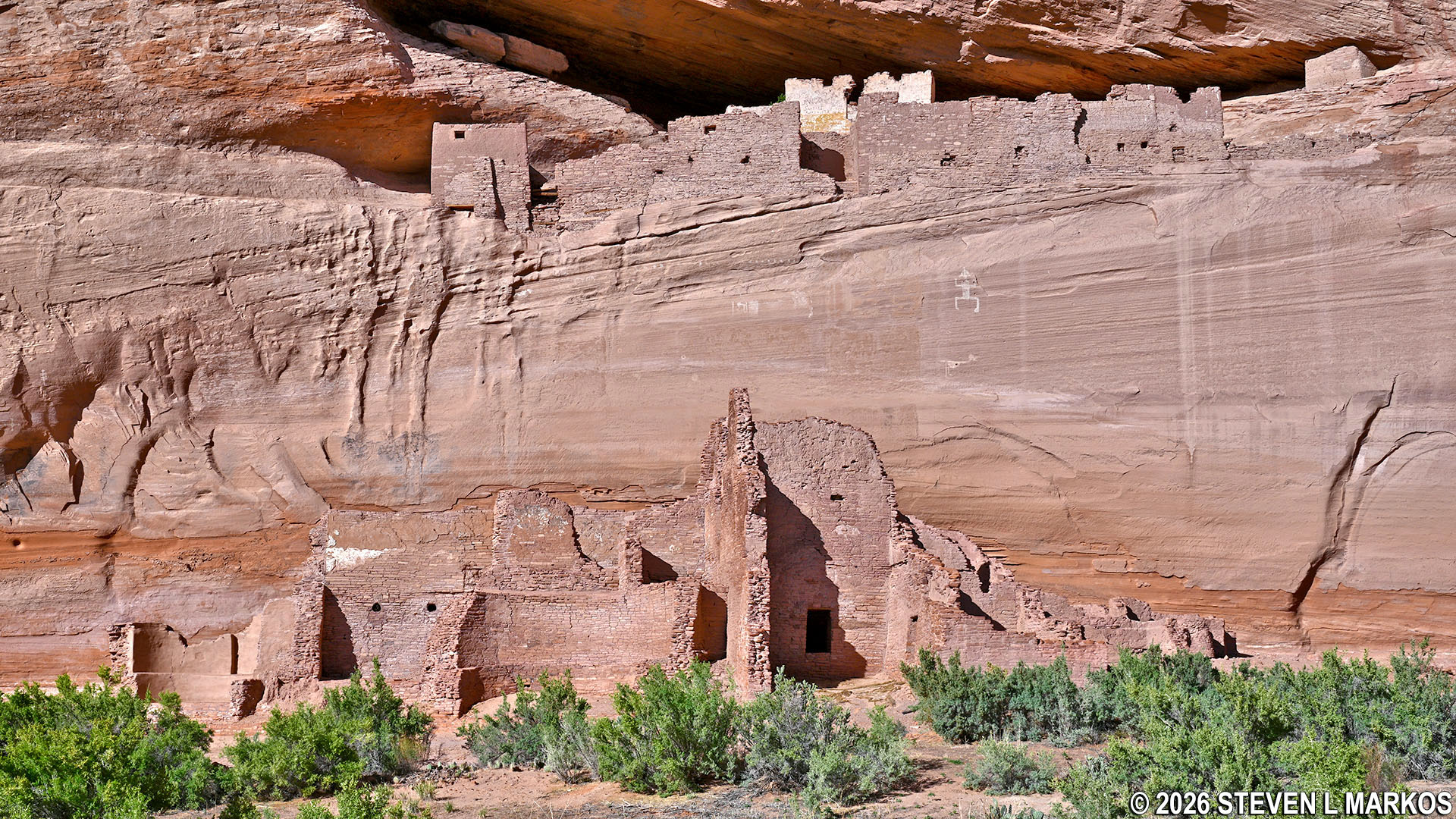
White House archeological site at Canyon de Chelly National Monument
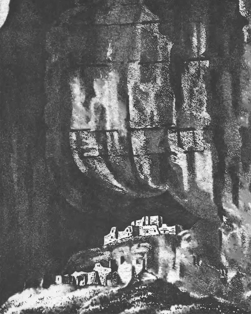
Sketch of the White House ruins made by Lieutenant Simpson in 1849, Canyon de Chelly National Monument
After admiring the ruins and the natural beauty of the canyon, follow the White House Trail back the way you came. When the trail reaches the point where it veers from the dirt road, an arrow in the sand constructed out of rocks points the way. I did not notice it on the way down, but it is very helpful to make sure hikers stay on the right path. Just up ahead is the Navajo hogan, and from there the hike is all uphill.
Path of the White House Trail splits off to the right from the dirt road at Canyon de Chelly National Monument
Path leading to the canyon wall on the White House Trail at Canyon de Chelly National Monument
When you reach to the switchbacks, be mindful of the terrain as it changes between broken sandstone, loose gravel, and multiple steps. Some sections are a little more rugged than others. When coming out of the lower tunnel, the multiple horizontal layers of sandstone can be a little tricky—I almost rolled an ankle hiking back up it.
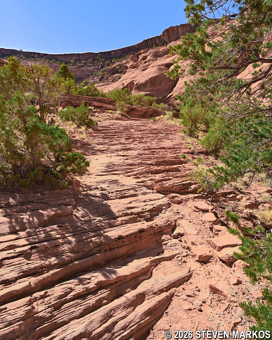
Horizontal layers of sandstone on the White House Trail at Canyon de Chelly National Monument
Steps on the path leading up to the lower switchbacks on the White House Trail at Canyon de Chelly National Monument
View of the switchbacks up the canyon wall on the White House Trail at Canyon de Chelly National Monument
The return hike gives a literal meaning to the phrase “uphill battle,” for the eight switchbacks are no joke. That being said, the breathtaking views of the canyon throughout the White House Trail can’t be beat.
Path back to the eighth switchback on the White House Trail at Canyon de Chelly National Monument
View of a hiker on the steps of the straight leg between the fourth and fifth switchbacks on the White House Trail at Canyon de Chelly National Monument
Sandstone path back to the third switchback on the White House Trail at Canyon de Chelly National Monument
Overall, the White House Trail at Canyon de Chelly National Monument is one of the best ways to see the canyon and the White House ruins, and it is the only free way to do so. It is not an easy trail, but it is not as hard as it looks either.
With a few exceptions, use of any photograph on the National Park Planner website requires a paid Royalty Free Editorial Use License or Commercial Use License. See the Photo Usage page for details.
Last updated on March 18, 2026


