

Yorktown Battlefield Tour Map (click to enlarge)
A six-stop tour of the Yorktown Battlefield has been designed to take visitors to the most important spots on the battlefield. Signs direct visitors from one stop to the next. Signs with red arrows are for the Yorktown Battlefield Tour. Signs with yellow arrows are for the Allied Encampment Tour, a tour that begins at the last stop of the Battlefield Tour. (The Allied Encampment Tour is of locations used by the American and French troops for sleeping, drilling, and storing artillery and other equipment.)
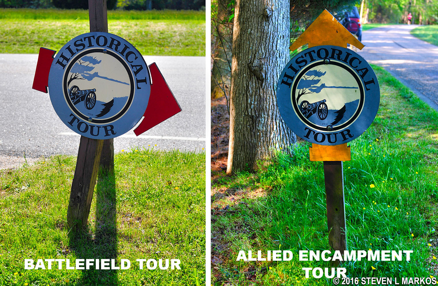
Signs for the two different tours of the Yorktown Battlefield, Colonial National Historical Park
The National Park Service claims that the Yorktown Battlefield Tour can be done in about an hour. Yes, if you pull into the tour stop parking lot, take a look from your car, and drive on, it will take you about an hour. If you want to do the tour right, which means getting out of your car to read the wayside exhibits and walking around the area, plan to spend three hours.
Some roads used for the Battlefield Tour are major highways used by everyone in the area. Vehicles are traveling in excess of 55 MPH. Therefore, I do not recommend using a bike for the tour unless you have one that wins out over large vehicles in an accident.
If you want to learn more about the Battle of Yorktown than you can from simply reading the wayside exhibits at the tour stops, a CD Audio Tour is available for sale at the Visitor Center. This is well worth the price if you have a CD player in your car. The CD is for the Yorktown Battlefield Tour only, not the Allied Encampment Tour. When you reach a tour stop, play the CD and listen to the information. When done, pause the player until you reach the next stop. Simple as that.
For a virtual tour of the Yorktown Battlefield, see the tour stop web pages here on National Park Planner. At the bottom of each page is a navigation menu that will take you to the next or previous tour stop.
Stop A: British Inner Defense Line
Stop B: Grand French Battery
Stop C: Second Allied Siege Line
Stop D: Redoubts 9 and 10
Stop E: Moore House
Stop F: Surrender Field
With a few exceptions, use of any photograph on the National Park Planner website requires a paid Royalty Free Editorial Use License or Commercial Use License. See the Photo Usage page for details.
Last updated on July 17, 2024


