

Yellow Trail Loop Hike map (click to enlarge)
Length: 5.5-mile loop with Cunningham Falls side trip
Time: 4 hours
Difficulty: Mainly moderate with a few very steep and strenuous hills
The Yellow Trail Loop Hike is a 5.5-mile trek the covers the east-central section of Catoctin Mountain Park, taking hikers to the Blue Ridge Summit Overlook, Hog Rock, and Cunningham Falls. There are easier ways to see these features, as most have parking lots much closer, but if you want exercise, the Yellow Trail is the way to go.
The best place to start the hike is at the Catoctin Mountain Park Visitor Center, either at the main parking lot or at the gravel overflow parking lot on the other side of the road. I started from the main parking lot, which set me off hiking around the loop in the counterclockwise direction. If starting from the overflow lot, you’ll be hiking in the clockwise direction.
One word of warning about hiking ANYWHERE in Catoctin Mountain Park during the summer: there are a ton of gnats. I highly advise wearing a hat and mosquito net on your head—I had one in my bag just by chance. I saw dozens of people with mosquito nets during my four-day visit, so it appears that the locals know to come prepared.
The Yellow Trail starts off up a steep, stone staircase, and you’ll be heading uphill for about a tenth of a mile before reaching a level area. The grade averages 20%. Most hikers consider a grade of 15% to be where strenuous hiking begins.

Start of the Yellow Trail Loop hike at the Catoctin Mountain Park Visitor Center
The trail surface in this area has plenty of small, loose rocks, but I’ve seen worse. Just be careful where you steep so that you don’t twist an ankle. Hiking boots are highly recommended, as are hiking poles if you have them.

Typical terrain on the Yellow Trail north of the Catoctin Mountain Park Visitor Center
At the start of the hike, the Yellow Trail and the Orange Trail, which eventually heads east towards Chimney Rock, are merged, so the blazes on the trees are yellow and orange (though they look red to me). After a half mile the two trails diverge, but the Yellow and Pink trails merge, so you’ll see yellow and pink blazes for a while. For those who are not familiar with blazes, these are paint splotches on trees and rocks that you follow like Hansel and Gretel breadcrumbs so that you don’t get lost.

Yellow and Orange blazes mark the first .4 mile of the Yellow Trail at Catoctin Mountain Park
The level reprieve doesn’t last long, and you will soon be hiking back up the mountain for another quarter mile, though the hill is a little less steep (14% average grade). However, the rocks on this section of the trail do get worse.

Rocky section on the first .4 mile of the Yellow Trail from the Catoctin Mountain Visitor Center
At the crest of the hill is the turnoff for the Orange Trail (right), which leads over to Wolf Rock and Chimney Rock (see the Chimney Rock-Wolf Rock Loop Hike for details). You also have the option to hike a short distance to a parking lot on Park Central Road (left). To stay on the Yellow Trail, follow the sign towards Hog Rock (straight ahead).

Intersection of the Yellow, Orange, and Pink trails at Catoctin Mountain Park
As mentioned, it is at this point where the Yellow and Pink trails merge. The terrain remains hilly until the next intersection .7 mile away, though the climb is much easier than before.

Typical terrain on the Yellow and Pink trail segment north of the Catoctin Mountain Visitor Center
When you reach the next intersection, which is where the Yellow and Pink trails split, stay straight towards Hog Rock. A right leads to the Thurmont Vista (covered in the Thurmont Vista Loop Hike review) and a left to another parking lot on Park Central Road.

Intersection where the Yellow and Pink trails at Catoctin Mountain Park make a split
At this point the Yellow Trail heads downhill for about two tenths of a mile, levels out for a short distance, then heads back uphill for a half mile to the Blue Ridge Summit Overlook. It’s steeper than the last section, but milder than the first. The average grade is 12%, though there are some short segments that have grades as steep as 40%, which is what I call tippy-toe steep—nothing but the balls of your feet touch the ground. Be on the lookout for green rocks. These are known as Catoctin Greenstone.

Catoctin Greenstone along the Yellow Trail at Catoctin Mountain Park
The Yellow Trail gets much narrower as it begins following a ridge. These narrow sections are why I wear long pants even on hikes when it is 90+ degrees and the humidity is 90+ percent as it was when I did the hike. Narrow trails are where you are likely to pick up ticks, brush up against poison ivy, or get scratched by briars (though nothing of the sort happened to me here). And by the way, do yourself a favor. Don’t hike at Catoctin Mountain Park when the temperature and humidity are 90+.

Narrow section of the Yellow Trail at Catoctin Mountain Park
The Blue Ridge Summit Overlook comes at two miles into the hike. A sign marks the spot where you turn off from the main trail and take a very short detour to the overlook. Remember, you don’t have to hike from the Catoctin Mountain Visitor Center to see the view. You can park at the Hog Rock Parking Lot on Park Central Road and walk .3 mile from there (.6 round trip). But to tell the truth, a trip specifically to the overlook and back isn’t worth the effort because there’s not much of a view. The only reason to come this way is if you are on a longer hike such as the Yellow Trail Loop Hike.

View from the Blue Ridge Summit Overlook at Catoctin Mountain Park
The next stop on the hike is at the Hog Rock Parking Lot, which, as mentioned, is .3 mile from the Blue Ridge Summit Overlook. If you need a restroom, there is a fancy outhouse—pit toilet in a permanent building. There are also some picnic tables and a brochure holder that has trail maps.
The Yellow Trail continues on the other side of the road from the parking lot, though it is a little confusing since the only sign reads HOG ROCK NATURE TRAIL, a lollypop-shaped loop trail. At this point the Yellow Trail and the nature trail are one in the same, so follow the sign. You’ll be hiking on the “stick” portion of the nature trail, and a little ways down is an option to leave the main trail and take a C-shaped detour—the loop portion of the trail. If you have no interest in this detour, just keep hiking south towards Cunningham Falls. For information on the nature trail, see the Hog Rock Nature Trail review here on National Park Planner.

Continuation of the Yellow Trail at the Hog Rock Parking Lot at Catoctin Mountain Park
Typical of a nature trail are signs along the way that identify trees and other vegetation. If you pick up the Hog Rock Nature Trail brochure from the box at the trailhead, you can read more about each tree mentioned on the signage.

Sign along the Yellow Trail / Hog Rock Nature Trail at Catoctin Mountain Park identifies a tree
The Hog Rock Nature Trail is marked with yellow triangles, so when it and the Yellow Trail are merged you’ll see yellow triangles and standard rectangular yellow blazes on the trees.

Yellow Triangle blaze marks the Hog Rock Nature Trail at Catoctin Mountain Park
The trail proceeds uphill all the way to the turnoff for the loop portion of the Hog Rock Nature Trail, though it is a mild and gradual climb. The trail surface has some rocks and roots, but it is much smoother than the Yellow Trail up to this point. The National Park Service has removed as much debris as possible to make the nature trail a family-friendly hike.

Typical terrain on the Hog Rock Nature Trail / Yellow Trail at Catoctin Mountain Park
The first turnoff for the loop portion of the nature trail comes .3 mile from the parking lot and the second a little over a tenth of a mile later, just about 2.75 miles from the start of the hike at the Visitor Center. The second intersection is clearly marked with signage, and Hog Rock itself is near the sign, so you don’t have to hike the nature trail to see it. However, I don’t know what the big deal is or why it is even called Hog Rock. There is a scenic view, but even that’s not very good. Keep on walking straight to continue on the Yellow Trail towards Cunningham Falls, which is about a mile away.

View from the Hog Rock overlook at Catoctin Mountain Park
The Yellow Trail heads downhill for the first third of a mile past Hog Rock. It is steep and narrow with a lot of large rocks that you must step down from, so if you have bad knees, expect a difficult journey. Be sure to check yourself for ticks every time you brush up against vegetation.

Rocky section of the Yellow Trail just south of Hog Rock at Catoctin Mountain Park
The next .4 mile is hilly. No sooner do you walk down one moderate hill than you walk up another. You’ll see a lot of Catoctin Greenstone along this section of trail.

Catoctin Greenstone near Hog Rock, Catoctin Mountain Park
The last quarter mile of the Yellow Trail before coming to the intersection with Highway 77 is one of the steepest sections. Grades range from 15-25%, with an average of 16%. There are so many loose rocks on this section that it’s like walking through the rubble of a bombed-out building. The logs you see across the trail are irrigation steps designed to channel rainwater away from the trail so that it doesn’t rush down the path and eventually form a large gully. There are lots of these on the last quarter mile.

Steep section of Catoctin Mountain Park’s Yellow Trail near the intersection with Highway 77
A mile from Hog Rock is the intersection with a side trail that leads to Cunningham Falls, which is actually in Cunningham Falls State Park, not Catoctin Mountain Park. The Yellow Trail itself continues to the left (follow the sign to the Visitor Center), but if you want to see the falls, head down to the highway and cross to the other side by either walking down the road to the left towards a parking lot (handicap parking permit required) or heading directly across the road and cutting through a gap in the guardrail. The road is very busy and there is no road shoulder, so the safest bet is to get across ASAP, which makes the guardrail gap the best option. Either way, your destination is the boardwalk to the left of where you came out on the road. The trail to the waterfall is entirely on this boardwalk. Round trip is .4 mile.

Gap in the guardrails at the intersection of Catoctin Mountain Park’s Yellow Trail and Hwy 77

Head towards the boardwalk to get to Cunningham Falls from Catoctin Mountain Park
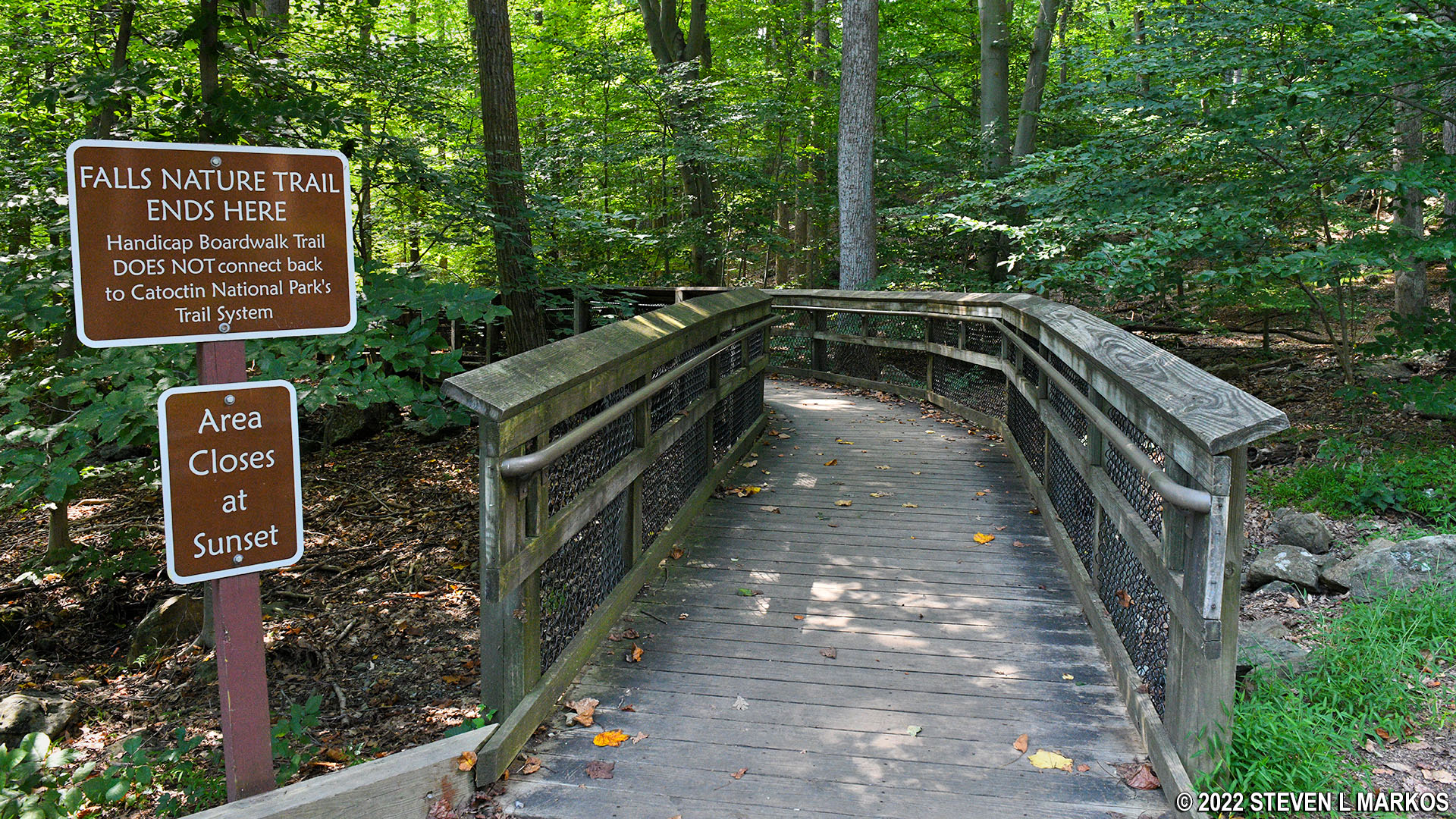
Boardwalk to Cunningham Falls from Catoctin Mountain Park
In truth, the detour is a waste of time, for while you can get to Cunningham Falls, the view at the end of the boardwalk sucks—you can barely see the waterfall without binoculars. The waterfall is really meant to be accessed from the state park, so if you want to see it, pay the Cunningham Falls State Park entrance fee and see it from there.

View of Cunningham Falls from Catoctin Mountain Park boardwalk
When I visited, people on the state park side of the waterfall were hopping off the boardwalk (the park has its own boardwalk trail to the falls) and onto the rocks at the base of the falls for a closer look, which is not allowed. If you don’t care about the rules, you can do the same thing from the Catoctin Mountain Park boardwalk, but you’ve got one hell of a walk through a field of boulders ahead of you.

Boulder field between Cunningham Falls and the Catoctin Mountain Park boardwalk
Once back at the Yellow Trail intersection you have, according to the sign, 1.4 miles to go to reach the Visitor Center. The trail follows Highway 77, which is down below and often in sight on the hike back. On its website, the National Park Service calls this segment of the Yellow Trail the Cunningham Falls Nature Trail, the assumption being that the only reason you would be hiking on it from the Visitor Center is to see Cunningham Falls. The website even claims this is the most popular trail in the park, though I saw nobody when I hiked it.
The hike back to the Visitor Center starts up a very steep hill that continues for a tenth of a mile. However, other than this and a very short-but-steep segment (30% grade) right before the Visitor Center, the Cunningham Falls Nature Trail portion of the hike, while always hilly, is only moderate in difficulty.

Steep section of the Yellow Trail just west of the Catoctin Mountain Park Visitor Center
The Yellow Trail continues to have a lot of rocks on its surface, and to a lesser extent, tree roots. It is, however, much wider than the segment from Hog Rock to Cunningham Falls, so you won’t come into contact with vegetation other than at a few spots here and there.

Typical terrain on Catoctin Mountain Park’s Yellow Trail east of Cunningham Falls

Yellow blaze on a large boulder along Catoctin Mountain Park’s Yellow Trail east of Cunningham Falls
Once down the aforementioned steep section right before the Visitor Center, it’s level ground back to the parking lot. The trail comes out at the gravel overflow parking lot on the other side of the road from the Visitor Center. The overall length of the hike, including the side trip to Cunningham Falls, is 5.5 miles.

Yellow Trail just west of the Catoctin Mountain Park Visitor Center

Trailhead for the Yellow Trail at the Catoctin Mountain Park Visitor Center overflow parking lot
With a few exceptions, use of any photograph on the National Park Planner website requires a paid Royalty Free Editorial Use License or Commercial Use License. See the Photo Usage page for details.
Last updated on January 28, 2026


