
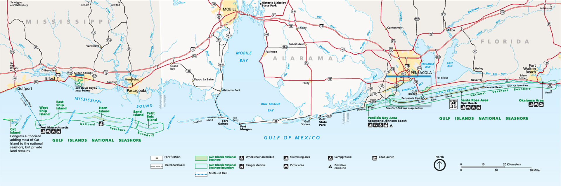
Gulf Islands National Seashore Map (click to enlarge)
Gulf Islands National Seashore is the largest National Seashore in the National Park system. It is also one of the few National Parks that lies within two different states, and even rarer because the states do not border each other. Yellowstone, Assateague Island National Seashore, and a few other parks are situated across the borders of adjacent states but are still one, continuous mass of land. The Mississippi and Florida sections of Gulf Islands National Seashore are 70 miles apart by boat and 125 miles by car—the state of Alabama sits between them. For all intents and purposes, they are two separate parks and are visited by two distinct sets of vacationers.
The Mississippi portion of the park is largely made up of barrier islands that can only be reached by boat. Only one island has public ferry service. There is a small, mainland-based portion of the park located in the swamps of Davis Bayou near Ocean Springs (Biloxi area). In contrast, all sections of the Florida unit can be accessed by car, for even though the park is still comprised of islands, causeways across Pensacola Bay connect them to the mainland. The main island is Santa Rosa Island, home of Pensacola Beach and large areas of development. The National Park Service only owns sections of the island and has kept these areas from being developed. There is a marked difference between public and private land, as hotels and restaurants butt right up to the park border. It is only a few feet difference between modern civilization and beaches that remain as they have been for thousands of years.
The following is a one-hour documentary on Gulf Islands National Seashore. It covers both the Mississippi and Florida units of the park.
With a few exceptions, use of any photograph on the National Park Planner website requires a paid Royalty Free Editorial Use License or Commercial Use License. See the Photo Usage page for details.
Last updated on March 15, 2025


