

Big Cypress National Preserve Scenic Drives (click to enlarge)
There are two scenic drives along dirt roads at Big Cypress National Preserve, the Turner River-Upper Wagonwheel-Birdon Road Loop and the Loop Road. Both form loops by using the paved Tamiami Trail (Highway 41). These are excellent places to see the area’s wildlife, but unfortunately I can’t bring myself to recommend either of them simply for the sake of spotting wildlife or viewing the scenery. The dirt roads at Big Cypress are the dustiest that I have ever driven on, and I have driven on more dirt roads than the average person. The surface is made of crushed limestone, which is essentially chalk. I have passed people standing alongside the road and have seen them literally disappear into a cloud of dust like a sandstorm in a disaster movie. If another car passes you, it takes a couple of minutes of driving time for the air to clear. And heaven help you if you get behind another car—you might as well be driving in heavy fog. The interiors of convertibles and other soft top vehicles will be inundated with dust, and though enclosed vehicles will fare much better, they will still need a car wash afterwards.
I don’t want to discourage driving on the roads to reach hiking trails, campgrounds, or backcountry access areas, but for simply viewing wildlife and scenery, there are alternate avenues. Yes, there is often a lot of wildlife along the dirt roads, but you can see the same wildlife in the canals along the Tamiami Trail or at the boardwalks and overlooks at the Nathaniel P. Reed Visitor Center, Oasis Visitor Center, H.P. Williams Roadside Park, and the Kirby Storter Roadside Park. Better yet, rent a canoe or kayak and take a journey on the Turner River or Halfway Creek. You haven’t really seen an alligator in the wild until you have been in the water with one. Or hike on the park’s best trail, the Florida Trail. There are plenty of ways to see the wildlife at Big Cypress National Preserve without dirtying your car.
With that said, here are descriptions of the two scenic drives:
TURNER RIVER-UPPER WAGONWHEEL-BIRDON ROADS SCENIC DRIVE
A 17-mile scenic loop drive can be formed using the Turner River, Upper Wagonwheel, and Birdon Roads. All roads were built in the 1950s by digging ditches on either side of the proposed road bed and then piling the dirt in the middle to create a road that was raised higher than the surrounding water. Today these canals remain filled with water even during the dry season and alligators, fish, and birds make them their winter homes. Unlike the park’s other scenic drive, Loop Road, which runs through a well shaded Cypress Swamp, the roads in the Turner River area are out in the open and exposed to the sun, so you are more likely to see alligators here. I found the bird concentration on Loop Road to be better.
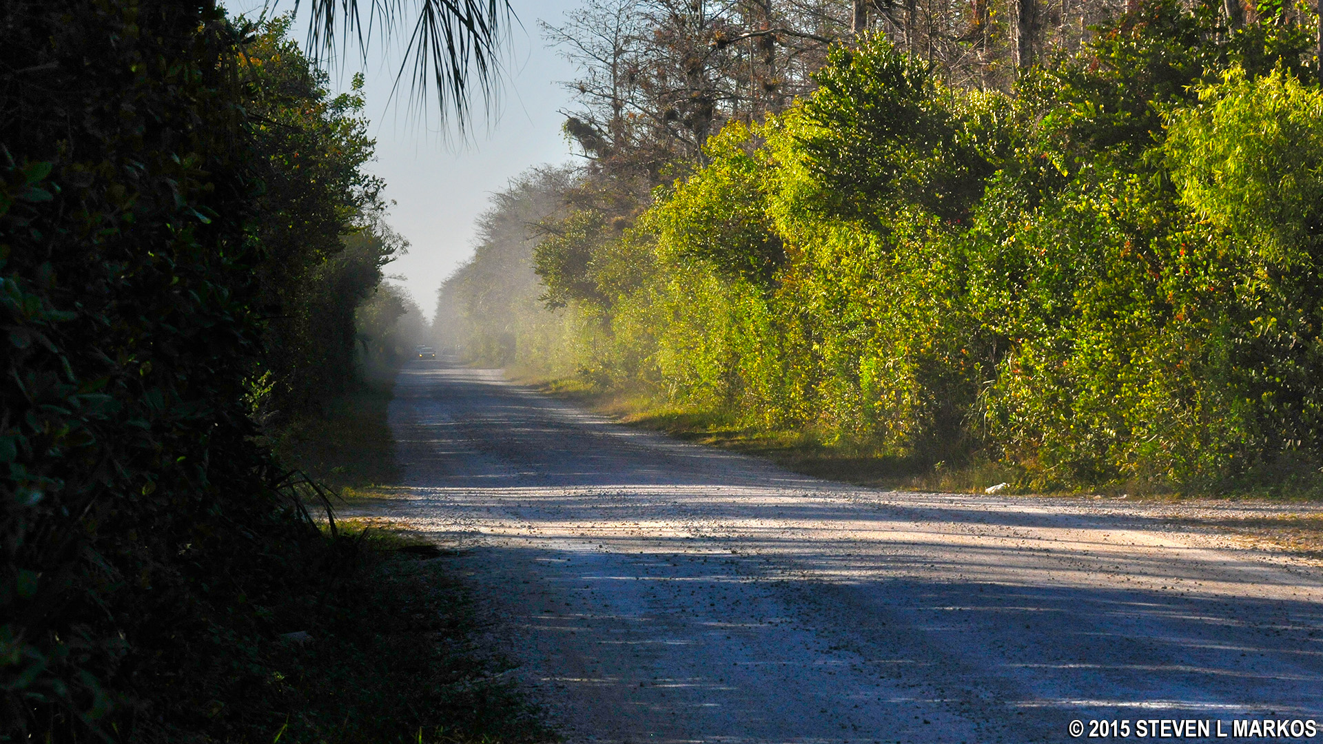
The Turner River Road is the dustiest of the two scenic drives because people tend to travel at much higher speeds here than on Loop Road. The goal of most drivers on Turner River Road is to get to the Bear Island Backcountry Unit as quickly as possible. The higher the speed, the more dust that gets kicked up. I never got out of my car to see alligators or birds because I had passed wildlife spectators along the road and saw them disappear into the cloud of dust created when I drove by them, and I had no intention of enduring the same. People drive much slower on Loop Road because viewing wildlife is the main attraction and they don’t want to miss anything.
There is nothing of interest—trails, campgrounds, backcountry access—along the Upper Wagonwheel and Birdon Roads. In fact, when I drove these I wasn’t even aware that they were part of a “scenic drive” and figured that their sole purpose was to provide home owners in the area with access to their property. Even when I drove the Turner River Road I never thought of it as anything other than the road you take to Bear Island.

Following behind another vehicle on the Turner River Road at Big Cypress National Preserve
LOOP ROAD SCENIC DRIVE
Dust stirs up after a car drives down the Loop Road at Big Cypress National Preserve
The western end of Loop Road is off of Highway 41 near the Monument Lake Campground, and in the east it is where Highway 41 enters Big Cypress National Preserve. The area between 41 and Loop Road forms the boundary of the Loop Backcountry Unit. A drive down the road will take hikers to the trailheads for the Gator Hook Trail, a former segment of the Florida Trail, and the short Tree Snail Hammock Trail. The road also passes through the town of Pinecrest and you can get to the Pinecrest Group Campground and the Mitchell Landing Campground. Along the way there are plenty of swampy areas where you have an excellent chance of seeing the area’s waterfowl and ever some alligators.

Snowy Egret fishing in the swamp along Loop Road at Big Cypress National Preserve
Loop Road is 24 miles long, though it is not entirely dirt, switching over to pavement after 16 miles if driving from Monument Lake towards Pinecrest. This road differs from the Turner River area roads in that those roads run along man-made canals and are exposed to the open sun, whereas part of Loop Road runs through a natural Cypress swamp that offers much more shade and trees for the birds. I found this section of Loop Road to have the greatest concentration of birds along a road in the park, but of course it could have just been my lucky day. I did not see many alligators (only two), but other people swear by it when it comes to spotting them.

Blue Heron at Big Cypress National Preserve
Near the half-way point the road enters into a drier area and the Cypress trees are replaced with hardwoods and pines. You can visit what is known as a hardwood hammock by walking the .2-mile Tree Snail Hammock Trail. A hammock is an area located on the high ground of the swamp and remains dry enough throughout the year for hardwood trees to grow.
One of the reasons I was interested in the Loop Road Scenic Drive was that the National Park Service’s brochure about the drive stated that the road passes through “what remains of the town of Pinecrest,” like it passed through a ghost town or something like that. I love ghost towns and ruins of old buildings, but there is none of that here, and the statement is completely misleading. It’s like saying, “Come visit New York and see what remains of the city.” Plenty. Pinecrest supposedly was home to many interesting places and colorful characters in the past, but all you will find today are a bunch of houses that people still live in. Every house has a gate around it and a “No Trespassing” sign in front, even the dumps.
Once exiting from Loop Road you can return to where you started from by driving on the Tamiami Trail. It is a 20-mile return trip, making the complete loop about 44 miles long. The drive on Loop Road takes about two hours, assuming you stop at a few places to see wildlife. You can travel at highway speeds on the way back on the Tamiami Trail.
With a few exceptions, use of any photograph on the National Park Planner website requires a paid Royalty Free Editorial Use License or Commercial Use License. See the Photo Usage page for details.
Last updated on July 13, 2026


